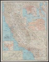
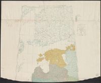
National Geographic Society (U.S.). Cartographic Section
Published / Created:
1954
Call Number:
844 1954
Container / Volume:
BRBL_00603
Image Count:
1
Resource Type:
Maps, Atlases & Globes
Description:
"Compiled by R.J. Darley, R.G. Fritz, A.D. Grazzini, R.E. McAleer, R.W. Northrop, W.T. Peele, F.W. Sheppard, and C.L. Stern. Physiography by J.J. Brehm and A.E. Holdstock. Typography by C.E. Riddiford." and Ancillary maps: Los Angeles [Scale 1:380,160] -- San Francisco Bay region [Scale 1:380,160] -- San Francisco [Scale ca. 1:41,000] -- San Diego [Scale 1:190,080] -- Yosemite Valley, Yosemite National Park [Scale 1:63,360].
Publisher:
National Geographic Society,
Subject (Geographic):
California--Maps
Subject (Name):
Brehm, J. J, Darley, Richard J, Fritz, R. G, Grazzini, Athos D, Holdstock, A. E, McAleer, Ralph E, Northrop, R. W, Peele, William T, Riddiford, Charles E, and S
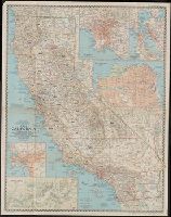
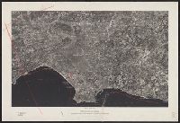
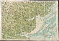
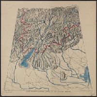
Covers area from Laguna Beach to the San Gabriel Mountains, and from Dume Pt. to Corona., Ms. notes in red pencil., Oriented with north toward the upper left., and Place names overprinted in white.
Publisher:
Fairchild Aerial Surveys,
Subject (Geographic):
Los Angeles Metropolitan Area (Calif.)--Remote-sensing maps
Bartholomew, J. G. (John George), 1860-1920 Edinburgh Geographical Institute
Published / Created:
[19--?]
Call Number:
3225 1900
Container / Volume:
BRBL_00060
Image Count:
1
Resource Type:
Maps, Atlases & Globes
Description:
"Copyright, John Bartholomew., "Roads revised by the Cyclists' Touring Club"--Bottom margin., and Indicates first class, secondary and passable roads, footpaths & bridlepaths, hights in feet above sea level, railways and stations, canals, and county boundaries.
Publisher:
Edinburgh Geographical Institute,
Subject (Geographic):
Essex (England)--Maps and Essex (England)--Maps, Tourist
Subject (Topic):
Bicycle trails--England--Essex--Maps, Cycling--England--Essex--Maps, and Roads--England--Essex--Maps
"Heliozincographed at the Survey of India Offices, Calcutta." in lower right margins., "Seasons 1918-21", "Seasons 1919-21", "Seasons 1920-22", and "Seasons 1905-06, 1920-21" in upper left margins., Includes index to sheets, index to districts., and No. 79 B/N.W
Publisher:
s.n.,
Subject (Geographic):
Bengal (India)--Maps and Chandernagore (India)--Maps