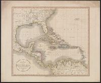
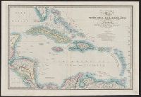
Railroad and military map of the United States, Mexico, the West Indies &c.
Description:
In upper left margin: No. 7. and Insets: Map of the Americas, Africa and a portion of Europe, showing the Atlantic and part of the Pacific oceans -- New Orleans and delta of the Mississippi, Louisiana -- Mobile Harbor, Alabama -- Key West and Tortugas, Florid
Publisher:
J.H. Colton,
Subject (Geographic):
Central America--Maps, Mexico--Maps, United States--Maps, and West Indies--Maps
Subject (Topic):
Military bases--United States--Maps and Railroads--United States--Maps
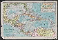
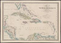
National Geographic magazine map of Central America, Cuba, Porto Rico, and the islands of the Caribbean Sea
Description:
"Copyright ... by American Bank Note Company, New York.", Also shows distances between major, Copy 2 stamped in red "Prepared for distribution by the Pan-American Union" in bottom left margin., and Includes inset of Canal Zone and relief profile of Panama Canal.
Publisher:
National Geographic Magazine,
Subject (Geographic):
Caribbean Area--Maps, Central America--Maps, and West Indies--Maps
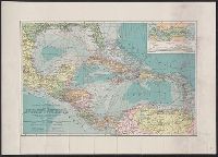
National Geographic magazine map of Central America, Cuba, Porto Rico, and the islands of the Caribbean Sea
Description:
"Copyright ... by American Bank Note Company, New York.", Also shows distances between major points., At head of title: The National Geographic Magazine., Includes inset of Canal Zone and relief profile of Panama Canal., and Relief shown by hachures. Depths shown by contours and gradient tints.
Publisher:
National Geographic Magazine,
Subject (Geographic):
Caribbean Area--Maps, Central America--Maps, and West Indies--Maps
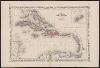
"Entered according to Act of Congress in the year 1850 by John Monk in the Clerks Office of the District of Maryland.", Includes: Legend, Table of distances, routes by water, inland routes, Names of counties and county towns in the United States., and Inset: Ne
Publisher:
Jacob Monk,
Subject (Geographic):
Central America--Maps, Mexico--Maps, North America--Maps, United States--Maps, and West Indies--Maps