Search
You Searched For
Search Results
- Creator:
- Homann Erben (Firm)
- Published / Created:
- 1756
- Call Number:
- 71 1756H
- Container / Volume:
- BRBL_00726
- Image Count:
- 1
- Resource Type:
- Maps, Atlases & Globes
- Found in:
- Beinecke Rare Book and Manuscript Library > America Septentrionalis a Domino d'Anville in Galliis edita nunc in Anglia : coloniis in interiorem Virginiam deductis nec non Fluvii Ohio cursu aucta notisque geographicis et historicis illustrata / sumptibus Homannianorum Heredum.
- Creator:
- Homann Erben (Firm), cartographer, publisher.
- Published / Created:
- 1756
- Call Number:
- 755 1756Ea
- Image Count:
- 1
- Resource Type:
- Maps, Atlases & Globes
- Found in:
- Beinecke Rare Book and Manuscript Library > America Septentrionalis a Domino d'Anville in Galliis edita nunc in Anglia : coloniis in interiorem Virginiam deductis nec non Fluvii Ohio cursu aucta notisque geographicis et historicis illustrata / sumptibus Homannianorum Heredum.
- Creator:
- Homann Erben (Firm)
- Published / Created:
- 1756
- Call Number:
- 755 1756B
- Container / Volume:
- BRBL_00428
- Image Count:
- 1
- Resource Type:
- Maps, Atlases & Globes
- Found in:
- Beinecke Rare Book and Manuscript Library > America Septentrionalis a Domino d'Anville in Galliis edita nunc in Anglia : coloniis in interiorem Virginiam deductis nec non Fluvii Ohio cursu aucta notisque geographicis et historicis illustrata / sumptibus Homannianorum Heredum.
- Creator:
- Homann Erben (Firm)
- Published / Created:
- 1756
- Call Number:
- 755 1756Ea
- Container / Volume:
- BRBL_00428
- Image Count:
- 1
- Resource Type:
- Maps, Atlases & Globes
- Found in:
- Beinecke Rare Book and Manuscript Library > America Septentrionalis a Domino d'Anville in Galliis edita nunc in Anglia : coloniis in interiorem Virginiam deductis nec non Fluvii Ohio cursu aucta notisque geographicis et historicis illustrata / sumptibus Homannianorum Heredum.
- Creator:
- Homann Erben (Firm)
- Published / Created:
- 1756
- Call Number:
- 755 1756G
- Container / Volume:
- BRBL_00690
- Image Count:
- 1
- Resource Type:
- Maps, Atlases & Globes
- Found in:
- Beinecke Rare Book and Manuscript Library > America Septentrionalis a Domino d'Anville in Galliis edita nunc in Anglia : coloniis in interiorem Virginiam deductis nec non Fluvii Ohio cursu aucta notisque geographicis et historicis illustrata / sumptibus Homannianorum Heredum.
- Creator:
- Homann Erben (Firm)
- Published / Created:
- 1777
- Call Number:
- 71 1777H
- Container / Volume:
- BRBL_00726
- Image Count:
- 1
- Resource Type:
- Maps, Atlases & Globes
- Found in:
- Beinecke Rare Book and Manuscript Library > America Septentrionalis a Domino d'Anville in Galliis edita nunc in Anglia : coloniis in interiorem Virginiam deductis nec non Fluvii Ohio cursu aucta notisque geographicis et historicis illustrata et ad bellum praesentis temporis accomodata / sumptibus H
- Creator:
- Homann Erben (Firm)
- Published / Created:
- 1777
- Call Number:
- 755 1777B
- Container / Volume:
- BRBL_00431
- Image Count:
- 1
- Resource Type:
- Maps, Atlases & Globes
- Found in:
- Beinecke Rare Book and Manuscript Library > America Septentrionalis a Domino d'Anville in Galliis edita nunc in Anglia : coloniis in interiorem Virginiam deductis nec non Fluvii Ohio cursu aucta notisque geographicis et historicis illustrata et ad bellum praesentis temporis accomodata / sumptibus Homannianorum Heredum.
- Creator:
- United States. Office of Strategic Services. Research and Analysis Branch
- Published / Created:
- 1944
- Call Number:
- 42gmb 1944
- Container / Volume:
- BRBL_00245
- Image Count:
- 1
- Resource Type:
- Maps, Atlases & Globes
- Found in:
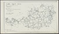
- Beinecke Rare Book and Manuscript Library > Austria [cartographic material] : Federal roads 1937.
- Published / Created:
- 1737]
- Call Number:
- 8555 1737
- Container / Volume:
- BRBL_00695
- Image Count:
- 1
- Resource Type:
- Maps, Atlases & Globes
- Found in:
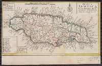
- Beinecke Rare Book and Manuscript Library > Insula Iamaica [cartographic material] : in suas parochias divisa et secundum exemplar primitivum Londinense excusa.
- Creator:
- Sotzmann, D. F
- Published / Created:
- 1798
- Call Number:
- 761 1798
- Container / Volume:
- BRBL_00729
- Image Count:
- 1
- Resource Type:
- Maps, Atlases & Globes
- Found in:
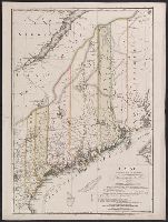
- Beinecke Rare Book and Manuscript Library > Maine / entworfen von D.F. Sotzmann ; Sander, sc.
- Creator:
- Sotzmann, D. F
- Published / Created:
- 1798
- Call Number:
- 761 1798
- Container / Volume:
- BRBL_00447
- Image Count:
- 1
- Resource Type:
- Maps, Atlases & Globes
- Found in:
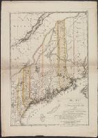
- Beinecke Rare Book and Manuscript Library > Maine / entworfen von D.F. Sotzmann ; Sander, sc.
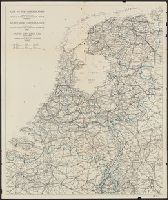
- Published / Created:
- [1946?]
- Call Number:
- 331 1946
- Container / Volume:
- BRBL_00079
- Image Count:
- 1
- Resource Type:
- Maps, Atlases & Globes
- Found in:
- Beinecke Rare Book and Manuscript Library > Map of the Netherlands = Karte der Niederlande = Carte de Pays-Bas.
- Creator:
- Blaeu, Willem Janszoon, 1571-1638, cartographer
- Call Number:
- 217 1635
- Image Count:
- 1
- Resource Type:
- Maps, Atlases & Globes
- Found in:
- Beinecke Rare Book and Manuscript Library > Mappa Aestivarum insularum, alias Barmudas dictarum : ad ostia Mexicani aestuarij jacentium in latitudine graduum 32 minutorum 25 ab Anglia, Londino scilicet versus Libonotum 3300 miliaribus Anglicanis, et a Roanoack (qui locus est in Virginia) versus Eur
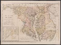
- Creator:
- Sotzmann, D. F
- Published / Created:
- 1797
- Call Number:
- 777 1797
- Container / Volume:
- BRBL_00730
- Image Count:
- 1
- Resource Type:
- Maps, Atlases & Globes
- Found in:
- Beinecke Rare Book and Manuscript Library > Maryland und Delaware / entworfen von D.F. Sotzmann.
- Creator:
- Sotzmann, D. F
- Published / Created:
- [ca. 1797?]
- Call Number:
- 764 1796
- Container / Volume:
- BRBL_00729
- Image Count:
- 1
- Resource Type:
- Maps, Atlases & Globes
- Found in:
- Beinecke Rare Book and Manuscript Library > Massachusetts / entworfen von D.F. Sotzmann ; gestochen v. Paulus Schmidt.
- Published / Created:
- [1894]
- Call Number:
- 643 W782 1894
- Container / Volume:
- BRBL_00340
- Image Count:
- 1
- Resource Type:
- Maps, Atlases & Globes
- Found in:
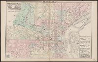
- Beinecke Rare Book and Manuscript Library > Mittleres Grubenfeld des Witwatersrands (von May Cons. bis United Langlaagte).
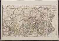
- Creator:
- Sotzmann, D. F
- Published / Created:
- 1797
- Call Number:
- 774 1797
- Container / Volume:
- BRBL_00730
- Image Count:
- 1
- Resource Type:
- Maps, Atlases & Globes
- Found in:
- Beinecke Rare Book and Manuscript Library > Pennsylvania / entworfen von D.F. Sotzman[n].
- Creator:
- O.W. Gray & Son
- Published / Created:
- c1876.
- Call Number:
- 774 P53 1876A
- Container / Volume:
- BRBL_00500
- Image Count:
- 1
- Resource Type:
- Maps, Atlases & Globes
- Found in:
- Beinecke Rare Book and Manuscript Library > Philadelphia / [cartographic material] / O.W. Gray & Son.
- Creator:
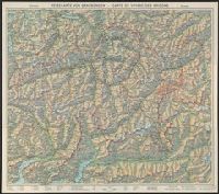
- Imhof, Eduard, 1895-1986
- Published / Created:
- 1944
- Call Number:
- 3763 1944
- Container / Volume:
- BRBL_00150A
- Image Count:
- 2
- Resource Type:
- Maps, Atlases & Globes
- Found in:
- Beinecke Rare Book and Manuscript Library > Reisekarte von Graubünden, Schweiz = Carte de voyage des Grisons, Suisse.
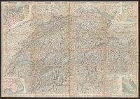
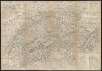
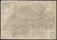
- Creator:
- Leuthold, H. F
- Published / Created:
- 1860
- Call Number:
- 37 1860A
- Image Count:
- 2
- Resource Type:
- Maps, Atlases & Globes
- Found in:
- Beinecke Rare Book and Manuscript Library > Roadmap of Switzerland = Reisekarte der Schweiz = Carta stradale della Svizzera = Carte routière de la Suisse : en partie tirée de l'atlas topographique de la confederation / dresée et gravée par Mullhaupt ; publiée par H.F. Leuthold editeur ; ecrit
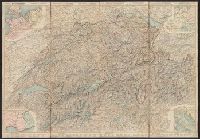
- Creator:
- Leuthold, H. F
- Published / Created:
- 1861
- Call Number:
- 37 1861A
- Image Count:
- 2
- Resource Type:
- Maps, Atlases & Globes
- Found in:
- Beinecke Rare Book and Manuscript Library > Roadmap of Switzerland = Reisekarte der Schweiz = Carta stradale della Svizzera = Carte routière de la Suisse : en partie tirée de l'atlas topographique de la confederation / dresée et gravée par Mullhaupt ; publiée par H.F. Leuthold editeur ; ecrit
- Creator:
- Leuthold, H. F
- Published / Created:
- 1858
- Call Number:
- 37 1858
- Image Count:
- 2
- Resource Type:
- Maps, Atlases & Globes
- Found in:
- Beinecke Rare Book and Manuscript Library > Roadmap of Switzerland = Reisekarte der Schweiz = Carta stradale della Svizzera = Carte routière de la Suisse : en partie tirée de l'atlas topographique de la confederation / dresée et gravée par Mullhaupt ; publiée par H.F. Leuthold editeur ; ecrit
- Creator:
- Leuthold, H. F
- Published / Created:
- 1867
- Call Number:
- 37 1867
- Image Count:
- 2
- Resource Type:
- Maps, Atlases & Globes
- Found in:
- Beinecke Rare Book and Manuscript Library > Roadmap of Switzerland = Reisekarte der Schweiz = Carta stradale della Svizzera = Carte routière de la Suisse : en partie tirée de l'atlas topographique de la confederation / dresée et gravée par Mullhaupt ; publiée par H.F. Leuthold editeur ; ecrit
- Creator:
- Leuthold, H. F
- Published / Created:
- 1856
- Call Number:
- 37 1856
- Image Count:
- 2
- Resource Type:
- Maps, Atlases & Globes
- Found in:
- Beinecke Rare Book and Manuscript Library > Roadmap of Switzerland = Reisekarte der Schweiz = Carta stradale della Svizzera = Carte routière de la Suisse : en partie tirée de l'atlas topographique de la confederation / dresée et gravée par Mullhaupt ; publiée par H.F. Leuthold editeur ; ecrit
- Creator:
- Rose, Fredk. W. (Frederick W.)
- Published / Created:
- [1877]
- Call Number:
- 30an 1877B
- Container / Volume:
- BRBL_00037
- Image Count:
- 1
- Resource Type:
- Maps, Atlases & Globes
- Found in:
- Beinecke Rare Book and Manuscript Library > Serio-comic war map for the year 1877 / by F.W. Rose.
- Creator:
- Vallier & Blanc
- Published / Created:
- [1941]
- Call Number:
- 53f 1941
- Container / Volume:
- BRBL_00287
- Image Count:
- 1
- Resource Type:
- Maps, Atlases & Globes
- Found in:
- Beinecke Rare Book and Manuscript Library > South-eastern Europe [cartographic material] = Europe Sud-est = Südost-Europa.
- Creator:
- Kiepert, Heinrich, 1818-1899
- Published / Created:
- 1890-1892
- Call Number:
- 501 1890
- Container / Volume:
- BRBL_00276
- Image Count:
- 1
- Resource Type:
- Maps, Atlases & Globes
- Found in:
- Beinecke Rare Book and Manuscript Library > Specialkarte vom westlichen Kleinasien : nach seinen eigenen Reisen und anderen grösstenteils noch unveröffentlichten Routenaufnahmen bearbeitet / von Heinrich Kiepert = Carte de la partie occidentale de l 'Asie mineure / dressée par Henri Kiepert d'ap
- Creator:
- Freytag, Berndt und Artaria
- Published / Created:
- 1941
- Call Number:
- 45gmb 1941A
- Container / Volume:
- BRBL_00258
- Image Count:
- 1
- Resource Type:
- Maps, Atlases & Globes
- Found in:
- Beinecke Rare Book and Manuscript Library > Strassenkarte 1:300,000. 56, Lugoj [cartographic material].
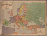
- Creator:
- Gea verlag
- Published / Created:
- 1921
- Call Number:
- 30 1921
- Container / Volume:
- BRBL_00032
- Image Count:
- 1
- Resource Type:
- Maps, Atlases & Globes
- Found in:
- Beinecke Rare Book and Manuscript Library > The Gea map of Europe.
- Published / Created:
- [1919?]
- Call Number:
- 11hcf 1919-43
- Container / Volume:
- BRBL_00010L
- Image Count:
- 1
- Resource Type:
- Maps, Atlases & Globes
- Found in:
- Beinecke Rare Book and Manuscript Library > The boundary lines of the Czech-Sclavonian state = Die Grenzen des tschecho-slowakischen Staates.
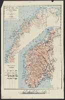
- Creator:
- Landslaget for reiselivet i Norge
- Published / Created:
- [1900?]
- Call Number:
- 344ag 1900
- Container / Volume:
- BRBL_00095
- Image Count:
- 1
- Resource Type:
- Maps, Atlases & Globes
- Found in:
- Beinecke Rare Book and Manuscript Library > Turistkart over Norge = Tourist map of Norway = Carte de Norvège pour les tourists = Touristenkarte über Norwegen.
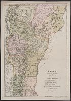
- Creator:
- Sotzmann, D. F
- Published / Created:
- 1796
- Call Number:
- 763 1796
- Container / Volume:
- BRBL_00729
- Image Count:
- 1
- Resource Type:
- Maps, Atlases & Globes
- Found in:
- Beinecke Rare Book and Manuscript Library > Vermont / entworfen von D.F. Sotzmann ; P. Schmidt sc. zu Berlin.
- Creator:
- Sotzmann, D. F
- Published / Created:
- 1796
- Call Number:
- 763 1796A
- Container / Volume:
- BRBL_00452
- Image Count:
- 1
- Resource Type:
- Maps, Atlases & Globes
- Found in:
- Beinecke Rare Book and Manuscript Library > Vermont / entworfen von D.F. Sotzmann ; P. Schmidt sc. zu Berlin.
- Creator:
- Wyld, James, 1812-1887
- Published / Created:
- [1862]
- Call Number:
- 32 L84 1862
- Container / Volume:
- BRBL_00050
- Image Count:
- 1
- Resource Type:
- Maps, Atlases & Globes
- Found in:
- Beinecke Rare Book and Manuscript Library > Wyld's new plan of London = Nouveau plan des Londres = Neuer Plan von London.