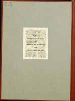
Letters to the Ministro de Estado y de Relaciones 1828 Apr 14, May 19, by José Mariá Viesca.
Image Count:
5
Abstract:
Letters concerning proposals by Reuben Ross to establish a colony in Texas. Governor Viesca reports to the Ministro de Estado y de Relaciones that Ross' original petition in 1826 had been refused due to the disturbances in the frontier region. The area has now been pacified, and Ross is offering to bring two-thirds of the families to Texas at his own expense. Governor Viesca concludes that the project could be carried out without cost to Mexico.
Description:
Gift of Frederick W. Beinecke. and In Spanish.
Subject (Geographic):
Coahuila and Texas (Mexico), Coahuila and Texas (Mexico) Colonization, and Texas--Emigration and immigration
Subject (Name):
Coahuila and Texas (Mexico). Governor (1827-1830 : Viesca and Ross, Reuben, d. 1828
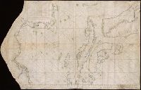
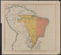
"Copia de esto plano se remitio á la Conte en 28 de Febrero de 1777 con carta no. 320. Doctor Julian Viso." and Manuscript map. Lakes, rivers, and swamps handtinted in green; limits of Dutch, French and Portuguese claims shown by red and dotted line, roughly paralleling the seacoast an the north bank of the Amazon as far as Fuerte Sn. Joseph de los Marivitanas; inside this line various European possessions indicated by lines of color as follows: Dutch, brown: French, yellow: Portuguese, green. Settlements shown by red dots. South at top.
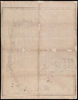
Color: pen and ink with green and blue shading., In the corner there is a table of the Florida and Cuban cays with their locations on the map. On the Island of Jamaica is marked Pta. Portland, presumably named after the Earl of Portland, councillor for trade and navigation, who died in 1663, or his son, who was killed fighting the Dutch in the battle off the Texel in 1665., On Jamaica the name "Kiniston" (Kingston) has been added early on, presumably about 1695, soon after its foundation, and in Hayti the name St. Luiz at a later period., and Spanish manuscript portolan chart on vellum. Unsigned and undated.
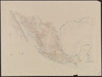
Carta Esferica que comprende las costas del Seno Mexicano construida de ordes del Rey en el deposito hidrografico de marina.
Description:
Backed with paper., Imperfect: mutilated along folds., Possibly copied from a Spanish chart "Carta Esferica que comprende las costas del Seno Mexicano construida de ordes del Rey en el deposito hidrografico de marina.", and Relief shown by hachures; depth by soundings.
Subject (Geographic):
Mexico, Gulf of--Maps.
Subject (Topic):
Coasts--Mexico--Maps. and Nautical charts--Mexico, Gulf of.
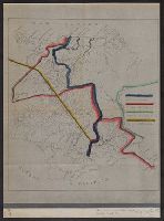
Boundary lines noted in hand-colored ink., Ms. notes along bottom right margin: "Taken from map without title, property of the United Fruit Co.", and Positive photostat.
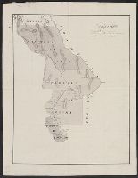
From the Streeter collection., Pen-and-ink and watercolor., Relief shown by hachur, Shows "Partido del Paso," "Partido de Aldama," and "Partido de Rosales," with New Mexico to the north and Coahuila and Texas to the east., Spanish., and Title devised by cataloger.
Subject (Geographic):
Chihuahua (Mexico : State)--Maps, Manuscript, Coahuila and Texas (Mexico)--Maps, Manuscript, and New Mexico--Maps, Manuscript