Skip to search
Skip to main content
Skip to first result
Search
You Searched For
Extent of Digitization
Completely digitized
Access
Public
Repository
Beinecke Rare Book and Manuscript Library
Resource Type
Maps, Atlases & Globes
New Search
Search Results
Published / Created:
[1605]
Call Number:
3361 1605
Container / Volume:
BRBL_00088
Image Count:
2
Resource Type:
Maps, Atlases & Globes
Description:
Preliminary record. and Verso: Text.
Subject (Geographic):
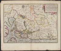
West Flanders (Belgium)--Maps--Early works to 1800
Found in:
Beinecke Rare Book and Manuscript Library > [West Flanders] Petrus Koerius coelavit.
Published / Created:
[1945?]
Call Number:
307cbf 1945
Container / Volume:
BRBL_00036
Image Count:
1
Resource Type:
Maps, Atlases & Globes
Description:
Map in Japanese.
Subject (Geographic):
Europe, Western--Maps
Found in:
Beinecke Rare Book and Manuscript Library > [Western Europe].
Published / Created:
1855
Call Number:
811ca 1855
Container / Volume:
BRBL_00554
Image Count:
1
Resource Type:
Maps, Atlases & Globes
Description:
"Entered according to act of Congress by E.J. Hulbert in the year 1855 in the Clerk's Office of the District Court of the United States for the State of Michigan". and Imperfect: Mutilated with some loss of text.
Publisher:
s.n.,]
Subject (Geographic):
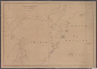
Michigan--Maps
Found in:
Beinecke Rare Book and Manuscript Library > [Western part of upper peninsula, Michigan].
Published / Created:
1845
Call Number:
54635cea 1845
Container / Volume:
BRBL_00290
Image Count:
2
Resource Type:
Maps, Atlases & Globes
Description:
Preliminary record.
Publisher:
W.C. Taber & Son,
Subject (Geographic):
Kamchatskai︠a︡ oblastʹ (Russia)--Maps--Early works to 1800
Found in:
Beinecke Rare Book and Manuscript Library > [Whaling] Chart of Kamscatka, and the Sea of Ochotsk. Copied from the best Russian Authorities. ... respectfully dedicated to the Whaling Fleet of the United States.
Published / Created:
[1700]
Call Number:
11 1700A
Container / Volume:
BRBL_00004
Image Count:
1
Resource Type:
Maps, Atlases & Globes
Description:
Preliminary record.
Subject (Geographic):
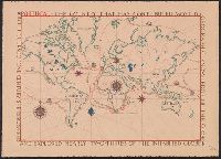
World--Maps--Early works to 1800
Found in:
Beinecke Rare Book and Manuscript Library > [World Map] Portugal - The Country that has contributed most to geographic knowledge of the Globe in the course of one century she discovered and explored nearly two-thirds of the inhabited Globe.
Published / Created:
[1853]
Call Number:
11 1853
Container / Volume:
BRBL_00009
Image Count:
1
Resource Type:
Maps, Atlases & Globes
Description:
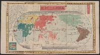
Map of the World in the Ortelius manner; more decorative than accurate. and Preliminary record.
Subject (Geographic):
World--maps
Found in:
Beinecke Rare Book and Manuscript Library > [World Map].
Published / Created:
[1848]
Call Number:
11 1848
Container / Volume:
BRBL_00009
Image Count:
1
Resource Type:
Maps, Atlases & Globes
Description:
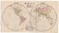
Preliminary record. and World map in two hemispheres.
Subject (Geographic):
World--maps
Found in:
Beinecke Rare Book and Manuscript Library > [World Map].
Published / Created:
1860?]
Call Number:
11 1860A
Container / Volume:
BRBL_00009
Image Count:
1
Resource Type:
Maps, Atlases & Globes
Description:
Title supplied by cataloger.
Found in:
Beinecke Rare Book and Manuscript Library > [World map in Chinese, 1860.]
Creator:
Published / Created:
1900?]
Call Number:
11 1529
Image Count:
2
Resource Type:
Maps, Atlases & Globes
Description:
Copy 2: Col. Preliminary record. and Reprint of original at the Vatican Library.
Publisher:
W. Griggs,
Subject (Topic):
World maps--Early works to 1800
Found in:
Beinecke Rare Book and Manuscript Library > [World map]
Creator:
Published / Created:
Anno Domini 1511]
Call Number:
11 1511A
Container / Volume:
BRBL_00732
Image Count:
1
Resource Type:
Maps, Atlases & Globes
Description:
Cordiform projection., From: "Claudii Ptholemaei Alexandrini liber geographiae cum tabulis...", From: Clavdii Ptholemaei Alexandrini Liber geographiae cvm tabvlis...1511., Lanman collection; dgvmp2008., Map is printed in two colors, red and black., Outer map border shows decorative windheads and zodiacal signs., The author's name is often given as Bernard Sylvanus (see Shirley entry 32, plate 35) or Bernardus Sylvanus., and Title supplied by cataloger.
Publisher:
Per Iacobum Pentium de Leucho,
Subject (Name):
Pencio, Jacopo, active 1486-1530 and Ptolemy, active 2nd century. Geographia
Subject (Topic):
World maps--Early works to 1800
Found in:
Beinecke Rare Book and Manuscript Library > [World map].
Branch:v1.61.8 ,Deployed:2024-06-20T11:15:15-04:00