Search
You Searched For
Search Results
- Published / Created:
- 1782
- Call Number:
- 21cea 1782
- Container / Volume:
- BRBL_00016
- Image Count:
- 1
- Resource Type:
- Maps, Atlases & Globes
- Found in:
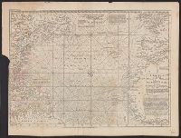
- Beinecke Rare Book and Manuscript Library > A Chart of the Atlantic Ocean.
- Published / Created:
- 1755
- Call Number:
- 21 1755
- Container / Volume:
- BRBL_00014
- Image Count:
- 1
- Resource Type:
- Maps, Atlases & Globes
- Found in:
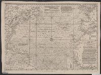
- Beinecke Rare Book and Manuscript Library > A New Chart of the Vast Atlantic Ocean; Exhibiting the Seat of War, both in Europe and America ...
- Published / Created:
- 1755
- Call Number:
- 21 1755
- Container / Volume:
- BRBL_00014
- Image Count:
- 1
- Resource Type:
- Maps, Atlases & Globes
- Found in:
- Beinecke Rare Book and Manuscript Library > A New Chart of the Vast Atlantic Ocean; Exhibiting the Seat of War, both in Europe and America ...
- Published / Created:
- 1720?]
- Call Number:
- 21 1720
- Image Count:
- 1
- Resource Type:
- Maps, Atlases & Globes
- Found in:
- Beinecke Rare Book and Manuscript Library > A map of the King of Great Britain's dominions in Europe, Africa, and America ... Eman: Bowen Sculpt.
- Published / Created:
- 1775
- Call Number:
- 21 1775
- Container / Volume:
- BRBL_00014
- Image Count:
- 1
- Resource Type:
- Maps, Atlases & Globes
- Found in:
- Beinecke Rare Book and Manuscript Library > Carte Réduite D'une de L'Océan Atlantique ou Occidental. Divisée et Gravée au Burin par Petit.
- Published / Created:
- 1753
- Call Number:
- 21 1753
- Image Count:
- 1
- Resource Type:
- Maps, Atlases & Globes
- Found in:
- Beinecke Rare Book and Manuscript Library > Carte Réduite de L'Ocean Meridional ...
- Published / Created:
- [1780?]
- Call Number:
- 21 1780A
- Container / Volume:
- BRBL_00014
- Image Count:
- 1
- Resource Type:
- Maps, Atlases & Globes
- Found in:
- Beinecke Rare Book and Manuscript Library > Carte pour servir A L'Histoire Philosophique et Politique des Etablissemens et du Commerce des Européens dans les Deux indes ... Par M. Bonne ... Gravée par André.
- Creator:
- Jefferys, Thomas, d. 1771
- Published / Created:
- 1762]
- Call Number:
- 71 1762
- Container / Volume:
- BRBL_00364
- Image Count:
- 3
- Resource Type:
- Maps, Atlases & Globes
- Found in:
- Beinecke Rare Book and Manuscript Library > Chart of the Atlantic Ocean, with the British, French, & Spanish settlements in North America, and the West Indies, as also on the coast of Africa / by Thos. Jefferys, geographer to His Majesty.
- Creator:
- Robijn, Jacobus, d. ca. 1710
- Published / Created:
- [1683?]
- Call Number:
- 21 1683
- Container / Volume:
- BRBL_00682
- Image Count:
- 1
- Resource Type:
- Maps, Atlases & Globes
- Found in:
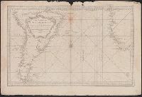
- Beinecke Rare Book and Manuscript Library > Pascaarte vande zee custen van Guinea en Brasilias van Cabo de Verde, tot C. de bona Esperanca en van R. de Amazones tot Rio de la Plata, alles op wassende graaden gestelt [cartographic material].
- Published / Created:
- 1787
- Call Number:
- 21 1787
- Container / Volume:
- BRBL_00724
- Image Count:
- 1
- Resource Type:
- Maps, Atlases & Globes
- Found in:
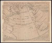
- Beinecke Rare Book and Manuscript Library > The Atlantic Ocean / by Governor Pownall F.R.S.
- Published / Created:
- [1670?]
- Call Number:
- 21 1670
- Image Count:
- 1
- Resource Type:
- Maps, Atlases & Globes
- Found in:
- Beinecke Rare Book and Manuscript Library > The New Sea map of the Spannish-Zea between Ireland et C. Blanco ... and Canary Islands.
- Published / Created:
- 1619?]
- Call Number:
- 21cea 1619
- Container / Volume:
- BRBL_00700
- Image Count:
- 1
- Resource Type:
- Maps, Atlases & Globes
- Found in:
- Beinecke Rare Book and Manuscript Library > [Anonymous ms. Portugese portolano of the Atlantic Ocean.]