Search
You Searched For
Search Results
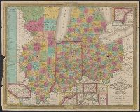
- Published / Created:
- 1835
- Call Number:
- 755 1835B
- Container / Volume:
- BRBL_00440
- Image Count:
- 1
- Resource Type:
- Maps, Atlases & Globes
- Found in:
- Beinecke Rare Book and Manuscript Library > Map of the States of Ohio, Indiana, and Illinois with the settled part of Michigan.
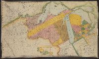
- Published / Created:
- 1829
- Call Number:
- 755GFC 1829A
- Container / Volume:
- BRBL_00442
- Image Count:
- 1
- Resource Type:
- Maps, Atlases & Globes
- Found in:
- Beinecke Rare Book and Manuscript Library > Map of the United States Lead Mines on the Upper Mississippi River ... Ebr. Martin, engraver.
- Published / Created:
- 1827
- Call Number:
- 755 1827A
- Container / Volume:
- BRBL_00440
- Image Count:
- 4
- Resource Type:
- Maps, Atlases & Globes
- Found in:
- Beinecke Rare Book and Manuscript Library > Map of the United States and the Provinces of Upper and Lower Canada, New Brunswick and Nova Scotia ... by John & Alexr. Walker.
- Published / Created:
- 1829
- Call Number:
- 755 1829A
- Container / Volume:
- BRBL_00440
- Image Count:
- 1
- Resource Type:
- Maps, Atlases & Globes
- Found in:
- Beinecke Rare Book and Manuscript Library > Map of the United States and the Southern part of the Canadas. By James Whitelaw, Esq.
- Published / Created:
- 1841]
- Call Number:
- 754GFC 1841
- Container / Volume:
- BRBL_00419
- Image Count:
- 1
- Resource Type:
- Maps, Atlases & Globes
- Found in:
- Beinecke Rare Book and Manuscript Library > Map of the country between New York and the Susquehanna River.
- Published / Created:
- 1830
- Call Number:
- 755 1830
- Container / Volume:
- BRBL_00440
- Image Count:
- 1
- Resource Type:
- Maps, Atlases & Globes
- Found in:
- Beinecke Rare Book and Manuscript Library > Map of the territories of Michigan and Ouisconsin on a scale of 30 geographical miles to an inch by John Farmer of Detroit, Engraved by Rawdon Clark & Co., Albany, NY.
- Published / Created:
- [1835?]
- Call Number:
- 755 1835
- Container / Volume:
- BRBL_00440
- Image Count:
- 1
- Resource Type:
- Maps, Atlases & Globes
- Found in:
- Beinecke Rare Book and Manuscript Library > Map showing the most direct commercial Route from Atlantic via L. Ontario, to the Province of Upper Canada the North West States and Territories and to the Mississippi. J. Price Scrip. N.Y., T. & C. Woods lithography N.Y.
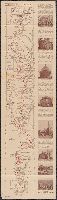
- Creator:
- James River Bridge Corporation
- Published / Created:
- [1920?]
- Call Number:
- 779gmb W27 1920
- Container / Volume:
- BRBL_00505A
- Image Count:
- 2
- Resource Type:
- Maps, Atlases & Globes
- Found in:
- Beinecke Rare Book and Manuscript Library > Motor strip map, Washington and Jacksonville, via the coastal highway : through historic lands, "the cradle of the republic."