Skip to search
Skip to main content
Skip to first result
Search
You Searched For
Extent of Digitization
Completely digitized
Subject (Geographic)
Japan--Maps
Search Results
Creator:
Published / Created:
1904
Call Number:
556 1904B
Container / Volume:
BRBL_00292
Image Count:
1
Resource Type:
Maps, Atlases & Globes
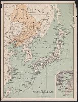
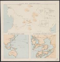
Description:
Inset: Bay of Tokio.
Publisher:
Walker,
Subject (Geographic):
Japan--Maps, Korea--Maps, and Manchuria (China)--Maps
Found in:
Beinecke Rare Book and Manuscript Library > Map of Manchuria, Corea & Japan [cartographic material].
Published / Created:
[1846?]
Call Number:
57 N134 1846
Container / Volume:
BRBL_00304
Image Count:
1
Resource Type:
Maps, Atlases & Globes
Subject (Geographic):
Japan--Maps
Found in:
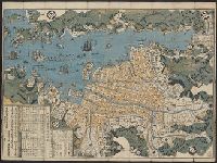
Beinecke Rare Book and Manuscript Library > Map of Nagasaki.
Published / Created:
1891
Call Number:
57 N571 1891
Container / Volume:
BRBL_00304
Image Count:
1
Resource Type:
Maps, Atlases & Globes
Description:
Preliminary record.
Subject (Geographic):
Japan--Maps
Found in:
Beinecke Rare Book and Manuscript Library > Map of Niigate.
Published / Created:
1895
Call Number:
57EH 1895
Container / Volume:
BRBL_00305
Image Count:
1
Resource Type:
Maps, Atlases & Globes
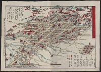
Alternative Title:
Map of the missionary districts of north Tokyo and Kyoto
Description:
Includes population table in left margin.
Publisher:
Walker Engraving Co.,
Subject (Geographic):
Japan--Maps
Found in:
Beinecke Rare Book and Manuscript Library > Map of the missionary districts of north Tokyo & Kyoto : under the jurisdiction of the Bishop of Tokyo 1895.
Published / Created:
1943
Call Number:
57 1943
Container / Volume:
BRBL_00303
Image Count:
2
Resource Type:
Maps, Atlases & Globes
Description:
"The London Geographical Institute, M.C.H."
Publisher:
George Philip & Son,
Subject (Geographic):
China--Maps, Japan--Maps, and Korea--Maps
Found in:
Beinecke Rare Book and Manuscript Library > The Japanese empire : with central and southern Manchukuo (Manchuria).
Published / Created:
1943
Call Number:
57 1943
Container / Volume:
BRBL_00303
Image Count:
1
Resource Type:
Maps, Atlases & Globes
Description:
"The London Geographical Institute, M.C.H."
Publisher:
George Philip & Son,
Subject (Geographic):
China--Maps, Japan--Maps, and Korea--Maps
Found in:
Beinecke Rare Book and Manuscript Library > The Japanese empire : with central and southern Manchukuo (Manchuria).
Published / Created:
1902
Call Number:
57ceh 1902
Container / Volume:
BRBL_00305
Image Count:
1
Resource Type:
Maps, Atlases & Globes
Description:
"C. Schmidt, Autogr."
Publisher:
Justes Perthes,
Subject (Geographic):
Japan--Maps
Found in:
Beinecke Rare Book and Manuscript Library > Tiefenkarte des Japanischen Binnenmeeres : Setouchi / von Dr. N. Yamasaki.
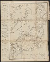
Creator:
Published / Created:
1899
Call Number:
57 1899A
Container / Volume:
BRBL_00302
Image Count:
15
Resource Type:
Maps, Atlases & Globes
Description:
Includes 5 insets, var. scales: Hypsometrical and bathymetrical chart -- Political division of the Japanese Empire -- Chishima (Kurile Islands) -- [Taiwan and Ryūkyū Islands] -- Ogasawa-Jima (Bonin Islands), Ka
Publisher:
Tōyōdō,
Subject (Geographic):
Japan--Administrative and political divisions--Maps, Japan--Maps, and Taiwan--Maps
Subject (Name):
Matsudaira, N, Suzuki, Kiyotada, and Togawa, Tametsugu
Found in:
Beinecke Rare Book and Manuscript Library > Topographical map of the Japanese Empire, 1899 / Imperial Geological Survey of Japan ; drawn by T. Togawa and K. Suzuki ; engraved by N. Matsudaira.
Published / Created:
1922
Call Number:
57 Un9 1921
Container / Volume:
BRBL_00304
Image Count:
2
Resource Type:
Maps, Atlases & Globes
Description:
"February 1921".
Publisher:
Japan Tourist Bureau,
Subject (Geographic):
Japan--Maps
Found in:
Beinecke Rare Book and Manuscript Library > Unzen and neighbourhood.
Creator:
Published / Created:
1854
Call Number:
57 1854
Container / Volume:
BRBL_00302
Image Count:
1
Resource Type:
Maps, Atlases & Globes
Description:
I
Publisher:
Hydrographic Dept.],
Subject (Geographic):
Japan--Maps
Subject (Name):
Bien, Julius, 1826-1909, Maury, William L, Perry, Matthew Calbraith, 1794-1858, Sels, Edward, Siebert, Selmar, and United States Naval Expedition to Japan--1852-1854
Subject (Topic):
Nautical charts--Japan
Found in:
Beinecke Rare Book and Manuscript Library > Western shore of the Bay of Yedo / surveyed by order of Commodore M.C. Perry U.S.N. by Lieut. Wm. L. Maury and other officers of the Japan Expedition 1854 ; drawn by Edward Sels ; engraved by Selmar Siebert.
Branch:v1.68.7 ,Deployed:2025-07-09T09:07:59-04:00