Search
You Searched For
Search Results
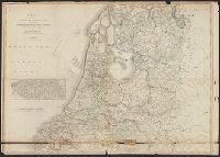
- Published / Created:
- 1789
- Call Number:
- 331 1789
- Container / Volume:
- BRBL_00078
- Image Count:
- 1
- Resource Type:
- Maps, Atlases & Globes
- Publisher:
- W. Faden,
- Subject (Geographic):
- Netherlands--Maps--Early works to 1800
- Found in:
- Beinecke Rare Book and Manuscript Library > A map of the Seven United Provinces ... By W. Faden ... 1789.
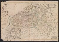
- Creator:
- Senex, John, d. 1740
- Published / Created:
- 1714
- Call Number:
- 33 1714
- Container / Volume:
- BRBL_00683
- Image Count:
- 1
- Resource Type:
- Maps, Atlases & Globes
- Description:
- Decorative title cartouche shows siege and defence techniques.
- Publisher:
- s.n.],
- Subject (Geographic):
- Belgium--Maps--Early works to 1800, Luxembourg--Maps--Early works to 1800, and Netherlands--Maps--Early works to 1800
- Subject (Name):
- Senex, John, d. 1740, dedicator and Sutherland, Charles Spencer, Earl of, 1674-1722, dedicatee
- Found in:
- Beinecke Rare Book and Manuscript Library > A new and correct map of the ten Spanish provinces : according to the new observations communicated to the Royal Society at London and the Royal Academy at Paris ? / by Iohn Senex.
- Published / Created:
- [1708?]
- Call Number:
- 331 1708
- Container / Volume:
- BRBL_00078
- Image Count:
- 1
- Resource Type:
- Maps, Atlases & Globes
- Description:
- Insets: Chart banks of England & Holland, Views of Amsterdam, Middelburg, Utrecht, Gronningen, King Williams Pallace called T'Loo.
- Publisher:
- T. Bowles,
- Subject (Geographic):
- Netherlands--Maps--Early works to 1800
- Found in:
- Beinecke Rare Book and Manuscript Library > A new and exact map of the United Provinces or Netherlands &c. ... Herman Moll Geographer.
- Published / Created:
- 1794
- Call Number:
- 331 1794A
- Container / Volume:
- BRBL_00078
- Image Count:
- 1
- Resource Type:
- Maps, Atlases & Globes
- Publisher:
- J. Cary, Engraver,
- Subject (Geographic):
- Netherlands--Maps--Early works to 1800
- Found in:
- Beinecke Rare Book and Manuscript Library > A new map of the United Provinces ...
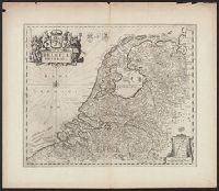
- Published / Created:
- [1660?]
- Call Number:
- 331 1660
- Container / Volume:
- BRBL_00078
- Image Count:
- 2
- Resource Type:
- Maps, Atlases & Globes
- Description:
- Verso: Text.
- Subject (Geographic):
- Netherlands--Maps--Early works to 1800
- Found in:
- Beinecke Rare Book and Manuscript Library > Belgica Foederata.
- Creator:
- Schenk, Peter, 1660-1718 or 1719
- Published / Created:
- 1700?]
- Call Number:
- 331 1700A
- Container / Volume:
- BRBL_00078
- Image Count:
- 1
- Resource Type:
- Maps, Atlases & Globes
- Description:
- "Cum privil."
- Publisher:
- Peter Schenk?
- Subject (Geographic):
- East Indies--Maps--Early works to 1800, Netherlands--Maps--Early works to 1800, and New Netherland--Maps--Early works to 1800
- Found in:
- Beinecke Rare Book and Manuscript Library > Belgii pars septentrionalis communi nomine vulgo Hollandia : nuncupata continens statum potentissimae Batavorum Reipublicae seu Provincias VII. foederatas. Cum omnium provinciarum insignibus, additis omnibus nominibus urbium et pagorum edente / Petro Sche
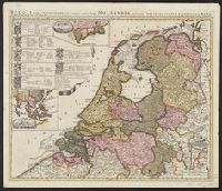
- Creator:
- Homann, Johann Baptist, 1663-1724
- Published / Created:
- 1720?]
- Call Number:
- 33 1700
- Container / Volume:
- BRBL_00077
- Image Count:
- 1
- Resource Type:
- Maps, Atlases & Globes
- Description:
- Imperfect: Split into 2 pieces. Mounted on board. Sheet measures 51.3 x 59.7 cm.
- Publisher:
- [Johann Baptist Homann,
- Subject (Geographic):
- Netherlands--Maps--Early works to 1800 and New York (State)--Maps
- Found in:
- Beinecke Rare Book and Manuscript Library > Belgii pars septentrionalis communi nomine vulgo Hollandia nuncupata continens statum potentissimae Batavorum Reipublicea sev provincias VII foederatas / exhibente Io. Baptista Homanno.
- Creator:
- Homann, Johann Baptist, 1663-1724
- Published / Created:
- 1720?]
- Call Number:
- 331 1720
- Container / Volume:
- BRBL_00078
- Image Count:
- 1
- Resource Type:
- Maps, Atlases & Globes
- Description:
- Sheet measures 53.4 x 61.4 cm. Ms. note on verso: No. 9, Holland.
- Publisher:
- [Johann Baptist Homann,
- Subject (Geographic):
- Netherlands--Maps--Early works to 1800 and New York (State)--Maps
- Found in:
- Beinecke Rare Book and Manuscript Library > Belgii pars septentrionalis communi nomine vulgo Hollandia nuncupata continens statum potentissimae Batavorum Reipublicea sev provincias VII foederatas / exhibente Io. Baptista Homanno.
- Published / Created:
- 1702
- Call Number:
- 331 1702
- Container / Volume:
- BRBL_00078
- Image Count:
- 1
- Resource Type:
- Maps, Atlases & Globes
- Subject (Geographic):
- Netherlands--Maps--Early works to 1800
- Found in:
- Beinecke Rare Book and Manuscript Library > Carte des Provinces Unies des Pays bas ... Par G. De L'Isle ... Gravée par Lièbaux le fils 1702.
- Published / Created:
- [1675?]
- Call Number:
- 3332 1675
- Container / Volume:
- BRBL_00083
- Image Count:
- 1
- Resource Type:
- Maps, Atlases & Globes
- Subject (Geographic):
- Netherlands--Maps--Early works to 1800
- Found in:
- Beinecke Rare Book and Manuscript Library > Comitatus Hollandiae Tabula Pluribus locis Recens emendata a Frederico de Wit.