Skip to search
Skip to main content
Skip to first result
Search
You Searched For
"New England"
Extent of Digitization
Completely digitized
Access
Public
New Search
Search Results
Creator:
Published / Created:
1655?]
Call Number:
755 1655
Container / Volume:
BRBL_00423
Image Count:
1
Resource Type:
Maps, Atlases & Globes
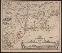
Description:
Copy 1: 47 x 56 cm., on sheet 51 x 59 cm. Stamp on verso: Yale Horace Brown 1900 S. Ms. title on verso: Neu Holland & Neu Engelland & Virginien. Ms. no. on verso: 397., Inset view: Nieuw Amsterdam op t eylant Manhattans., and Relief shown pictorially.
Publisher:
s.n.,
Subject (Geographic):
New England --Maps--Early works to 1800
Found in:
Beinecke Rare Book and Manuscript Library > Novi Belgii, Novaeque Angliae nec non partis Virginiae tabula / [cartographic material] / multis in locis emendata a Nicolao Joannis Visschero.
Creator:
Published / Created:
1655?]
Call Number:
755 1655
Container / Volume:
BRBL_00423
Image Count:
1
Resource Type:
Maps, Atlases & Globes
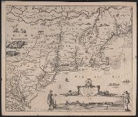
Description:
Copy 2: Not hand col. 47 x 56 cm., on sheet 51 x 59 cm., Inset view: Nieuw Amsterdam op t eylant Manhattans., and Relief shown pictorially.
Publisher:
s.n.,
Subject (Geographic):
New England --Maps--Early works to 1800
Found in:
Beinecke Rare Book and Manuscript Library > Novi Belgii, Novaeque Angliae nec non partis Virginiae tabula / [cartographic material] / multis in locis emendata a Nicolao Joannis Visschero.
Creator:
Published / Created:
[1919]
Call Number:
76 1919
Container / Volume:
BRBL_00445
Image Count:
2
Resource Type:
Maps, Atlases & Globes
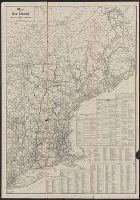
Description:
Indexed.
Publisher:
Rand McNally,
Subject (Geographic):
New England --Maps
Subject (Name):
Rand McNally and Company
Found in:
Beinecke Rare Book and Manuscript Library > Map of New England / issued by United States Railroad Administration.
Published / Created:
[1760?]
Call Number:
76 1760
Container / Volume:
BRBL_00443
Image Count:
1
Resource Type:
Maps, Atlases & Globes
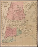
Description:
Colored map. and From Maine to New York
Publisher:
John Bowles& Carington Bowles,
Subject (Geographic):
New England --Maps--Early works to 1800
Found in:
Beinecke Rare Book and Manuscript Library > A map of the most inhabited part of New England ...
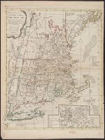
Published / Created:
1771
Call Number:
76 1771
Container / Volume:
BRBL_00443
Image Count:
1
Resource Type:
Maps, Atlases & Globes
Description:
2 copies.
Publisher:
Carington Bowles,
Subject (Geographic):
New England --Maps--Early works to 1800
Found in:
Beinecke Rare Book and Manuscript Library > A map of the most inhabited part of New England ...
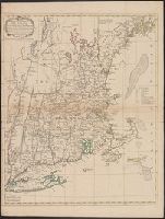
Published / Created:
1776
Call Number:
76 1776A
Container / Volume:
BRBL_00443
Image Count:
1
Resource Type:
Maps, Atlases & Globes
Description:
Inset: Town, Harbor & environs of Boston.
Publisher:
Carington Bowles,
Subject (Geographic):
New England --Maps--Early works to 1800
Found in:
Beinecke Rare Book and Manuscript Library > Bowles's Map of the Seat of War in New England ...
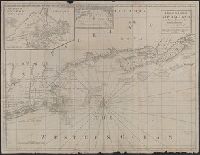
Published / Created:
[1775?]
Call Number:
76cea 1775A
Container / Volume:
BRBL_00446
Image Count:
1
Resource Type:
Maps, Atlases & Globes
Description:
Insets: The Town of Boston in New
Publisher:
I. Mount & T. Page & W. Mount, Tower Hill,
Subject (Geographic):
New England --Maps--Early works to 1800
Found in:
Beinecke Rare Book and Manuscript Library > A Map of the Coast of New England from Staten Island to the Island of Breton; as it was actualy survey'd by Capt Cyprian Southback.
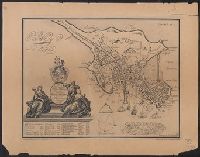
Creator:
Published / Created:
1869
Call Number:
764 B65 1729
Container / Volume:
BRBL_00454
Image Count:
1
Resource Type:
Maps, Atlases & Globes
Alternative Title:
Plan of Boston in New England
Description:
"Originally engraved in 1729. Reproduced in 1869.", In upper right corner "Exhibit no. 1.", and Mounted on paper which is mounted on linen.
Subject (Geographic):
Boston (Mass.)--Maps
Subject (Name):
Burnet, William, 1688-1729
Found in:
Beinecke Rare Book and Manuscript Library > To His Excellency William Burnet, Esq., this Plan of Boston in New England is humbly dedicated / engraved by Thos. Johnson.
Published / Created:
[1775?]
Call Number:
76cea 1775
Container / Volume:
BRBL_00446
Image Count:
1
Resource Type:
Maps, Atlases & Globes
Description:
Insets: The Town of Boston in new
Publisher:
I. Mount, T. Page & W. Mount,
Subject (Geographic):
New England --Maps--Early works to 1800
Found in:
Beinecke Rare Book and Manuscript Library > A Map of the Coast of New England from Staten Island of Breton; as if was actualy survey'd by Capt. Cyprian Southback.
Branch:v1.61.6 ,Deployed:2024-06-12T09:55:36-04:00