Search
You Searched For
Search Results
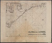
- Published / Created:
- [1751]
- Call Number:
- BrSides Box 2019 32
- Image Count:
- 1
- Resource Type:
- Maps, Atlases & Globes
- Subject (Geographic):
- --Early works to 1800.
- Subject (Topic):
- Coasts--South Africa--Maps--Early works
- Found in:
- Beinecke Rare Book and Manuscript Library > Kort over Bayen St. Helena : udkaftet efter de Söfarendes Anmerkninger af N. Bellin.
- Creator:
- Anville, Jean Baptiste Bourguignon d', 1697-1782, cartographer.
- Published / Created:
- 1781
- Call Number:
- BrSides Folio 2017 19
- Image Count:
- 1
- Resource Type:
- Maps, Atlases & Globes
- Subject (Geographic):
- Africa, West--Maps--Early works to 1800.
- Subject (Topic):
- Coasts--Africa, West--Maps--Early works
- Found in:
- Beinecke Rare Book and Manuscript Library > Carta della bassa Guinea tra il capo tres puntas, e l'equatore / di Mr. d'Anville.
- Creator:
- Ogilby, John, 1600-1676
- Published / Created:
- 1670]
- Call Number:
- 655 1670
- Container / Volume:
- BRBL_00345
- Image Count:
- 1
- Resource Type:
- Maps, Atlases & Globes
- Subject (Geographic):
- Africa, West--Maps--Early works to 1800
- Subject (Topic):
- Coasts--Africa, West--Maps--Early works
- Found in:
- Beinecke Rare Book and Manuscript Library > Guinea.
- Creator:
- Dudley, Robert, Sir, 1574-1649
- Published / Created:
- 1646 or 1647]
- Call Number:
- 64 1646
- Container / Volume:
- BRBL_00338
- Image Count:
- 1
- Resource Type:
- Maps, Atlases & Globes
- Subject (Geographic):
- Africa, Southern--Maps--Early works to
- Subject (Topic):
- Coasts--Africa, Eastern--Maps--Early
- Found in:
- Beinecke Rare Book and Manuscript Library > Carta seconda generale d'Affrica / AF: Lucini fece.
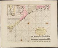
- Published / Created:
- [1751]
- Call Number:
- BrSides Box 2019 29
- Image Count:
- 1
- Resource Type:
- Maps, Atlases & Globes
- Subject (Geographic):
- Table Bay (South Africa)--Maps--Early
- Subject (Topic):
- Coasts--South Africa--Maps--Early works
- Found in:
- Beinecke Rare Book and Manuscript Library > Kort over Taffelbayen og Reden ved det Gode Haabs Forbierg efter adskillige Manuskripter udkastet af N. Bellin, Ing. de la Marine.
- Creator:
- Seale, Richard William
- Published / Created:
- 1766]
- Call Number:
- 654 1766
- Container / Volume:
- BRBL_00344
- Image Count:
- 1
- Resource Type:
- Maps, Atlases & Globes
- Subject (Geographic):
- Africa, West--Maps--Early works to 1800
- Subject (Topic):
- Coasts--Africa, West--Maps--Early works
- Found in:
- Beinecke Rare Book and Manuscript Library > A new and correct map of the coast of Africa, from Cape Blanco (lat. 20⁰40Ń) to the coast of Angola (lat. 11⁰S) : with explanatory notes of all the forts and settlements belonging to the several European powers / R.W. Seale, sculp.
- Creator:
- Dudley, Robert, Sir, 1574-1649
- Published / Created:
- 1646-1647]
- Call Number:
- 655 1646
- Container / Volume:
- BRBL_00345
- Image Count:
- 1
- Resource Type:
- Maps, Atlases & Globes
- Subject (Geographic):
- Africa, West--Maps--Early works to 1800
- Subject (Topic):
- Coasts--Africa, West--Maps--Early works
- Found in:
- Beinecke Rare Book and Manuscript Library > Carta particolare che comincia con il fiume Iuntas nella Guinea è finisce con il capo di S. Dara è con l'Isola d'S:Tomaso / AF:Lucini fece.
- Creator:
- Duval, P. (Pierre), 1619-1682
- Published / Created:
- 1677
- Call Number:
- 655 1677
- Container / Volume:
- BRBL_00345
- Image Count:
- 1
- Resource Type:
- Maps, Atlases & Globes
- Subject (Geographic):
- Africa, West--Maps--Early works to 1800
- Subject (Topic):
- Coasts--Africa, West--Maps--Early works
- Found in:
- Beinecke Rare Book and Manuscript Library > Costes de Guińee avec les royaumes qui y sont connus des Européens, au dedans des terres : selon les relations les plus nouvelles / par P. Duval.
- Creator:
- Linschoten, Jan Huygen van, 1563-1611
- Published / Created:
- 1596?]
- Call Number:
- 63 1596
- Container / Volume:
- BRBL_00334
- Image Count:
- 1
- Resource Type:
- Maps, Atlases & Globes
- Subject (Geographic):
- Africa, Eastern--Maps--Early works to
- Subject (Topic):
- Coasts--Africa, Eastern--Maps--Early
- Found in:
- Beinecke Rare Book and Manuscript Library > Delineatio orarum maritimarum, terrae vulgo indigetatae terra do Natal item Sofalae, Mozambicae & Melindae ... [cartographic material] = Affbeeldinghe der custen des landts genaempt terra do Natal, item van alle de custen van Coffala, Mozambique, Melinde
- Creator:
- Jefferys, Thomas, d. 1771
- Published / Created:
- 1st January 1789.
- Call Number:
- 655 1789
- Container / Volume:
- BRBL_00345
- Image Count:
- 1
- Resource Type:
- Maps, Atlases & Globes
- Subject (Geographic):
- Africa, West--Maps--Early works to 1800
- Subject (Topic):
- Coasts--Africa, West--Maps--Early works
- Found in:
- Beinecke Rare Book and Manuscript Library > The western coast of Africa, from Cape Blanco to Cape Virga, exhibiting Senegambia proper / by T. Jefferys.
- Creator:
- Linschoten, Jan Huygen van, 1563-1611
- Published / Created:
- 1596]
- Call Number:
- 64 1596
- Container / Volume:
- BRBL_00337
- Image Count:
- 1
- Resource Type:
- Maps, Atlases & Globes
- Subject (Geographic):
- Africa, Southern--Maps--Early works to
- Subject (Topic):
- Coasts--Africa, Southern--Maps--Early
- Found in:
- Beinecke Rare Book and Manuscript Library > Typus orarum maritimarum Guineae, Manicongo, & Angôlae ultra promontorium Bonae Spei ... [cartographic material] = Afheeldinghe der custen des landts Guinea, Manicongo, ende Angôla, ende voorts tot voorby de C. de boa esperança ... / Arnoldus F. á Lan
- Creator:
- L'Isle, Guillaume de, 1675-1726
- Published / Created:
- 1720?]
- Call Number:
- 49 1740
- Container / Volume:
- BRBL_00684
- Image Count:
- 1
- Resource Type:
- Maps, Atlases & Globes
- Subject (Topic):
- --Maps--Early works to 1800
- Found in:
- Beinecke Rare Book and Manuscript Library > In notitiam ecclesiasticam Africae tabula geographica / auctore G. De L'Isle ...
- Creator:
- L'Isle, Guillaume de, 1675-1726
- Published / Created:
- 1780
- Call Number:
- 49 1780
- Container / Volume:
- BRBL_00267
- Image Count:
- 1
- Resource Type:
- Maps, Atlases & Globes
- Subject (Topic):
- --Maps--Early works to 1800
- Found in:
- Beinecke Rare Book and Manuscript Library > In notitiam ecclesiasticam Africæ tabula geographica [cartographic material] / Auctore G. de l'Isle ; Joan. Bap. Liébaux inv. et sculp.
- Published / Created:
- 1792
- Call Number:
- 60cea 1792
- Container / Volume:
- BRBL_00329
- Image Count:
- 1
- Resource Type:
- Maps, Atlases & Globes
- Subject (Geographic):
- Africa--Maps--Early works to 1800
- Found in:
- Beinecke Rare Book and Manuscript Library > A new Survey of the Coast of Africa from Senegal and Cape Verd to Cape St. Ann ...
- Creator:
- Bowen, Thomas, d. 1790
- Published / Created:
- 1794?]
- Call Number:
- 60 1794B
- Container / Volume:
- BRBL_00324
- Image Count:
- 1
- Resource Type:
- Maps, Atlases & Globes
- Subject (Geographic):
- Africa--Maps--Early works to 1800
- Found in:
- Beinecke Rare Book and Manuscript Library > A new and accurate map of Africa, drawn from the best authorities / by Thos. Bowen.
- Published / Created:
- 1794
- Call Number:
- 60cea 1794
- Container / Volume:
- BRBL_00329
- Image Count:
- 1
- Resource Type:
- Maps, Atlases & Globes
- Subject (Geographic):
- Africa--Maps--Early works to 1800
- Found in:
- Beinecke Rare Book and Manuscript Library > A new chart of the Coast of Africa from the Straits of Gibralter to Cape Blanco with Madeira & the Canary Islands ...
- Creator:
- Senex, John, d. 1740
- Published / Created:
- 1721]
- Call Number:
- 60 1721
- Container / Volume:
- BRBL_00322
- Image Count:
- 1
- Resource Type:
- Maps, Atlases & Globes
- Subject (Geographic):
- Africa--Maps--Early works to 1800
- Found in:
- Beinecke Rare Book and Manuscript Library > A new map of Africa, from the latest observations.
- Published / Created:
- 1700?]
- Call Number:
- 60 1700
- Container / Volume:
- BRBL_00322
- Image Count:
- 1
- Resource Type:
- Maps, Atlases & Globes
- Subject (Geographic):
- Africa--Maps--Early works to 1800
- Found in:
- Beinecke Rare Book and Manuscript Library > A new map of Africk : shewing its present general divisions, cheif cities or towns, rivers, mountains &c.
- Creator:
- Sandrart, Jakob von, 1630-1708
- Published / Created:
- 1700]
- Call Number:
- 60 1700A
- Container / Volume:
- BRBL_00322
- Image Count:
- 1
- Resource Type:
- Maps, Atlases & Globes
- Subject (Geographic):
- Africa--Maps--Early works to 1800
- Found in:
- Beinecke Rare Book and Manuscript Library > Accuratissima totius Africae tabula / in lucem producta per Iacobum de Sandrart ; Joann. Bapt. Homann, sculpsit.
- Creator:
- Anville, Jean Baptiste Bourguignon d', 1697-1782
- Published / Created:
- 1766?]
- Call Number:
- 60 1766
- Container / Volume:
- BRBL_00323
- Image Count:
- 4
- Resource Type:
- Maps, Atlases & Globes
- Subject (Geographic):
- Africa--Maps--Early works to 1800
- Found in:
- Beinecke Rare Book and Manuscript Library > Africa / performed by the Sr. Danville under the patronage of the Duke of Orleans ; revised and improved by Mr. Bolton ; E. Bowen sculpt.
- Creator:
- Anville, Jean Baptiste Bourguignon d', 1697-1782
- Published / Created:
- 1774?]
- Call Number:
- 60 1774
- Container / Volume:
- BRBL_00323
- Image Count:
- 4
- Resource Type:
- Maps, Atlases & Globes
- Subject (Geographic):
- Africa--Maps--Early works to 1800
- Found in:
- Beinecke Rare Book and Manuscript Library > Africa / performed by the Sr. Danville under the patronage of the Duke of Orleans ; revised and improved by Mr. Bolton ; E. Bowen sculpt.
- Creator:
- L'Isle, Guillaume de, 1675-1726
- Published / Created:
- [ca. 1760]
- Call Number:
- 60 1760B
- Container / Volume:
- BRBL_00323
- Image Count:
- 1
- Resource Type:
- Maps, Atlases & Globes
- Subject (Geographic):
- Africa--Maps--Early works to 1800
- Found in:
- Beinecke Rare Book and Manuscript Library > Africa : concinnata secundum observationes membror. acad. regal. scientiarum et non nullorum aliorum, et juxta recentissimas annotationes / per G. de l'Isle, geographum.
- Creator:
- Berry, William, fl. 1669-1708, creator
Sanson, Nicolas, 1600-1667
- Published / Created:
- 1680
- Call Number:
- 1973 Folio 10
- Image Count:
- 1
- Resource Type:
- Maps, Atlases & Globes
- Subject (Geographic):
- Africa --Maps --Early works to 1800
- Found in:
- Beinecke Rare Book and Manuscript Library > Africa : divided according to the extent of its principall parts in which are distinguished one from the other the empires, monarchies, kingdoms, states and peoples, which at this time inhabite Africa
- Creator:
- Jefferys, Thomas, -1771.
- Published / Created:
- [1748]
- Call Number:
- BrSides Folio 2017 11
- Image Count:
- 1
- Resource Type:
- Maps, Atlases & Globes
- Subject (Geographic):
- Africa--Maps--Early works to 1800.
- Found in:
- Beinecke Rare Book and Manuscript Library > Africa [cartographic material] / drawn from the best maps by T. Jefferys, Geographer to his Royal Highness the Prince of Wales.
- Published / Created:
- [1968]
- Call Number:
- 60 1710
- Container / Volume:
- BRBL_00322
- Image Count:
- 1
- Resource Type:
- Maps, Atlases & Globes
- Subject (Geographic):
- Africa--Maps--Early works to 1800
- Found in:
- Beinecke Rare Book and Manuscript Library > Africa according to H. Moll 1710.
- Creator:
- Guthrie, William, 1708-1770
- Published / Created:
- 1792
- Call Number:
- 60 1795B
- Container / Volume:
- BRBL_00324
- Image Count:
- 1
- Resource Type:
- Maps, Atlases & Globes
- Subject (Geographic):
- Africa--Maps--Early works to 1800
- Found in:
- Beinecke Rare Book and Manuscript Library > Africa according to the best authorities.
- Creator:
- Carey, Mathew, 1760-1839
- Published / Created:
- 1795]
- Call Number:
- 60 1795A
- Container / Volume:
- BRBL_00324
- Image Count:
- 1
- Resource Type:
- Maps, Atlases & Globes
- Subject (Geographic):
- Africa--Maps--Early works to 1800
- Found in:
- Beinecke Rare Book and Manuscript Library > Africa according to the best authorities.
- Creator:
- Dunn, Samuel, d. 1794
- Published / Created:
- 1794
- Call Number:
- 60 1794C
- Container / Volume:
- BRBL_00324
- Image Count:
- 1
- Resource Type:
- Maps, Atlases & Globes
- Subject (Geographic):
- Africa--Maps--Early works to 1800
- Found in:
- Beinecke Rare Book and Manuscript Library > Africa and it's several regions / by Samuel Dunn, mathematician.
- Published / Created:
- [1968]
- Call Number:
- 60 1668
- Container / Volume:
- BRBL_00322
- Image Count:
- 1
- Resource Type:
- Maps, Atlases & Globes
- Subject (Geographic):
- Africa--Maps--Early works to 1800
- Found in:
- Beinecke Rare Book and Manuscript Library > Africa by Jacob van Meurs 1668.
- Creator:
- Seutter, Matthaeus, 1678-1756, cartographer.
- Published / Created:
- after 1741]
- Call Number:
- 60 1735
- Container / Volume:
- BRBL_00323
- Image Count:
- 1
- Resource Type:
- Maps, Atlases & Globes
- Subject (Geographic):
- Africa--Maps--Early works to 1800.
- Found in:
- Beinecke Rare Book and Manuscript Library > Africa iuxta navigationes et observationaes recentissimas aucta, correcta et in sua regna et status divisa / in lucem edita a Matth. Seuttero, s. Caes. maj. geographo aug.
- Creator:
- Hase, Johann Matthias, 1684-1742
- Published / Created:
- [1737?]
- Call Number:
- 60 1737B
- Container / Volume:
- BRBL_00323
- Image Count:
- 1
- Resource Type:
- Maps, Atlases & Globes
- Subject (Geographic):
- Africa--Maps--Early works to 1800
- Found in:
- Beinecke Rare Book and Manuscript Library > Africa secundum legitimas projectionis stereographicae regulas : et juxta recentissimas relationes et observationes in subsidium vocatis quoque veterum Leonis Africani ... / à Joh. Matthia Hasio, M.P.P.O. ...
- Creator:
- Hase, Johann Matthias, 1684-1742
- Published / Created:
- [ca. 1737]
- Call Number:
- 60 1737A
- Container / Volume:
- BRBL_00323
- Image Count:
- 1
- Resource Type:
- Maps, Atlases & Globes
- Subject (Geographic):
- Africa--Maps--Early works to 1800
- Found in:
- Beinecke Rare Book and Manuscript Library > Africa secundum legitimas projectionis stereographicae regulas et juxta recentissimas relationes et observationes in subsidium vocatis quoque veterum Leonis Africani Nubiensis Geographi et aliorum monumentis et eleminatis fabulosis aliorum designationibus
- Creator:
- Hase, Johann Matthias, 1684-1742
- Published / Created:
- 1737
- Call Number:
- 60 1737
- Container / Volume:
- BRBL_00323
- Image Count:
- 1
- Resource Type:
- Maps, Atlases & Globes
- Subject (Geographic):
- Africa--Maps--Early works to 1800
- Found in:
- Beinecke Rare Book and Manuscript Library > Africa secundum legitimas projectionis stereographicae regulas et juxta recentissimas relationes et observationes in subsidium vocatis quoque veterum Leonis Africani Nubiensis Geographi et aliorum monumentis et eleminatis fabulosis aliorum designationibus
- Creator:
- Hase, Johann Matthias, 1684-1742
Homann Erben (Firm)
- Published / Created:
- [ca. 1737]
- Call Number:
- 1983 Folio 23
- Collection Title:
- [Atlas factice of 50 maps, primarily by Johann Baptist Homann and/or issued by the Homann Erben
- Image Count:
- 1
- Subject (Geographic):
- Africa --Maps --Early works to 1800
- Found in:
- Beinecke Rare Book and Manuscript Library > Africa secundum legitimas projectionis stereographicae regulas et juxta recentissimas relationes et observationes in subsidium vocatis quoque veterum Leonis Africani Nubiensis Geographi et aliorum monumentis et eleminatis fabulosis aliorum designationibus
- Creator:
- Hase, Johann Matthias, 1684-1742
Homann Erben (Firm)
- Published / Created:
- 1737
- Call Number:
- 1975 Folio 31
- Collection Title:
- [Atlas factice of 42 maps, produced by the Homann Erben firm]
- Image Count:
- 1
- Subject (Geographic):
- Africa --Maps --Early works to 1800
- Found in:
- Beinecke Rare Book and Manuscript Library > Africa secundum legitimas projectionis stereographicae regulas et juxta recentissimas relationes et observationes in subsidium vocatis quoque veterum Leonis Africani Nubiensis Geographi et aliorum monumentis et eleminatis fabulosis aliorum designationibus
- Creator:
- Hase, Johann Matthias, 1684-1742
Homann Erben (Firm)
- Published / Created:
- 1737
- Call Number:
- 1973 Folio 30
- Collection Title:
- [Atlas factice of 32 maps and 1 distance table, produced by the Homann Erben firm]
- Image Count:
- 2
- Subject (Geographic):
- Africa --Maps --Early works to 1800
- Found in:
- Beinecke Rare Book and Manuscript Library > Africa secundum legitimas projectionis stereographicae regulas et juxta recentissimas relationes et observationes in subsidium vocatis quoque veterum Leonis Africani Nubiensis Geographi et aliorum monumentis et eleminatis fabulosis aliorum designationibus
- Creator:
- Bünting, Heinrich, 1545-1606
- Published / Created:
- 1592]
- Call Number:
- 60 1592
- Container / Volume:
- BRBL_00321
- Image Count:
- 2
- Resource Type:
- Maps, Atlases & Globes
- Subject (Geographic):
- Africa--Maps--Early works to 1800
- Found in:
- Beinecke Rare Book and Manuscript Library > Africa tertia pars terrae.
- Creator:
- Payne, John, fl. 1800
- Published / Created:
- 1792?]
- Call Number:
- 60 1792
- Container / Volume:
- BRBL_00324
- Image Count:
- 1
- Resource Type:
- Maps, Atlases & Globes
- Subject (Geographic):
- Africa--Maps--Early works to 1800
- Found in:
- Beinecke Rare Book and Manuscript Library > Africa, 1792 / Ferguson sculpsit.
- Creator:
- Münster, Sebastian, 1489-1552
- Published / Created:
- ca. 1545]
- Call Number:
- 60 1545
- Container / Volume:
- BRBL_00321
- Image Count:
- 2
- Resource Type:
- Maps, Atlases & Globes
- Subject (Geographic):
- Africa--Maps--Early works to 1800
- Found in:
- Beinecke Rare Book and Manuscript Library > Africa, Lybia, Mörenlandt, mit allen Königreichen, so zü unsern Zeiten darin̄ gefunden werden.
- Creator:
- Mercator, Gerard, ca. 1565-1656
- Published / Created:
- 1595]
- Call Number:
- 60 1595
- Container / Volume:
- BRBL_00321
- Image Count:
- 2
- Resource Type:
- Maps, Atlases & Globes
- Subject (Geographic):
- Africa--Maps--Early works to 1800
- Found in:
- Beinecke Rare Book and Manuscript Library > Africa, ex magna orbis terre descriptione Gerardi Mercatoris / desumpta, studio & industria G.M. Iunioris.
- Creator:
- Meurs, Jacob van, 1619-1680
- Published / Created:
- 1670]
- Call Number:
- 60 1670
- Container / Volume:
- BRBL_00322
- Image Count:
- 1
- Resource Type:
- Maps, Atlases & Globes
- Subject (Geographic):
- Africa--Maps--Early works to 1800
- Found in:
- Beinecke Rare Book and Manuscript Library > Africae accurata tabula / ex officina Iacobum Meursium.
- Creator:
- Visscher, Claes Jansz., 1586 or 7-1652
- Published / Created:
- anno 1652
- Call Number:
- 1983 Folio 19
- Collection Title:
- [Atlas factice of 96 maps by Blaeu, Visscher, Jansson, Hondius and others]
- Image Count:
- 1
- Subject (Geographic):
- Africa --Maps --Early works to 1800
- Found in:
- Beinecke Rare Book and Manuscript Library > Africae nova descr. / per Nicolaum Io[annem] Visscher
- Creator:
- Blaeu, Willem Janszoon, 1571-1638
- Published / Created:
- 1641?]
- Call Number:
- 60 1641
- Container / Volume:
- BRBL_00321
- Image Count:
- 2
- Resource Type:
- Maps, Atlases & Globes
- Subject (Geographic):
- Africa--Maps--Early works to 1800
- Found in:
- Beinecke Rare Book and Manuscript Library > Africae nova descriptio / auct. Guiljelmo Blaeuw.
- Creator:
- Hondius, Hendrik, 1597-1651
- Published / Created:
- between 1639 and 1649?]
- Call Number:
- 60 1639
- Container / Volume:
- BRBL_00321
- Image Count:
- 2
- Resource Type:
- Maps, Atlases & Globes
- Subject (Geographic):
- Africa--Maps--Early works to 1800
- Found in:
- Beinecke Rare Book and Manuscript Library > Africae nova tabula / auct. Hen. Hondio, 1631.
- Creator:
- Ortelius, Abraham, 1527-1598
- Published / Created:
- 1570
- Call Number:
- 60 1570
- Container / Volume:
- BRBL_00321
- Image Count:
- 2
- Resource Type:
- Maps, Atlases & Globes
- Subject (Geographic):
- Africa--Maps--Early works to 1800
- Found in:
- Beinecke Rare Book and Manuscript Library > Africae tabula nova.
- Creator:
- Sanson, Nicolas, 1600-1667
- Published / Created:
- 1650
- Call Number:
- 60 1650
- Container / Volume:
- BRBL_00321
- Image Count:
- 1
- Resource Type:
- Maps, Atlases & Globes
- Subject (Geographic):
- Africa--Maps--Early works to 1800
- Found in:
- Beinecke Rare Book and Manuscript Library > Afrique / par N. Sanson d'Abbebille, geog. du Roy ; A. Peyrounin, sculp.
- Creator:
- Robert de Vaugondy, Gilles, 1688-1766
- Published / Created:
- l'an IIIe. de la République Franc? [1794 or 1795]
- Call Number:
- 60 1794A
- Container / Volume:
- BRBL_00324
- Image Count:
- 1
- Resource Type:
- Maps, Atlases & Globes
- Subject (Geographic):
- Africa--Maps--Early works to 1800
- Found in:
- Beinecke Rare Book and Manuscript Library > Afrique divisée en ses principaux empires et royaumes / par Robert de Vaugondy, géographe ; corrigée par Lamarche, son successeur et successeur de Fortin mécanicien pour les globes et sphéres ; Arrivet inv. & sculp.
- Creator:
- Coronelli, Vincenzo, 1650-1718
- Published / Created:
- 1689
- Call Number:
- 60 1689
- Container / Volume:
- BRBL_00322
- Image Count:
- 1
- Resource Type:
- Maps, Atlases & Globes
- Subject (Geographic):
- Africa--Maps--Early works to 1800
- Found in:
- Beinecke Rare Book and Manuscript Library > Afrique selon les relations les plus nouvelles / dressée et dediée par le P. Coronelli, cosmographe de la serenissime republique de Venise, a Monseigneur le duc de Brissac, pair de France ; H. Van Loon, sculp.
- Creator:
- Münster, Sebastian, 1489-1552
- Published / Created:
- 1571?]
- Call Number:
- 60 1571
- Container / Volume:
- BRBL_00321
- Image Count:
- 2
- Resource Type:
- Maps, Atlases & Globes
- Subject (Geographic):
- Africa--Maps--Early works to 1800
- Found in:
- Beinecke Rare Book and Manuscript Library > Aphricae tabula IIII.
- Creator:
- Fries, Lorenz, ca. 1490-1531
- Published / Created:
- 1535?]
- Call Number:
- 60 1535
- Container / Volume:
- BRBL_00321
- Image Count:
- 2
- Resource Type:
- Maps, Atlases & Globes
- Subject (Geographic):
- Africa--Maps--Early works to 1800
- Found in:
- Beinecke Rare Book and Manuscript Library > Aphricae tabula quarta continet Libyam & duas Aethiopias.
- Published / Created:
- 1754
- Call Number:
- 60cea 1754
- Container / Volume:
- BRBL_00329
- Image Count:
- 1
- Resource Type:
- Maps, Atlases & Globes
- Subject (Geographic):
- Africa--Maps--Early works to 1800
- Found in:
- Beinecke Rare Book and Manuscript Library > Carte Reduit des costes Occidentales D'Afrique ... Depuis l'Equateur jasqu' au Vingtieme degré de Latitude Meridonale ...
- Published / Created:
- 1765
- Call Number:
- 60cea 1765
- Container / Volume:
- BRBL_00329
- Image Count:
- 1
- Resource Type:
- Maps, Atlases & Globes
- Subject (Geographic):
- Africa--Maps--Early works to 1800
- Found in:
- Beinecke Rare Book and Manuscript Library > Carte Reduite des costes Occidentales D'Afrique ... Cape Bojador jusqui a la Riviere de Sierra Lèona ... 1753. Par le Sr. Bellin Ingenieur de la Marine. Corrigée en 1765.
- Creator:
- L'Isle, Guillaume de, 1675-1726.
- Published / Created:
- 1730
- Call Number:
- 60 1730
- Image Count:
- 1
- Resource Type:
- Maps, Atlases & Globes
- Subject (Geographic):
- Africa--Maps--Early works to 1800.
- Found in:
- Beinecke Rare Book and Manuscript Library > Carte d'Afrique / dressée pour l'usage du Roy par Guillaume Delisle, premier geographe de sa Majesté, de l'aacademie [sic] royale des sciences.
- Creator:
- L'Isle, Guillaume de, 1675-1726
- Published / Created:
- [1797?]
- Call Number:
- 60 1797
- Container / Volume:
- BRBL_00324
- Image Count:
- 1
- Resource Type:
- Maps, Atlases & Globes
- Subject (Geographic):
- Africa--Maps--Early works to 1800
- Found in:
- Beinecke Rare Book and Manuscript Library > Carte d'Afrique : dressée pour l'instruction / par Guillaume de L'Isle, premier géographe de l'Académie des sciences ; revue et augmentée par Dezauche, successeur des srs. Delisle et Phil. Buache.
- Creator:
- L'Isle, Guillaume de, 1675-1726
- Published / Created:
- [ca. 1774?]
- Call Number:
- 60 1774A
- Container / Volume:
- BRBL_00323
- Image Count:
- 1
- Resource Type:
- Maps, Atlases & Globes
- Subject (Geographic):
- Africa--Maps--Early works to 1800
- Found in:
- Beinecke Rare Book and Manuscript Library > Carte d'Afrique, dressée pour l'usage du Roy / par Guillaume Delisle, Premier Geographe de sa Majesté de l'Academie Royale de Sciences ; J. Kondet, schulpsit.
- Creator:
- L'Isle, Guillaume de, 1675-1726
- Published / Created:
- Nov. 1707.
- Call Number:
- 60 1707
- Container / Volume:
- BRBL_00322
- Image Count:
- 1
- Resource Type:
- Maps, Atlases & Globes
- Subject (Geographic):
- Africa--Maps--Early works to 1800
- Found in:
- Beinecke Rare Book and Manuscript Library > Carte de l'Egypte, de la Nubie, de l'Abissinie &c. / par Guillaume Delisle de l'Academie R[oya]le des Sciences ; Desrosiers, sculp.
- Creator:
- Le Rouge, Georges-Louis
- Published / Created:
- 1747
- Call Number:
- 60 1747
- Container / Volume:
- BRBL_00323
- Image Count:
- 1
- Resource Type:
- Maps, Atlases & Globes
- Subject (Geographic):
- Africa--Maps--Early works to 1800
- Found in:
- Beinecke Rare Book and Manuscript Library > L'Afrique / suivant les dernres. observations de Mr. Hass. et des R R.P.P. Jesuites ; par le Sr. le Rouge, ingr. geographe du Roi.
- Creator:
- Fer, Nicolas de, 1646-1720
- Published / Created:
- 1705
- Call Number:
- 60 1705
- Container / Volume:
- BRBL_00322
- Image Count:
- 1
- Resource Type:
- Maps, Atlases & Globes
- Subject (Geographic):
- Africa--Maps--Early works to 1800
- Found in:
- Beinecke Rare Book and Manuscript Library > L'Afrique : dressée selon les dernieres relat. et suivant les nouvelles decouvertes dont les points principaux sont placez sur les observations de Mrs. de l'Academie Royale des Sciences / par N. de Fer.
- Creator:
- L'Isle, Guillaume de, 1675-1726
- Published / Created:
- [1730]
- Call Number:
- 60 1730A
- Container / Volume:
- BRBL_00323
- Image Count:
- 1
- Resource Type:
- Maps, Atlases & Globes
- Subject (Geographic):
- Africa--Maps--Early works to 1800
- Found in:
- Beinecke Rare Book and Manuscript Library > L'Afrique dressée sur les observations de mrs. de l'Académie royale des sciences et quelques autres, and sur les memoires les plus recens [cartographic material] / par G. De L'Isle geographe.
- Creator:
- Janvier, Jean
- Published / Created:
- 1789
- Call Number:
- 60 1782
- Container / Volume:
- BRBL_00324
- Image Count:
- 1
- Resource Type:
- Maps, Atlases & Globes
- Subject (Geographic):
- Africa--Maps--Early works to 1800
- Found in:
- Beinecke Rare Book and Manuscript Library > L'Afrique, divisée en ses principaux etats / par le Sr. Janvier, geographe.
- Creator:
- Hondius, Jodocus, 1563-1612
- Published / Created:
- [1609]
- Call Number:
- 60 1609
- Container / Volume:
- BRBL_00321
- Image Count:
- 2
- Resource Type:
- Maps, Atlases & Globes
- Subject (Geographic):
- Africa--Maps--Early works to 1800
- Found in:
- Beinecke Rare Book and Manuscript Library > Nova Africae tabula / auctore Jodoco Hondio.
- Creator:
- Danckerts, Justus, d. 1692
- Published / Created:
- ca. 1680]
- Call Number:
- 60 1680
- Container / Volume:
- BRBL_00322
- Image Count:
- 1
- Resource Type:
- Maps, Atlases & Globes
- Subject (Geographic):
- Africa--Maps--Early works to 1800
- Found in:
- Beinecke Rare Book and Manuscript Library > Novissima et perfectissima Africae descriptio / authore I. Danckerts.
- Creator:
- Allard, Carel, 1648-ca. 1709
- Published / Created:
- 1690]
- Call Number:
- 60 1690A
- Container / Volume:
- BRBL_00322
- Image Count:
- 1
- Resource Type:
- Maps, Atlases & Globes
- Subject (Geographic):
- Africa--Maps--Early works to 1800
- Found in:
- Beinecke Rare Book and Manuscript Library > Novissima et perfectissima Africae descriptio / ex formis Caroli Allard ; Ph. Tideman, del. ; G. v. Gouwen, sculp.
- Creator:
- Gastaldi, Giacomo, ca. 1500-ca. 1565
- Published / Created:
- 1563]
- Call Number:
- 60 1563
- Container / Volume:
- BRBL_00321
- Image Count:
- 1
- Resource Type:
- Maps, Atlases & Globes
- Subject (Geographic):
- Africa--Maps--Early works to 1800
- Found in:
- Beinecke Rare Book and Manuscript Library > Prima tavola [Africa].
- Creator:
- Thevet, André, 1502-1590
- Published / Created:
- 1575]
- Call Number:
- 60 1575
- Container / Volume:
- BRBL_00321
- Image Count:
- 1
- Resource Type:
- Maps, Atlases & Globes
- Subject (Geographic):
- Africa--Maps--Early works to 1800
- Found in:
- Beinecke Rare Book and Manuscript Library > Table d'Afrique / A. Thevet.
- Creator:
- Pigafetta, Filippo, 1533-1604
- Published / Created:
- 1598?]
- Call Number:
- 60 1598
- Container / Volume:
- BRBL_00321
- Image Count:
- 1
- Resource Type:
- Maps, Atlases & Globes
- Subject (Geographic):
- Africa--Maps--Early works to 1800
- Found in:
- Beinecke Rare Book and Manuscript Library > Tabulam hanc Aegypti, si aequus ac diligens lector ...
- Creator:
- Moll, Herman, -1732
- Published / Created:
- [1710]
- Call Number:
- 60 1708
- Container / Volume:
- BRBL_00322
- Image Count:
- 1
- Resource Type:
- Maps, Atlases & Globes
- Subject (Geographic):
- Africa--Maps--Early works to 1800
- Found in:
- Beinecke Rare Book and Manuscript Library > To the right honourable Charles, Earl of Peterborow and Monmouth, &c this map of Africa ... is most humbly dedicated / by your Lordship's humble servant H: Moll geographer.
- Creator:
- Wit, Frederik de
- Published / Created:
- [1688?]
- Call Number:
- BrSides Double Folio 2019 114
- Image Count:
- 1
- Resource Type:
- Maps, Atlases & Globes
- Subject (Geographic):
- Africa--Maps--Early works to 1800.
- Found in:
- Beinecke Rare Book and Manuscript Library > Totius Africae accuratissima tabula [cartographic material] : denuo correcte revisa multis locis aucta, in partes tam maiores quam minores divisa / per F. de Witt.
- Creator:
- Ramusio, Giovanni Battista, 1485-1557
- Published / Created:
- 155-?]
- Call Number:
- 60 155X
- Container / Volume:
- BRBL_00321
- Image Count:
- 2
- Resource Type:
- Maps, Atlases & Globes
- Subject (Geographic):
- Africa--Maps--Early works to 1800
- Found in:
- Beinecke Rare Book and Manuscript Library > [Map of Africa].
- Published / Created:
- 1722
- Call Number:
- 60 1722
- Container / Volume:
- BRBL_00323
- Image Count:
- 1
- Resource Type:
- Maps, Atlases & Globes
- Subject (Geographic):
- Africa--Maps--Early works to 1800
- Found in:
- Beinecke Rare Book and Manuscript Library > [Map of Africa].
- Creator:
- Bellin, Jacques Nicolas, 1703-1772
- Published / Created:
- 1750
- Call Number:
- 655 1750
- Container / Volume:
- BRBL_00345
- Image Count:
- 1
- Resource Type:
- Maps, Atlases & Globes
- Subject (Geographic):
- Africa, West--Maps--Early works to 1800
- Subject (Topic):
- Coasts--Africa, West--Maps--Early works
- Found in:
- Beinecke Rare Book and Manuscript Library > Carte generale de la coste de Guińee : depuis la riviere de Sierra Leona jusqu'au Cap de Lopes Gonsalvo / dresśee au D́epost des cartes et plans de la marine par ordre de M. Rouilĺe, Chr. comte de Jouy &ca., secretaire d'etat ayant le D́epartment de la
- Creator:
- Keulen, Johannes van, 1654-1715
- Published / Created:
- [between 1681 and 1696?]
- Call Number:
- 655 1681
- Container / Volume:
- BRBL_00345
- Image Count:
- 1
- Resource Type:
- Maps, Atlases & Globes
- Subject (Geographic):
- Africa, West--Maps--Early works to 1800
- Subject (Topic):
- Coasts--Africa, West--Maps--Early works
- Found in:
- Beinecke Rare Book and Manuscript Library > Pas caarte van Rio Gambia, van C. Verde tot Rio de Serraliones.
- Creator:
- Sparrman, Anders, 1748-1820
- Published / Created:
- 1779
- Call Number:
- 648 1779
- Container / Volume:
- BRBL_00340
- Image Count:
- 1
- Resource Type:
- Maps, Atlases & Globes
- Subject (Geographic):
- --Early works to 1800
- Found in:
- Beinecke Rare Book and Manuscript Library > Carte géographique du Cap de Bonne Esperance : contenant les noms et la position des lieux habités tant par les colons hollandois que par les Hottentots ... / par André Sparman.
- Creator:
- Ogilby, John, 1600-1676
- Published / Created:
- 1670]
- Call Number:
- 66 1670A
- Container / Volume:
- BRBL_00347
- Image Count:
- 1
- Resource Type:
- Maps, Atlases & Globes
- Subject (Geographic):
- Africa, Central--Maps--Early works to
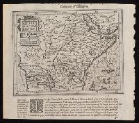
- Found in:
- Beinecke Rare Book and Manuscript Library > Aethiopia superior vel interior vulgo Abissinorum sive Presbiteriioannis Imperior.
- Creator:
- Bowen, Emanuel, d. 1767
- Call Number:
- 623 1750
- Container / Volume:
- BRBL_00333
- Image Count:
- 1
- Resource Type:
- Maps, Atlases & Globes
- Subject (Geographic):
- Africa, Eastern--Maps--Early works to
- Found in:
- Beinecke Rare Book and Manuscript Library > A new and accurate map of Nubia & Abissinia, together with all the kingdoms tributary thereto, and bordering upon them / laid down from the latest & best authorities and regulated by astronl. observations ny Emanl. Bowen.
- Creator:
- Blaeu, Joan, 1596-1673, creator
- Published / Created:
- [ca. 1690]
- Call Number:
- 1973 Folio 10
- Image Count:
- 1
- Resource Type:
- Maps, Atlases & Globes
- Subject (Geographic):
- Africa, Central --Maps --Early works to
- Found in:
- Beinecke Rare Book and Manuscript Library > Aethiopia inferior vel exterior: partes magis Septentrionales, quae hic desiderantur, vide in tabula Aethiopiae superioris
- Creator:
- Blaeu, Joan, 1596-1673, creator
- Published / Created:
- [ca. 1690?]
- Call Number:
- 1973 Folio 10
- Image Count:
- 1
- Resource Type:
- Maps, Atlases & Globes
- Subject (Geographic):
- Africa, Central --Maps --Early works to
- Found in:
- Beinecke Rare Book and Manuscript Library > Aethiopia superior vel interior, vulgo Abissinorum sive Presbiteri Ioannis imperium
- Creator:
- Blaeu, Joan, 1596-1673
- Published / Created:
- 1635]
- Call Number:
- 62 1635
- Container / Volume:
- BRBL_00734
- Image Count:
- 2
- Resource Type:
- Maps, Atlases & Globes
- Subject (Geographic):
- Africa, Central--Maps--Early works to
- Found in:
- Beinecke Rare Book and Manuscript Library > Aethiopia svperior vel interior : vulgo Abissinorvm sive Presbiteri Ioannis imperivm.
- Creator:
- Blaeu, Joan, 1596-1673
- Published / Created:
- 1672]
- Call Number:
- 63 1662
- Container / Volume:
- BRBL_00334
- Image Count:
- 2
- Resource Type:
- Maps, Atlases & Globes
- Subject (Geographic):
- Africa, Central--Maps--Early works to
- Found in:
- Beinecke Rare Book and Manuscript Library > Aethiopia svperior vel interior, vulgo Abissinorvm sive Presbiteri Ioannis imperivm.
- Creator:
- Blaeu, Joan, 1596-1673
- Published / Created:
- 1670?]
- Call Number:
- 63 1670
- Container / Volume:
- BRBL_00334
- Image Count:
- 1
- Resource Type:
- Maps, Atlases & Globes
- Subject (Geographic):
- Africa, Central--Maps--Early works to
- Found in:
- Beinecke Rare Book and Manuscript Library > Aethiopia svperior vel interior, vulgo Abissinorvm sive Presbiteri Ioannis imperivm.
- Creator:
- Weigel, Christoph, 1654-1725, cartographer
- Published / Created:
- 1720?]
- Call Number:
- 60 1720
- Container / Volume:
- BRBL_00322
- Image Count:
- 1
- Resource Type:
- Maps, Atlases & Globes
- Subject (Geographic):
- Africa--Maps--Early works to 1800
- Found in:
- Beinecke Rare Book and Manuscript Library > Africa vetus / per Christophorum Wegelium, Normibergae, cum privilegio sac[ra] Caes[areae] Majestatis.
- Creator:
- L'Isle, Guillaume de, 1675-1726
- Published / Created:
- 1707 [i.e. 1718?]
- Call Number:
- 66 1718
- Container / Volume:
- BRBL_00347
- Image Count:
- 1
- Resource Type:
- Maps, Atlases & Globes
- Subject (Geographic):
- Africa, West--Maps--Early works to 1800
- Found in:
- Beinecke Rare Book and Manuscript Library > Carte de la Barbarie, de la Nigritie, et de la Guinée / par Guillaume Del'Isle de l'academie royale des sciences, premier geographe du Roy ; C. Inselin sculpsit.
- Creator:
- L'Isle, Guillaume de, 1675-1726
- Published / Created:
- 1708 [i.e. 1718?]
- Call Number:
- 64 1718
- Container / Volume:
- BRBL_00338
- Image Count:
- 1
- Resource Type:
- Maps, Atlases & Globes
- Subject (Geographic):
- Africa, Central--Maps--Early works to
- Found in:
- Beinecke Rare Book and Manuscript Library > Carte du Congo et du pays des Cafres / par G. De l'Isle de l'academie royale des sciences, premier geographe du Roy.
- Creator:
- Sanson, Nicolas, 1600-1667
- Published / Created:
- 1655
- Call Number:
- 655 1655
- Container / Volume:
- BRBL_00345
- Image Count:
- 1
- Resource Type:
- Maps, Atlases & Globes
- Subject (Geographic):
- Africa, West--Maps--Early works to 1800
- Found in:
- Beinecke Rare Book and Manuscript Library > L'Afrique, ou Libie ulterieure : ou sont le Saara, ou desert, le pays des Negres, la Guinee, et les pays circonv. tirée en partie de Sanut, et de l'Arabe de Nubie, en partie de diverses cartes veües jusques a present / par le S. Sanson d'Abbeville, geog
- Creator:
- Ogilby, John, 1600-1676
- Published / Created:
- 1670]
- Call Number:
- 655 1670A
- Container / Volume:
- BRBL_00345
- Image Count:
- 1
- Resource Type:
- Maps, Atlases & Globes
- Subject (Geographic):
- Africa, West--Maps--Early works to 1800
- Found in:
- Beinecke Rare Book and Manuscript Library > Nigritarum regio.
- Creator:
- Fries, Lorenz, ca. 1490-1531
- Published / Created:
- 1541?]
- Call Number:
- 655 1541
- Container / Volume:
- BRBL_00345
- Image Count:
- 1
- Resource Type:
- Maps, Atlases & Globes
- Subject (Geographic):
- Africa, West--Maps--Early works to 1800
- Found in:
- Beinecke Rare Book and Manuscript Library > Tabula noua partis Africae.
- Creator:
- Lapie, M. (Pierre), 1779-1850
- Call Number:
- 60 1795
- Container / Volume:
- BRBL_00324
- Image Count:
- 1
- Resource Type:
- Maps, Atlases & Globes
- Subject (Geographic):
- Africa--Maps--Early works to 1800
- Found in:
- Beinecke Rare Book and Manuscript Library > General map of Africa : corrected according to the best observations and discovereies of the most recent travels / prepared by Citn. Lapie ; under the direction of the author.
- Creator:
- Keulen, Gerard van, cartographer
- Published / Created:
- [1738]
- Call Number:
- 65 1738
- Container / Volume:
- BRBL_00341
- Image Count:
- 1
- Resource Type:
- Maps, Atlases & Globes
- Subject (Geographic):
- Africa, Central--Maps--Early works to
- Found in:
- Beinecke Rare Book and Manuscript Library > Nieuwe paskaert van de custen zee Loango en Angoy van C. de Lopo Gonzalves tot R. de Zaire of Congo vertoonende alle desselfs gelegentheden / gamaakt ... by en door Gerard van Keulen.
- Creator:
- Bowen, Emanuel, 1693 or 1694-1767, cartographer.
- Published / Created:
- [1747]
- Call Number:
- 655 1747
- Container / Volume:
- BRBL_00345
- Image Count:
- 1
- Resource Type:
- Maps, Atlases & Globes
- Subject (Geographic):
- Africa, West--Maps--Early works to 1800.
- Found in:
- Beinecke Rare Book and Manuscript Library > A new & accurate map of Negroland and the adjacent countries : also Upper Guinea, shewing the principal European settlements, & distinguishing w[hi]ch belong to England, Denmark, Holland &c., the sea coast & some of the rivers being drawn from surveys & t
- Creator:
- Hondius, Jodocus, 1563-1612, cartographer.
- Published / Created:
- [1625]
- Call Number:
- BrSides Box 2019 15
- Image Count:
- 2
- Resource Type:
- Maps, Atlases & Globes
- Subject (Geographic):
- Africa, Central--Maps--Early works to
- Found in:
- Beinecke Rare Book and Manuscript Library > Abissinorum Regnu[m].
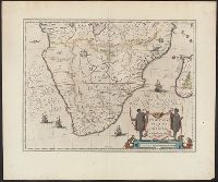
- Creator:
- Blaeu, Willem Janszoon, 1571-1638
- Published / Created:
- between 1643 and 1650]
- Call Number:
- 64 1643
- Container / Volume:
- BRBL_00338
- Image Count:
- 2
- Resource Type:
- Maps, Atlases & Globes
- Subject (Geographic):
- Africa, Southern--Maps--Early works to
- Found in:
- Beinecke Rare Book and Manuscript Library > Aethiopia inferior vel exterior.
- Creator:
- Blaeu, Willem Janszoon, 1571-1638
- Published / Created:
- anno 1635]
- Call Number:
- 62 1635A
- Container / Volume:
- BRBL_00734
- Image Count:
- 2
- Resource Type:
- Maps, Atlases & Globes
- Subject (Geographic):
- Africa, Southern--Maps--Early works to
- Found in:
- Beinecke Rare Book and Manuscript Library > Aethiopia inferior vel exterior.
- Creator:
- Sanson, Nicolas, 1600-1667, cartographer
- Published / Created:
- 1667
- Call Number:
- 60 1667
- Container / Volume:
- BRBL_00322
- Image Count:
- 1
- Resource Type:
- Maps, Atlases & Globes
- Subject (Geographic):
- Africa--History--Maps--Early works to
- Found in:
- Beinecke Rare Book and Manuscript Library > Africa vetus / Nicolai Sanson, Christianiss. Galliar. Regis geographi ; recognita emendata et multis in locis mutata, conatibus geographicis Gulielmi Sanson N[icolai] filii.
- Creator:
- Blankaart, Nikolaas, 1624-1703
- Published / Created:
- ca. 1662]
- Call Number:
- 60 1662A
- Container / Volume:
- BRBL_00322
- Image Count:
- 1
- Resource Type:
- Maps, Atlases & Globes
- Subject (Geographic):
- Africa--History--Maps--Early works to
- Found in:
- Beinecke Rare Book and Manuscript Library > Africae antiquae, et quarundam Europae, Asiaeque adiacentium regionum / accurata delineatio ad historiarum lucem a Nicolao Blancardo, Batavo, Leidensi historiarum et politices professore.
- Creator:
- Blankaart, Nikolaas, 1624-1703
- Published / Created:
- ca. 1662]
- Call Number:
- 60 1662
- Container / Volume:
- BRBL_00322
- Image Count:
- 1
- Resource Type:
- Maps, Atlases & Globes
- Subject (Geographic):
- Africa--History--Maps--Early works to
- Found in:
- Beinecke Rare Book and Manuscript Library > Africae antiquae, et quarundam Europae, Asiaeque adiacentium regionum / accurata delineatio ad historiarum lucem a Nicolao Blancardo, Batavo, Leidensi historiarum et politices professore.
- Creator:
- Blaeu, Joan, 1596-1673, creator
- Published / Created:
- [ca. 1670]
- Call Number:
- 1973 Folio 10
- Image Count:
- 1
- Resource Type:
- Maps, Atlases & Globes
- Subject (Geographic):
- Africa, North --Maps --Early works to
- Found in:
- Beinecke Rare Book and Manuscript Library > Barbaria