Skip to search
Skip to main content
Skip to first result
Search
You Searched For
Date
Unknown
"Africa--Maps--Early works to 1800"
Extent of Digitization
Completely digitized
Date Created
[Missing]
New Search
Search Results
Creator:
Call Number:
623 1750
Container / Volume:
BRBL_00333
Image Count:
1
Resource Type:
Maps, Atlases & Globes
Alternative Title:
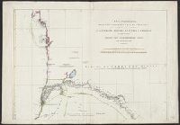
Nubia & Abissinia
Description:
From Bowen's A complete system of geography, 1747., Includes text and ill., and Relief shown pictorially.
Publisher:
Printed for W. Innys, R. Ware [etc.], 1747]
Subject (Geographic):
Africa , Eastern--Maps --Early works to
Subject (Name):
Bowen, Emanuel, d. 1767. Complete system of geography
Found in:
Beinecke Rare Book and Manuscript Library > A new and accurate map of Nubia & Abissinia, together with all the kingdoms tributary thereto, and bordering upon them / laid down from the latest & best authorities and regulated by astronl. observations ny Emanl. Bowen.
Creator:
Call Number:
60 1795
Container / Volume:
BRBL_00324
Image Count:
1
Resource Type:
Maps, Atlases & Globes
Description:
Relief shown pictorially. and Shows the routes of Bruce, Park, Brown, Watts and Winterbotts, and Le Vaillant.
Publisher:
s.n., 1799?]
Subject (Geographic):
Africa --Maps --Early works to 1800
Found in:
Beinecke Rare Book and Manuscript Library > General map of Africa : corrected according to the best observations and discovereies of the most recent travels / prepared by Citn. Lapie ; under the direction of the author.
Creator:
Call Number:
655 1751
Container / Volume:
BRBL_00345
Image Count:
1
Resource Type:
Maps, Atlases & Globes
Description:
Bar scales given in "Lieues Françoises de 3000 Pas Géométriques ou de 2500 Toises" and "Lieues Marines de 20au Degré, ou d'environ 2850 Toises.", Prime meridian: Ferro., Relief sho, Shows anchorages, banks, rivers, settlements, kingdoms, etc., and Watermarks.
Subject (Geographic):
Africa , West--Maps --Early works to 1800
Subject (Name):
Anville, Jean Baptiste Bourguignon d', 1697-1782. Atlas général and Haye, G. de la, engraver
Found in:
Beinecke Rare Book and Manuscript Library > Carte particulière de la Côte occidentale de l'Afrique : depuis le Cap Blanc jusqu'au Cap de Verga, et du cours des rivières de Sénéga et de Gambie, en ce qui est connu / dressée pour la Compagnie des Indes par le Sr. d'Anville ; Gravé par Guill. D
Branch:v1.61.6 ,Deployed:2024-06-12T09:55:36-04:00