Search
You Searched For
Search Results
- Creator:
- Tanner, Henry Schenck, 1786-1858
- Published / Created:
- [1839?]
- Call Number:
- G1200 T34 1839 (LC)
- Image Count:
- 4
- Resource Type:
- Maps, Atlases & Globes
- Found in:
- Beinecke Rare Book and Manuscript Library > A new American atlas [cartographic material] : containing maps of the several states of the North American union ... / by Henry S. Tanner.
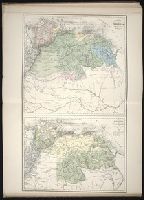
- Creator:
- Stieler, Adolf, 1775-1836
- Call Number:
- Lxe2 +842s
- Image Count:
- 2
- Resource Type:
- Maps, Atlases & Globes
- Found in:
- Beinecke Rare Book and Manuscript Library > Schul-Atlas über alle Theile der Erde nach dem neuesten Zustande, und über das Weltgebäude : nach Stieler's Hand-Atlas verkleinert.
- Creator:
- Chauveau, François, 1613-1676
Jaillot, Alexis Hubert, 1632?-1712. Atlas nouveau
Sanson, Guillaume
- Published / Created:
- 1673
- Call Number:
- 1973 Folio 57
- Collection Title:
- Composite atlas of 41 maps from Alexis Hubert Jaillot's Atlas nouveau.
- Image Count:
- 1
- Found in:
- Beinecke Rare Book and Manuscript Library > Provinces-Unies des Pays-Bas : auec leurs acquisitions dans La Flandre, Le Brabant, Le Limbourg, et Le Lyege, et les places queílles possedoient sur le Rhein, dans le Ducheí de Cleves, et dans l'Archevescheí et Eslectorat de Cologne / par le Sr. Sanson
- Creator:
- Moll, Herman, d. 1732
- Published / Created:
- [1732]
- Call Number:
- E1015 M66 1732
- Image Count:
- 1
- Found in:
- Beinecke Rare Book and Manuscript Library > Atlas minor: or a set of sixty-two new and correct maps, of all parts of the world. All composed and done by Herman Moll, geographer ...
- Creator:
- Moll, Herman, d. 1732
- Published / Created:
- [1732]
- Call Number:
- E1015 M66 1732
- Collection Title:
- Atlas minor: or a set of sixty-two new and correct maps, of all parts of the world. All composed
- Image Count:
- 1
- Found in:
- Beinecke Rare Book and Manuscript Library > The Island of St. Christophers, alias St. Kitts By H. Moll Geographer
- Published / Created:
- 1850
- Call Number:
- 1976 Folio 96
- Collection Title:
- A new universal atlas containing maps of the various empires, kingdoms, states and republics of the
- Image Count:
- 1
- Resource Type:
- Maps, Atlases & Globes
- Found in:
- Beinecke Rare Book and Manuscript Library > 10. Map of Connecticut
- Creator:
- Moll, Herman, d. 1732
- Published / Created:
- [1732]
- Call Number:
- E1015 M66 1732
- Collection Title:
- Atlas minor: or a set of sixty-two new and correct maps, of all parts of the world. All composed
- Image Count:
- 1
- Resource Type:
- Maps, Atlases & Globes
- Found in:
- Beinecke Rare Book and Manuscript Library > A general map of Great Britain and Ireland with part of Germany, Holland, Flanders, France &c. agreeable to modern history
- Published / Created:
- 1833
- Call Number:
- 2002 Folio 97
- Collection Title:
- Tanner’s universal atlas : subscription price $1.00 a number, seperate [sic] numbers $1.50 each
- Image Count:
- 1
- Resource Type:
- Maps, Atlases & Globes
- Found in:
- Beinecke Rare Book and Manuscript Library > A new map of Maine
- Creator:
- Humphrys, F
- Published / Created:
- 1850
- Call Number:
- 1975 Folio 26
- Collection Title:
- A new universal atlas containing maps of the various empires, kingdoms, states and republics of the
- Image Count:
- 1
- Resource Type:
- Maps, Atlases & Globes
- Found in:
- Beinecke Rare Book and Manuscript Library > Lengths of the principal rivers in the world
- Published / Created:
- 1850
- Call Number:
- 1975 Folio 26
- Collection Title:
- A new universal atlas containing maps of the various empires, kingdoms, states and republics of the
- Image Count:
- 1
- Resource Type:
- Maps, Atlases & Globes
- Found in:
- Beinecke Rare Book and Manuscript Library > A new map of Maine
- Published / Created:
- 1846
- Call Number:
- 1976 Folio 93
- Collection Title:
- Mitchell’s universal atlas
- Image Count:
- 1
- Resource Type:
- Maps, Atlases & Globes
- Found in:
- Beinecke Rare Book and Manuscript Library > A new map of Maine
- Published / Created:
- 1833
- Call Number:
- 1976 Folio 98
- Collection Title:
- A new universal atlas, containing maps of the various empires, kingdoms, states and republics of
- Image Count:
- 1
- Resource Type:
- Maps, Atlases & Globes
- Found in:
- Beinecke Rare Book and Manuscript Library > A new map of Maine
- Published / Created:
- 1850
- Call Number:
- 1976 Folio 96
- Collection Title:
- A new universal atlas containing maps of the various empires, kingdoms, states and republics of the
- Image Count:
- 1
- Resource Type:
- Maps, Atlases & Globes
- Found in:
- Beinecke Rare Book and Manuscript Library > A new map of Maine
- Call Number:
- 1976 Folio 94
- Collection Title:
- A new universal atlas containing maps of the various empires, kingdoms, states and republics of the
- Image Count:
- 1
- Resource Type:
- Maps, Atlases & Globes
- Found in:
- Beinecke Rare Book and Manuscript Library > A new map of Maine
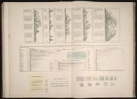
- Creator:
- Benitz, A.
- Published / Created:
- [1840]
- Call Number:
- 1973 Folio 105
- Collection Title:
- Atlas fisico y politico de la Republica de Venezuela ... por ... Agustin Codazzi ...
- Image Count:
- 1
- Resource Type:
- Maps, Atlases & Globes
- Found in:
- Beinecke Rare Book and Manuscript Library > Mapa de las costas de Tierra-Firme desde el Orinoco hasta Yucatan: de las islas Antillas y la mayor parte de las Lucayas, con las derrotas que siguio Dn. Cristobal Colon en sus descubrimientos por estos mares y las derrotas de otros navegantes que reconoc
- Creator:
- Benitz, A.
- Published / Created:
- [1840]
- Call Number:
- 1973 Folio 105
- Collection Title:
- Atlas fisico y politico de la Republica de Venezuela ... por ... Agustin Codazzi ...
- Image Count:
- 1
- Resource Type:
- Maps, Atlases & Globes
- Found in:
- Beinecke Rare Book and Manuscript Library > Mapa fisico de Venezuela, divida en hoyas hydrograficas.
- Creator:
- Benitz, A.
- Published / Created:
- [1840]
- Call Number:
- 1973 Folio 105
- Collection Title:
- Atlas fisico y politico de la Republica de Venezuela ... por ... Agustin Codazzi ...
- Image Count:
- 1
- Resource Type:
- Maps, Atlases & Globes
- Found in:
- Beinecke Rare Book and Manuscript Library > [Provincia de Apure]
- Creator:
- Benitz, A.
- Published / Created:
- [1840]
- Call Number:
- 1973 Folio 105
- Collection Title:
- Atlas fisico y politico de la Republica de Venezuela ... por ... Agustin Codazzi ...
- Image Count:
- 1
- Resource Type:
- Maps, Atlases & Globes
- Found in:
- Beinecke Rare Book and Manuscript Library > Carta del Canton de Upata de la provincia de la Guayana
- Creator:
- Benitz, A.
- Published / Created:
- [1840]
- Call Number:
- 1973 Folio 105
- Collection Title:
- Atlas fisico y politico de la Republica de Venezuela ... por ... Agustin Codazzi ...
- Image Count:
- 1
- Resource Type:
- Maps, Atlases & Globes
- Found in:
- Beinecke Rare Book and Manuscript Library > Carta del Canton de Angostura de la provincia de la Guayana
- Creator:
- Benitz, A.
- Published / Created:
- [1840]
- Call Number:
- 1973 Folio 105
- Collection Title:
- Atlas fisico y politico de la Republica de Venezuela ... por ... Agustin Codazzi ...
- Image Count:
- 1
- Resource Type:
- Maps, Atlases & Globes
- Found in:
- Beinecke Rare Book and Manuscript Library > Un cuadro de alturas que comprende las de las cordilleras de Merida, de la costa de Caracas, Coro, Cumana y Margarita, y ultimamente las del sistema de la Parima. Otro cuadro comparativo de la superficie y poblacion de cada provincia. Otro de los principa
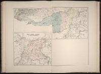
- Creator:
- Raleigh, Walter, Sir, 1552?-1618
- Call Number:
- 1978 Folio 106
- Collection Title:
- Maps of the Orinoco-Essequibo region, South America. Compiled for the Commission appointed by the
- Image Count:
- 1
- Resource Type:
- Maps, Atlases & Globes
- Found in:
- Beinecke Rare Book and Manuscript Library > Chart of Guiana by Sir Walter Raleigh, [1595?]
- Creator:
- Bry, Theodor de, 1528-1598
- Call Number:
- 1978 Folio 106
- Collection Title:
- Maps of the Orinoco-Essequibo region, South America. Compiled for the Commission appointed by the
- Image Count:
- 1
- Resource Type:
- Maps, Atlases & Globes
- Found in:
- Beinecke Rare Book and Manuscript Library > Map of Guiana by Theodore de Bry, 1599
- Creator:
- Sanson, Nicolas, 1600-1667
- Call Number:
- 1978 Folio 106
- Collection Title:
- Maps of the Orinoco-Essequibo region, South America. Compiled for the Commission appointed by the
- Image Count:
- 1
- Resource Type:
- Maps, Atlases & Globes
- Found in:
- Beinecke Rare Book and Manuscript Library > Map of Guiana and Caribana by N. Sanson d'Abbeville, Paris, 1656
- Creator:
- Arrowsmith, John, 1790-1873
- Published / Created:
- 1832
- Call Number:
- 1978 Folio 106
- Collection Title:
- Maps of the Orinoco-Essequibo region, South America. Compiled for the Commission appointed by the
- Image Count:
- 1
- Resource Type:
- Maps, Atlases & Globes
- Found in:
- Beinecke Rare Book and Manuscript Library > Part of a map of Colombia by J. Arrowsmith, London, 1832
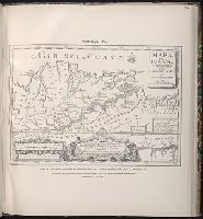
- Creator:
- Gumilla, Joseph, d. 1750
- Published / Created:
- 1741
- Call Number:
- 1978 Folio 106
- Collection Title:
- Maps of the Orinoco-Essequibo region, South America. Compiled for the Commission appointed by the
- Image Count:
- 1
- Resource Type:
- Maps, Atlases & Globes
- Found in:
- Beinecke Rare Book and Manuscript Library > Map of the Jesuit missions of New Granada, by father Joseph Gumilla, S. J., Madrid, 1741
- Published / Created:
- 1778
- Call Number:
- 1978 Folio 106
- Collection Title:
- Maps of the Orinoco-Essequibo region, South America. Compiled for the Commission appointed by the
- Image Count:
- 1
- Resource Type:
- Maps, Atlases & Globes
- Found in:
- Beinecke Rare Book and Manuscript Library > Map of the Spanish privince of Nueva Andalucia made at the order of the head of the Spanish Archive of the Indies by Luis de Surville, Assistant Archivist, 1778
- Published / Created:
- [15--]
- Call Number:
- 1978 Folio 106
- Collection Title:
- Maps of the Orinoco-Essequibo region, South America. Compiled for the Commission appointed by the
- Image Count:
- 1
- Resource Type:
- Maps, Atlases & Globes
- Found in:
- Beinecke Rare Book and Manuscript Library > Early Spanish map of Guiana
- Creator:
- Danckerts, Justus, 1635-1701
Danckerts, Theodore
- Published / Created:
- [1703?]
- Call Number:
- 1975 Folio 55
- Image Count:
- 6
- Found in:
- Beinecke Rare Book and Manuscript Library > Atlas
- Creator:
- Aa, Pieter van der, 1659-1733
Ferrarius, Philippus, d. 1626
Gueudeville, Nicolas, ca. 1654-ca. 1721
- Published / Created:
- 1713
- Call Number:
- 1978 Folio 112
- Image Count:
- 1
- Resource Type:
- Maps, Atlases & Globes
- Found in:
- Beinecke Rare Book and Manuscript Library > Le nouveau theatre du monde. ou La geographie royale, composée de nouvelles cartes tres-exactes ... Avec une description geographique et historique des quatre parties de l'univers, desquelles l'Europe en detail est écrite par Mr. Gueudeville, & les trois autres parties par Mr. Ferrarius ...
- Creator:
- Jode, Gerard de, 1509-1591
- Published / Created:
- [1578]
- Call Number:
- 1976 Folio 2
- Image Count:
- 1
- Found in:
- Beinecke Rare Book and Manuscript Library > Specvlvum orbis terrarvm.
- Creator:
- Berlinghieri, Francesco, 1440-1501
- Published / Created:
- before Sept. 1482]
- Call Number:
- 1978 Folio 136
- Image Count:
- 2
- Resource Type:
- Maps, Atlases & Globes
- Found in:
- Beinecke Rare Book and Manuscript Library > Geographia