Search
You Searched For
Search Results
- Creator:
- Cóvens et Mortier
- Published / Created:
- ca. 1730-ca. 1800]
- Call Number:
- 1973 Folio 71
- Image Count:
- 1
- Resource Type:
- Maps, Atlases & Globes
- Found in:
- Beinecke Rare Book and Manuscript Library > [Atlas nouveau contenant toutes les parties du monde ou sont exactement marqués les empires, monarchies, royaumes, états, republiques &c. Le tout recueilli par les meilleurs geógraphes.]
- Creator:
- Stockdale, John, 1749?-1814
- Published / Created:
- 1800 Nov. 24
- Call Number:
- CF1921 E38 1801
- Collection Title:
- An historical survey of the island of Saint Domingo, together with an account of the Maroon negroes
- Image Count:
- 1
- Resource Type:
- Maps, Atlases & Globes
- Found in:
- Beinecke Rare Book and Manuscript Library > A Map of the Island of St. Domingo
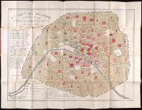
- Creator:
- Montigny, Léon.
- Published / Created:
- [1869]
- Call Number:
- 2015 523
- Image Count:
- 5
- Resource Type:
- Maps, Atlases & Globes
- Found in:
- Beinecke Rare Book and Manuscript Library > Les élections parisiennes de mai et juin 1869 [cartographic material] : application de la géométrie à la statistique / par Léon Montigny.
- Creator:
- Wytfliet, Corneille.
- Published / Created:
- 1597
- Call Number:
- 1977 +400
- Image Count:
- 2
- Resource Type:
- Maps, Atlases & Globes
- Found in:
- Beinecke Rare Book and Manuscript Library > Descriptionis Ptolemaicae avgmentvm, siue Occidentis notitia breui commentario illustrata, studio et opera Cornely Wytfliet Louaniensis.
- Creator:
- Great Britain. Hydrographic Dept.
- Call Number:
- Conrad +Zz1
- Image Count:
- 2
- Resource Type:
- Maps, Atlases & Globes
- Found in:
- Beinecke Rare Book and Manuscript Library > Original navigation charts used by Joseph Conrad.
- Creator:
- Kitchin, Thomas, d. 1784.
- Published / Created:
- 1773
- Call Number:
- 1979 Folio 59
- Image Count:
- 2
- Resource Type:
- Maps, Atlases & Globes
- Found in:
- Beinecke Rare Book and Manuscript Library > A general atlas, describing the whole universe. Being a compleat and new collection of the most approved maps extant; corrected with the utmost care, and augmented from the latest discoveries: the whole being an improvement of the maps of d'Anville and Robert ... By Thomas Kitchen, senior, and others ...
- Creator:
- Stieler, Adolf, 1775-1836
- Call Number:
- Lxe2 +842s
- Image Count:
- 2
- Resource Type:
- Maps, Atlases & Globes
- Found in:
- Beinecke Rare Book and Manuscript Library > Schul-Atlas über alle Theile der Erde nach dem neuesten Zustande, und über das Weltgebäude : nach Stieler's Hand-Atlas verkleinert.
- Creator:
- Beautemps-Beaupré, Charles François, 1766-1854.
- Published / Created:
- 1822-43.
- Call Number:
- 1975 +8
- Image Count:
- 3
- Resource Type:
- Maps, Atlases & Globes
- Found in:
- Beinecke Rare Book and Manuscript Library > Pilote français... rédigé par M. Beautemps-Beaupré, ingénieur hydrographe en chef de la Marine... Publié par ordre du roi...
- Creator:
- Moll, Herman, d. 1732
- Published / Created:
- [1732]
- Call Number:
- E1015 M66 1732
- Image Count:
- 1
- Found in:
- Beinecke Rare Book and Manuscript Library > Atlas minor: or a set of sixty-two new and correct maps, of all parts of the world. All composed and done by Herman Moll, geographer ...
- Creator:
- Moll, Herman, d. 1732
- Published / Created:
- [1732]
- Call Number:
- E1015 M66 1732
- Collection Title:
- Atlas minor: or a set of sixty-two new and correct maps, of all parts of the world. All composed
- Image Count:
- 1
- Found in:
- Beinecke Rare Book and Manuscript Library > The Island of St. Christophers, alias St. Kitts By H. Moll Geographer
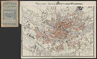
- Published / Created:
- [ca. 1896]
- Call Number:
- 36 N93 1896
- Container / Volume:
- BRBL_00125
- Image Count:
- 1
- Resource Type:
- Maps, Atlases & Globes
- Found in:
- Beinecke Rare Book and Manuscript Library > Neuester Plan der k[öniglichen] bayr[ischen] Stadt Nürnberg.
- Published / Created:
- 1797
- Call Number:
- 3213 1797
- Container / Volume:
- BRBL_00055
- Image Count:
- 1
- Resource Type:
- Maps, Atlases & Globes
- Found in:
- Beinecke Rare Book and Manuscript Library > A map of Kent.
- Creator:
- Rupert, Prince, Count Palatine, 1619-1682
- Published / Created:
- 1645
- Call Number:
- Osborn fb190
- Collection Title:
- Letters to and from Col. Willm Legge, transcribed from the originals, in the possession of William
- Image Count:
- 2
- Resource Type:
- Archives or Manuscripts
- Found in:
- Beinecke Rare Book and Manuscript Library > [Letter to William Legge, 1645 Jun 3, Leicester]
- Creator:
- Jefferys, Thomas, d. 1771
- Call Number:
- 1977 Folio 96
- Collection Title:
- The West-India atlas: or, A compendious description of the West-Indies: illustrated with forty
- Image Count:
- 1
- Resource Type:
- Maps, Atlases & Globes
- Found in:
- Beinecke Rare Book and Manuscript Library > The harbour of Bluefields.
- Call Number:
- 1972 Folio 31
- Collection Title:
- El teniente general D. Jose Manuel de Goyeneche, primer conde de Guaqui; apuntes y datos para la
- Image Count:
- 1
- Resource Type:
- Maps, Atlases & Globes
- Found in:
- Beinecke Rare Book and Manuscript Library > Region del lago Titicaca. Mapa mandado levantar por el General Goyeneche. (Del Archivo del Condo de Guaqui.)
- Published / Created:
- 1720
- Call Number:
- C6 033c
- Collection Title:
- The natural and civil history of the French dominions in North and South America : with an
- Image Count:
- 1
- Resource Type:
- Maps, Atlases & Globes
- Found in:
- Beinecke Rare Book and Manuscript Library > Plan of New Orleans the capital of Louisiana; with the disposition of its quarters and canals as they have been traced by Mr. de la Tour in the year 1720
- Creator:
- Jefferys, Thomas, d. 1771
- Call Number:
- C6 033c
- Collection Title:
- The natural and civil history of the French dominions in North and South America : with an
- Image Count:
- 1
- Resource Type:
- Maps, Atlases & Globes
- Found in:
- Beinecke Rare Book and Manuscript Library > The island of Hispaniola called by the French St. Domingo. Subject to France and Spain. from the best authorities by Thomas Jeffreys, geographer to his Royal Highness the Prince of Wales
- Creator:
- Jefferys, Thomas, d. 1771
- Call Number:
- C6 033c
- Collection Title:
- The natural and civil history of the French dominions in North and South America : with an
- Image Count:
- 1
- Resource Type:
- Maps, Atlases & Globes
- Found in:
- Beinecke Rare Book and Manuscript Library > An authentic plan of the town and harbour of Cap Francois in the isle of St. Domingo. By Thomas Jefferys geographer to his Royal Highness the Prince of Wales
- Creator:
- Bennett, John
Sayer, Robert, 1725-1794
- Call Number:
- 1977 Folio 78
- Collection Title:
- A New and accurate chart of the West-India Islands and coast, with the gulf passage through the New
- Image Count:
- 1
- Resource Type:
- Maps, Atlases & Globes
- Found in:
- Beinecke Rare Book and Manuscript Library > A new general chart of the West Indies from the latest marine journals and surveys. Regulated and ascertained by astronomical observations
- Call Number:
- 1977 Folio 78
- Collection Title:
- A New and accurate chart of the West-India Islands and coast, with the gulf passage through the New
- Image Count:
- 1
- Resource Type:
- Maps, Atlases & Globes
- Found in:
- Beinecke Rare Book and Manuscript Library > A plan of Fort St. Louis harbour on the south side of Hispaniola, pl. 31.