Search
You Searched For
Search Results
- Creator:
- Great Britain. Foreign Office
Justus Perthes (Firm : Gotha, Germany)
Moras, Ferdinand, 1821-1908
Petermann, A. (August Heinrich), 1822-1878
- Published / Created:
- 1854
- Call Number:
- Folio 296
- Image Count:
- 1
- Resource Type:
- Books, Journals & Pamphlets
- Found in:
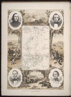
- Beinecke Rare Book and Manuscript Library > ... An account of the progress of the expedition to Central Africa, performed by order of Her Majesty's Foreign office, under Messrs. Richardson, Barth, Overweg & Vogel, in the years 1850, 1851, 1852, and 1853. Consisting of maps and illustrations, with descriptive notes, constructed and comp. from official and private materials by Augustus Petermann ...
- Published / Created:
- 1846
- Call Number:
- 1976 Folio 93
- Collection Title:
- A new universal atlas containing maps of the various empires, kingdoms, states and republics of the
- Image Count:
- 1
- Resource Type:
- Maps, Atlases & Globes
- Found in:
- Beinecke Rare Book and Manuscript Library > 9. Connecticut
- Published / Created:
- 1719
- Call Number:
- Defoe 50 719db 1
- Collection Title:
- The life and strange surprizing adventures of Robinson Crusoe, of York, mariner : who lived eight
- Image Count:
- 1
- Resource Type:
- Maps, Atlases & Globes
- Found in:
- Beinecke Rare Book and Manuscript Library > A Map of the world, on wch is delineated the voyages of Robinson Cruso
- Call Number:
- 1989 +19
- Collection Title:
- A collection of voyages and travels, some now first printed from original manuscripts, others now
- Image Count:
- 1
- Resource Type:
- Maps, Atlases & Globes
- Found in:
- Beinecke Rare Book and Manuscript Library > A chart and map of the Gold Coast of Guinea from Rio da Corsa to Ro da Volta. vol. V [5], pl. K
- Published / Created:
- 1739
- Call Number:
- WeInd Ehc 739
- Collection Title:
- A description of the Windward Passage, and Gulf of Florida, with the course of the British trading
- Image Count:
- 1
- Resource Type:
- Maps, Atlases & Globes
- Found in:
- Beinecke Rare Book and Manuscript Library > A chart of the Bahamas Islands with a description of the Gulf of Florida and Windward passage &c. referr'd from the figures here set down, to the general index annexed ... by J.C
- Creator:
- Evans, Lewis, 1700?-1756
- Call Number:
- Egg +755E
- Collection Title:
- Geographical, historical, political, philosophical and mechanical essays : the first, containing an
- Image Count:
- 1
- Found in:
- Beinecke Rare Book and Manuscript Library > A general map of the middle British colonies in America
- Creator:
- Seller, John, fl. 1658-1698
- Call Number:
- 1976 Folio 139
- Collection Title:
- The English pilot: describing the sea-coasts, capes, head-lands, soundings, sands, shoals, rocks
- Image Count:
- 1
- Found in:
- Beinecke Rare Book and Manuscript Library > A large description of the two chanells in the River Dwina goeing up to the citty of Archangel by John Seller
- Creator:
- Clark, William, 1770-1838
Lewis, Samuel, 1753 or 4-1822
- Published / Created:
- [ca. 1814]
- Call Number:
- Zc10 814Le
- Collection Title:
- History of the expedition under the command of Captains Lewis and Clark, to the sources of the
- Image Count:
- 2
- Resource Type:
- Maps, Atlases & Globes
- Found in:
- Beinecke Rare Book and Manuscript Library > A map of Lewis and Clark's track, across the western portion of North America fom the Mississippi to the Pacific Ocean; by order of the Executive of the United States . In 1804, 5 & 6
- Call Number:
- 1977 +392
- Collection Title:
- A survey of the cities of London and Westminster : containing the original, antiquity, increase
- Image Count:
- 1
- Resource Type:
- Maps, Atlases & Globes
- Found in:
- Beinecke Rare Book and Manuscript Library > A map of the parish if St. Katherines by the Tower
- Call Number:
- 1977 +392
- Collection Title:
- A survey of the cities of London and Westminster : containing the original, antiquity, increase
- Image Count:
- 1
- Resource Type:
- Maps, Atlases & Globes
- Found in:
- Beinecke Rare Book and Manuscript Library > A map of the parish of St. Dustans Stepney and Stebunheath divided into hamlets
- Call Number:
- 1977 +392
- Collection Title:
- A survey of the cities of London and Westminster : containing the original, antiquity, increase
- Image Count:
- 1
- Resource Type:
- Maps, Atlases & Globes
- Found in:
- Beinecke Rare Book and Manuscript Library > A mapp of the parishes of St. Clements Danes, St. Mary Savoy; with the Rolls Liberty and Lincolns Inn, taken from the last survey with corrections and additions
- Call Number:
- 1977 +392
- Collection Title:
- A survey of the cities of London and Westminster : containing the original, antiquity, increase
- Image Count:
- 1
- Resource Type:
- Maps, Atlases & Globes
- Found in:
- Beinecke Rare Book and Manuscript Library > A mapp of the parishes of St. Saviours Southwark and St. Georges taken from the last survey with corrections
- Creator:
- Bennett, John
Sayer, Robert, 1725-1794
- Call Number:
- 1977 Folio 78
- Collection Title:
- A New and accurate chart of the West-India Islands and coast, with the gulf passage through the New
- Image Count:
- 1
- Resource Type:
- Maps, Atlases & Globes
- Found in:
- Beinecke Rare Book and Manuscript Library > A new general chart of the West Indies from the latest marine journals and surveys. Regulated and ascertained by astronomical observations
- Published / Created:
- 1850
- Call Number:
- 1975 Folio 26
- Collection Title:
- A new universal atlas containing maps of the various empires, kingdoms, states and republics of the
- Image Count:
- 1
- Resource Type:
- Maps, Atlases & Globes
- Found in:
- Beinecke Rare Book and Manuscript Library > A new map of Maine
- Published / Created:
- 1846
- Call Number:
- 1976 Folio 93
- Collection Title:
- Mitchell’s universal atlas
- Image Count:
- 1
- Resource Type:
- Maps, Atlases & Globes
- Found in:
- Beinecke Rare Book and Manuscript Library > A new map of Maine
- Call Number:
- 1977 +379
- Collection Title:
- Geografia; cioe, Descrittione vniversale della terra. Partita in due volumi, nel primo de' quali si
- Image Count:
- 1
- Found in:
- Beinecke Rare Book and Manuscript Library > A new map of that part of Africacalled the coast of Guinea ...
- Call Number:
- 1977 Folio 78
- Collection Title:
- A New and accurate chart of the West-India Islands and coast, with the gulf passage through the New
- Image Count:
- 1
- Resource Type:
- Maps, Atlases & Globes
- Found in:
- Beinecke Rare Book and Manuscript Library > A plan of Fort St. Louis harbour on the south side of Hispaniola, pl. 31.
- Call Number:
- 1977 Folio 78
- Collection Title:
- A New and accurate chart of the West-India Islands and coast, with the gulf passage through the New
- Image Count:
- 1
- Resource Type:
- Maps, Atlases & Globes
- Found in:
- Beinecke Rare Book and Manuscript Library > A plan of Monte-Christe Bay with the Seven Brothers on the north coast of St. Domingo, pl. 38
- Call Number:
- 1977 Folio 78
- Collection Title:
- A New and accurate chart of the West-India Islands and coast, with the gulf passage through the New
- Image Count:
- 1
- Resource Type:
- Maps, Atlases & Globes
- Found in:
- Beinecke Rare Book and Manuscript Library > A plan of the road of Port Paix in the island of Hispaniola, pl. 35.
- Creator:
- Smith, John, 1580-1631
- Published / Created:
- 1631
- Call Number:
- Taylor 316
- Image Count:
- 2
- Found in:
- Beinecke Rare Book and Manuscript Library > Advertisements for the unexperienced planters of New-England, or anywhere, or, The path-way to experience to erect a plantation : With the yearely proceedings of this country in fishing and planting, since the yeare 1614. to the yeare 1630. and their present estate. Also how to prevent the greatest inconveniences, by their proceedings in Virginia, and other plantations, by approved examples. With the countries armes, a description of the coast, harbours, habitations, land-markes, latitude and longitude: with the map, allowed by our royall King Charles. By Captaine Iohn Smith, sometimes governour of Virginia, and admirall of Nevv-England.