Skip to search
Skip to main content
Skip to first result
Search
You Searched For
Extent of Digitization
Partially digitized
Format
cartographic
New Search
Search Results
Call Number:
Ik P810 +Z745
Collection Title:
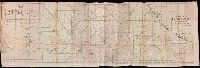
A plan of Mr. Pope’s garden : as it was left at his death, with a plan and perspective view of the
Image Count:
1
Resource Type:
Books, Journals & Pamphlets
Subject (Name):
Pope, Alexander, 1688-1744, Pope, Alexander, 1688-1744 --Homes and haunts, and Pope, Alexander, 1688-1744 Verses on the grotto at Twickenham
Collection Created:
London, Printed for R. Dodsley, at Tully’s Head in Pall-Mall; and sold by M. Cooper in Pater-noster-Row, 1745
Found in:
Beinecke Rare Book and Manuscript Library > A plan of Mr. Pope's garden as it was left at his death
Call Number:
1977 Folio 78
Collection Title:
A New and accurate chart of the West-India Islands and coast, with the gulf passage through the New
Image Count:
1
Resource Type:
Maps, Atlases & Globes
Alternative Title:
A plan on the town and harbour of Cap Francois in the island of St. Domingo. pl. 36
Collection Created:
London, Printed for Robert Sayer and John Bennett, Fleet-Street, 1779
Found in:
Beinecke Rare Book and Manuscript Library > A plan of the road of Port Paix in the island of Hispaniola, pl. 35.
Call Number:
CF2041 +L54
Collection Title:
A true & exact history of the island of Barbados. Illustrated with a mapp of the island, as also
Image Count:
1
Resource Type:
Maps, Atlases & Globes
Description:
Verso blank.
Subject (Geographic):
Barbados --Description and travel and Barbados --Maps --Early works to 1800
Collection Created:
London, Printed for H. Moseley, 1657
Found in:
Beinecke Rare Book and Manuscript Library > A topographicall description and admeasurement of the yland of Barbados in the West Indyaes with the m.rs names of the seuerall plantacons
Creator:
Published / Created:
1748
Call Number:
2000 876
Image Count:
1
Description:
"With charts of the southern part of South America, of part of the Pacific Ocean, and of the track of the Centurion round the world"--T.p., Apparently compiled by Richard Walter and revised by Benjamin Robins (cf. Dictionary of National Biography, v. 48, p. 435)., BEIN 2000 876: Autograph: W. Smith., and Page 541 numbered 441.
Publisher:
Printed for John and Paul Knapton ...,
Subject (Name):
Anson, George Anson,--Baron,--1697-1762, Centurion (Ship), Robins, Benjamin, 1707-1751, Smith, W.--Autograph, and Walter, Richard, 1716?-1785
Subject (Topic):
Voyages around the world--Early works to 1800
Found in:
Beinecke Rare Book and Manuscript Library > A voyage round the world in the years MDCCXL, I, II, III, IV / by George Anson, Esq. ; compiled from the papers and other materials of the Right Honourable George Lord Anson and published under his direction by Richard Walter, M.A. ...
Creator:
Published / Created:
1631
Call Number:
Taylor 316
Image Count:
2
Alternative Title:
New England: the most remarqueable parts thus named by the high and mighty Prince Charles, nowe King of great Britaine [map] and Path-way to experience to erect a plantation.
Description:
Imperfect: damp-stained; added port. of Charles I., Map with portrait of Capt. Smith in corner: New England ... / observed and described by Captayn John Smith. 1614. Pendleton's Lithography, Boston. Drawn by J. Eddy. London, printed by Geor: Low., Signatures: A-F⁴., and Teaching resource: Professor John Mack Faragher, History 141: The American West.
Publisher:
Printed by I. Haviland, and are to be sold by R. Milbovrne,
Subject (Geographic):
Massachusetts--History--Colonial period, ca. 1600-1775, Massachusetts--Maps--Early works to 1800, New England--Description and travel, New England--History--Colonial period, ca. 1600-1775, and New England--Maps--Early works to 1800
Subject (Name):
Pasaeus, Simon and Reeve, James
Found in:
Beinecke Rare Book and Manuscript Library > Advertisements for the unexperienced planters of New-England, or anywhere, or, The path-way to experience to erect a plantation : With the yearely proceedings of this country in fishing and planting, since the yeare 1614. to the yeare 1630. and their present estate. Also how to prevent the greatest inconveniences, by their proceedings in Virginia, and other plantations, by approved examples. With the countries armes, a description of the coast, harbours, habitations, land-markes, latitude and longitude: with the map, allowed by our royall King Charles. By Captaine Iohn Smith, sometimes governour of Virginia, and admirall of Nevv-England.
Published / Created:
[1542]
Call Number:
Taylor 86
Collection Title:
Rvdimenta cosmographica
Image Count:
1
Subject (Geographic):
Africa, Arab countries, and Middle East
Subject (Topic):
Cosmography, Early maps, and Geography, Medieval
Collection Created:
Impressvm in inclyta Transylvaniae Corona 1542
Found in:
Beinecke Rare Book and Manuscript Library > Africa
Call Number:
1977 +392
Collection Title:
A survey of the cities of London and Westminster : containing the original, antiquity, increase
Image Count:
1
Resource Type:
Maps, Atlases & Globes
Description:
Plate between p. 54-55.
Subject (Geographic):
London (England)--History
Collection Created:
London : Printed for A. Churchill, J. Knapton, R. Knaplock, J. Walthoe [and 6 others], 1720
Found in:
Beinecke Rare Book and Manuscript Library > Aldgate Ward with its division into parishes. Taken from the last survey, with corrections & additions
Call Number:
1971 Folio 601
Collection Title:
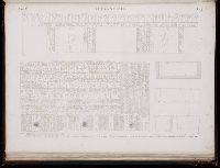
Description de lEgypte, ou, Recueil de observations et des recherches qui ont ete faites en Egypte
Image Count:
1
Subject (Geographic):
Egypt
Subject (Topic):
Inscriptions, Hieroglyphic, Natural history., and Scientific expeditions.
Collection Created:
Paris, Imprimerie imperiale, 1809-28
Found in:
Beinecke Rare Book and Manuscript Library > Alexandrie. pl. 41
Call Number:
1977 1341
Collection Title:
Geographiae vniversae opvs habentur Cl. Ptolemaei ... Geographicae enarationis libri octo [tr. by W
Image Count:
1
Resource Type:
Books, Journals & Pamphlets
Subject (Topic):
Geography--Early works to 1800
Collection Created:
Venetiis : Apud Haeredes Simonis Galignani de Karera, 1596
Found in:
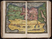
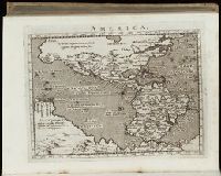
Beinecke Rare Book and Manuscript Library > America
Call Number:
Gfp94 gf525j
Collection Title:
Geographiae vniversae ... opvs ... habentur Cl. Ptolemaei ... Geographicae enarrationis libri octo
Image Count:
1
Resource Type:
Books, Journals & Pamphlets
Subject (Topic):
Geography--Early works to 1800
Collection Created:
Venetiis : Apud Haeredes Simonis Galignani de Karera, 1596
Found in:
Beinecke Rare Book and Manuscript Library > America
Branch:v1.61.6 ,Deployed:2024-06-12T09:55:33-04:00