Skip to search
Skip to main content
Skip to first result
Search
You Searched For
Extent of Digitization
Partially digitized
Access
Public
Genre
Engravings
Genre
Maps in books
New Search
Search Results
Published / Created:
1833
Call Number:
1976 Folio 98
Collection Title:
A new universal atlas, containing maps of the various empires, kingdoms, states and republics of
Image Count:
1
Resource Type:
Maps, Atlases & Globes
Subject (Geographic):
Maine
Collection Created:
Philadelphia, Published by the author, 1836
Found in:
Beinecke Rare Book and Manuscript Library > A new map of Maine
Published / Created:
1850
Call Number:
1976 Folio 96
Collection Title:
A new universal atlas containing maps of the various empires, kingdoms, states and republics of the
Image Count:
1
Resource Type:
Maps, Atlases & Globes
Publisher:
Thomas, Cowperthwait & Co
Subject (Geographic):
Maine
Collection Created:
Philadelphia, Cowperthwait, DeSilver & Butler, 1854, c1850
Found in:
Beinecke Rare Book and Manuscript Library > A new map of Maine
Call Number:
1976 Folio 94
Collection Title:
A new universal atlas containing maps of the various empires, kingdoms, states and republics of the
Image Count:
1
Resource Type:
Maps, Atlases & Globes
Subject (Geographic):
Maine
Collection Created:
Philadelphia, S.A. Mitchell, 1849
Found in:
Beinecke Rare Book and Manuscript Library > A new map of Maine
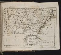
Creator:
Published / Created:
1775 September
Call Number:
A89 P384
Collection Title:
The Pennsylvania magazine: or, American monthly museum
Image Count:
1
Resource Type:
Books, Journals & Pamphlets
Description:
Verso blank.
Subject (Name):
Paine, Thomas, 1737-1809
Collection Created:
Philadelphia, Printed and sold by R. Aitken [1775-1776]
Found in:
Beinecke Rare Book and Manuscript Library > A new map of North & South Carolina, & Georgia
Creator:
Published / Created:
Undated
Call Number:
1973 Folio 71
Collection Title:
[Atlas nouveau contenant toutes les parties du monde ou sont exactement marques les empires
Image Count:
1
Resource Type:
Maps, Atlases & Globes
Abstract:
Factitious collection of about 549 maps taken from the atlases of the 17th and the beginning of the 18th century, put together with the title "Atlas" and bound in 6 volumes. These volumes originally bore the imprint: Amstelaedamii apvd Reiniervm & Josvam Ottens. Over these words on the title pages of volumes 1-2 and 4-6 is the name of Henrik de Leth who painted them.
Description:
Verso blank.
Subject (Geographic):
British Isles --Maps --Early works to 1800
Subject (Name):
Leth, Hendrik de, 1703-1766, Reiner et Josua Ottens (Firm), Schenck, Peter, 1661-1715, Schenck, Peter, ca. 1698-1752, Valck, G. (Gerard), 1651 or 2-1726, and Wit, Frederik de
Subject (Topic):
Atlases --Early works to 1800
Collection Created:
[A Amsterdam, chez J. Covens & C. Mortier, ca. 1730-ca. 1800]
Found in:
Beinecke Rare Book and Manuscript Library > A new mapp of the kingdome of England, representing the princedome of Wales, and other provinces, cities, market towns, with the roads from town to town and the number of reputed miles between them, are given by inspection without scale or compass
Call Number:
Ik P810 +Z745
Collection Title:
A plan of Mr. Pope’s garden : as it was left at his death, with a plan and perspective view of the
Image Count:
1
Resource Type:
Books, Journals & Pamphlets
Subject (Name):
Pope, Alexander, 1688-1744, Pope, Alexander, 1688-1744 --Homes and haunts, and Pope, Alexander, 1688-1744 Verses on the grotto at Twickenham
Collection Created:
London, Printed for R. Dodsley, at Tully’s Head in Pall-Mall; and sold by M. Cooper in Pater-noster-Row, 1745
Found in:
Beinecke Rare Book and Manuscript Library > A plan of Mr. Pope's garden as it was left at his death
Branch:v1.61.6 ,Deployed:2024-06-12T09:55:36-04:00