Skip to search
Skip to main content
Skip to first result
Search
You Searched For
Date
-
Extent of Digitization
Partially digitized
Access
Public
Genre
Maps
Genre
Prints (Visual works)
Resource Type
Maps, Atlases & Globes
New Search
Search Results
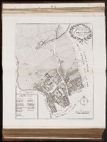
Call Number:
1977 +392
Collection Title:
A survey of the cities of London and Westminster : containing the original, antiquity, increase
Image Count:
1
Resource Type:
Maps, Atlases & Globes
Description:
Plate between p. 52-53.
Subject (Geographic):
London (England)--History
Collection Created:
London : Printed for A. Churchill, J. Knapton, R. Knaplock, J. Walthoe [and 6 others], 1720
Found in:
Beinecke Rare Book and Manuscript Library > The Wards of Farington within and Baynards Castle with its divisions into parishes taken from the last survey with corrections
Creator:
Call Number:
Ee +633gb
Collection Title:
The voyages and travells of the ambassadors sent by Frederick, duke of Holstein, to the great Duke
Image Count:
1
Resource Type:
Maps, Atlases & Globes
Description:
Between pp. 112-113.
Subject (Geographic):
Asia--Description and travel., East Indies--Description and travel, and Iran--Description and travel.
Subject (Topic):
Voyages and travels
Collection Created:
London : Printed for J. Starkey and T. Basset, 1669
Found in:
Beinecke Rare Book and Manuscript Library > The course of the great River Wolga
Creator:
Call Number:
1977 Folio 96
Collection Title:
The West-India atlas: or, A compendious description of the West-Indies: illustrated with forty
Image Count:
1
Resource Type:
Maps, Atlases & Globes
Alternative Title:
The harbours of Kingston and Port Royal and The windward passage, with the several passages, from the...east end of Cuba, and the north part of St. Domingo.
Description:
With two inset maps.
Subject (Geographic):
Cuba. and Santo Domingo (Dominican Republic)
Subject (Topic):
Nautical charts
Collection Created:
London, Printed for Robert Sayer and John Bennett, Fleet-Street, 1775
Found in:
Beinecke Rare Book and Manuscript Library > The harbour of Bluefields.
Call Number:
WeInd Ehc 762J
Collection Title:
A description of the Spanish islands and settlements on the coast of the West Indies / compiled
Image Count:
1
Resource Type:
Maps, Atlases & Globes
Description:
Between pp. 92-93
Subject (Geographic):
Hispaniola. and West Indies --Description and travel
Collection Created:
London : For T. Jefferys, 1762
Found in:
Beinecke Rare Book and Manuscript Library > The island of Hispaniola called by the French St. Domingo. Subject to France and Spain
Creator:
Call Number:
C6 033c
Collection Title:
The natural and civil history of the French dominions in North and South America : with an
Image Count:
1
Resource Type:
Maps, Atlases & Globes
Description:
Plate between p. 2-3.
Subject (Geographic):
Atlantic Ocean--Charts, maps, etc., Atlantic Ocean--Maps--Early works to 1800, and Santo Domingo (Dominican Republic)
Collection Created:
London, Printed for T. Jeffreys, 1761
Found in:
Beinecke Rare Book and Manuscript Library > The island of Hispaniola called by the French St. Domingo. Subject to France and Spain. from the best authorities by Thomas Jeffreys, geographer to his Royal Highness the Prince of Wales
Call Number:
1977 +392
Collection Title:
A survey of the cities of London and Westminster : containing the original, antiquity, increase
Image Count:
2
Resource Type:
Maps, Atlases & Globes
Description:
Plate between p. 62-63.
Subject (Geographic):
London
Collection Created:
London : Printed for A. Churchill, J. Knapton, R. Knaplock, J. Walthoe [and 6 others],
Found in:
Beinecke Rare Book and Manuscript Library > The parish of St. James Clerkenwell taken from [the] last survey with corrections
Call Number:
1977 +392
Collection Title:
A survey of the cities of London and Westminster : containing the original, antiquity, increase
Image Count:
1
Resource Type:
Maps, Atlases & Globes
Description:
Plate between p. 44-45.
Subject (Geographic):
London (England)--History
Collection Created:
London : Printed for A. Churchill, J. Knapton, R. Knaplock, J. Walthoe [and 6 others], 1720
Found in:
Beinecke Rare Book and Manuscript Library > The parish of St. Johns Wapping
Creator:
Published / Created:
1841
Call Number:
1977 Folio 193
Collection Title:
A new general atlas of modern geography, consisting of a complete collection of maps of the four
Image Count:
1
Resource Type:
Maps, Atlases & Globes
Subject (Topic):
Cosmology --Pictorial works and Solar system --Pictorial works
Collection Created:
London, Published by James Wyld [1845?]
Found in:
Beinecke Rare Book and Manuscript Library > The phenomena of the universe ...
Creator:
Published / Created:
c1891
Call Number:
Zc86 893scd
Collection Title:
Appletons' guide-book to Alaska and the northwest coast ...
Image Count:
1
Resource Type:
Maps, Atlases & Globes
Description:
Folded map in back pocket.
Publisher:
Poole Bros
Subject (Geographic):
Alaska. and Northwest Coast of North America
Collection Created:
New York, D. Appleton and Company, 1899
Found in:
Beinecke Rare Book and Manuscript Library > The route of the Alaska excursion steamers
Creator:
Published / Created:
1775
Call Number:
1977 Folio 96
Collection Title:
The West-India atlas: or, A compendious description of the West-Indies: illustrated with forty
Image Count:
1
Resource Type:
Maps, Atlases & Globes
Subject (Geographic):
Turks Island Passage (Turks and Caicos Islands)
Subject (Topic):
Nautical charts
Collection Created:
London, Printed for Robert Sayer and John Bennett, Fleet-Street, 1775
Found in:
Beinecke Rare Book and Manuscript Library > Turks Islands, from a survey made in 1753, by the the sloops l'Aigle and l'Emeraude, by order of the French Governor of Hispaniola, with improvements from observations, made in 1770, in the Sr. Edward Hawke Kings Schooner
Branch:v1.61.6 ,Deployed:2024-06-12T09:55:36-04:00