Search
You Searched For
Search Results
- Published / Created:
- 1846
- Call Number:
- 1976 Folio 93
- Collection Title:
- A new universal atlas containing maps of the various empires, kingdoms, states and republics of the
- Image Count:
- 1
- Resource Type:
- Maps, Atlases & Globes
- Publisher:
- S. Augustus Mitchell
- Subject (Geographic):
- Connecticut
- Collection Created:
- Philadelphia, S.A. Mitchell, 1847, c1844
- Found in:
- Beinecke Rare Book and Manuscript Library > 9. Connecticut
- Creator:
- Stockdale, John, 1749?-1814
- Published / Created:
- 1800 Nov. 24
- Call Number:
- CF1921 E38 1801
- Collection Title:
- An historical survey of the island of Saint Domingo, together with an account of the Maroon negroes
- Image Count:
- 1
- Resource Type:
- Maps, Atlases & Globes
- Description:
- Between p. 224-225.
- Subject (Geographic):
- Jamaica and West Indies
- Subject (Topic):
- Indians of the West Indies --Jamaica
- Collection Created:
- London,
- Found in:
- Beinecke Rare Book and Manuscript Library > A Map of the Island of St. Domingo
- Creator:
- Clark, William, 1770-1838
Lewis, Samuel, 1753 or 4-1822
- Published / Created:
- [ca. 1814]
- Call Number:
- Zc10 814Le
- Collection Title:
- History of the expedition under the command of Captains Lewis and Clark, to the sources of the
- Image Count:
- 2
- Resource Type:
- Maps, Atlases & Globes
- Description:
- Verso blank.
- Subject (Geographic):
- Columbia River, Missouri River, and West (U.S.)
- Subject (Topic):
- Lewis and Clark Expedition (1804-1806)
- Collection Created:
- Philadelphia : Bradford & Inskeep ; New York : A.H. Inskeep : J. Maxwell, Printer, 1814
- Found in:
- Beinecke Rare Book and Manuscript Library > A map of Lewis and Clark's track, across the western portion of North America fom the Mississippi to the Pacific Ocean; by order of the Executive of the United States . In 1804, 5 & 6
- Published / Created:
- 1833
- Call Number:
- 2002 Folio 97
- Collection Title:
- Tanner’s universal atlas : subscription price $1.00 a number, seperate [sic] numbers $1.50 each
- Image Count:
- 1
- Resource Type:
- Maps, Atlases & Globes
- Alternative Title:
- II.-Map of the state of Maine
- Description:
- Plate identified as "II" on atlas cover and "5" on map. and Verso blank.
- Subject (Geographic):
- Maine
- Collection Created:
- Philadelphia : Published by the author, 1833-1836
- Found in:
- Beinecke Rare Book and Manuscript Library > A new map of Maine
- Published / Created:
- 1846
- Call Number:
- 1976 Folio 93
- Collection Title:
- Mitchell’s universal atlas
- Image Count:
- 1
- Resource Type:
- Maps, Atlases & Globes
- Subject (Geographic):
- Maine
- Collection Created:
- Philadelphia, S.A. Mitchell, 1847, c1844
- Found in:
- Beinecke Rare Book and Manuscript Library > A new map of Maine
- Published / Created:
- 1833
- Call Number:
- 1976 Folio 98
- Collection Title:
- A new universal atlas, containing maps of the various empires, kingdoms, states and republics of
- Image Count:
- 1
- Resource Type:
- Maps, Atlases & Globes
- Subject (Geographic):
- Maine
- Collection Created:
- Philadelphia, Published by the author, 1836
- Found in:
- Beinecke Rare Book and Manuscript Library > A new map of Maine
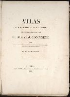
- Creator:
- Barralet, John James, 1747-1815
Humphrys, William, 1794-1865
- Published / Created:
- 1836
- Call Number:
- 1976 Folio 98
- Collection Title:
- A new universal atlas, containing maps of the various empires, kingdoms, states and republics of
- Image Count:
- 1
- Resource Type:
- Maps, Atlases & Globes
- Description:
- Illustrated vignette depicting the first landing of Columbus in the new world.
- Collection Created:
- Philadelphia, Published by the author, 1836
- Found in:
- Beinecke Rare Book and Manuscript Library > A new universal atlas, containing maps of the various empires, kingdoms, states and republics of the world ...