Skip to search
Skip to main content
Skip to first result
Search
You Searched For
Date
1850 - 1899
Extent of Digitization
Partially digitized
Resource Type
Maps, Atlases & Globes
Date Created
1850 to 1899
New Search
Search Results
Published / Created:
1850
Call Number:
1976 Folio 96
Collection Title:
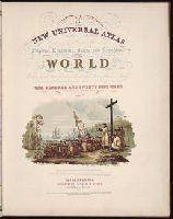
A new universal atlas containing maps of the various empires, kingdoms, states and republics of the
Image Count:
1
Resource Type:
Maps, Atlases & Globes
Publisher:
Thomas, Cowperthwait & Co
Subject (Geographic):
Connecticut
Collection Created:
Philadelphia, Cowperthwait, DeSilver & Butler, 1854, c1850
Found in:
Beinecke Rare Book and Manuscript Library > 10. Map of Connecticut
Published / Created:
1850
Call Number:
1975 Folio 26
Collection Title:
A new universal atlas containing maps of the various empires, kingdoms, states and republics of the
Image Count:
1
Resource Type:
Maps, Atlases & Globes
Subject (Name):
P.S. Duval & Son
Collection Created:
Philadelphia, Thomas, Cowperthwait & Co., No. 253 Market street, 1852
Found in:
Beinecke Rare Book and Manuscript Library > A new map of Maine
Published / Created:
1850
Call Number:
1976 Folio 96
Collection Title:
A new universal atlas containing maps of the various empires, kingdoms, states and republics of the
Image Count:
1
Resource Type:
Maps, Atlases & Globes
Publisher:
Thomas, Cowperthwait & Co
Subject (Geographic):
Maine
Collection Created:
Philadelphia, Cowperthwait, DeSilver & Butler, 1854, c1850
Found in:
Beinecke Rare Book and Manuscript Library > A new map of Maine
Creator:
Published / Created:
1850
Call Number:
1975 Folio 26
Collection Title:
A new universal atlas containing maps of the various empires, kingdoms, states and republics of the
Image Count:
1
Resource Type:
Maps, Atlases & Globes
Collection Created:
Philadelphia, Thomas, Cowperthwait & Co., No. 253 Market street, 1852
Found in:
Beinecke Rare Book and Manuscript Library > A new universal atlas containing maps of the various empires, kingdoms, states and republics of the world ...
Creator:
Published / Created:
1882 May
Call Number:
Za M692 +882
Collection Title:
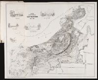
A report to the commissioners on lay-out of East Rock Park / by Donald G. Mitchell, LL.D
Image Count:
1
Resource Type:
Maps, Atlases & Globes
Abstract:
Five inset illustrations: Timber Bridge at Rock Lane / Rock-Lane Bridge / Iron Bridge at Rock Lane / Hanging Foot-Bridge over Whitney Dam / Dairy House
Description:
At foot: Lith by L.S. Punderson, New Haven, CT, Reduced from the large colored sketch which accompanied report, and Tipped in at end of report
Subject (Geographic):
East Rock Park (New Haven, Conn.)
Subject (Topic):
Parks --Connecticut --New Haven
Collection Created:
New Haven : L.S. Punderson,
Found in:
Beinecke Rare Book and Manuscript Library > Hints for the lay-out of East-Rock Park
Creator:
Published / Created:
1850
Call Number:
1975 Folio 26
Collection Title:
A new universal atlas containing maps of the various empires, kingdoms, states and republics of the
Image Count:
1
Resource Type:
Maps, Atlases & Globes
Alternative Title:
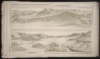
Heights of the principal mountains in the world
Subject (Name):
P.S. Duval & Son
Collection Created:
Philadelphia, Thomas, Cowperthwait & Co., No. 253 Market street, 1852
Found in:
Beinecke Rare Book and Manuscript Library > Lengths of the principal rivers in the world
Creator:
Published / Created:
1882
Call Number:
ZZc56 882dua
Collection Title:
Tertiary history of the Grand Cañon district, with atlas.
Image Count:
1
Resource Type:
Maps, Atlases & Globes
Subject (Geographic):
Arizona and Grand Canyon (Ariz.)
Subject (Topic):
Geology --Arizona and Volcanoes
Collection Created:
Washington, Govt. Print. Off., 1882
Found in:
Beinecke Rare Book and Manuscript Library > Looking up the Toroweap from Vulcan's Throne
Branch:v1.61.6 ,Deployed:2024-06-12T09:55:33-04:00