Search
You Searched For
Search Results
- Creator:
- Sanborn Map Company, issuing body
- Published / Created:
- 1931
- Call Number:
- 766 N472 1931
- Image Count:
- 11
- Resource Type:
- Maps, Atlases & Globes
- Found in:
- Beinecke Rare Book and Manuscript Library > New Milford, Litchfield County, Connecticut.
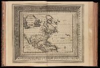
- Creator:
- Aa, Pieter van der, 1659-1733
- Published / Created:
- [1729?]
- Call Number:
- 1973 +32
- Image Count:
- 13
- Resource Type:
- Maps, Atlases & Globes
- Found in:
- Beinecke Rare Book and Manuscript Library > La galerie agreable du monde, ouíÛ l'on voit en un grand nombre de cartes tres-exactes et de belles tailles-douces, les principaux empires, roiíöaumes, republiques, provinces, villes, bourgs et forteresses ... dans les quatre parties de l'univers. Diviseí
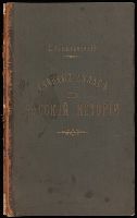
- Creator:
- Zamyslovskīĭ, E. (Egor), 1841-1896
- Published / Created:
- 1887
- Call Number:
- 1978 Folio 3
- Image Count:
- 31
- Found in:
- Beinecke Rare Book and Manuscript Library > Uchebnyií atlas po russkoií istoriíãi / sostavlen i izdan pod red. E. Zamyslovskago.
- Creator:
- Sanborn Map Company, issuing body
- Published / Created:
- 1926
- Call Number:
- 766 M31 1926
- Image Count:
- 36
- Resource Type:
- Maps, Atlases & Globes
- Found in:
- Beinecke Rare Book and Manuscript Library > Insurance maps of Manchester, including part of Highland Park and Manchester Green, Hartford Co., Connecticut.
- Creator:
- Sanborn Map Company, issuing body
- Published / Created:
- 1925
- Call Number:
- 766 M59 1925
- Image Count:
- 31
- Resource Type:
- Maps, Atlases & Globes
- Found in:
- Beinecke Rare Book and Manuscript Library > Insurance maps of Milford, New Haven County, Connecticut, including Woodmont, Merwin's Point, Bay View, Fort Trumbull Beach, Silver Sands, Seaside, Myrtle Beach, Meadows End, Walnut Beach, Wildmere Beach, Laurel Beach, Cedar Beach, Devon and Rivercliff.
- Creator:
- Sanborn-Perris Map Co., issuing body
- Published / Created:
- July 1941
- Call Number:
- 766 M54 1901
- Image Count:
- 5
- Resource Type:
- Maps, Atlases & Globes
- Found in:
- Beinecke Rare Book and Manuscript Library > Insurance maps of Meriden, New Haven, Connecticut., Insurance maps of Meriden, New Haven, Connecticut: [New sheets and correction slips].
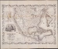
- Creator:
- Bellin, Jacques Nicolas, 1703-1772
- Published / Created:
- M.DCC.LV. [1755]
- Call Number:
- BrSides Zc10 755be
- Image Count:
- 1
- Found in:
- Beinecke Rare Book and Manuscript Library > Carte de l'Amerique Septentrionale : depuis le 28 degré de latitude jusqu'au 72 / par M. Bellin, Ingenieur de la Marine et du Dêpost des Plans, Censeur Royal, de l'Academie de Marine, et de la Societé Royale de Londres.
- Creator:
- Atwood, J.M
- Published / Created:
- 1849
- Call Number:
- Zc72 849ro
- Collection Title:
- California and its gold regions; with a geographical and topographical view of the country, its
- Image Count:
- 1
- Found in:
- Beinecke Rare Book and Manuscript Library > Map of the United States The British Provinces Mexico & c. Showing the Routes of the U.S. Mail Steam Packets to California, and a Plan of the Gold Region
- Published / Created:
- [1866?]
- Call Number:
- Zc72 866sa
- Collection Title:
- Prospectus of the San Saba Iron Mining Co., Sierra County, state of California, with report of
- Image Count:
- 1
- Found in:
- Beinecke Rare Book and Manuscript Library > [Folded map of the area surrounding the San Saba Iron Mining co, Sierra County, California.]
- Published / Created:
- undated
- Call Number:
- WA MSS S-2962
- Collection Title:
- Northern Pacific Railway Company maps and drawings
- Container / Volume:
- Box 1 | Map 11
- Image Count:
- 1
- Resource Type:
- Maps, Atlases & Globes
- Found in:
- Beinecke Rare Book and Manuscript Library > (IDAHO & WASHINGTON) [Anon.] [Untitled map of northwestern Idaho and northeastern Washington].
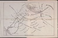
- Creator:
- Gibboney, J. M
Kendrick, J. W
- Published / Created:
- 1890
- Call Number:
- WA MSS S-2962
- Collection Title:
- Northern Pacific Railway Company maps and drawings
- Container / Volume:
- Box 1 | Map 10
- Image Count:
- 2
- Resource Type:
- Maps, Atlases & Globes
- Found in:
- Beinecke Rare Book and Manuscript Library > (IDAHO) Kendrick, J. W., Surveyor. Map Showing Definite Location of the Spokane & Palouse Ry. (Lewiston Extension). From Julietta to Lewiston Idaho Territory. Distance 24-1/lO Miles. Drawn by J. M. Gibboney. Assistant Engineer's Office, Tacoma, Washington. Scale 1 in.=2000 ft.
- Creator:
- Beckler, Eldridge H
Bischoff, A
- Published / Created:
- 1891 April 6
- Call Number:
- WA MSS S-2962
- Collection Title:
- Northern Pacific Railway Company maps and drawings
- Container / Volume:
- Box 1 | Map 34
- Image Count:
- 1
- Resource Type:
- Maps, Atlases & Globes
- Found in:
- Beinecke Rare Book and Manuscript Library > (MONTANA) Bischoff, A. Map of North- West part of Montana...Great Northern Line St. Paul, Minneapolis & Manitoba Ry. Pacific Extension. Elbridge H. Beckler, Chief Engineer. Helena, Mont. Scale 1 in.= 2 miles.
- Published / Created:
- 1886
- Call Number:
- WA MSS S-2962
- Collection Title:
- Northern Pacific Railway Company maps and drawings
- Container / Volume:
- Box 1 | Map 31
- Image Count:
- 1
- Resource Type:
- Maps, Atlases & Globes
- Found in:
- Beinecke Rare Book and Manuscript Library > (MONTANA) [Anon.] Map of a Portion of Montana Territory.
- Creator:
- Roberts. E.J
- Published / Created:
- 1887 August
- Call Number:
- WA MSS S-2962
- Collection Title:
- Northern Pacific Railway Company maps and drawings
- Container / Volume:
- Box 1 | Map 33
- Image Count:
- 2
- Resource Type:
- Maps, Atlases & Globes
- Found in:
- Beinecke Rare Book and Manuscript Library > (MONTANA) Roberts, E. J. Montana Extension. The Saint Paul, Minneapolis and Manitoba Ry. Co. Scale 12 miles to 1 inch.
- Published / Created:
- 1891 September 10
- Call Number:
- WA MSS S-2962
- Collection Title:
- Northern Pacific Railway Company maps and drawings
- Container / Volume:
- Box 1 | Map 40
- Image Count:
- 1
- Resource Type:
- Maps, Atlases & Globes
- Found in:
- Beinecke Rare Book and Manuscript Library > (WASHINGTON) [Anon.] Sketch of Country North of Spokane Wash. Helena Mont.
- Published / Created:
- undated
- Call Number:
- WA MSS S-2962
- Collection Title:
- Northern Pacific Railway Company maps and drawings
- Container / Volume:
- Box 1 | Map 36
- Image Count:
- 1
- Resource Type:
- Maps, Atlases & Globes
- Found in:
- Beinecke Rare Book and Manuscript Library > (MONTANA) [Anon.] [Untitled map of a part of north central Montana.]
- Published / Created:
- undated
- Call Number:
- WA MSS S-2962
- Collection Title:
- Northern Pacific Railway Company maps and drawings
- Container / Volume:
- 3 (Roll) | Map 24
- Image Count:
- 1
- Resource Type:
- Maps, Atlases & Globes
- Found in:
- Beinecke Rare Book and Manuscript Library > (MONTANA & IDAHO) [Anon.] [Untitled map of far northwestern Montana and a part of the Idaho panhandle.]
- Creator:
- Clift, Emory W., d. 1886
- Published / Created:
- 1869
- Call Number:
- WA MSS S-1964 C613
- Image Count:
- 2
- Found in:
- Beinecke Rare Book and Manuscript Library > Exploration for wagon road from Fort Ellis, M.T., to mouth of Muscleshell River / by Capt. E.W. Clift, 13th Infty. ; Office of Engineers, H'd. Q'rs., Dep't of Dakota ; reduced from field notes of Geo. B. Foote, C.E., 1869 Nov 9
- Call Number:
- 1977 +392
- Collection Title:
- A survey of the cities of London and Westminster : containing the original, antiquity, increase
- Image Count:
- 1
- Resource Type:
- Maps, Atlases & Globes
- Found in:
- Beinecke Rare Book and Manuscript Library > Spittle Fields and places adjacent taken from the last survey with corrections
- Call Number:
- 1993 +44
- Collection Title:
- Topographia provinciarum austriacaru, Austriæ, Striæ, Carinthiæ, Carniolæ, Tyrolis. etc.: das ist
- Image Count:
- 1
- Found in:
- Beinecke Rare Book and Manuscript Library > [Topographia provinciarum Austriacarum]