Search
You Searched For
Search Results
- Creator:
- Sanborn Map Company, issuing body
- Published / Created:
- 1931
- Call Number:
- 766 N472 1931
- Image Count:
- 11
- Resource Type:
- Maps, Atlases & Globes
- Found in:
- Beinecke Rare Book and Manuscript Library > New Milford, Litchfield County, Connecticut.
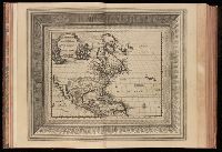
- Creator:
- Aa, Pieter van der, 1659-1733
- Published / Created:
- [1729?]
- Call Number:
- 1973 +32
- Image Count:
- 13
- Resource Type:
- Maps, Atlases & Globes
- Found in:
- Beinecke Rare Book and Manuscript Library > La galerie agreable du monde, ouíÛ l'on voit en un grand nombre de cartes tres-exactes et de belles tailles-douces, les principaux empires, roiíöaumes, republiques, provinces, villes, bourgs et forteresses ... dans les quatre parties de l'univers. Diviseí
- Creator:
- Sanborn Map Company, issuing body
- Published / Created:
- 1926
- Call Number:
- 766 M31 1926
- Image Count:
- 36
- Resource Type:
- Maps, Atlases & Globes
- Found in:
- Beinecke Rare Book and Manuscript Library > Insurance maps of Manchester, including part of Highland Park and Manchester Green, Hartford Co., Connecticut.
- Creator:
- Sanborn Map Company, issuing body
- Published / Created:
- 1925
- Call Number:
- 766 M59 1925
- Image Count:
- 31
- Resource Type:
- Maps, Atlases & Globes
- Found in:
- Beinecke Rare Book and Manuscript Library > Insurance maps of Milford, New Haven County, Connecticut, including Woodmont, Merwin's Point, Bay View, Fort Trumbull Beach, Silver Sands, Seaside, Myrtle Beach, Meadows End, Walnut Beach, Wildmere Beach, Laurel Beach, Cedar Beach, Devon and Rivercliff.
- Creator:
- Sanborn-Perris Map Co., issuing body
- Published / Created:
- July 1941
- Call Number:
- 766 M54 1901
- Image Count:
- 5
- Resource Type:
- Maps, Atlases & Globes
- Found in:
- Beinecke Rare Book and Manuscript Library > Insurance maps of Meriden, New Haven, Connecticut., Insurance maps of Meriden, New Haven, Connecticut: [New sheets and correction slips].
- Published / Created:
- 1918
- Call Number:
- RG 14
- Collection Title:
- Archives of the Trustees of Lingnan University
- Container / Volume:
- Box 51 | Folder 573
- Image Count:
- 1
- Resource Type:
- Maps, Atlases & Globes
- Found in:
- Yale Divinity Library > Architect's Map of Campus
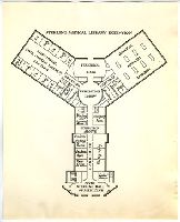
- Published / Created:
- approximately 1935
- Image Count:
- 1
- Resource Type:
- Maps, Atlases & Globes
- Found in:
- Medical Historical Library, Cushing/Whitney Medical Library > Cushing/Whitney Medical Library sketch
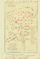
- Creator:
- Salmon, Edwin Ashley
- Published / Created:
- 1932
- Image Count:
- 1
- Resource Type:
- Maps, Atlases & Globes
- Found in:
- Medical Historical Library, Cushing/Whitney Medical Library > "A View of Human Welfare Group"
- Published / Created:
- undated
- Call Number:
- WA MSS S-2962
- Collection Title:
- Northern Pacific Railway Company maps and drawings
- Container / Volume:
- Box 1 | Map 11
- Image Count:
- 1
- Resource Type:
- Maps, Atlases & Globes
- Found in:
- Beinecke Rare Book and Manuscript Library > (IDAHO & WASHINGTON) [Anon.] [Untitled map of northwestern Idaho and northeastern Washington].
- Creator:
- Gibboney, J. M
Kendrick, J. W
- Published / Created:
- 1890
- Call Number:
- WA MSS S-2962
- Collection Title:
- Northern Pacific Railway Company maps and drawings
- Container / Volume:
- Box 1 | Map 10
- Image Count:
- 2
- Resource Type:
- Maps, Atlases & Globes
- Found in:
- Beinecke Rare Book and Manuscript Library > (IDAHO) Kendrick, J. W., Surveyor. Map Showing Definite Location of the Spokane & Palouse Ry. (Lewiston Extension). From Julietta to Lewiston Idaho Territory. Distance 24-1/lO Miles. Drawn by J. M. Gibboney. Assistant Engineer's Office, Tacoma, Washington. Scale 1 in.=2000 ft.
- Creator:
- Beckler, Eldridge H
Bischoff, A
- Published / Created:
- 1891 April 6
- Call Number:
- WA MSS S-2962
- Collection Title:
- Northern Pacific Railway Company maps and drawings
- Container / Volume:
- Box 1 | Map 34
- Image Count:
- 1
- Resource Type:
- Maps, Atlases & Globes
- Found in:
- Beinecke Rare Book and Manuscript Library > (MONTANA) Bischoff, A. Map of North- West part of Montana...Great Northern Line St. Paul, Minneapolis & Manitoba Ry. Pacific Extension. Elbridge H. Beckler, Chief Engineer. Helena, Mont. Scale 1 in.= 2 miles.
- Published / Created:
- 1886
- Call Number:
- WA MSS S-2962
- Collection Title:
- Northern Pacific Railway Company maps and drawings
- Container / Volume:
- Box 1 | Map 31
- Image Count:
- 1
- Resource Type:
- Maps, Atlases & Globes
- Found in:
- Beinecke Rare Book and Manuscript Library > (MONTANA) [Anon.] Map of a Portion of Montana Territory.
- Creator:
- Roberts. E.J
- Published / Created:
- 1887 August
- Call Number:
- WA MSS S-2962
- Collection Title:
- Northern Pacific Railway Company maps and drawings
- Container / Volume:
- Box 1 | Map 33
- Image Count:
- 2
- Resource Type:
- Maps, Atlases & Globes
- Found in:
- Beinecke Rare Book and Manuscript Library > (MONTANA) Roberts, E. J. Montana Extension. The Saint Paul, Minneapolis and Manitoba Ry. Co. Scale 12 miles to 1 inch.
- Published / Created:
- 1891 September 10
- Call Number:
- WA MSS S-2962
- Collection Title:
- Northern Pacific Railway Company maps and drawings
- Container / Volume:
- Box 1 | Map 40
- Image Count:
- 1
- Resource Type:
- Maps, Atlases & Globes
- Found in:
- Beinecke Rare Book and Manuscript Library > (WASHINGTON) [Anon.] Sketch of Country North of Spokane Wash. Helena Mont.
- Published / Created:
- undated
- Call Number:
- WA MSS S-2962
- Collection Title:
- Northern Pacific Railway Company maps and drawings
- Container / Volume:
- Box 1 | Map 36
- Image Count:
- 1
- Resource Type:
- Maps, Atlases & Globes
- Found in:
- Beinecke Rare Book and Manuscript Library > (MONTANA) [Anon.] [Untitled map of a part of north central Montana.]
- Published / Created:
- undated
- Call Number:
- WA MSS S-2962
- Collection Title:
- Northern Pacific Railway Company maps and drawings
- Container / Volume:
- 3 (Roll) | Map 24
- Image Count:
- 1
- Resource Type:
- Maps, Atlases & Globes
- Found in:
- Beinecke Rare Book and Manuscript Library > (MONTANA & IDAHO) [Anon.] [Untitled map of far northwestern Montana and a part of the Idaho panhandle.]
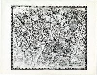
- Call Number:
- 1977 +392
- Collection Title:
- A survey of the cities of London and Westminster : containing the original, antiquity, increase
- Image Count:
- 1
- Resource Type:
- Maps, Atlases & Globes
- Found in:
- Beinecke Rare Book and Manuscript Library > Spittle Fields and places adjacent taken from the last survey with corrections
- Creator:
- Cleveland and Toledo Railroad Company
- Published / Created:
- 1859]
- Call Number:
- BrSides Zc49 859cL
- Image Count:
- 1
- Resource Type:
- Maps, Atlases & Globes
- Found in:
- Beinecke Rare Book and Manuscript Library > For Pike's Peak and the gold mines, via Cleveland & Toledo Rail Road. A direct and all rail road line to St. Joseph, Kansas T
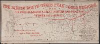
- Creator:
- Toledo, Wabash and Great Western Railroad Company
- Published / Created:
- [1859]
- Call Number:
- BrSides Zc49 859to
- Image Count:
- 1
- Resource Type:
- Maps, Atlases & Globes
- Found in:
- Beinecke Rare Book and Manuscript Library > The direct route to Pike's peak and the gold regions via the Toledo Wabash & Great Western Rail Road Line and the Hannibal & St. Joseph R.R
- Creator:
- Gunn, O. B. (Otis Berthoude), 1828-1901
- Published / Created:
- 1859
- Call Number:
- Zc39 859gu
- Collection Title:
- New map and hand-book of Kansas & the gold mines : containing descriptions and statistics of the
- Image Count:
- 1
- Resource Type:
- Maps, Atlases & Globes
- Found in:
- Beinecke Rare Book and Manuscript Library > Gunn's new map of Kansas and the gold mines