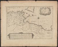
Also shows Amerindian reservations: Cayuga Reservation -- Onondago Reservation -- Oneida Reservation., Imperfect: mutilated. Backed with paper., Includes note describing the numbering of military-township lots., and Shows property tract boundaries, town (militar
Publisher:
[publisher not identified],
Subject (Geographic):
New York (State)--Administrative and political divisions--Maps--Early works to 1800, New York (State)--Upstate New York, and Upstate New York (N.Y.)--Administrative and political divisions--Maps--Early works to 1800
Subject (Name):
Tiebout, Cornelius, 1777-1832
Subject (Topic):
Administrative and political divisions, Indian reservations--New York (State)--Maps--Early works to 1800., Landowners--New York (State)--Maps--Early works to 1800., and Landowners--New York (State)--Upstate New York--Maps--Ear
"The seat of the war in the middle British colonies, containing Virginia, Maryland, the Delaware counties, &ca.", From the author's The American military pocket atlas. [1776], Hand colored., Inset: A sketch of the upper parts of Canada., and Relief shown pictoria
Publisher:
Printed for R. Sayer & J. Bennett, map, chart & printsellers,
Both sheets backed with paper., Includes text and historical notes., Inset: Chart of Falkland Islands named by the French Malouine Islands and discovered by Hawkins in the year 1593., Outline color., Prime meridian: Ferro., Relief sh, and Watermarks on both sheets.
Publisher:
Sayer and Bennett,
Subject (Geographic):
Falkland Islands--Maps--Early works to 1800 and South America--Maps--Early works to 1800
Accompanied by the author's: A topographical description of such parts of North America as are contained in the (annexed) map of the middle British colonies, &c. in North America. vi, 46, 16 p., Includes text, list of townships, distance charts, and inset "A sketch of the remaining part of Ohio R. &c.", Prime meridian: London and Philadelphia., Relief shown pictorially., and Without accompanying text.
Publisher:
Printed & published ... for J. Almon,
Subject (Geographic):
North America--Maps--Early works to 1800 and Northeastern States--Maps--Early works to 1800.
Subject (Name):
Almon, John, 1737-1805, Evans, Lewis, 1700?-1756, and Turner, James, -1759
Accompanied by the author's: A topographical description of such parts of North America as are contained in the (annexed) map of the middle British colonies, &c. in North America. vi, 46, 16 p. and Includes text, list of townships, distance charts, and inset
Publisher:
Printed & published ... for J. Almon,
Subject (Geographic):
America, Canada--Maps--Early works to 1800, East (U.S.)--Maps--Early works to 1800, and Northeastern States--Maps--Early works to 1800.
Subject (Name):
Almon, John, 1737-1805, Evans, Lewis, 1700?-1756, and Turner, James, -1759
Accompanied by the author's: A topographical description of such parts of North America as are contained in the (annexed) map of the middle British colonies, &c. in North America. vi, 46, 16 p., Includes text, list of townships, distance charts, and inset "A sketch of the remaining part of Ohio R. &c.", Prime meridian: London and Philadelphia., Relief shown pictorially., and Without accompanying text.
Publisher:
Printed & published ... for J. Almon,
Subject (Geographic):
North America--Maps--Early works to 1800 and Northeastern States--Maps--Early works to 1800.
Subject (Name):
Almon, John, 1737-1805, Evans, Lewis, 1700?-1756, and Turner, James, -1759
Armenian., Includes inset of northern North America and col. ill., Inscription in upper right: Yale College Library, from Professor E.E. Salisbury, 1870., and Relief shown pictorially.
Publisher:
I Vans Srboyn Ghazaru,
Subject (Geographic):
America--Maps--Early works to 1800.
Subject (Name):
Mkhitʻarean Miabanutʻiwn i Venetik and Salisbury, Edward Elbridge,--1814-1901--Ownership.
Covers from Maine to South Carolina and west to Lake Michigan., From Universal magazine of knowledge and pleasure, Dec., 1754, v. 15, pg. 241., and Relief shown pictorially.