Skip to search
Skip to main content
Skip to first result
Search
You Searched For
Date
1500 - 1799
america maps
Repository
Beinecke Rare Book and Manuscript Library
Format
cartographic
Genre
Early maps
Genre
Maps
Resource Type
Maps, Atlases & Globes
Date Created
1500 to 1799
New Search
Search Results
Creator:
Published / Created:
March 25th, 1776.
Call Number:
71 1776N
Container / Volume:
BRBL_00726
Image Count:
4
Resource Type:
Maps , Atlases & Globes
Alternative Title:
Middle British colonies.
Description:
America as are contained in the (annexed) map
Publisher:
Printed & published ... for J. Almon,
Subject (Geographic):
North America --Maps --Early works to
Subject (Name):
Almon, John, 1737-1805, Evans, Lewis, 1700?-1756, and Turner, James, -1759
Subject (Topic):
British--America --Maps --Early works to
Found in:
Beinecke Rare Book and Manuscript Library > A map of the middle British colonies in North America [cartographic material] : First published by Lewis Evans, of Philadelphia, in 1755 ; and since corrected and improved, as also extended, with the addition of New England, and bordering parts of Canada
Creator:
Published / Created:
March 25th, 1776.
Call Number:
71 1776N
Container / Volume:
BRBL_00726
Image Count:
1
Resource Type:
Maps , Atlases & Globes
Alternative Title:
Middle British colonies.
Description:
America as are contained in the (annexed) map
Publisher:
Printed & published ... for J. Almon,
Subject (Geographic):
North America --Maps --Early works to
Subject (Name):
Almon, John, 1737-1805, Evans, Lewis, 1700?-1756, and Turner, James, -1759
Subject (Topic):
British--America --Maps --Early works to
Found in:
Beinecke Rare Book and Manuscript Library > A map of the middle British colonies in North America [cartographic material] : First published by Lewis Evans, of Philadelphia, in 1755 ; and since corrected and improved, as also extended, with the addition of New England, and bordering parts of Canada
Creator:
Published / Created:
March 25th, 1776.
Call Number:
755 1776P
Container / Volume:
BRBL_00430
Image Count:
1
Resource Type:
Maps , Atlases & Globes
Alternative Title:
Middle British colonies.
Description:
America as are contained in the (annexed) map
Publisher:
Printed & published ... for J. Almon,
Subject (Geographic):
America
Subject (Name):
Almon, John, 1737-1805, Evans, Lewis, 1700?-1756, and Turner, James, -1759
Subject (Topic):
British--America --Maps --Early works to
Found in:
Beinecke Rare Book and Manuscript Library > A map of the middle British colonies in North America [cartographic material] : First published by Lewis Evans, of Philadelphia, in 1755 ; and since corrected and improved, as also extended, with the addition of New England, and bordering parts of Canada
Creator:
Published / Created:
1776
Call Number:
755 1776
Container / Volume:
BRBL_00430
Image Count:
1
Resource Type:
Maps , Atlases & Globes
Alternative Title:
Middle British colonies.
Description:
"The seat of the war in the middle British colonies, containing Virginia, Maryland, the Delaware counties, &ca.", From the author's The American military pocket atlas. [1776], Hand colored., Inset: A sketch of the upper parts of Canada., and Relief shown pictoria
Publisher:
Printed for R. Sayer & J. Bennett, map
Subject (Geographic):
Northeastern States--Maps --Early works
Subject (Name):
Pownall, Thomas, 1722-1805
Subject (Topic):
British--America --Maps --Early works to
Found in:
Beinecke Rare Book and Manuscript Library > A general map of the middle British colonies, in America [cartographic material] : Containing Virginia, Maryland, the Delaware counties, Pennsylvania and New Jersey. With the addition of New York, and the greatest part of New England, as also of the borde
Creator:
Published / Created:
1779
Call Number:
90 1779
Container / Volume:
BRBL_00661
Image Count:
2
Resource Type:
Maps , Atlases & Globes
Description:
Both sheets backed with paper., Includes text and historical notes., Inset: Chart of Falkland Islands named by the French Malouine Islands and discovered by Hawkins in the year 1593., Outline color., Prime meridian: Ferro., Relief sh, and Watermarks on both sheets.
Publisher:
Sayer and Bennett,
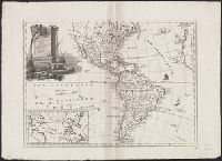
Subject (Geographic):
South America --Maps --Early works to
Subject (Name):
Robert Sayer and John Bennett (Firm)
Found in:
Beinecke Rare Book and Manuscript Library > A map of South America containing Tierra-Firma, Guayana, New Granada, Amazonia, Brasil, Peru, Paraguay, Chaco, Tucuman, Chili and Patagonia [cartographic material] : from Mr. d'Anville, with several improvements and additions, and the newest discoveries /
Creator:
Published / Created:
[1793?]
Call Number:
771 1793
Container / Volume:
BRBL_00477
Image Count:
1
Resource Type:
Maps , Atlases & Globes
Alternative Title:
First sheet of De Witt's state-map of
Description:
Also shows Amerindian reservations: Cayuga Reservation -- Onondago Reservation -- Oneida Reservation., Imperfect: mutilated. Backed with paper., Includes note describing the numbering of military-township lots., and Shows property tract boundaries, town (militar
Publisher:
[publisher not identified],
Subject (Geographic):
political divisions--Maps --Early works to 1800
Subject (Name):
Tiebout, Cornelius, 1777-1832
Subject (Topic):
)--Maps --Early works to 1800.
Found in:
Beinecke Rare Book and Manuscript Library > 1st sheet of De Witt's state-map of New-York / C. Tiebout sculp. NYork.
Creator:
Published / Created:
1757
Call Number:
BrSides 2018 139
Image Count:
1
Resource Type:
Maps , Atlases & Globes
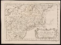
Description:
"Tom. XIV. in 4°, no. 9. Tome 14. in 8°, page 97." in lower margin., Appears in Jean François de La Harpe's Abrégé de l'histoire générale des voyages. 1780., Covers the area from Penobscot Bay to Chesapeake Bay and west to Lake Erie., Prime meridian: Paris., Relief shown pictorially., Shows provices, towns, forts, rivers, Indian tribal territory, and relief., and Watermark.
Publisher:
[publisher not identified],
Subject (Geographic):
Middle Atlantic States--Maps --Early
Subject (Name):
La Harpe, Jean-François de, 1739-1803. Abrégé de l'histoire générale des voyages.
Found in:
Beinecke Rare Book and Manuscript Library > Carte de la Nouvelle Angleterre, Nouvelle Yorck, et Pensilvanie / pour servir à l'Histoire générale des voyages. Par M.B., ing. de la mare.
Branch:v1.61.6 ,Deployed:2024-06-12T09:55:33-04:00