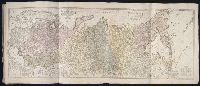
Twenty four new and accurate maps of the several parts of Europe ... : all (except the last) new
Image Count:
1
Alternative Title:
The Swisse Cantons, or Switzerland; with the Grisons Country, &c
Description:
In pencil on verso: 22. and Table of contents for maps 20-24 misnumbered.
Subject (Geographic):
Graubuenden (Switzerland) and Switzerland --Maps --Early works to 1800
Subject (Name):
Barker, B. (Benjamin), d. 1764, bookseller, Clements, Henry, d. 1719, bookseller, King, Charles, d. 1735, bookseller, Nicholson, John, d. ca. 1717, bookseller, Parker, Richard, fl. 1692-1725, bookseller, and Tooke, Benjamin, d. 1716, bookseller
Subject (Topic):
Atlases --Early works to 1800
Collection Created:
[London] : Sold by J. Nicholson at the King’s-Arms in Little Britain, Benj. Barker and Charles King ..., Benj. Tooke ..., Hen. Clements ..., R. Parker and Ralph Smith under the Royal-Exchange ..., [1715?]
Twenty four new and accurate maps of the several parts of Europe ... : all (except the last) new
Image Count:
1
Alternative Title:
Sweden and Norway
Description:
In pencil on verso: 3.
Subject (Geographic):
Norway --Maps --Early works to 1800 and Sweden --Maps
Subject (Name):
Barker, B. (Benjamin), d. 1764, bookseller, Clements, Henry, d. 1719, bookseller, King, Charles, d. 1735, bookseller, Nicholson, John, d. ca. 1717, bookseller, Parker, Richard, fl. 1692-1725, bookseller, and Tooke, Benjamin, d. 1716, bookseller
Subject (Topic):
Atlases --Early works to 1800
Collection Created:
[London] : Sold by J. Nicholson at the King’s-Arms in Little Britain, Benj. Barker and Charles King ..., Benj. Tooke ..., Hen. Clements ..., R. Parker and Ralph Smith under the Royal-Exchange ..., [1715?]
Delarochette, L. (Louis), 1731-1802, creator Faden, William, 1749-1836
Published / Created:
1782 March 20
Call Number:
1982 Folio 10
Image Count:
1
Description:
No. 37 of 43 maps bound together in composite atlas., Place names in Dutch; pictorial relief. "The red line describes the route of the British Army from its landing at Simons Baay to Cape Town.", and Scale [ca. 1:528 000].
Publisher:
W. Faden
Subject (Geographic):
Cape of Good Hope (South Africa) --Maps --Early works to 1800
Imperatorskaia akademia nauk (Russia) Kitchin, Thomas, d. 1784, creator Sayer, Robert, 1725-1794
Published / Created:
1788 May 1
Call Number:
1982 Folio 10
Image Count:
2
Alternative Title:
Asiatic part of the Russian empire : from the maps published by the Imperial Academy of St. Petersburg with the new discoveries of Captn. Cook &c
Description:
Also appeared in Kitchin's General atlas describing the whole universe. London : Printed R. Sayer and J. Bennet, 1780., No. 25 of 43 maps bound together in composite atlas., Prime meridian: Ferro., Relief shown pictorially., Scale [ca. 1:8,000,000]., Sheets mounted together to form 1 sheet., and Shows vegetation, sailing and explorers tracks, etc.
United Provinces of the Netherlands viz the Dutchy of Gelderland, the counties of Holland, Zeeland, Zutphen ... described by Sanson, corrected and amended by Will. Berry
Description:
Bar scales in Italian miles, common leagues of France, great leagues of France, common leagues of Germany, great leagues of Germany, and leagues of an hours travell., Dedicated To the most serene and most sacred majesty Charles II ... by William Berry., Ferro meridian., No. 43 of 69 maps bound together in composite atlas., Relief shown pictorially., and Scale [ca. 1:640 000].
Publisher:
Sold by William Berry at the sign of ye Globe betweene Charing-Cross and White-Hall
British & Spanish territories according to the treaty of 1784
Description:
For a description of the second and third states see Stevens and Tree, Comparative Cartography, Map Collectors' Circle (1967)., Includes historical notes and a color key., Includes text., No. 40 of 43 maps bound together in composite atlas., Prime meridian: London., Relief shown pictorially., Scale [ca. 1:6,750,000]., and Shows numerous boundary changes.
Publisher:
Willm. Faden
Subject (Geographic):
United States --Boundaries --Maps --Early works to 1800 and United States --Maps --Early works to 1800
Circle and elector of the Rhine, in which are the archbishopricks and electors of Mayence, Treves, and Colen ... described by Sanson, corrected and amended by William Berry
Description:
Bar scales in Italian miles, common leagues of France, great leagues of France, common leagues of Germany, great leagues of Germany, and leagues of one houers travelling., Ferro meridian., Includes advertisement There are these mapps published all in two large sheets by William Berry ... at bottom., No. 32 of 69 maps bound together in composite atlas., Relief shown pictorially., and Scale [ca. 1:560 000].
Publisher:
Sold by William Berry at the signe of the Globe between Charing-Cross, and White Hall
Subject (Geographic):
Rhine Province (Germany) --Maps --Early works to 1800
Circle of Bavaria, in which are the Dukdom, Palatinat, and Electorat of Bavaria, the Arch-Bishoprick of Saltzbourg, the Bishopricks of Ratisbone, Frisingue, Passaw, the Abbays of St. Emerian, of high and low Monstiers ... described by Sanson, corrected and amended by William Berry
Description:
Bar scales in Italian miles, common leagues of France, great leagues of France, common leagues of Germany, great leagues of Germany, and leagues of one hours travelling., Dedicated To the most serene and most sacred majesty James II ... by William Berry., Ferro meridian., No. 29 of 69 maps bound together in composite atlas., Relief shown pictorially., and Scale [ca. 1:590 000].
Publisher:
Sold by William Berry at the signe of the Globe between Charing-Cross, and White-Hall