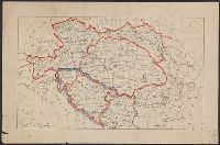
Search
You Searched For
Search Results
- Creator:
- Királyi Magyar Térképészeti Intézet
- Published / Created:
- [1918?-1943?]
- Call Number:
- 304 1886A
- Container / Volume:
- BRBL_00740
- Image Count:
- 9
- Resource Type:
- Maps, Atlases & Globes
- Found in:
- Beinecke Rare Book and Manuscript Library > [Kelet-Európa térképe] [cartographic material].
- Creator:
- Great Britain. Ordnance Survey
- Published / Created:
- Novr. 9th, 1843 [i.e. ca. 1853-1874?]
- Call Number:
- 32 1873
- Container / Volume:
- BRBL_00744
- Image Count:
- 8
- Resource Type:
- Maps, Atlases & Globes
- Found in:
- Beinecke Rare Book and Manuscript Library > [Old series Ordnance Survey maps of England and Wales] / engraved at the Ordnance Map Office, Southampton ...
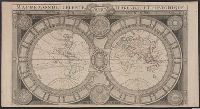
- Creator:
- Jaugeon, N
- Published / Created:
- 173-?]
- Call Number:
- 11 1670
- Container / Volume:
- BRBL_00680
- Image Count:
- 1
- Resource Type:
- Maps, Atlases & Globes
- Found in:
- Beinecke Rare Book and Manuscript Library > Mappe-monde celeste, terrestre et historique [cartographic material].
- Creator:
- Rossi, Giovanni Giacomo de, 17th cent
- Published / Created:
- 1674
- Call Number:
- 11 1674
- Container / Volume:
- BRBL_00680
- Image Count:
- 1
- Resource Type:
- Maps, Atlases & Globes
- Found in:
- Beinecke Rare Book and Manuscript Library > Mappa mondo o vero carta generale del globo terrestre [cartographic material] : rapresentato in due planisferi ... / da N. Sanson de Abbeville Giografo di sua Maesta Cristma ; intagliata da Gio. Lhuilier.
- Creator:
- Homann, Johann Baptist, 1663-1724
- Published / Created:
- 1716?]
- Call Number:
- 11 1716
- Container / Volume:
- BRBL_00680
- Image Count:
- 1
- Resource Type:
- Maps, Atlases & Globes
- Found in:
- Beinecke Rare Book and Manuscript Library > Planiglobii terrestris cum utroq hemisphaerio caelesti generalis repraesentatio [cartographic material] : quam ex novissimis probatissimisque recentium geographorum scriptis concinnatam, multisq[ue] phaenomenis illustratam / publice proponit Io. Bapt. Hom
- Published / Created:
- 1737
- Call Number:
- 11 1737
- Container / Volume:
- BRBL_00681
- Image Count:
- 1
- Resource Type:
- Maps, Atlases & Globes
- Found in:
- Beinecke Rare Book and Manuscript Library > A new and correct map of ye world [cartographic material] : laid down according to ye latest and best observations : to which is added several curious discourses on the tides, trade winds & monsoons ...
- Creator:
- Senex, John, d. 1740
- Published / Created:
- 1720]
- Call Number:
- 11 1720B
- Container / Volume:
- BRBL_00680
- Image Count:
- 1
- Resource Type:
- Maps, Atlases & Globes
- Found in:
- Beinecke Rare Book and Manuscript Library > A new map of the world [cartographic material] : from the latest observations / revised by I. Senex.
- Creator:
- Moll, Herman, d. 1732
- Published / Created:
- [after 1754]
- Call Number:
- 11 1728
- Container / Volume:
- BRBL_00680
- Image Count:
- 1
- Resource Type:
- Maps, Atlases & Globes
- Found in:
- Beinecke Rare Book and Manuscript Library > A new and correct map of the world laid down according to the newest discoveries and from the most exact observations / [cartographic material] / by Herman Moll, geographer.
- Creator:
- Cóvens et Mortier
- Published / Created:
- ca. 1730-ca. 1800]
- Call Number:
- 1973 Folio 71
- Image Count:
- 1
- Resource Type:
- Maps, Atlases & Globes
- Found in:
- Beinecke Rare Book and Manuscript Library > [Atlas nouveau contenant toutes les parties du monde ou sont exactement marqués les empires, monarchies, royaumes, états, republiques &c. Le tout recueilli par les meilleurs geógraphes.]
- Creator:
- Evans, Lewis, 1700?-1756
- Published / Created:
- 1771
- Call Number:
- 755 1771C
- Container / Volume:
- BRBL_00429
- Image Count:
- 1
- Resource Type:
- Maps, Atlases & Globes
- Found in:
- Beinecke Rare Book and Manuscript Library > A general map of the middle British colonies in America : viz. Virginia, Maryland, Delaware, Pensilvania, New-Jersey, New York, Connecticut & Rhode-Island : of Aquanishuonigy the country of the confederate Indians comprehending Aquanishuonigy proper, thei
- Creator:
- Moll, Herman, d. 1732
- Published / Created:
- [178-?]
- Call Number:
- 1973 Folio 113
- Image Count:
- 2
- Resource Type:
- Maps, Atlases & Globes
- Found in:
- Beinecke Rare Book and Manuscript Library > Atlas minor: or A new and curious set of sixty two maps, in which are shewn all the empires, kingdoms, countries, states in all the known parts of the earth ... by Herman Moll ...
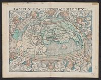
- Creator:
- Münster, Sebastian, 1489-1552
Münster, Sebastian, 1489-1552. Cosmographei
Ptolemy, fl. 2nd cent
- Published / Created:
- 1552?]
- Call Number:
- 13 1552
- Container / Volume:
- BRBL_00011
- Image Count:
- 2
- Resource Type:
- Maps, Atlases & Globes
- Found in:
- Beinecke Rare Book and Manuscript Library > La seconde table generale selon Ptol[omée].
- Creator:
- Chauveau, François, 1613-1676
Jaillot, Alexis Hubert, 1632?-1712. Atlas nouveau
Sanson, Guillaume
- Published / Created:
- 1673
- Call Number:
- 1973 Folio 57
- Collection Title:
- Composite atlas of 41 maps from Alexis Hubert Jaillot's Atlas nouveau.
- Image Count:
- 1
- Found in:
- Beinecke Rare Book and Manuscript Library > Provinces-Unies des Pays-Bas : auec leurs acquisitions dans La Flandre, Le Brabant, Le Limbourg, et Le Lyege, et les places queílles possedoient sur le Rhein, dans le Ducheí de Cleves, et dans l'Archevescheí et Eslectorat de Cologne / par le Sr. Sanson
- Creator:
- Moll, Herman, d. 1732
- Published / Created:
- 17--]
- Call Number:
- 1978 47
- Collection Title:
- Atlas minor.
- Image Count:
- 1
- Found in:
- Beinecke Rare Book and Manuscript Library > The Island of St. Christophers By Her. Moll Geographer
- Creator:
- Wyld, James, 1812-1887, cartographer
- Call Number:
- 13 1873A
- Container / Volume:
- BRBL_00011
- Image Count:
- 1
- Resource Type:
- Maps, Atlases & Globes
- Found in:
- Beinecke Rare Book and Manuscript Library > Map of the countries between England & India : designed to shew the over-land and sea-routes to the east, and the relative position of Russia to England & Hindostan / by James Wyld.
- Published / Created:
- 1919?]
- Call Number:
- 11hcf 1919C-3-4
- Container / Volume:
- BRBL_00010U
- Image Count:
- 1
- Resource Type:
- Maps, Atlases & Globes
- Found in:
- Beinecke Rare Book and Manuscript Library > [Map of Balkan Peninsula and Eastern Europe].
- Published / Created:
- 1919?]
- Call Number:
- 11hcf 1919C-3-5
- Container / Volume:
- BRBL_00010U
- Image Count:
- 1
- Resource Type:
- Maps, Atlases & Globes
- Found in:
- Beinecke Rare Book and Manuscript Library > [Map of Balkan Peninsula and Eastern Europe].
- Published / Created:
- 1919?]
- Call Number:
- 11hcf 1919C-3-8
- Container / Volume:
- BRBL_00010U
- Image Count:
- 1
- Resource Type:
- Maps, Atlases & Globes
- Found in:
- Beinecke Rare Book and Manuscript Library > Austria-Hungary.
- Published / Created:
- 1919?]
- Call Number:
- 11hcf 1919C-3-6
- Container / Volume:
- BRBL_00010U
- Image Count:
- 1
- Resource Type:
- Maps, Atlases & Globes
- Found in:
- Beinecke Rare Book and Manuscript Library > [Map of Balkan Peninsula and Eastern Europe].
- Published / Created:
- 1919?]
- Call Number:
- 11hcf 1919C-3-9
- Container / Volume:
- BRBL_00010U
- Image Count:
- 1
- Resource Type:
- Maps, Atlases & Globes
- Found in:
- Beinecke Rare Book and Manuscript Library > [Map of Eastern Europe and the Balkan Peninsula].
- Creator:
- Hole, William, d. 1624, engraver
- Published / Created:
- [ca. 1606]
- Call Number:
- Taylor 301
- Collection Title:
- The generall historie of Virginia, New-England, and the Summer Iles : with the names of the
- Image Count:
- 1
- Found in:
- Beinecke Rare Book and Manuscript Library > Virginia
- Published / Created:
- 1801
- Call Number:
- Zc90 801mab
- Collection Title:
- Voyages from Montreal, on the river St. Laurence, through the continent of North America, to the
- Image Count:
- 1
- Found in:
- Beinecke Rare Book and Manuscript Library > A map of America, between latitudes 40 and 70 north and longitudes 45 and 180 west, exhibiting Mackenzie's track from Montreal to Fort Chipewyan & from thence to the North Sea In 1789 & to the West Pacific Ocean in 1793
- Published / Created:
- 1783
- Call Number:
- Cb21 35B
- Collection Title:
- History of the war with America, France, Spain, and Holland; commencing in 1775 and ending in 1783
- Image Count:
- 1
- Found in:
- Beinecke Rare Book and Manuscript Library > A Map of the United States of America, as settled by the peace of 1783
- Creator:
- Dunn, Samuel
- Published / Created:
- 1774
- Call Number:
- Cb23 27
- Collection Title:
- The American military pocket atlas : being an approved collection of correct maps, both general and
- Image Count:
- 1
- Found in:
- Beinecke Rare Book and Manuscript Library > North America as divided amongst the European powers
- Published / Created:
- 1776
- Call Number:
- Cb23 27
- Collection Title:
- The American military pocket atlas : being an approved collection of correct maps, both general and
- Image Count:
- 1
- Found in:
- Beinecke Rare Book and Manuscript Library > A General map of the northern British colonies in America. which comprehends the province of Quebec, the government of Newfoundland, Nova-Scotia, New-England and New-York. From the maps published by the Admiralty and Board of Trade regulated by the astronomic and trigonometric observations of M. von Holland and corrected from Governor Pownall's late map 1776.
- Published / Created:
- 1776
- Call Number:
- Cb23 27
- Collection Title:
- The American military pocket atlas : being an approved collection of correct maps, both general and
- Image Count:
- 1
- Found in:
- Beinecke Rare Book and Manuscript Library > A general map of the middle British colonies in America. Containing Virginia, Maryland, the Delaware counties, Pennsylvania and New Jersey. With the addition of New York, and of the greatest part of New England, as also of the bordering parts of the province of Quebec, improved from several surveys made after the late war, and corrected from Governor Pownall's late map 1776.
- Creator:
- Romans, B
- Published / Created:
- 1776
- Call Number:
- Cb23 27
- Collection Title:
- The American military pocket atlas : being an approved collection of correct maps, both general and
- Image Count:
- 1
- Found in:
- Beinecke Rare Book and Manuscript Library > A General map of the southern British colonies, in America, comprehending North and South Carolina, Georgia, east and west Florida, with the neighbouring Indian countries. From the modern surveys of engineer de Brahm, Capt. Collet, Mouzon & others; and from the large hydrographical survey of the coasts of east and west Florida
- Creator:
- Brasier, William
- Published / Created:
- 1776
- Call Number:
- Cb23 27
- Collection Title:
- The American military pocket atlas : being an approved collection of correct maps, both general and
- Image Count:
- 1
- Found in:
- Beinecke Rare Book and Manuscript Library > A Survey of Lake Champlain, including Lake George, Crown Point and St. John. Surveyed by order of His Excellency Major General Sr. Jeffery Amherst, knight of the most honble. Order of the Bath, Commander in Chief of His Majesty's forces in North America (now Lord Amherst) by William Brassier, draughtsman, 1762
- Creator:
- Catlin, George, 1796-1872
- Published / Created:
- 1848
- Call Number:
- Zc12 +841cabj
- Image Count:
- 7
- Found in:
- Beinecke Rare Book and Manuscript Library > Illustrations of the manners, customs, and condition of the North American Indians : in a series of letters and notes written during eight years of travel and adventure among the wildest and most remarkable tribes now existing. : with three hundred and si
- Creator:
- Weller, Edward, d. 1884
- Call Number:
- Zc90 859ka
- Collection Title:
- Wanderings of an artist among the Indians of North America : from Canada to Vancouver's Island and
- Image Count:
- 1
- Found in:
- Beinecke Rare Book and Manuscript Library > Map to illustrate Mr. Kane's travels in the territory of the Hudson's Bay Company
- Creator:
- Sotzmann, D. F
- Call Number:
- Zm Sp79
- Collection Title:
- Allgemeines historisches Taschenbuch, oder, Abriss der merkwurdigsten neuen Welt-Begebenheiten
- Image Count:
- 1
- Found in:
- Beinecke Rare Book and Manuscript Library > Die Vereinigten Staaten von Nord America. nach der von Wm Faden 1783
- Creator:
- Wadsworth, James, 1730-1817
- Published / Created:
- 1748
- Call Number:
- ZZ35 5 1
- Image Count:
- 1
- Resource Type:
- Maps, Atlases & Globes
- Found in:
- Beinecke Rare Book and Manuscript Library > Plan of the city of New Haven taken in 1748
- Creator:
- Tanner, Henry Schenck, 1786-1858
- Published / Created:
- 1822
- Call Number:
- 2003 Folio 81
- Collection Title:
- The New American Atlas ...
- Container / Volume:
- No. IV [4]
- Image Count:
- 1
- Found in:
- Beinecke Rare Book and Manuscript Library > A Map of North America, Constructed According to the Latest Information by H. S. Tanner
- Creator:
- Miera y Pacheco, Bernardo de
- Published / Created:
- Año de 1778.
- Call Number:
- WA MSS S-2856
- Image Count:
- 2
- Found in:
- Beinecke Rare Book and Manuscript Library > Plano geografico de los descubrimientos hechos por Dn. Bernardo Miera y Pacheco y los RRs. Ps. Fr. Francisco Atanasio Dominguez y Fr. Silvestre Veles : S. Felipe Rt. de Chiguagua.
- Creator:
- Danckerts, Justus, 1635-1701
Danckerts, Theodore
- Published / Created:
- [1703?]
- Call Number:
- 1975 Folio 55
- Image Count:
- 6
- Found in:
- Beinecke Rare Book and Manuscript Library > Atlas
- Creator:
- La Rue, Philippe de.
Mariette, Pierre, 1603-1657
Sommer, Jean, fl. 1651, engraver
- Published / Created:
- [1651]
- Call Number:
- 1983 Folio 19
- Collection Title:
- [Atlas factice of 96 maps by Blaeu, Visscher, Jansson, Hondius and others]
- Image Count:
- 1
- Found in:
- Beinecke Rare Book and Manuscript Library > Terra Promissa in sortes seu tribvs XII distincta seu tabula ad Librum Iosve / auctore Ph. de la Rue ...
- Creator:
- Jansson, Jan, 1588-1664
- Published / Created:
- [ca. 1641]
- Call Number:
- 1983 Folio 19
- Collection Title:
- [Atlas factice of 96 maps by Blaeu, Visscher, Jansson, Hondius and others]
- Image Count:
- 1
- Found in:
- Beinecke Rare Book and Manuscript Library > Silesiae Ducatus accurata et vera delineatio
- Creator:
- Marker, J. P
- Published / Created:
- undated
- Call Number:
- WA MSS 328
- Image Count:
- 1
- Resource Type:
- Maps, Atlases & Globes
- Found in:
- Beinecke Rare Book and Manuscript Library > Map of the ’Great Blue-Gravel Lead’ of Northern California /by J. P. Marker
- Published / Created:
- 1802
- Call Number:
- Im B388 Zz802B
- Collection Title:
- The imperial guide : with picturesque plans of the great post roads, containing miniatures
- Image Count:
- 1
- Found in:
- Beinecke Rare Book and Manuscript Library > [Map: Coventry to Stony Stratford]
- Published / Created:
- 1802
- Call Number:
- Im B388 Zz802B
- Collection Title:
- The imperial guide : with picturesque plans of the great post roads, containing miniatures
- Image Count:
- 1
- Found in:
- Beinecke Rare Book and Manuscript Library > [Map: Stafford to Coventry]
- Published / Created:
- 1802
- Call Number:
- Im B388 Zz802B
- Collection Title:
- The imperial guide : with picturesque plans of the great post roads, containing miniatures
- Image Count:
- 1
- Found in:
- Beinecke Rare Book and Manuscript Library > [Map: Talk on the Hill to Birmingham]
- Published / Created:
- 1802
- Call Number:
- Im B388 Zz802B
- Collection Title:
- The imperial guide : with picturesque plans of the great post roads, containing miniatures
- Image Count:
- 1
- Found in:
- Beinecke Rare Book and Manuscript Library > [Map: Lancaster to Worsley]
- Published / Created:
- 1802
- Call Number:
- Im B388 Zz802B
- Collection Title:
- The imperial guide : with picturesque plans of the great post roads, containing miniatures
- Image Count:
- 1
- Found in:
- Beinecke Rare Book and Manuscript Library > [Map: Carlisle to Bolton]
- Published / Created:
- 1802
- Call Number:
- Im B388 Zz802B
- Collection Title:
- The imperial guide : with picturesque plans of the great post roads, containing miniatures
- Image Count:
- 1
- Found in:
- Beinecke Rare Book and Manuscript Library > [Map: Islip to Paddington]
- Creator:
- Boehme, August Gottlieb, 1719-1797
Hase, Johann Matthias, 1684-1742
Homann Erben (Firm)
- Published / Created:
- MDCCXXXXVI [i.e., 1759]
- Call Number:
- 1983 Folio 23
- Collection Title:
- [Atlas factice of 50 maps, primarily by Johann Baptist Homann and/or issued by the Homann Erben
- Image Count:
- 1
- Found in:
- Beinecke Rare Book and Manuscript Library > Americae mappa generalis : secundum legitimas projectionis stereographicae regulas, relationesque recentissimas et observationes sociorum Acad. reg. sc. quae Parisiis est aliorumque auctorum nec non secundum mentem D.I.M. Hasii ; M.P.P. in partes suas met
- Creator:
- Homann, Johann Baptist, 1663-1724
- Published / Created:
- [ca. 1715]
- Call Number:
- 1983 Folio 23
- Collection Title:
- [Atlas factice of 50 maps, primarily by Johann Baptist Homann and/or issued by the Homann Erben
- Image Count:
- 1
- Found in:
- Beinecke Rare Book and Manuscript Library > Tabula Ducatus Carnioliae, vindorum Marchiae et Histriae et mente Mustr. quondam J.B. Valvasorii / concinnatia et exhibita a Io. Bapt. Homanno, S.C.M. Geogr
- Creator:
- Guessefeld, F. L. (Franz Ludwig), 1744-1807
Homann Erben (Firm)
- Published / Created:
- 1775
- Call Number:
- 1983 Folio 23
- Collection Title:
- [Atlas factice of 50 maps, primarily by Johann Baptist Homann and/or issued by the Homann Erben
- Image Count:
- 1
- Found in:
- Beinecke Rare Book and Manuscript Library > Lubomeriae et Galliciae regni tabula geographica / [cartographic material] / F.I.G
- Creator:
- Homann Erben (Firm)
Mayer, Tobias, 1723-1762
- Published / Created:
- 1773
- Call Number:
- 1983 Folio 23
- Collection Title:
- [Atlas factice of 50 maps, primarily by Johann Baptist Homann and/or issued by the Homann Erben
- Image Count:
- 1
- Found in:
- Beinecke Rare Book and Manuscript Library > Mappa geographica Regni Poloniae [cartographic material] : ex novissimis quotquot sunt mappis specialibus composita et ad L.L. stereographicae projectionis / revocata a Tob. Mayero, S.C.S.
- Creator:
- Guessefeld, F. L. (Franz Ludwig), 1744-1807
Homann Erben (Firm)
Lopez, D. T.
- Published / Created:
- MDCCLXXXII [1782]
- Call Number:
- 1983 Folio 23
- Collection Title:
- [Atlas factice of 50 maps, primarily by Johann Baptist Homann and/or issued by the Homann Erben
- Image Count:
- 1
- Found in:
- Beinecke Rare Book and Manuscript Library > Regnorum Hispaniae et Portugalliae [cartographic material] : tabula generalis ad statum hodiernum in suas provincias / divisa per D.T. Lopez ; in nonnullis emendavit F.L. Guessefeld
- Creator:
- Gussefeld, F. L. (Franz Ludwig), 1744-1807
Homann Erben (Firm)
Schmidt, I. M.
- Published / Created:
- ao. 1784
- Call Number:
- 1983 Folio 23
- Collection Title:
- [Atlas factice of 50 maps, primarily by Johann Baptist Homann and/or issued by the Homann Erben
- Image Count:
- 1
- Found in:
- Beinecke Rare Book and Manuscript Library > Charte ueber die XIII vereinigte Staaten von Nord-Amerika / [cartographic material] / entworfen durch F.L. Guessefeld ; und herausgegeben von den Homaennischen Erben
- Creator:
- Homann Erben (Firm)
- Published / Created:
- 1784
- Call Number:
- 1983 Folio 23
- Collection Title:
- [Atlas factice of 50 maps, primarily by Johann Baptist Homann and/or issued by the Homann Erben
- Image Count:
- 1
- Found in:
- Beinecke Rare Book and Manuscript Library > Neue Welt-Karte welch auf zwoo Klugelflaechen die Haupt-Theile der Erde, Inseln, Insel-Gruppen, Theile des Welt-Meers und der en Benennungen den fuensten Welt-theil und die neuesten Entdekkungen nach den Karten und Reisebeschreibungen der beruehmtesten Se
- Creator:
- Hase, Johann Matthias, 1684-1742
Homann Erben (Firm)
- Published / Created:
- [1743?]
- Call Number:
- 1983 Folio 23
- Collection Title:
- [Atlas factice of 50 maps, primarily by Johann Baptist Homann and/or issued by the Homann Erben
- Image Count:
- 1
- Found in:
- Beinecke Rare Book and Manuscript Library > Europa, secundum legitimas projectionis stereographicae regulas [cartographic material] : et juxta recentissimas observationes aeque ac relationes adhibitis quoq[ue] veterum monumentorum subsidiis / descripta et in partes suas methodicas X divisa a Ioh. M
- Creator:
- Homann Erben (Firm)
Homann, Johann Baptist, 1663-1724
- Published / Created:
- [ca. 1730]
- Call Number:
- 1983 Folio 23
- Collection Title:
- [Atlas factice of 50 maps, primarily by Johann Baptist Homann and/or issued by the Homann Erben
- Image Count:
- 1
- Found in:
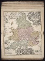
- Beinecke Rare Book and Manuscript Library > Magna Britannia complectens Angliae, Scotiae, et Hyberniae regn. [cartographic material] : in suas prov. et comitat. divisa et ex mappis Londinensibus designata / per Homannianos heredes
- Creator:
- Homann, Johann Baptist, 1663-1724
Visscher, Nicolaes, 1649-1702
- Published / Created:
- [172-?]
- Call Number:
- 1983 Folio 23
- Collection Title:
- [Atlas factice of 50 maps, primarily by Johann Baptist Homann and/or issued by the Homann Erben
- Image Count:
- 1
- Found in:
- Beinecke Rare Book and Manuscript Library > Magnae Britanniae pars meridionalis in qua regnum Angliae tam in septem antiqua Anglo-Saxonum regna quom in omnes Hodiernas regiones accurate divisum hic ostenditur quam tabula ab archetypo Vischeriano desumptam exhibet [cartographic material] / Ioh. Bapt
- Creator:
- Cassini, Cesar-Francois, 1714-1784
Mayer, Tobias, 1723-1762
Snellius, Willebrord, 1580-1626
- Published / Created:
- 1747
- Call Number:
- 1983 Folio 23
- Collection Title:
- [Atlas factice of 50 maps, primarily by Johann Baptist Homann and/or issued by the Homann Erben
- Image Count:
- 1
- Found in:
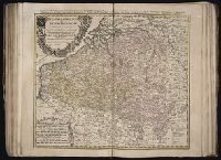
- Beinecke Rare Book and Manuscript Library > Belgivm Catholicvm seu decem provinciae Germaniae inferioris : cum confiniis Germaniae svp. et Franciae legitime omnia delineata et ad ductum observationum astronomicarum, nec non geometricarum operationum a Cassinio Snellio Muschenbrokio aliisqve rite ha
- Creator:
- Homann Erben (Firm)
L'Isle, Guillaume de, 1675-1726
Riccioli, Giovanni Battista, 1598-1671
- Published / Created:
- [1742?]
- Call Number:
- 1983 Folio 23
- Collection Title:
- [Atlas factice of 50 maps, primarily by Johann Baptist Homann and/or issued by the Homann Erben
- Image Count:
- 1
- Found in:
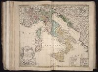
- Beinecke Rare Book and Manuscript Library > Italia : in suos status divisa et ex prototypo del Isliano desumta, elementis insuper Geographiae Schazianis accom[m]odata
- Creator:
- Homann Erben (Firm)
Mayer, Tobias, 1723-1762
- Published / Created:
- 1748
- Call Number:
- 1983 Folio 23
- Collection Title:
- [Atlas factice of 50 maps, primarily by Johann Baptist Homann and/or issued by the Homann Erben
- Image Count:
- 1
- Found in:
- Beinecke Rare Book and Manuscript Library > Statvs Ecclesiastici nec non Magni Ducatvs Toscanae nova tabula geographica [cartographic material] / secundum prinicipia legitimae delineationis descripta a Tob. Majero, Societ. Geogr. Sodali.
- Creator:
- Homann Erben (Firm)
Homann, Johann Baptist, 1663-1724
- Published / Created:
- [1741?]
- Call Number:
- 1983 Folio 23
- Collection Title:
- [Atlas factice of 50 maps, primarily by Johann Baptist Homann and/or issued by the Homann Erben
- Image Count:
- 1
- Found in:
- Beinecke Rare Book and Manuscript Library > Imperii Romano Germanici in svos statvs et circvlos divisi tabvla generalis in ufus iuventutis erundiendae accommodata
- Creator:
- Homann Erben (Firm)
Muller, J. C. (Johann Christoph), 1673-1721
- Published / Created:
- [ca. 1730?]
- Call Number:
- 1983 Folio 23
- Collection Title:
- [Atlas factice of 50 maps, primarily by Johann Baptist Homann and/or issued by the Homann Erben
- Image Count:
- 1
- Found in:
- Beinecke Rare Book and Manuscript Library > Bohemiae Regnum in XII Circulos divisum [cartographic material] : cum Com. Glac. et Distr. Egerano ceterisq[ue] circumjacentibiis terris / ex Muellerianis aliisq[ue] chorographicis subsidys delineatum nunc noviter revisum et emendatum per Homannianos Here
- Creator:
- Homann, Johann Baptist, 1663-1724
Mueller, J. C. (Johann Christoph), 1673-1721
- Published / Created:
- [ca. 1715]
- Call Number:
- 1983 Folio 23
- Collection Title:
- [Atlas factice of 50 maps, primarily by Johann Baptist Homann and/or issued by the Homann Erben
- Image Count:
- 1
- Found in:
- Beinecke Rare Book and Manuscript Library > Tabula generalis Marchionatus Moraviae in sex circulos divisae [cartographic material] : quos mandato Caesareo accurate emensus / hac mappa delineatos exhibet Ioh. Christoph. Muå¬ller, S.C.M. Capitan ; editore Joh. Bapt. Homanno
- Creator:
- Homann Erben (Firm)
Mayer, Tobias, 1723-1762
- Published / Created:
- [ca. 1745]
- Call Number:
- 1983 Folio 23
- Collection Title:
- [Atlas factice of 50 maps, primarily by Johann Baptist Homann and/or issued by the Homann Erben
- Image Count:
- 1
- Found in:
- Beinecke Rare Book and Manuscript Library > Dvcatvs Silesiae tabula geographica generalis, statui hodierno ei nempe qui post pacem Dresdensem locum obtinet [cartographic material] / adaptata iustaque graduatione rectificata per Tob. Maier
- Creator:
- Homann Erben (Firm)
Mayer, Tobias, 1723-1762
- Published / Created:
- 1747
- Call Number:
- 1983 Folio 23
- Collection Title:
- [Atlas factice of 50 maps, primarily by Johann Baptist Homann and/or issued by the Homann Erben
- Image Count:
- 1
- Found in:
- Beinecke Rare Book and Manuscript Library > S.R.I. circulus Austriacus [cartographic material] : quem componunt archid. Austriae, ducatus Stiriae, Carinthiae, Carnioliae, comit. Tyrolensis, ditionesque Sueviae austriacae, cum suis confiniis / a Tobia Majero ; curantibus Homannianis Heridibus = Le C
- Creator:
- Homann Erben (Firm)
Homann, Johann Baptist, 1663-1724
- Published / Created:
- [ca. 1730]
- Call Number:
- 1983 Folio 23
- Collection Title:
- [Atlas factice of 50 maps, primarily by Johann Baptist Homann and/or issued by the Homann Erben
- Image Count:
- 1
- Found in:
- Beinecke Rare Book and Manuscript Library > S.R.I. circulus Rhenanus inferior sive electorum Rheni [cartographic material] : complectens tres archiepiscopatus, Moguntinum, Coloniensem et Trevirensem, Palatinatum Rheni, Comit. Beilstein, Newenaer, Inf. Isenburg, et Reiferscheit / repraesentatus a Io
- Creator:
- Homann, Johann Baptist, 1663-1724
Hubner, Johann, 1668-1731
- Published / Created:
- [173-?]
- Call Number:
- 1983 Folio 23
- Collection Title:
- [Atlas factice of 50 maps, primarily by Johann Baptist Homann and/or issued by the Homann Erben
- Image Count:
- 1
- Found in:
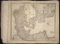
- Beinecke Rare Book and Manuscript Library > Regni Daniae, in quo sunt Ducatus Holsatia et Slesvicum, insulae Danicae, provinciae Iutia, Scania, Bleckingia, nova tabula [cartographic material] / edita a Io. Baptista Homanno ; et aucta secundum geographiam novissimam Iohann Huebneri, J.U.L
- Creator:
- Hase, Johann Matthias, 1684-1742
Homann Erben (Firm)
Homann, Johann Baptist, 1663-1724
- Published / Created:
- [1737]
- Call Number:
- 1983 Folio 23
- Collection Title:
- [Atlas factice of 50 maps, primarily by Johann Baptist Homann and/or issued by the Homann Erben
- Image Count:
- 1
- Found in:
- Beinecke Rare Book and Manuscript Library > Imperium Turcicum in Europa, Asia et Africa regiones proprias, tributarias, clientelares sicut et omnes eusdem Beglirbegatus seu praefecturas generales exhibens [cartographic material] / sumptibus Io. Baptista Hommani
- Creator:
- Boehm, Augustus Gottlieb
Hase, Johann Matthias, 1684-1742
Homann Erben (Firm)
- Published / Created:
- 1744
- Call Number:
- 1983 Folio 23
- Collection Title:
- [Atlas factice of 50 maps, primarily by Johann Baptist Homann and/or issued by the Homann Erben
- Image Count:
- 1
- Found in:
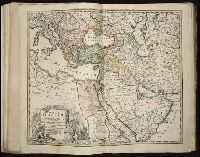
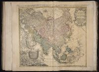
- Beinecke Rare Book and Manuscript Library > Asia secundum legitimas projectionis stereographicae regulas et juxta recentissimas observationes [cartographic material] : et relationes explosis aliorum fabulosis designationibus et narrationibus, adhibitis quoque veterum monumentis et recentiorum itine
- Creator:
- Hase, Johann Matthias, 1684-1742
Homann Erben (Firm)
- Published / Created:
- [ca. 1737]
- Call Number:
- 1983 Folio 23
- Collection Title:
- [Atlas factice of 50 maps, primarily by Johann Baptist Homann and/or issued by the Homann Erben
- Image Count:
- 1
- Found in:
- Beinecke Rare Book and Manuscript Library > Africa secundum legitimas projectionis stereographicae regulas et juxta recentissimas relationes et observationes in subsidium vocatis quoque veterum Leonis Africani Nubiensis Geographi et aliorum monumentis et eleminatis fabulosis aliorum designationibus
- Creator:
- Homann Erben (Firm)
Mayer, Tobias, 1723-1762
- Published / Created:
- ca. 1751
- Call Number:
- 1983 Folio 23
- Collection Title:
- [Atlas factice of 50 maps, primarily by Johann Baptist Homann and/or issued by the Homann Erben
- Image Count:
- 1
- Found in:
- Beinecke Rare Book and Manuscript Library > Helvetia tredecim statibvs liberis, quos cantones vocant composita: una cum foederatis & subjectis provinciis, ex probatissimis subsidiis
- Creator:
- Homann Erben (Firm)
Mayer, Tobias, 1723-1762
- Published / Created:
- ca. 1748
- Call Number:
- 1983 Folio 23
- Collection Title:
- [Atlas factice of 50 maps, primarily by Johann Baptist Homann and/or issued by the Homann Erben
- Image Count:
- 1
- Found in:
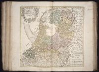
- Beinecke Rare Book and Manuscript Library > Septem provinciae seu Belgivm Foederatvm quod generaliter Hollandia [cartographic material] : audit speciali mappa delineatum adhibitis auxilium observationibus astronomieis nec non mensurationibus Snellii, Muschenbrokii, etc. / auctore Tobia Mayero ...
- Creator:
- Dorn, Sebastian
Hase, Johann Matthias, 1684-1742
Homann Erben (Firm)
- Published / Created:
- 1744
- Call Number:
- 1983 Folio 23
- Collection Title:
- [Atlas factice of 50 maps, primarily by Johann Baptist Homann and/or issued by the Homann Erben
- Image Count:
- 1
- Found in:
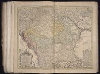
- Beinecke Rare Book and Manuscript Library > Hvngariae ampliori significatu et veteris vel methodicae, complexae regna: Hvngariae Propriae, Croatiae, Dalmatiae, Bosniae, Serviae, Bvlgariae, Cvmaniae, principatvm: Transylvaniae, despotatvs: Walachiae, Moldaviae (exclusis ab eadem alienatis Galitia et
- Creator:
- Boehme, August Gottlieb, 1719-1797
Homann Erben (Firm)
- Published / Created:
- anno 1776
- Call Number:
- 1983 Folio 23
- Collection Title:
- [Atlas factice of 50 maps, primarily by Johann Baptist Homann and/or issued by the Homann Erben
- Image Count:
- 1
- Found in:
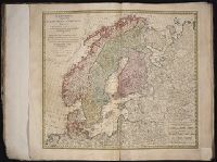
- Beinecke Rare Book and Manuscript Library > Scandinavia complectens Sveciae, Daniae et Norvegiae Regna [cartographic material] : ex novissimis subsidiis delineata et ad Leges projectionis stereographicae legitimae reducta / ab Augusto Gottlob Boehmio ...
- Creator:
- Homann, Johann Baptist, 1663-1724
- Published / Created:
- [ca. 1710]
- Call Number:
- 1983 Folio 23
- Collection Title:
- [Atlas factice of 50 maps, primarily by Johann Baptist Homann and/or issued by the Homann Erben
- Image Count:
- 1
- Found in:
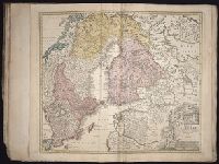
- Beinecke Rare Book and Manuscript Library > Regni Sueciae in omnes suas subjacentes provincias accurate divisi tabula generalis [cartographic material] / edita a Ioh. Bapt. Homanno
- Creator:
- Gussefeld, F. L. (Franz Ludwig), 1744-1807
Homann Erben (Firm)
- Published / Created:
- 1786
- Call Number:
- 1983 Folio 23
- Collection Title:
- [Atlas factice of 50 maps, primarily by Johann Baptist Homann and/or issued by the Homann Erben
- Image Count:
- 1
- Found in:
- Beinecke Rare Book and Manuscript Library > Charte das Russische Reich, und die von den Tatarn bewohnte Laender in Europa und Asien enthaltend [cartographic material] / entworfen von F.L. Guessefeld = Carte de l'Empire de Russie et de la Grande Tatarie / dressee avec soin par F.L. Guessefeld
- Creator:
- Gussefeld, F. L. (Franz Ludwig), 1744-1807
Homann Erben (Firm)
- Published / Created:
- 1775
- Call Number:
- 1983 Folio 23
- Collection Title:
- [Atlas factice of 50 maps, primarily by Johann Baptist Homann and/or issued by the Homann Erben
- Image Count:
- 1
- Found in:
- Beinecke Rare Book and Manuscript Library > Tabula regni Borussiae, Borussiam orientalem exhibens [cartographic material] / F.L. Guessefeld, C. P. S. C. M
- Creator:
- Gussefeld, F. L. (Franz Ludwig), 1744-1807
Homann Erben (Firm)
- Published / Created:
- 1780
- Call Number:
- 1983 Folio 23
- Collection Title:
- [Atlas factice of 50 maps, primarily by Johann Baptist Homann and/or issued by the Homann Erben
- Image Count:
- 1
- Found in:
- Beinecke Rare Book and Manuscript Library > Borussiae occidentalis tabula [cartographic material] / a Franc. Ludov. Guessefeld
- Creator:
- Boehm, August Gottlieb
Homann Erben (Firm)
- Published / Created:
- 1766
- Call Number:
- 1983 Folio 23
- Collection Title:
- [Atlas factice of 50 maps, primarily by Johann Baptist Homann and/or issued by the Homann Erben
- Image Count:
- 1
- Found in:
- Beinecke Rare Book and Manuscript Library > Totius Danubii cum adjacentibus regnis nec non totius Graeciae et archipelagi [cartographic material] : novissima tabula ex recentissimis subsidiis concinnata et ad leges projectionis stereographicae legitimae / reducta ab Augusto Gottlob Boehmio ...
- Creator:
- Guessefeld, F. L. (Franz Ludwig), 1744-1807
Homann Erben (Firm)
Schmidt, I. M.
- Published / Created:
- 1785
- Call Number:
- 1983 Folio 23
- Collection Title:
- [Atlas factice of 50 maps, primarily by Johann Baptist Homann and/or issued by the Homann Erben
- Image Count:
- 1
- Found in:
- Beinecke Rare Book and Manuscript Library > Charte von der Moldau und Walachey [cartographic material] : nach den Astronomischen Beobachtungen des Russisch-Kayserl. Majors Jslenief und denen Charten und Beschreibung des H. Hauptm. Sulzer, ingl. den Charten des ehmal. Russ. Kaysl. Gen.-Lieut. v. Bau
- Creator:
- Dorn, Sebastian
Homann Erben (Firm)
Rizzi-Zannoni, Giovanni Antonio, 1736-1814
- Published / Created:
- 1764
- Call Number:
- 1983 Folio 23
- Collection Title:
- [Atlas factice of 50 maps, primarily by Johann Baptist Homann and/or issued by the Homann Erben
- Image Count:
- 1
- Found in:
- Beinecke Rare Book and Manuscript Library > Tres nouvelle Carte du Royaume de France [cartographic material] : divise en toutes les Provinces et Gouvernements dressee sur une nouvelle observation astronomique faite aux environ du Globe, assujetie aux memoires du feu M. Cassini de Thury, dans toute
- Creator:
- Homann, Johann Baptist, 1663-1724
- Published / Created:
- [ca. 1710]
- Call Number:
- 1983 Folio 23
- Collection Title:
- [Atlas factice of 50 maps, primarily by Johann Baptist Homann and/or issued by the Homann Erben
- Image Count:
- 1
- Found in:
- Beinecke Rare Book and Manuscript Library > Archiducatus Austriae [cartographic material] : inferioris in omnes suas quadrantes ditiones divisi nova et exacta tabula / e conatibus Io. Baptistae Homanni
- Creator:
- Homann, Johann Baptist, 1663-1724
Vischer, Georg Matthaeus, 1628-1695
- Published / Created:
- [ca. 1710]
- Call Number:
- 1983 Folio 23
- Collection Title:
- [Atlas factice of 50 maps, primarily by Johann Baptist Homann and/or issued by the Homann Erben
- Image Count:
- 1
- Found in:
- Beinecke Rare Book and Manuscript Library > Archiducatus Austriae superioris in suas quadrantes ditiones exacte divisi accuratissima tabula [cartographic material] / ex amplissima Rev. Dn. Georg Matth. Vischer Sac. Caes. Mai. (Leopoldi Glor.mae Mem.) Geogra. ; desumta et exhibita a Ioh. Baptista Ho
- Creator:
- Homann, Johann Baptist, 1663-1724
Vischer, Georg Matthaeus, 1628-1695
- Published / Created:
- [ca. 1710]
- Call Number:
- 1983 Folio 23
- Collection Title:
- [Atlas factice of 50 maps, primarily by Johann Baptist Homann and/or issued by the Homann Erben
- Image Count:
- 1
- Found in:
- Beinecke Rare Book and Manuscript Library > Ducatus Stiriae novissima tabula [cartographic material] / ex ampliore mappa olim R. Dni. Georgii Matth. Vischer S.C.M., Leopoldi I. Glorssae. Memae. Geographi deducta ; et in hac utiliore forma curiosorum oculis exhibita a Ioh. Bapti. Homanno
- Creator:
- Homann, Johann Baptist, 1663-1724
- Published / Created:
- [ca. 1715]
- Call Number:
- 1983 Folio 23
- Collection Title:
- [Atlas factice of 50 maps, primarily by Johann Baptist Homann and/or issued by the Homann Erben
- Image Count:
- 1
- Found in:
- Beinecke Rare Book and Manuscript Library > Nova et accurata Carinthiae Ducatus tabula geographica [cartographic material] : in superiorem et inferiorem divisa, cum insertis partibus, Archiepiscopatui Salisburgensi propriis nec non dynastiis aliquot, quae tempore S. Henrici Imperiatoris circa A. 10
- Creator:
- Homann Erben (Firm)
Sperges, Joseph, Freiherr von, 1725-1791
- Published / Created:
- [ca. 1762?]
- Call Number:
- 1983 Folio 23
- Collection Title:
- [Atlas factice of 50 maps, primarily by Johann Baptist Homann and/or issued by the Homann Erben
- Image Count:
- 1
- Found in:
- Beinecke Rare Book and Manuscript Library > Tyrolis pars meridionalis cum Espicopatu Tridentino finitimisque vallibus et limitibus Venetis [cartographic material] / accurate descripta a Iosepho de Spergs in Palenz et Reisdorf
- Creator:
- Gussefeld, F. L. (Franz Ludwig), 1744-1807
Homann Erben (Firm)
Schmidt, I. M.
- Published / Created:
- 1783
- Call Number:
- 1983 Folio 23
- Collection Title:
- [Atlas factice of 50 maps, primarily by Johann Baptist Homann and/or issued by the Homann Erben
- Image Count:
- 1
- Found in:
- Beinecke Rare Book and Manuscript Library > Der Rhein, die Maass und Mosel [cartographic material] : mit den anliegenden Laendern des Ober-Chur- und Nieder-Rhein wie auch des Burgundischen Kreisesing Elsass und Lothringen & c. / durch F.L. Guessefeld = Carte geographique contenant le cours du Rhin,
- Creator:
- Guessefeld, F. L. (Franz Ludwig), 1744-1807
Homann Erben (Firm)
Schmidt, I. M.
- Published / Created:
- 1782
- Call Number:
- 1983 Folio 23
- Collection Title:
- [Atlas factice of 50 maps, primarily by Johann Baptist Homann and/or issued by the Homann Erben
- Image Count:
- 1
- Found in:
- Beinecke Rare Book and Manuscript Library > Der Fraenkische Kreis / [cartographic material] / von F.L. Guessefeld = Charte geographique du Cercle de Franconie / dressee nouvellement par F.L. Guessefeld
- Creator:
- Homann, Johann Baptist, 1663-1724
- Published / Created:
- [ca. 1710?]
- Call Number:
- 1983 Folio 23
- Collection Title:
- [Atlas factice of 50 maps, primarily by Johann Baptist Homann and/or issued by the Homann Erben
- Image Count:
- 1
- Found in:
- Beinecke Rare Book and Manuscript Library > Bavariae Circulus et Electorat in suas quas que ditiones tam cum adiacentibus quam insertis regionibus accuratissime divisus / [cartographic material] / per Io. Baptistam Homannum
- Creator:
- Hase, Johann Matthias, 1684-1742
Homann Erben (Firm)
Michal, Jacques de
- Published / Created:
- ca. 1743
- Call Number:
- 1983 Folio 23
- Collection Title:
- [Atlas factice of 50 maps, primarily by Johann Baptist Homann and/or issued by the Homann Erben
- Image Count:
- 1
- Found in:
- Beinecke Rare Book and Manuscript Library > Circvli Sveviae mappa / [cartographic material] / ex subsidijs Michalianis delineata & a Dno. I.M. Hasio M.P.P. quoad accuratam singulorums statuum determinationem emendata & ad. L. magis legitimae project. reducta ; opus sum[m]i geographi posthumum, & ad
- Creator:
- Gussefeld, F. L. (Franz Ludwig), 1744-1807
Homann Erben (Firm)
- Published / Created:
- 1786
- Call Number:
- 1983 Folio 23
- Collection Title:
- [Atlas factice of 50 maps, primarily by Johann Baptist Homann and/or issued by the Homann Erben
- Image Count:
- 1
- Found in:
- Beinecke Rare Book and Manuscript Library > Der Ober Rheinische Kreis [cartographic material]: nach seinen Unterabtheilungen, entworfen von F.L. Guessefeld
- Creator:
- Homann Erben (Firm)
- Published / Created:
- ao. 1761
- Call Number:
- 1983 Folio 23
- Collection Title:
- [Atlas factice of 50 maps, primarily by Johann Baptist Homann and/or issued by the Homann Erben
- Image Count:
- 1
- Found in:
- Beinecke Rare Book and Manuscript Library > Circuli Westphaliae [cartographic material]: quoad partem septentrionalem in suos Status ecclesiasticos & seculares divisi tabula geographica
- Creator:
- Gussefeld, F. L. (Franz Ludwig), 1744-1807
Homann Erben (Firm)
- Published / Created:
- 1783
- Call Number:
- 1983 Folio 23
- Collection Title:
- [Atlas factice of 50 maps, primarily by Johann Baptist Homann and/or issued by the Homann Erben
- Image Count:
- 1
- Found in:
- Beinecke Rare Book and Manuscript Library > Der suedliche Theil des Ober-Saechsische Kreises [cartographic material] : die Chur-und Fuerstl Saechsische und andere hiehergehoerige Laender vorstellend / aufs neue entworfen von F.L. Guessefeld ; und herausgegeben von den Homaennischen Erben
- Creator:
- Gussefeld, F. L. (Franz Ludwig), 1744-1807
Homann Erben (Firm)
Schmidt, I. M.
- Published / Created:
- 1780
- Call Number:
- 1983 Folio 23
- Collection Title:
- [Atlas factice of 50 maps, primarily by Johann Baptist Homann and/or issued by the Homann Erben
- Image Count:
- 1
- Found in:
- Beinecke Rare Book and Manuscript Library > Der noerdliche Theil des Obersaechsischen Kreises oder die Mark Brandenburg und das Herzogthum Pommern / [cartographic material] / aufs neue entworfen durch F.L.G. ; und ans Licht gestellet von den Homan[n] Erben = Tabula Marchionatus Brandenburgici & Duc
- Creator:
- Guessefeld, Franz Ludwig, 1744-1808
Homanniorum Heredum
- Published / Created:
- MDCCLXXXIV [1784]
- Call Number:
- 1983 Folio 23
- Collection Title:
- [Atlas factice of 50 maps, primarily by Johann Baptist Homann and/or issued by the Homann Erben
- Image Count:
- 1
- Found in:
- Beinecke Rare Book and Manuscript Library > Repraesentationem hancce Circuli Saxonici Inferioris [cartographic material] : ad mentem domini D. Buesching, et ex novissimis ac praestantissimis observationibus delineavit F. L. Guessefeld
- Creator:
- Harenberg, Johann Christoph, 1696-1774
Homann Erben (Firm)
- Published / Created:
- ca. 1750
- Call Number:
- 1983 Folio 23
- Collection Title:
- [Atlas factice of 50 maps, primarily by Johann Baptist Homann and/or issued by the Homann Erben
- Image Count:
- 1
- Found in:
- Beinecke Rare Book and Manuscript Library > Palaestina in XII tribus divisa cum terris adiacentibus / [cartographic material] / denuo revisa & copiosior reddita studio Iohannis Christoph Harenbergh, Praep. S. Laur. Schening
- Creator:
- Homann Erben (Firm)
Ovalle, Alonso de, 1601-1651
Techo, Nicolas del, 1611-1685
- Published / Created:
- A. MDCCXXXIII [1733]
- Call Number:
- 1975 Folio 31
- Collection Title:
- [Atlas factice of 42 maps, produced by the Homann Erben firm]
- Image Count:
- 1
- Found in:
- Beinecke Rare Book and Manuscript Library > Typus geographicus [cartographic material] : Chili a Paraguay freti Magellanici &c., ex. PPbg. Alfonso d'Ovalle & Nicol. Techo nec non de Brouwer, Narbouroug, de Beauchesne &c., a Guiliel de l'Islio descripta, insuperque secundum recentiores du Frezier re
- Creator:
- Homann, Johann Baptist, 1663-1724
Visscher, Nicolaes, 1649-1702
- Published / Created:
- 1715?
- Call Number:
- 1975 Folio 31
- Collection Title:
- [Atlas factice of 42 maps, produced by the Homann Erben firm]
- Image Count:
- 1
- Found in:
- Beinecke Rare Book and Manuscript Library > Hiberniae regnum tam in praecipuas Ultoniae, Connaciae, Laceniae et Momoniae [cartographic material] : quam in minores earundem provincias et ditiones divisum ex prototype Guil. Petty-Vischeriano deductu et exhibitum / a Joh. Bapt. Homanno
- Creator:
- Homann, Johann Baptist, 1663-1724, creator
- Published / Created:
- 1720?
- Call Number:
- 1975 Folio 31
- Collection Title:
- [Atlas factice of 42 maps, produced by the Homann Erben firm]
- Image Count:
- 1
- Found in:
- Beinecke Rare Book and Manuscript Library > Belgii pars septentrionalis communi nomine vulgo Hollandia nuncupata continens statum potentissimae Batavorum Reipublicea sev provincias VII foederatas / exhibente Io. Baptista Homanno
- Creator:
- Homann, Johann Baptist, 1663-1724
Hubner, Johann, 1668-1731
- Published / Created:
- ca. 1715
- Call Number:
- 1975 Folio 31
- Collection Title:
- [Atlas factice of 42 maps, produced by the Homann Erben firm]
- Image Count:
- 1
- Found in:
- Beinecke Rare Book and Manuscript Library > Regni Daniae, in quo sunt Ducatus Holsatia et Slesvicum, insulae Danicae, provinciae Iutia, Scania, Bleckingia, nova tabula / [cartographic material] / edita a Io. Baptista Homanno ; et aucta secundum geographiam novissimam Iohann Huebneri, I.U.L
- Creator:
- Homann, Johann Baptist, 1663-1724
- Published / Created:
- [172-?]
- Call Number:
- 1975 Folio 31
- Collection Title:
- [Atlas factice of 42 maps, produced by the Homann Erben firm]
- Image Count:
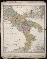
- 2
- Found in:
- Beinecke Rare Book and Manuscript Library > Novissima & exactissima totivs regni Neapolis tabvla / praesentis belli statvi accommodata et exhibita a Ioanne Bapt. Homanno
- Creator:
- Homann Erben (Firm)
L'Isle, Guillaume de, 1675-1726
Riccioli, Giovanni Battista, 1598-1671
- Published / Created:
- [1742?]
- Call Number:
- 1975 Folio 31
- Collection Title:
- [Atlas factice of 42 maps, produced by the Homann Erben firm]
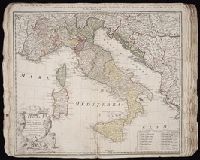
- Image Count:
- 1
- Found in:
- Beinecke Rare Book and Manuscript Library > Italia [cartographic material] : in suos status divisa et ex prototypo del Isliano desumta, elementis insuper Geographiae Schazianis accom[m]odata
- Creator:
- Hase, Johann Matthias, 1684-1742
Homann Erben (Firm)
Reinsberger, Johann Christoph
- Published / Created:
- A. MDCCXXXXIII [1743]
- Call Number:
- 1975 Folio 31
- Collection Title:
- [Atlas factice of 42 maps, produced by the Homann Erben firm]
- Image Count:
- 1
- Found in:
- Beinecke Rare Book and Manuscript Library > Europa, secundum legitimas projectionis stereographicae regulas : et juxta recentissimas observationes aeque ac relationes adhibitis quoq[ue] veterum monumentorum subsidiis / descripta et in partes suas methodicas X divisa a Ioh. Matth. Hasio, Math. P.P.O