
Search


Limit your search
- Public195
- cartographic✖[remove]195
- Illustrations✖[remove]195
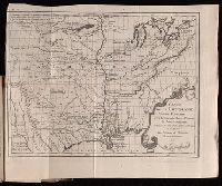
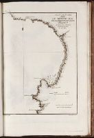
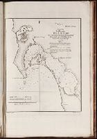
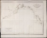
- Maps185
- Maps in books164
- Engravings119
- Prints (Visual works)48
- Hand coloring41
- Intaglio prints30
- Manuscripts17
- Illuminated manuscripts16
- Atlases12
- Pelletier, David9
- Alcala-Galiano, Dionisio, 1760-18055
- Mexicana (Ship)5
- Navarrete, Martin Fernandez de, 1765-18445
- Sutil (Ship)5
- Valdes Flores Bazan y Peon, Cayetano, 1767-18355
- Bry, Theodor de, 1528-15983
- Chauveton, Urbain, d. ca. 16162
- Crusoe, Robinson (Fictitious character)2
- Davis, E. H. (Edwin Hamilton), 1811-18882