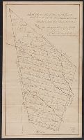
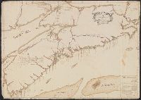
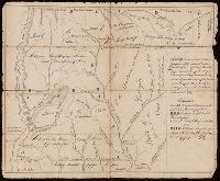
Inscription: "All this part of the peninsula from Cape Sable to the Mahone Bay abounds with oaks, pine, large firs and black Birch and has a rich and fertile soil and many fine rivers and harbours.", Preliminary record., and Table of latitude and longitude in b
Subject (Geographic):
Nova Scotia--Maps, Manuscript--Early works to 1800
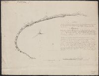
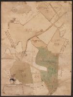
Coordinates not present on map and are approximated., From the Nathaniel Pendleton family papers., Imperfect: torn along folds, with some loss of text., Relief shown by hachures., and Shows locations and number of warriors for the Chickasaw and Choctaw Indian tribes.
Subject (Geographic):
Chickasaw Nation--Maps--Early works to 1800., Choctaw Nation--Maps--Early works to 1800., and Mississippi--Maps--Early works to 1800.
Subject (Name):
Cox, Zachariah, Pendleton, Nathaniel,--1756-1821--Ownership., South-Carolina Yazoo Company, Tennessee Company, and Virginia Yazoo Company
Subject (Topic):
Public lands--Georgia--Early works to 1800., Real property--Mississippi--Maps--Early works to 1800., and Yazoo Fraud, 1795--Maps--Early works to 1800.