Search
You Searched For
Search Results
- Published / Created:
- [1780?]
- Call Number:
- 40 N36 1780
- Container / Volume:
- BRBL_00705
- Image Count:
- 1
- Resource Type:
- Maps, Atlases & Globes
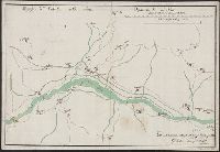
- Description:
- Color: White with some green indicating the river.
- Subject (Geographic):
- Italy--Maps, Manuscript--Early works to 1800
- Found in:
- Beinecke Rare Book and Manuscript Library > Dipartimento del Serio. Tipografico del Distretto della Nesa.
- Published / Created:
- [1790?]
- Call Number:
- 426 1790
- Container / Volume:
- BRBL_00706
- Image Count:
- 1
- Resource Type:
- Maps, Atlases & Globes
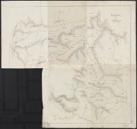
- Description:
- Color: White with yellow and blue detail.
- Subject (Geographic):
- Styria (Austria)--Maps, Manuscript--Early works to 1800
- Found in:
- Beinecke Rare Book and Manuscript Library > Ducato di Stiria.
- Published / Created:
- [ca. 1776]
- Call Number:
- 771hc 1776A
- Container / Volume:
- BRBL_00714
- Image Count:
- 1
- Resource Type:
- Maps, Atlases & Globes
- Description:
- Color: Pen and ink with blue and red detail.
- Subject (Geographic):
- New York--Maps--Early works to 1800
- Found in:
- Beinecke Rare Book and Manuscript Library > Emplacement des Trouppes en Quartier d'hyver Sur Yorck-Long & Staten Island.
- Published / Created:
- [1886]
- Call Number:
- 60 1886
- Container / Volume:
- BRBL_00707
- Image Count:
- 2
- Resource Type:
- Maps, Atlases & Globes
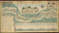
- Description:
- "Roughly illustrated during a discussion for book "Aller" Nov. 24, 1886. Drawn and signed by Sir Henry M. Stanley.
- Subject (Geographic):
- Africa--Maps, Manuscript
- Found in:
- Beinecke Rare Book and Manuscript Library > Equatorial Africa.
- Published / Created:
- [1810?]
- Call Number:
- BrSides Double Folio 2018 105
- Image Count:
- 1
- Resource Type:
- Maps, Atlases & Globes
- Description:
- Manuscript number on recto and verso: 2170.
- Subject (Geographic):
- Milan (Italy)--Maps
- Found in:
- Beinecke Rare Book and Manuscript Library > Estratto della mappa di nuovo censo del comune di Dresano mandamento di Paullo provincia di Milano.
- Published / Created:
- [1780]
- Call Number:
- 399 1780
- Container / Volume:
- BRBL_00704
- Image Count:
- 2
- Resource Type:
- Maps, Atlases & Globes
- Subject (Geographic):
- Gibraltar--Maps, Manuscript--Early works to 1800
- Found in:
- Beinecke Rare Book and Manuscript Library > Estrecho de Gibraltar.
- Creator:
- Kirkwood, James Pugh, 1807-1877
- Published / Created:
- [1847]
- Call Number:
- 766 N46 1847A
- Container / Volume:
- BRBL_00712
- Image Count:
- 2
- Resource Type:
- Maps, Atlases & Globes
- Alternative Title:
- Experimental survey for a railroad between New Haven and Humphreysville, forming part of the line to Waterbury
- Description:
- "Scale 800 feet to one inch."
- Subject (Geographic):
- New Haven (Conn.)--Maps, Manuscript
- Subject (Topic):
- Railroads--Connecticut--New Haven County--Maps.
- Found in:
- Beinecke Rare Book and Manuscript Library > Experimental survey for a railroad between New Haven & Humphreysville, forming part of the line to Waterbury / made in July 1847 by J.P. Kirkwood.
- Published / Created:
- [1780?]
- Call Number:
- BrSides Elephant Folio 2019 5
- Image Count:
- 1
- Resource Type:
- Maps, Atlases & Globes
- Alternative Title:
- Генеральной планъ Боровицкимъ порогамъ отъ Опеченской до Потерпельской пристани ...
- Description:
- Coordinates cannot be determined.
- Subject (Geographic):
- Novgorodskai︠a︡ oblastʹ (Russia)--Maps--Early works to 1800.
- Found in:
- Beinecke Rare Book and Manuscript Library > Generalʹnoĭ planʺ Borovit︠s︡kimʺ porogamʺ otʺ Opechenskoĭ do Poterpelʹskoĭ pristani ...
- Published / Created:
- [1800?]
- Call Number:
- 399 1800
- Container / Volume:
- BRBL_00704
- Image Count:
- 1
- Resource Type:
- Maps, Atlases & Globes
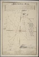
- Description:
- Drawing at bottom.
- Subject (Geographic):
- Gibraltar--Maps, Manuscript--Early works to 1800
- Found in:
- Beinecke Rare Book and Manuscript Library > Gibraltar Bay.
- Published / Created:
- [1780?]
- Call Number:
- 399 1780A
- Container / Volume:
- BRBL_00704
- Image Count:
- 1
- Resource Type:
- Maps, Atlases & Globes
- Description:
- Water color. Possibly as early as 1755.
- Subject (Geographic):
- Gibraltar--Maps, Manuscript--Early works to 1800
- Found in:
- Beinecke Rare Book and Manuscript Library > Gibraltar.