Search
You Searched For
Search Results
- Creator:
- Blodget, Samuel, 1724-1807
- Published / Created:
- February the 2d, 1756.
- Call Number:
- 771hc H864 1756
- Container / Volume:
- BRBL_00495
- Image Count:
- 1
- Resource Type:
- Maps, Atlases & Globes
- Found in:
- Beinecke Rare Book and Manuscript Library > A Prospective view of the battle fought near Lake George, on the 8th of Sepr. 1755 : between 2000 English, with 250 Mohawks, under the command of Gen. Johnson: & 2500 French & indians under the command of Genl. Dieskau in which the English were victorious
- Creator:
- Eddy, J.
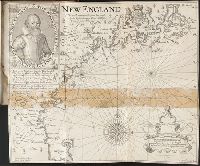
Lowe, George, fl. 1613?-ca. 1615?
- Published / Created:
- 1614-16
- Call Number:
- Zd 176
- Collection Title:
- Path-way to experience to erect a plantation
- Image Count:
- 1
- Found in:
- Beinecke Rare Book and Manuscript Library > New England: the most remarqueable parts thus named by the high and mighty Prince Charles, Prince of Great Britaine
- Call Number:
- Taylor 176
- Collection Title:
- De orbe novo Petri Martyris Anglerii Mediolanensis, protonotarij, & Caroli quinti Senatoris decades
- Image Count:
- 1
- Found in:
- Beinecke Rare Book and Manuscript Library > Novus Orbis
- Published / Created:
- 1802
- Call Number:
- Zc20 805peb
- Collection Title:
- Voyage dans les deux Lousiianes, et chez les nations sauvages du Missouri, par les Etats-Unis, l
- Image Count:
- 1
- Found in:
- Beinecke Rare Book and Manuscript Library > Carte du Missouri levee ou rectifiee dans toute son etendue. Par F.ois Perrin du Lac
- Creator:
- Guerard, Nicholas
- Call Number:
- Cn 105
- Collection Title:
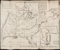
- Map: Carte de la Nouuelle France et de la Louisiane, nouuellement decouuerte, dediée au roy, l'an
- Image Count:
- 1
- Found in:
- Beinecke Rare Book and Manuscript Library > Carte de la nouvelle France et de la Louisiane nouvellement decouverte dediee au Roy l'An 1683. Par le Reverend Pere Louis Hennepin missionaire recollect et notaire apostolique
- Call Number:
- Zc90 +744do
- Collection Title:
- An account of the countries adjoining to Hudson's Bay, in the North-west part of America
- Image Count:
- 1
- Found in:
- Beinecke Rare Book and Manuscript Library > A new map of part of North America from the latitude of 40 to 68 degrees. Including the late discoveries made on board the Furnace Bomb Ketch in 1742. And the western rivers & lakes falling into Nelson River in Hudson's Bay, as described by Joseph La Fran
- Call Number:
- Egi M6 722
- Collection Title:
- A description of the English province of Carolana, by the Spaniards call'd Florida, and by the
- Image Count:
- 1
- Found in:
- Beinecke Rare Book and Manuscript Library > A map of Carolana and of the River Meschacebe & c.
- Published / Created:
- Undated
- Call Number:
- Taylor 355
- Collection Title:
- America painted to the life. The true history of the Spaniards proceedings in the conquests of the
- Image Count:
- 1
- Found in:
- Beinecke Rare Book and Manuscript Library > Americae descrip
- Creator:
- R. B., 1632?-1725?
- Call Number:
- Taylor 388
- Collection Title:
- The English empire in America: or A prospect of His Majesties dominions in the West-Indies ... By R
- Image Count:
- 1
- Found in:
- Beinecke Rare Book and Manuscript Library > The English empire in America
- Call Number:
- Zc20 758Le
- Collection Title:
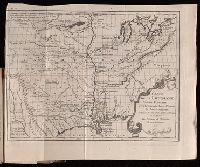
- Histoire de la Louisiane : contenant la decouverte de ce vaste pays ; sa description geographique
- Image Count:
- 1
- Found in:
- Beinecke Rare Book and Manuscript Library > Carte de la Louisiane colonie francaise avec le cours du fleuve St. Louis, les rivieres adjacentes, les nations de naturels, las etablissems francais, et les mines. Par l'Auteur de l'Histoire de cette Province 1757