Search
You Searched For
Search Results
- Creator:
- Popple, Henry, -1743
- Published / Created:
- [ca. 1741]
- Call Number:
- 755 1734A
- Container / Volume:
- BRBL_00426
- Image Count:
- 1
- Resource Type:
- Maps, Atlases & Globes
- Found in:
- Beinecke Rare Book and Manuscript Library > A map of the British Empire in America, with the French, Spanish and Hollandish settlements adjacent thereto / by Henry Popple.
- Creator:
- Popple, Henry, -1743
- Published / Created:
- [ca. 1741]
- Call Number:
- 71 1741
- Container / Volume:
- BRBL_00687
- Image Count:
- 1
- Resource Type:
- Maps, Atlases & Globes
- Found in:
- Beinecke Rare Book and Manuscript Library > A map of the British Empire in America, with the French, Spanish and Hollandish settlements adjacent thereto / by Henry Popple.
- Creator:
- Popple, Henry, -1743
- Published / Created:
- [ca. 1741]
- Call Number:
- 85 1760A
- Container / Volume:
- BRBL_00693
- Image Count:
- 1
- Resource Type:
- Maps, Atlases & Globes
- Found in:
- Beinecke Rare Book and Manuscript Library > A map of the British Empire in America, with the French, Spanish and Hollandish settlements adjacent thereto / by Henry Popple.
- Creator:
- Popple, Henry, -1743
- Published / Created:
- [ca. 1741]
- Call Number:
- 89 1733
- Container / Volume:
- BRBL_00697
- Image Count:
- 1
- Resource Type:
- Maps, Atlases & Globes
- Found in:
- Beinecke Rare Book and Manuscript Library > A map of the British Empire in America, with the French, Spanish and Hollandish settlements adjacent thereto / by Henry Popple.
- Creator:
- Popple, Henry, -1743
- Published / Created:
- [ca. 1741]
- Call Number:
- 85 1734
- Container / Volume:
- BRBL_00636
- Image Count:
- 1
- Resource Type:
- Maps, Atlases & Globes
- Found in:
- Beinecke Rare Book and Manuscript Library > A map of the British Empire in America, with the French, Spanish and Hollandish settlements adjacent thereto / by Henry Popple.
- Creator:
- Popple, Henry, -1743
- Published / Created:
- [ca. 1741]
- Call Number:
- 755 1734B
- Container / Volume:
- BRBL_00426
- Image Count:
- 1
- Resource Type:
- Maps, Atlases & Globes
- Found in:
- Beinecke Rare Book and Manuscript Library > A map of the British Empire in America, with the French, Spanish and Hollandish settlements adjacent thereto / by Henry Popple.
- Published / Created:
- 1806
- Call Number:
- 755 1806
- Container / Volume:
- BRBL_00438
- Image Count:
- 1
- Resource Type:
- Maps, Atlases & Globes
- Found in:
- Beinecke Rare Book and Manuscript Library > A map of the United States and Canada, New Scotland, New Brunswick and Newfoundland. Dresée par Lapie ... Gravée par P.A.F. Tardieu. Ecrit par J.J. Pachoux.
- Call Number:
- Zc20 720so
- Collection Title:
- Some considerations on the consequences of the French settling colonies on the Mississippi, with
- Image Count:
- 1
- Found in:
- Beinecke Rare Book and Manuscript Library > A new map of Louisiana and the River Mississipi
- Creator:
- Sayer, Robert, 1725-1794
- Published / Created:
- [between 1750 and 1769?]
- Call Number:
- 71 1760C
- Container / Volume:
- BRBL_00364
- Image Count:
- 1
- Resource Type:
- Maps, Atlases & Globes
- Found in:
- Beinecke Rare Book and Manuscript Library > A new map of North America : with the British, French, Spanish, Dutch & Danish dominions on that great continent; and the West India Islands / done from the latest geographers, with great improvements from the Sieurs d'Anville & Robert.
- Creator:
- Kip, Johannes, 1653-1722
- Published / Created:
- 1903
- Call Number:
- 32 L84 1720/1903
- Container / Volume:
- BRBL_00736
- Image Count:
- 12
- Resource Type:
- Maps, Atlases & Globes
- Found in:
- Beinecke Rare Book and Manuscript Library > A prospect of the city of London, Westminster and St. James Park = veue et perspective de la ville de Londre, Westminster et Parc St. Jacques / John Kip delineavit et sculpsit.
- Creator:
- Seutter, Matthaeus, 1678-1756
- Published / Created:
- 1734?]
- Call Number:
- 71 1750C
- Container / Volume:
- BRBL_00362
- Image Count:
- 1
- Resource Type:
- Maps, Atlases & Globes
- Found in:
- Beinecke Rare Book and Manuscript Library > Accurata delineatio celeberrimae regionis Ludovicianae vel Gallice Louisiane ot. Canadae et Floridae adpellatione in Septemtrionali America : descriptae quae hodie nomine fluminis Mississippi vel St. Louis per colonias et navigationes Gallorum ob immensas
- Creator:
- Blaeu, Willem Janszoon, 1571-1638
- Published / Created:
- between 1643 and 1650]
- Call Number:
- 64 1643
- Container / Volume:
- BRBL_00338
- Image Count:
- 2
- Resource Type:
- Maps, Atlases & Globes
- Found in:
- Beinecke Rare Book and Manuscript Library > Aethiopia inferior vel exterior.
- Creator:
- Great Britain. War Office. General Staff. Geographical Section
- Published / Created:
- 1942
- Call Number:
- 66gmb 1942
- Container / Volume:
- BRBL_00348
- Image Count:
- 1
- Resource Type:
- Maps, Atlases & Globes
- Found in:
- Beinecke Rare Book and Manuscript Library > Africa road map 1:2,000,000 and 1:500,000, Maroc-Algerie-Tunisie.
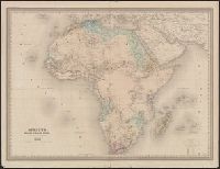
- Creator:
- Hondius, Hendrik, 1597-1651
- Published / Created:
- between 1639 and 1649?]
- Call Number:
- 60 1639
- Container / Volume:
- BRBL_00321
- Image Count:
- 2
- Resource Type:
- Maps, Atlases & Globes
- Found in:
- Beinecke Rare Book and Manuscript Library > Africae nova tabula / auct. Hen. Hondio, 1631.
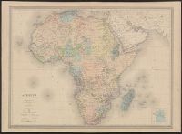
- Creator:
- Lorsignol, G
- Published / Created:
- [187-?]
- Call Number:
- 60 187X
- Container / Volume:
- BRBL_00327
- Image Count:
- 1
- Resource Type:
- Maps, Atlases & Globes
- Found in:
- Beinecke Rare Book and Manuscript Library > Afrique / dessinée et gravée par G. Lorsignol.
- Creator:
- Dufour, A.-H (Auguste-Henri), 1798-1865
- Published / Created:
- 1858
- Call Number:
- 60 1858
- Container / Volume:
- BRBL_00326
- Image Count:
- 1
- Resource Type:
- Maps, Atlases & Globes
- Found in:
- Beinecke Rare Book and Manuscript Library > Afrique / dressée par A.H. Dufour, gravée par Ch. Dyonnet ; Paulin & Le Chevalier.
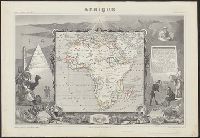
- Creator:
- Levasseur, V. (Victor)
- Published / Created:
- [1845?]
- Call Number:
- 60 1845
- Container / Volume:
- BRBL_00326
- Image Count:
- 1
- Resource Type:
- Maps, Atlases & Globes
- Found in:
- Beinecke Rare Book and Manuscript Library > Afrique / géographie et statistique de V. Levasseur ; gravé par Laguillermie ; illustré par Raimond Bonheur.
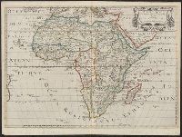
- Creator:
- Sanson, Nicolas, 1600-1667
- Published / Created:
- 1650
- Call Number:
- 60 1650
- Container / Volume:
- BRBL_00321
- Image Count:
- 1
- Resource Type:
- Maps, Atlases & Globes
- Found in:
- Beinecke Rare Book and Manuscript Library > Afrique / par N. Sanson d'Abbebille, geog. du Roy ; A. Peyrounin, sculp.
- Creator:
- Erhard (Firm)
- Published / Created:
- [1898]
- Call Number:
- BrSides 2019 5
- Image Count:
- 2
- Resource Type:
- Maps, Atlases & Globes
- Found in:
- Beinecke Rare Book and Manuscript Library > Afrique : (Partie sud) / Gravé par Erhard Fres. 35 bis. Rue Denfert-Rochereau Paris ; Imp. Erhard Fres.