Search
You Searched For
Search Results
- Published / Created:
- 1786
- Call Number:
- 755 1786A
- Container / Volume:
- BRBL_00435
- Image Count:
- 1
- Resource Type:
- Maps, Atlases & Globes
- Subject (Geographic):
- Canada--Maps--Early works to 1800
- Found in:
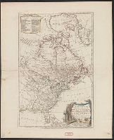
- Beinecke Rare Book and Manuscript Library > A new map of the United States of North America with the British Dominions ... By Samuel Dunn, Mathematician; Improved from the surveys of Capt. Carver.
- Published / Created:
- 1784
- Call Number:
- 755 1784E
- Container / Volume:
- BRBL_00435
- Image Count:
- 1
- Resource Type:
- Maps, Atlases & Globes
- Subject (Geographic):
- Canada--Maps--Early works to 1800
- Found in:
- Beinecke Rare Book and Manuscript Library > Bowles's new pocket map of the United States of America ... as settled by the preliminary articles of peace signed at Versailles the 20th Jany. 1783.
- Published / Created:
- [1761]
- Call Number:
- 23 1761
- Container / Volume:
- BRBL_00018
- Image Count:
- 1
- Resource Type:
- Maps, Atlases & Globes
- Subject (Geographic):
- Pacific Ocean--Maps--Early works to
- Found in:
- Beinecke Rare Book and Manuscript Library > A map of the discoveries made by the Russians on the north west coast of America. Published by the Royal Academy of Sciences at Petersburg.
- Published / Created:
- [1795?]
- Call Number:
- 23 1795
- Container / Volume:
- BRBL_00019
- Image Count:
- 1
- Resource Type:
- Maps, Atlases & Globes
- Subject (Geographic):
- Pacific Ocean--Maps--Early works to
- Found in:
- Beinecke Rare Book and Manuscript Library > Bowles's new pocket map of the discoveries made by the Russians on the north west coast of America. Printed for the proprietors, Bowles & Carver ... London.
- Published / Created:
- [1792?]
- Call Number:
- 755 1792
- Container / Volume:
- BRBL_00435
- Image Count:
- 1
- Resource Type:
- Maps, Atlases & Globes
- Subject (Geographic):
- Canada--Maps--Early works to 1800
- Found in:
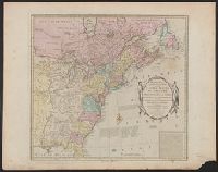
- Beinecke Rare Book and Manuscript Library > A map of the northern and middle states comprehending the western territory and the British dominions in North America ... Delineated & Eng. by Amos Doolittle, New Haven.
- Published / Created:
- 1783
- Call Number:
- 755 1783G
- Container / Volume:
- BRBL_00434
- Image Count:
- 1
- Resource Type:
- Maps, Atlases & Globes
- Subject (Geographic):
- Canada--Maps--Early works to 1800
- Found in:
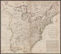
- Beinecke Rare Book and Manuscript Library > An accurate map of the United States of America with part of the Surrounding Provinces agreeable to the treaty of Peace of 1783. By Ino. Cary.
- Published / Created:
- 1794
- Call Number:
- 755 1794D
- Container / Volume:
- BRBL_00436
- Image Count:
- 1
- Resource Type:
- Maps, Atlases & Globes
- Subject (Geographic):
- East (U.S)--Maps--Early works to 1800
- Found in:
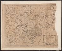
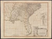
- Beinecke Rare Book and Manuscript Library > A new and general map of the Southern dominions belonging to the United States of America, ... Indian countries, and the Spanish Possessions of Louisiana and Florida.
- Published / Created:
- 1794
- Call Number:
- 23 1794B
- Container / Volume:
- BRBL_00019
- Image Count:
- 1
- Resource Type:
- Maps, Atlases & Globes
- Description:
- Not found in Phillips' List of Maps of
- Subject (Geographic):
- Oceania--Maps--Early works to 1800
- Found in:
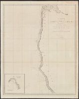
- Beinecke Rare Book and Manuscript Library > Chart of the N.W. coast of America and the N.E. coast of Asia, explored in the years 1778 and 1779. Prepared by Lieut. Hen[r]y Roberts under ... Capt. Cook. Engraved by W. Palmer ... 2nd edition.
- Creator:
- Vancouver, George, 1757-1798
- Published / Created:
- 1798
- Call Number:
- 845 1798H
- Container / Volume:
- BRBL_00619
- Image Count:
- 1
- Resource Type:
- Maps, Atlases & Globes
- Subject (Geographic):
- California--Maps--Early works to 1800
- Subject (Topic):
- Coasts--California--Maps--Early works
- Found in:
- Beinecke Rare Book and Manuscript Library > A chart shewing part of the coast of N.W. America, with the tracks of His Majesty's sloop Discovery and armed tender Chatham / commanded by George Vancouver, esq. and prepared under his immediate inspection by Lieut. Joseph Baker, in which the continental
- Creator:
- Fer, Nicolas de, 1646-1720
- Published / Created:
- 1720
- Call Number:
- 88 1720
- Container / Volume:
- BRBL_00644
- Image Count:
- 1
- Resource Type:
- Maps, Atlases & Globes
- Subject (Geographic):
- California--Maps--Early works to 1800
- Found in:
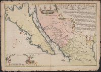
- Beinecke Rare Book and Manuscript Library > La Californie ou Nouvelle Caroline : teatro de los trabajos, Apostolicos de la Compa. e Jesus en la America Septe. / par N. de Fer, Geographe de sa Majesté Catolique.