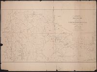
Search
You Searched For
Search Results
- Creator:
- Bien, Joseph R
- Published / Created:
- c1895.
- Call Number:
- 771 Al52 1895
- Container / Volume:
- BRBL_00480
- Image Count:
- 1
- Resource Type:
- Maps, Atlases & Globes
- Found in:
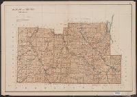
- Beinecke Rare Book and Manuscript Library > Allegany and Steuben counties.
- Creator:
- Abbot, Henry L
- Published / Created:
- 1862
- Call Number:
- 783hc 1862E
- Container / Volume:
- BRBL_00511
- Image Count:
- 3
- Resource Type:
- Maps, Atlases & Globes
- Found in:
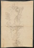
- Beinecke Rare Book and Manuscript Library > Campaign maps, Army of the Potomac / prepared by command of Maj. Gen. George B. McClellan ; compilation under the direction of Brig. Gen. A.A. Humphreys, by Capt. H.L. Abbot ; engraved by W.H. Dougal ; Julius Bien & Co., photo lith.
- Published / Created:
- [1894?]
- Call Number:
- BrSides Double Folio 2018 93
- Image Count:
- 1
- Resource Type:
- Maps, Atlases & Globes
- Found in:
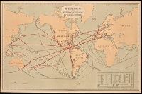
- Beinecke Rare Book and Manuscript Library > Chart of the world showing distances saved by the interoceanic canal of Nicaragua and Costa Rica [cartographic material].
- Creator:
- Bien, Joseph R
- Published / Created:
- c1895.
- Call Number:
- 771 C39 1895
- Container / Volume:
- BRBL_00482
- Image Count:
- 1
- Resource Type:
- Maps, Atlases & Globes
- Found in:
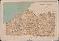
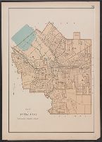
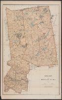
- Beinecke Rare Book and Manuscript Library > Chautauqua and Cattaraugus counties.
- Creator:
- Bien, Joseph R
- Published / Created:
- c1895.
- Call Number:
- 771 B863 1895
- Container / Volume:
- BRBL_00481
- Image Count:
- 1
- Resource Type:
- Maps, Atlases & Globes
- Found in:
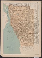
- Beinecke Rare Book and Manuscript Library > City of Buffalo.
- Creator:
- Bien, Joseph R
- Published / Created:
- c1895.
- Call Number:
- 771 R582 1895
- Container / Volume:
- BRBL_00490
- Image Count:
- 1
- Resource Type:
- Maps, Atlases & Globes
- Found in:
- Beinecke Rare Book and Manuscript Library > City of Rochester.
- Creator:
- Bien, Joseph R
- Published / Created:
- c1895.
- Call Number:
- 771 S81 1895
- Container / Volume:
- BRBL_00491
- Image Count:
- 1
- Resource Type:
- Maps, Atlases & Globes
- Found in:
- Beinecke Rare Book and Manuscript Library > City of Syracuse.
- Creator:
- Geological and Geographical Survey of the Territories (U.S.)
- Published / Created:
- 1879
- Call Number:
- 80cbj 1879
- Container / Volume:
- BRBL_00537
- Image Count:
- 1
- Resource Type:
- Maps, Atlases & Globes
- Found in:
- Beinecke Rare Book and Manuscript Library > Drainage map showing portions of Wyoming, Idaho and Utah / primary triangulation by A.D. Wilson ; topography by Henry Gannett, G.B. Chittenden, G.R. Bechler and F.A. Clark ; F.V. Hayden, U.S. Geologist in charge.
- Creator:
- Bien, Joseph R
- Published / Created:
- c1895.
- Call Number:
- 771 H18 1895
- Container / Volume:
- BRBL_00482A
- Image Count:
- 1
- Resource Type:
- Maps, Atlases & Globes
- Found in:
- Beinecke Rare Book and Manuscript Library > Hamilton and Herkimer counties.
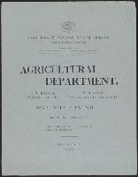
- Creator:
- Northern Transcontinental Survey. Agricultural Dept
- Published / Created:
- 1883
- Call Number:
- 847gc Y12 1883
- Container / Volume:
- BRBL_00628
- Image Count:
- 5
- Resource Type:
- Maps, Atlases & Globes
- Found in:
- Beinecke Rare Book and Manuscript Library > Map bulletin no. 1 / by E.W. Hilgard ; Northern Transcontinental Survey, Agricultural Department.
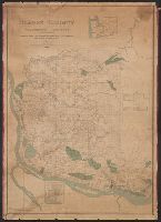
- Creator:
- Habersham, R. A
- Published / Created:
- 1888
- Call Number:
- 847 C65 1888
- Container / Volume:
- BRBL_00626
- Image Count:
- 1
- Resource Type:
- Maps, Atlases & Globes
- Found in:
- Beinecke Rare Book and Manuscript Library > Map of Clarke County, Washington Territory : compiled from the county records, rail road surveys, and other authentic data / compiled by R.A. Habersham.
- Creator:
- Veatch, A. C. (Arthur Clifford), 1878-1938
- Published / Created:
- 1906?]
- Call Number:
- 795gfa C645 1905
- Container / Volume:
- BRBL_00523
- Image Count:
- 1
- Resource Type:
- Maps, Atlases & Globes
- Found in:
- Beinecke Rare Book and Manuscript Library > Map of Cockfield artesian reservoir in northern Louisiana and southern Arkansas / by A.C. Veatch.
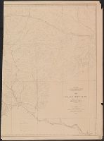
- Creator:
- Owen, F. D
- Published / Created:
- 1882
- Call Number:
- 831 C85 1882
- Container / Volume:
- BRBL_00580
- Image Count:
- 2
- Resource Type:
- Maps, Atlases & Globes
- Found in:
- Beinecke Rare Book and Manuscript Library > Map of Crazy Mountains and vicinity, Montana Ter. / Northern Transcontinental Survey, Raphael Pumpelly, director ; Department of Topography, A.D. Wilson, chief topographer ; drawn by F.D. Owen.
- Creator:
- United States. Census Office
- Published / Created:
- 1890
- Call Number:
- 826 1890
- Container / Volume:
- BRBL_00577
- Image Count:
- 1
- Resource Type:
- Maps, Atlases & Globes
- Found in:
- Beinecke Rare Book and Manuscript Library > Map of Indian Territory and Oklahoma.
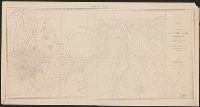
- Published / Created:
- 1882
- Call Number:
- 831 J89 1882
- Container / Volume:
- BRBL_00580
- Image Count:
- 1
- Resource Type:
- Maps, Atlases & Globes
- Found in:
- Beinecke Rare Book and Manuscript Library > Map of Judith Basin, Montana Ter. / Northern Transcontinental Survey, Raphael Pumpelly, director ; Department of Topography, A.D. Wilson, chief topographer ; lettering by F.D. Owen.
- Published / Created:
- 1882
- Call Number:
- 831 J89 1882A
- Container / Volume:
- BRBL_00580
- Image Count:
- 2
- Resource Type:
- Maps, Atlases & Globes
- Found in:
- Beinecke Rare Book and Manuscript Library > Map of Judith Basin, Montana Ter. / Northern Transcontinental Survey, Raphael Pumpelly, director ; Department of Topography, A.D. Wilson, chief topographer.
- Creator:
- Veatch, A. C. (Arthur Clifford), 1878-1938
- Published / Created:
- 1906?]
- Call Number:
- 795gfa Sa13 1905
- Container / Volume:
- BRBL_00523
- Image Count:
- 1
- Resource Type:
- Maps, Atlases & Globes
- Found in:
- Beinecke Rare Book and Manuscript Library > Map of Sabine artesian reservoir in northern Louisiana and southern Arkansas / by A.C. Veatch.
- Creator:
- Wilson, A. D. (Allen D.)
- Published / Created:
- 1882
- Call Number:
- 847 Y12 1882
- Container / Volume:
- BRBL_00627
- Image Count:
- 2
- Resource Type:
- Maps, Atlases & Globes
- Found in:
- Beinecke Rare Book and Manuscript Library > Map of Yakima Region, Washington Ter. / Northern Transcontinental Survey, Raphael Pumpelly, director ; A.D. Wilson, chief topographer ; R.U. Goode, topographer ; Frank Tweedy, Asst. ; F.D. Owen, chief draughtsman.
- Creator:
- Wilson, A. D. (Allen D.)
- Published / Created:
- 1882
- Call Number:
- 847 Y12 1882A
- Container / Volume:
- BRBL_00627
- Image Count:
- 2
- Resource Type:
- Maps, Atlases & Globes
- Found in:
- Beinecke Rare Book and Manuscript Library > Map of Yakima Region, Washington Ter. / Northern Transcontinental Survey, Raphael Pumpelly, director ; A.D. Wilson, chief topographer ; R.U. Goode, topographer ; Frank Tweedy, Asst. ; Fred D. Owen, chief draughtsman.
- Creator:
- Bien, Joseph R
- Published / Created:
- c1895.
- Call Number:
- 771 1895D
- Image Count:
- 1
- Resource Type:
- Maps, Atlases & Globes
- Found in:
- Beinecke Rare Book and Manuscript Library > Map of the state of New York.