Skip to search
Skip to main content
Skip to first result
Search
You Searched For
Format
cartographic
Genre
Maps
Search Results
Published / Created:
191-.
Call Number:
11hcf 1919E-31
Container / Volume:
BRBL_00010ZA
Image Count:
1
Resource Type:
Maps, Atlases & Globes
Description:
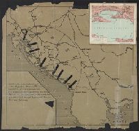
Ancillary map affixed to upper right corner of map, titled "Spalato e dintorni", scale 1:200,000. and Shows Yugoslavian port of Spalato, with arrows pointing to it and nearby ports.
Publisher:
s.n.,
Subject (Geographic):
Yugoslavia--Maps
Found in:
Beinecke Rare Book and Manuscript Library > [Spalato and envrions.]
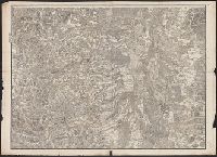
Published / Created:
1877
Call Number:
425 R119 1877
Container / Volume:
BRBL_00246
Image Count:
2
Resource Type:
Maps, Atlases & Globes
Description:
Title supplied by cataloger.
Publisher:
[K.u.k. militär-geographischen Institut],
Subject (Geographic):
Austria--Maps
Found in:
Beinecke Rare Book and Manuscript Library > [Specialkarte des österr. Alpengebietes 1:75.000.] Zone 16 Col. IX, Radstadt.
Published / Created:
1876
Call Number:
425 H676 1876
Container / Volume:
BRBL_00246
Image Count:
2
Resource Type:
Maps, Atlases & Globes
Description:
Title supplied by cataloger.
Publisher:
[K.u.k. militär-geographischen Institut],
Subject (Geographic):
Austria--Maps
Found in:
Beinecke Rare Book and Manuscript Library > [Specialkarte des österr. Alpengebietes 1:75.000.] Zone 17 Col. VIII, Hof-Gastein.
Published / Created:
[1890?]
Call Number:
32 R119 1890
Container / Volume:
BRBL_00054
Image Count:
1
Resource Type:
Maps, Atlases & Globes
Subject (Geographic):
Berkshire (England)--Maps
Found in:
Beinecke Rare Book and Manuscript Library > [St. Peter's College] Radley Bounds [Berkshire].
Published / Created:
[1780?]
Call Number:
38 ST81 1780
Container / Volume:
BRBL_00165
Image Count:
1
Resource Type:
Maps, Atlases & Globes
Subject (Geographic):
Strasbourg (France)--Maps--Early works to 1800
Found in:
Beinecke Rare Book and Manuscript Library > [Strasbourg and Environs].
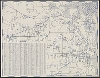
Published / Created:
c1949.
Call Number:
846 P837 1949A
Container / Volume:
BRBL_00622
Image Count:
4
Resource Type:
Maps, Atlases & Globes
Alternative Title:
North east districts, Portland., North-northwest district, Portland., S.E. district Portland., and S.W. district Portland.
Description:
Copyright: Henry R. Staats., Indexed., Sheets of map separately titled: North-northwest district, Portland -- North east districts, Portland -- S.W. district Portland -- S.E. district Portland., and Title devised by cataloger.
Publisher:
Henry R. Staats?],
Subject (Geographic):
Portland (Or.)--Maps
Subject (Name):
Staats, Henry R
Subject (Topic):
Streets--Oregon--Portland--Maps
Found in:
Beinecke Rare Book and Manuscript Library > [Street map of Portland, Or.].
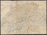
Published / Created:
1820?]
Call Number:
37 1820A
Image Count:
2
Resource Type:
Maps, Atlases & Globes
Description:
5 insets in border.
Publisher:
Heinrich Keller,
Subject (Geographic):
Switzerland--Maps
Found in:
Beinecke Rare Book and Manuscript Library > [Switzerland]
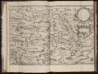
Published / Created:
MDXCVIII [1598]
Call Number:
Taylor 193 1-2
Collection Title:
Regnum Congo hoc est vera descriptio regni Africani : quod tam ab incolis quam Lusitanis Congus
Image Count:
1
Description:
Map has two identical small holes on both the top left and top right corners. and Third of three maps bound following leaf [4] of preface, continued from previous leaves.
Subject (Geographic):
Africa --Description and travel and Ethiopia
Collection Created:
Francofurti : Excudebat VVolffgangus Richter, impensis Io. Theo. & Io. Israel. de Bry, frat., MDXCVIII [1598]
Found in:
Beinecke Rare Book and Manuscript Library > [Tabulam hanc Aegypti ... sheet 2]
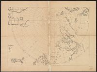
Published / Created:
[1650?]
Call Number:
18 1650
Container / Volume:
BRBL_00012
Image Count:
1
Resource Type:
Maps, Atlases & Globes
Subject (Geographic):
Arctic Regions--Maps--Early works to 1800
Found in:
Beinecke Rare Book and Manuscript Library > [The Arctic Regions].
Published / Created:
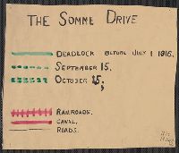
1916
Call Number:
11hc 1916
Container / Volume:
BRBL_00010C
Image Count:
1
Resource Type:
Maps, Atlases & Globes
Description:
Shows the location of battle lines dated "before July 1, 1916" and "September 15", "October 15", railways, canals, roads, wooded areas, and towns.
Publisher:
s.n.,
Subject (Geographic):
Somme (France)--Maps
Found in:
Beinecke Rare Book and Manuscript Library > [The Somme Drive.]
Branch:v1.68.2 ,Deployed:2025-06-12T06:59:21-04:00