Skip to search
Skip to main content
Skip to first result
Search
You Searched For
Format
cartographic
Genre
Maps.
Search Results
Creator:
Published / Created:
[between 1743-1747?]
Call Number:
BrSides Folio 2017 16
Image Count:
1
Resource Type:
Maps, Atlases & Globes
Alternative Title:
New general collection of voyages and travels.
Description:
From A new general collection of voyages and travels (London, 1745-47).
Publisher:
Labat,
Subject (Geographic):
Cameroon--Maps--Early works to 1800. and River Sanaga (Cameroon)--Maps--Early works to 1800.
Subject (Name):
Child, G., engraver. and Labat, Jean Baptiste, 1663-1738, publisher.
Found in:
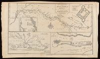
Beinecke Rare Book and Manuscript Library > A general map of the River Sanaga, from the falls of Govina to the Ocean / taken by a French Engineer in 1718, & drawn by Sr. d'Anville, from his particular draughts ; G. Child, sculpt.
Creator:
Call Number:
71 1811
Image Count:
4
Resource Type:
Maps, Atlases & Globes
Description:
Appears in Atlas to Thompson's Alcedo; or, dictionary of America & West Indies, 1816.
Subject (Geographic):
North America. and North America--Maps.
Subject (Name):
Puke, J., engraver.
Found in:
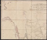
Beinecke Rare Book and Manuscript Library > A map exhibiting all the new discoveries in the interior parts of North America [cartographic material] / inscribed by permission to the honorable governor and company of the adventurers of England trading into Hudsons Bay, in testimony of their liberal communications to their most obedient and very humble servant A. Arrowsmith, hydrographer to H.R.H. the Prince of Wales, January 1st 1795 ; Puke, sc.
Creator:
Published / Created:
10 June 1775.
Call Number:
774 1775
Container / Volume:
BRBL_00497
Image Count:
2
Resource Type:
Maps, Atlases & Globes
Description:
Imprint in three places along lower left, center, and right margin.
Publisher:
Printed for Robt. Sayer & J. Bennett, map & printseller No. 53 in Fleet Street. Published as the Act directs,
Subject (Geographic):
Pennsylvania--Administrative and political divisions--Maps--Early works to 1800. and Pennsylvania--Maps--Early works to 1800.
Subject (Name):
Penn, Richard, 1706-1771, dedicatee., Penn, Thomas, 1702-1775, dedicatee., and Robert Sayer and John Bennett (Firm), publisher, printseller.
Found in:
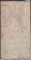
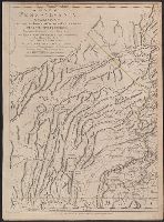
Beinecke Rare Book and Manuscript Library > A map of Pennsylvania exhibiting not only the improved parts of that Province, but also its extensive frontiers: Laid down from actual surveys, and chiefly from the late map of W. Scull published in 1770; and humbly inscribed to the Honorable Thomas Penn
Creator:
Published / Created:
10 June 1775.
Call Number:
774 1775
Container / Volume:
BRBL_00730
Image Count:
3
Resource Type:
Maps, Atlases & Globes
Description:
Imprint in three places along lower left, center, and right margin.
Publisher:
Printed for Robt. Sayer & J. Bennett, map & printseller No. 53 in Fleet Street. Published as the Act directs,
Subject (Geographic):
Pennsylvania--Administrative and political divisions--Maps--Early works to 1800. and Pennsylvania--Maps--Early works to 1800.
Subject (Name):
Penn, Richard, 1706-1771, dedicatee., Penn, Thomas, 1702-1775, dedicatee., and Robert Sayer and John Bennett (Firm), publisher, printseller.
Subject (Topic):
Administrative and political divisions
Found in:
Beinecke Rare Book and Manuscript Library > A map of Pennsylvania exhibiting not only the improved parts of that Province, but also its extensive frontiers: Laid down from actual surveys, and chiefly from the late map of W. Scull published in 1770; and humbly inscribed to the Honorable Thomas Penn
Creator:
Published / Created:
March 4, 1807.
Call Number:
BrSides Double Folio 2019 110
Image Count:
1
Resource Type:
Maps, Atlases & Globes
Alternative Title:
City of Richmond metropolis of Virginia.
Description:
Dedication: To the General Assembly of Virginia this map is respectfully inscribed by their fellow citizens, James Madison, William Prentis, William Davis, proprietors.
Publisher:
by the Proprietors,
Subject (Geographic):
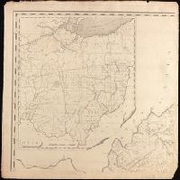
Ohio--Maps., Richmond (Va.)--Pictorial works., and Virginia--Maps.
Subject (Name):
Bossler, Fred. (Frederick), engraver., Davis, William, ill., Davis, William, publisher., and Prentis, William, -1824, publisher.
Found in:
Beinecke Rare Book and Manuscript Library > A map of Virginia [cartographic material] : Formed from actual surveys, and the latest as well as most accurate observations / by James Madison, D.D., president of Wm. & Mary College. ; Drawn by: Wm. Davis. ; Engraved by: Fred. Bossler, Ricmd.
Creator:
Published / Created:
[1806]
Call Number:
BrSides Folio 2017 61
Image Count:
1
Resource Type:
Maps, Atlases & Globes
Description:
"Engraved for The life of Washington."
Publisher:
Published Nov. 1, 1806, by Richard Phillips, New Bridge Street,
Subject (Geographic):
United States --History --Revolution, 1775-1783 --Maps
Subject (Name):
Neele, Josiah.
Subject (Topic):
United States--History--Revolution, 1775-1783
Found in:
Beinecke Rare Book and Manuscript Library > A map of the country from Rariton River in East Jersey, to Elk Head in Maryland [cartographic material] : shewing the several operations of the American & British armies, in 1776 & 1777 / Neele sc., Strand.
Creator:
Published / Created:
[between 1762 and 1773]
Call Number:
327 1785
Image Count:
2
Resource Type:
Maps, Atlases & Globes
Description:
Includes brief notes on the Irish history and political divisions.
Publisher:
Printed for Robt. Sayer, opposite Fetter Lane, Fleet Street,
Subject (Geographic):
Ireland--Maps--Early works to 1800.
Subject (Name):
Sayer, Robert Publisher.
Found in:
Beinecke Rare Book and Manuscript Library > A map of the kingdom of Ireland : divided into provinces, counties and baronies, shewing the archbishopricks, bishopricks, cities, boroughs, market towns, villages, barracks, mountains, lakes, bogs, rivers, bridges, ferries, passes : also, the great, the branch and the by post roads, together with the inland navigation, &c. / by John Rocque ...