Search
You Searched For
Search Results
- Creator:
- Blaeu, Joan, 1596-1673.
- Published / Created:
- 166-?]
- Call Number:
- 1973 Folio 18
- Image Count:
- 1
- Resource Type:
- Maps, Atlases & Globes
- Found in:
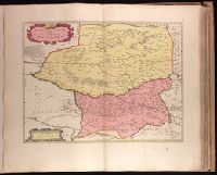
- Beinecke Rare Book and Manuscript Library > Petrocorium comitatus vulgo la comtée de Périgort [cartographic material].
- Creator:
- Keulen, Gerard van.
- Published / Created:
- 171-?]
- Call Number:
- 1973 Folio 18
- Image Count:
- 1
- Resource Type:
- Maps, Atlases & Globes
- Found in:
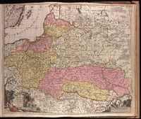
- Beinecke Rare Book and Manuscript Library > Regni Poloniae magnique Ducatus Lithuaniae, Volhyniae, Podoliae, Ucraniae, Prussiae, Livoniae exactissima descriptio [cartographic material] / auctore Ger. van Keulen.
- Creator:
- Blaeu, Joan, 1596-1673, cartographer.
- Published / Created:
- 164-?]
- Call Number:
- 1973 Folio 18
- Image Count:
- 1
- Resource Type:
- Maps, Atlases & Globes
- Found in:
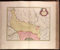
- Beinecke Rare Book and Manuscript Library > Territorio di Cremona [cartographic material].
- Creator:
- Schenk, Peter, 1660-1718 or 1719.
- Published / Created:
- anno 1706.
- Call Number:
- 1973 Folio 18
- Image Count:
- 1
- Resource Type:
- Maps, Atlases & Globes
- Found in:
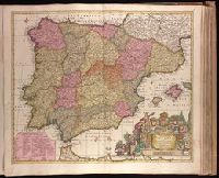
- Beinecke Rare Book and Manuscript Library > Novissima et accuratissima regnorum Hispaniae et Portugalliae tabula [cartographic material] / auctore P. Schenk.
- Creator:
- Blaeu, Joan, 1596-1673.
- Published / Created:
- 1647?]
- Call Number:
- 1973 Folio 18
- Image Count:
- 1
- Resource Type:
- Maps, Atlases & Globes
- Found in:
- Beinecke Rare Book and Manuscript Library > Il Bellunese con il Feltrino [cartographic material].
- Creator:
- Blaeu, Joan, 1596-1673.
- Published / Created:
- 1647?]
- Call Number:
- 1973 Folio 18
- Image Count:
- 1
- Resource Type:
- Maps, Atlases & Globes
- Found in:
- Beinecke Rare Book and Manuscript Library > Il Cadorino [cartographic material].
- Creator:
- Valck, G. (Gerard), 1651 or 1652-1726.
- Published / Created:
- ca. 1702]
- Call Number:
- 1973 Folio 18
- Image Count:
- 1
- Resource Type:
- Maps, Atlases & Globes
- Found in:
- Beinecke Rare Book and Manuscript Library > Bulgaria et Romania [cartographic material] : divisa in singulares sangiacatus Silistriam, Nicopolin, Bodinum, Sardiam, Bysantium, Kirkeliam et Gallipolin, una cum finitimis regionibus Valachia, Servia etc. / per Ger. et Leon. Valk.
- Creator:
- Visscher, Nicolaes, 1649-1702.
- Published / Created:
- 169-?]
- Call Number:
- 1973 Folio 18
- Image Count:
- 1
- Resource Type:
- Maps, Atlases & Globes
- Found in:
- Beinecke Rare Book and Manuscript Library > Jamaica, Americae Septentrionalis Ampla Insula a Christophoro Columbo detecta, in suas Gubernationes per accuratè distincta [cartographic material] / per Nicolaum Visser ; L. v Anse, schulp.
- Creator:
- Reelant, Adriaan, 1676-1718.
- Published / Created:
- MDCCV [1705]
- Call Number:
- 1973 Folio 18
- Image Count:
- 1
- Resource Type:
- Maps, Atlases & Globes
- Found in:
- Beinecke Rare Book and Manuscript Library > Imperii Persici delineatio [cartographic material] / ex scriptis potissimum geographicis arabum et persarum tentata ab Adriano Relando.
- Creator:
- Keulen, Gerard van.
- Published / Created:
- [1717]
- Call Number:
- 1973 Folio 18
- Image Count:
- 1
- Resource Type:
- Maps, Atlases & Globes
- Found in:
- Beinecke Rare Book and Manuscript Library > Nieuwe afteekening van de sterke stad Belgrado met desselfs Kasteel en alle de Buyten Werken in syn platte Grond ... berent den 24 Juny 1717 [cartographic material].
- Creator:
- Schenk, Peter, 1660-1718 or 1719.
- Published / Created:
- ca. 1700?]
- Call Number:
- 1973 Folio 18
- Image Count:
- 1
- Resource Type:
- Maps, Atlases & Globes
- Found in:
- Beinecke Rare Book and Manuscript Library > Regni Hungariae, Graeciae, Moreae, totius Danubii, adiacentiumque regnorum, nec non totius Graeciae et Archipelagi delineatio nova [cartographic material] / expressa a Petro Schenk.
- Creator:
- Verseyl, Elizabeth, d. 1726.
- Published / Created:
- 1710?]
- Call Number:
- 1973 Folio 18
- Image Count:
- 1
- Resource Type:
- Maps, Atlases & Globes
- Found in:
- Beinecke Rare Book and Manuscript Library > Carte du Paraguay, du Chili, Détroit de Magellan, & Terre de Feu, dans l'Amérique Méridionale / par la veuve de Nicolas Visscher.
- Creator:
- Danckerts, Theodore.
- Published / Created:
- ca. 1680]
- Call Number:
- 1973 Folio 18
- Image Count:
- 1
- Resource Type:
- Maps, Atlases & Globes
- Found in:
- Beinecke Rare Book and Manuscript Library > Lotharingiae et Utriusque Alsatiae in ditiones minores divisarum tractibusque insertis et finitimis circumscriptarum novissima, nitidissima et accuratissima delineatio [cartographic material] / per Theodorum Danckerts, cum privilegio.
- Creator:
- Schenk, Peter, 1660-1718 or 1719.
- Published / Created:
- 1708
- Call Number:
- 1973 Folio 18
- Image Count:
- 1
- Resource Type:
- Maps, Atlases & Globes
- Found in:
- Beinecke Rare Book and Manuscript Library > Novissima Regni Scotiae septentrionalis et meridionalis tabula [cartographic material] : divisae in ducatus, comitat., vice-comitat., prov., praefecturas, dominia et insulas / auctore Petro Schenk.
- Creator:
- Blaeu, Willem Janszoon, 1571-1638.
- Published / Created:
- [163-?]
- Call Number:
- 1973 Folio 18
- Image Count:
- 1
- Resource Type:
- Maps, Atlases & Globes
- Found in:
- Beinecke Rare Book and Manuscript Library > Languedoc [cartographic material].
- Creator:
- Schenk, Peter, 1660-1718 or 1719.
- Published / Created:
- 1705
- Call Number:
- 1973 Folio 18
- Image Count:
- 1
- Resource Type:
- Maps, Atlases & Globes
- Found in:
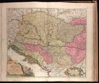
- Beinecke Rare Book and Manuscript Library > Regnorum Hungariae, Dalmatiae, Croatiae, Sclavoniae, Bosniae, Serviae, et Principatus Transylvaniae typus accuratior et plane novus [cartographic material] / editore Petro Schenck caelatur.
- Creator:
- Schenk, Peter, 1660-1718 or 1719.
- Published / Created:
- ca. 1700?]
- Call Number:
- 1973 Folio 18
- Image Count:
- 1
- Resource Type:
- Maps, Atlases & Globes
- Found in:
- Beinecke Rare Book and Manuscript Library > Tabula nova atque exacta Westphaliae finitimas quoque ditiones prafecturas et satrapias [cartographic material] / eleganter comprehendens, conante Petro Schenck.
- Creator:
- Le Rouge, Georges-Louis
- Published / Created:
- 1755
- Call Number:
- 755 1755J
- Container / Volume:
- BRBL_00427
- Image Count:
- 1
- Resource Type:
- Maps, Atlases & Globes
- Found in:
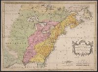
- Beinecke Rare Book and Manuscript Library > Canada et Louisiane / par le Sr. Le Rouge, ingenieur geographe du roy.
- Creator:
- Palairet, Jean, 1697-1774, cartographer.
- Call Number:
- 755 1755G
- Image Count:
- 1
- Resource Type:
- Maps, Atlases & Globes
- Found in:
- Beinecke Rare Book and Manuscript Library > Carte des possessions angloises & françoises du continent de l'Amérique septentrionale / Thos. Kitchin, sculpt.
- Creator:
- Le Rouge, Georges-Louis
- Published / Created:
- 1755
- Call Number:
- 755 1755C
- Container / Volume:
- BRBL_00427
- Image Count:
- 1
- Resource Type:
- Maps, Atlases & Globes
- Found in:
- Beinecke Rare Book and Manuscript Library > Canada et Louisiane / par le Sr. Le Rouge, ingenieur geographe du roy.
- Creator:
- Munson, Samuel B., 1806-1880.
- Published / Created:
- 1845
- Call Number:
- 80 1845A
- Image Count:
- 1
- Resource Type:
- Maps, Atlases & Globes
- Found in:
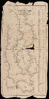
- Beinecke Rare Book and Manuscript Library > A new map of the western rivers, or, Travellers guide : exhibiting the Mississippi, Missouri, Ohio, and Illinois rivers with all the principal towns, islands & distances / by Saml. B. Munson.
- Creator:
- Trémaux, P. (Pierre)
- Published / Created:
- [1850]
- Call Number:
- BrSides Folio 2019 98
- Image Count:
- 1
- Resource Type:
- Maps, Atlases & Globes
- Found in:
- Beinecke Rare Book and Manuscript Library > Carte de la localité ou sont situées les principales mines d'or du Soudan oriental / dressée par Trémaux, architecte lauréat de l'Institut.
- Creator:
- Society for the Diffusion of Useful Knowledge (Great Britain)
- Published / Created:
- Novr. 1842.
- Call Number:
- BrSides Folio 2019 94
- Image Count:
- 1
- Resource Type:
- Maps, Atlases & Globes
- Found in:
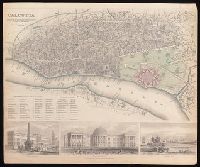
- Beinecke Rare Book and Manuscript Library > Calcutta / published under the superintendence of the Society for the Diffusion of Knowledge.
- Creator:
- Cruchley, G. F.
- Published / Created:
- February 1st, 1842.
- Call Number:
- BrSides Folio 2019 90
- Image Count:
- 1
- Resource Type:
- Maps, Atlases & Globes
- Found in:
- Beinecke Rare Book and Manuscript Library > China.
- Creator:
- D. St. John and N. Goodwin, creator.
- Published / Created:
- {1824?]
- Call Number:
- 766 H26 1824A
- Container / Volume:
- BRBL_00468
- Image Count:
- 1
- Resource Type:
- Maps, Atlases & Globes
- Found in:
- Beinecke Rare Book and Manuscript Library > Plan of the city of Hartford : from a survey made in 1824 / engraved by A. Willard.
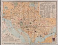
- Creator:
- Matthews-Northrup Company
- Published / Created:
- 1909, c1906.
- Call Number:
- 779 W27 1909
- Container / Volume:
- BRBL_00505A
- Image Count:
- 1
- Resource Type:
- Maps, Atlases & Globes
- Found in:
- Beinecke Rare Book and Manuscript Library > The "standard guide" ready reference map of Washington : to accompany the "Washington standard guide" / published by Foster & Reynolds.
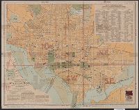
- Creator:
- Matthews-Northrup Company
- Published / Created:
- 1902, c1901.
- Call Number:
- 779 W27 1902
- Container / Volume:
- BRBL_00505A
- Image Count:
- 1
- Resource Type:
- Maps, Atlases & Globes
- Found in:
- Beinecke Rare Book and Manuscript Library > The "standard guide" ready reference map of Washington : to accompany the "Washington standard guide" / published by Foster & Reynolds.
- Creator:
- Matthews-Northrup Company
- Published / Created:
- 1904, c1901.
- Call Number:
- 779 W27 1904B
- Container / Volume:
- BRBL_00505A
- Image Count:
- 1
- Resource Type:
- Maps, Atlases & Globes
- Found in:
- Beinecke Rare Book and Manuscript Library > The "standard guide" ready reference map of Washington : to accompany the "Washington standard guide" / published by Foster & Reynolds.
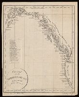
- Published / Created:
- [1814?]
- Call Number:
- BrSides 2018 138
- Image Count:
- 1
- Resource Type:
- Maps, Atlases & Globes
- Found in:
- Beinecke Rare Book and Manuscript Library > Charte von der nordwestküste America's nach Vancouver.
- Creator:
- Swanston, George H.
- Published / Created:
- [1872?]
- Call Number:
- 352 1872
- Image Count:
- 1
- Resource Type:
- Maps, Atlases & Globes
- Found in:
- Beinecke Rare Book and Manuscript Library > Russia in Europe [cartographic material] / by G.H. Swanston.
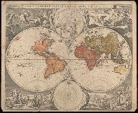
- Creator:
- Visscher, Nicolaes, 1618-1679
- Published / Created:
- [1658]
- Call Number:
- 11 1658
- Image Count:
- 1
- Resource Type:
- Maps, Atlases & Globes
- Found in:
- Beinecke Rare Book and Manuscript Library > Orbis terrarum nova et accuratissima tabula / auctore Nicolao Visscher.
- Creator:
- Walling, Henry Francis, 1825-1888, cartographer.
- Published / Created:
- 1885
- Call Number:
- 765 P94 1885
- Container / Volume:
- BRBL_00464
- Image Count:
- 1
- Resource Type:
- Maps, Atlases & Globes
- Found in:
- Beinecke Rare Book and Manuscript Library > Map of the city of Providence, Rhode Island / compiled from the most authentic sources by H.F. Walling, typographical engineer.
- Creator:
- Munson, Samuel B., 1806-1880, cartographer.
- Published / Created:
- 1844
- Call Number:
- 807 1844
- Image Count:
- 1
- Resource Type:
- Maps, Atlases & Globes
- Found in:
- Beinecke Rare Book and Manuscript Library > A new map of the western rivers, or, Travellers guide : exhibiting the Mississippi, Missouri, Ohio, and Illinois rivers with all the principal towns, islands & distances / by Saml. B. Munson.
- Creator:
- Jaillot, Alexis Hubert, 1632?-1712, cartographer.
- Published / Created:
- 1704
- Call Number:
- 38315 1704
- Container / Volume:
- BRBL_00177
- Image Count:
- 1
- Resource Type:
- Maps, Atlases & Globes
- Found in:
- Beinecke Rare Book and Manuscript Library > Le Verdunois ou sont les Prevotez dependans du Balliage de l'Evesché de Verdun et de son Chapitre. : partie du Barrois Ducal, ou Balliage de S. Mihel, dans le Duché de Bar, les Terres Adiacentes du Clermontois, de Stenay, Dun et Iametz &. / par le S. Ia
- Creator:
- Harris, John, 1667?-1719.
- Published / Created:
- [1744]
- Call Number:
- BrSides Folio 2017 33
- Image Count:
- 1
- Resource Type:
- Maps, Atlases & Globes
- Found in:
- Beinecke Rare Book and Manuscript Library > A plan of the city of Canton on the river Ta ho [cartographic material].
- Published / Created:
- [1826]
- Call Number:
- BrSides Folio 2017 31
- Image Count:
- 1
- Resource Type:
- Maps, Atlases & Globes
- Found in:
- Beinecke Rare Book and Manuscript Library > Anahuac o Imperio Megicano : con los Reinos de Acolhuacan y de Michuacan &c., como existan en el año de 1521, para servir de illustracion a la historia antigua de Megico / gravado por Neeles 352 Strand Londres.
- Creator:
- Oterschaden, Johannes, cartographer.
- Published / Created:
- 1879
- Call Number:
- 5 1550
- Container / Volume:
- BRBL_00271
- Image Count:
- 1
- Resource Type:
- Maps, Atlases & Globes
- Found in:
- Beinecke Rare Book and Manuscript Library > Globus aus der Mitte des XVI Jahrhunderts.
- Creator:
- Herrera y Tordesillas, Antonio de, -1625.
- Published / Created:
- 1622]
- Call Number:
- BrSides Folio 2017 36
- Image Count:
- 1
- Resource Type:
- Maps, Atlases & Globes
- Found in:
- Beinecke Rare Book and Manuscript Library > Descripcion de las Yndias del Norte, 2 [cartographic material].
- Creator:
- Seutter, Matthaeus, 1678-1756, creator.
- Published / Created:
- [after 1750?]
- Call Number:
- 5 1750
- Container / Volume:
- BRBL_00271
- Image Count:
- 1
- Resource Type:
- Maps, Atlases & Globes
- Found in:
- Beinecke Rare Book and Manuscript Library > Sphaerae artificiales / synoptica idea delineatae et propositae a Matthaeo Seuttero ...
- Creator:
- Jaillot, Bernard Antoine, -1749, cartographer.
- Published / Created:
- 1738
- Call Number:
- 3897 1738
- Container / Volume:
- BRBL_00183
- Image Count:
- 1
- Resource Type:
- Maps, Atlases & Globes
- Found in:
- Beinecke Rare Book and Manuscript Library > Carte particuliere de l'Isle de Corse : divisée par ses dix provinces ou juridictions et ses quatre fiefs / levée ... par le Sr. Bernard Antoine Jaillot Geographe Ordre. du Roy ; Delahaye sculpsit.
- Creator:
- Bailleul, Nicolas, cartographer.
- Published / Created:
- 1746
- Call Number:
- 384 1746
- Container / Volume:
- BRBL_00179
- Image Count:
- 1
- Resource Type:
- Maps, Atlases & Globes
- Found in:
- Beinecke Rare Book and Manuscript Library > Évêché de Dijon / dressé sur les lieux par le Sr. Bailleul le jeune ... ; Bailleul le jeune excudit et sculp ...
- Creator:
- Bowen, Emanuel, 1693 or 1694-1767, cartographer.
- Published / Created:
- [1747]
- Call Number:
- 655 1747
- Container / Volume:
- BRBL_00345
- Image Count:
- 1
- Resource Type:
- Maps, Atlases & Globes
- Found in:
- Beinecke Rare Book and Manuscript Library > A new & accurate map of Negroland and the adjacent countries : also Upper Guinea, shewing the principal European settlements, & distinguishing w[hi]ch belong to England, Denmark, Holland &c., the sea coast & some of the rivers being drawn from surveys & t
- Creator:
- Münster, Sebastian, 1489-1552, cartographer.
- Published / Created:
- [1580?]
- Call Number:
- BrSides Folio 2017 34
- Image Count:
- 1
- Resource Type:
- Maps, Atlases & Globes
- Found in:
- Beinecke Rare Book and Manuscript Library > Universaltafel des situs Asiae, Africae vnd Europae, samt der gelegenhäit des lands Eden, wie auch eine delineatio der arch Noe bäides im grund vnd auftitz.
- Creator:
- Merian, Matthaeus, 1593-1650, creator.
- Published / Created:
- [1644?]
- Call Number:
- BrSides Folio 2017 27
- Image Count:
- 1
- Resource Type:
- Maps, Atlases & Globes
- Found in:
- Beinecke Rare Book and Manuscript Library > Saltzburg.
- Published / Created:
- [between 1743-1747?]
- Call Number:
- BrSides Folio 2017 20
- Image Count:
- 1
- Resource Type:
- Maps, Atlases & Globes
- Found in:
- Beinecke Rare Book and Manuscript Library > An accurate map of Kalbar River (commonly called Kalabar or Rio Real) and adjacent coast drawn on ye spot by several pilots, 1699 / G. Child, sculpt.
- Creator:
- Neele, Samuel John, 1758-1824.
- Published / Created:
- June 1st, 1790.
- Call Number:
- BrSides Folio 2017 23
- Image Count:
- 1
- Resource Type:
- Maps, Atlases & Globes
- Found in:
- Beinecke Rare Book and Manuscript Library > Present Poland, Prussia &c. / engrav'd by S.J. Neele.
- Creator:
- Vancouver, George, 1757-1798
- Published / Created:
- [1798]
- Call Number:
- BrSides Folio 2017 57
- Collection Title:
- Voyage of discovery to the North Pacific ocean, and round the world.
- Image Count:
- 1
- Resource Type:
- Maps, Atlases & Globes
- Found in:
- Beinecke Rare Book and Manuscript Library > Views of parts of the coast of North West America / W. Alexander, delt. from sketches made on the spot ; J. Fittler sculp.
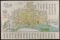
- Published / Created:
- [1912]
- Call Number:
- 811 D48 1912
- Container / Volume:
- BRBL_00553
- Image Count:
- 1
- Resource Type:
- Maps, Atlases & Globes
- Found in:
- Beinecke Rare Book and Manuscript Library > Map of the city of Detroit, Michigan.
- Creator:
- Tirion, Isaak
- Published / Created:
- 1747
- Call Number:
- BrSides Folio 2017 62
- Image Count:
- 1
- Resource Type:
- Maps, Atlases & Globes
- Found in:
- Beinecke Rare Book and Manuscript Library > Nieuwe kaart van het westelykste, oostelykste dedeelte van Staats-Vlaanderen.
- Creator:
- C.S. Hammond & Company.
- Published / Created:
- ©1913.
- Call Number:
- BrSides Double Folio 2017 10
- Image Count:
- 1
- Resource Type:
- Maps, Atlases & Globes
- Found in:
- Beinecke Rare Book and Manuscript Library > Hammond's new road map of Connecticut [cartographic material] / based on the surveys of the United States Geological Survey, United States Coast and Geodetic Survey and the various local surveys, revised and corrected ... C.S. Hammond & Company.