Skip to search
Skip to main content
Skip to first result
Search
You Searched For
Format
cartographic
Genre
Prints (Visual works)
New Search
Search Results
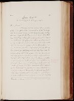
Creator:
Published / Created:
1645
Call Number:
Osborn fb190
Collection Title:
Letters to and from Col. Willm Legge, transcribed from the originals, in the possession of William
Image Count:
2
Resource Type:
Archives or Manuscripts
Found in:
Beinecke Rare Book and Manuscript Library > [Letter to William Legge, 1645 Jun 3, Leicester]
Creator:
Call Number:
1977 Folio 96
Collection Title:
The West-India atlas: or, A compendious description of the West-Indies: illustrated with forty
Image Count:
1
Resource Type:
Maps, Atlases & Globes
Found in:
Beinecke Rare Book and Manuscript Library > The harbour of Bluefields.
Published / Created:
1720
Call Number:
C6 033c
Collection Title:
The natural and civil history of the French dominions in North and South America : with an
Image Count:
1
Resource Type:
Maps, Atlases & Globes
Found in:
Beinecke Rare Book and Manuscript Library > Plan of New Orleans the capital of Louisiana; with the disposition of its quarters and canals as they have been traced by Mr. de la Tour in the year 1720
Creator:
Call Number:
C6 033c
Collection Title:
The natural and civil history of the French dominions in North and South America : with an
Image Count:
1
Resource Type:
Maps, Atlases & Globes
Found in:
Beinecke Rare Book and Manuscript Library > The island of Hispaniola called by the French St. Domingo. Subject to France and Spain. from the best authorities by Thomas Jeffreys, geographer to his Royal Highness the Prince of Wales
Creator:
Call Number:
C6 033c
Collection Title:
The natural and civil history of the French dominions in North and South America : with an
Image Count:
1
Resource Type:
Maps, Atlases & Globes
Found in:
Beinecke Rare Book and Manuscript Library > An authentic plan of the town and harbour of Cap Francois in the isle of St. Domingo. By Thomas Jefferys geographer to his Royal Highness the Prince of Wales
Creator:
Call Number:
1977 Folio 78
Collection Title:
A New and accurate chart of the West-India Islands and coast, with the gulf passage through the New
Image Count:
1
Resource Type:
Maps, Atlases & Globes
Found in:
Beinecke Rare Book and Manuscript Library > A new general chart of the West Indies from the latest marine journals and surveys. Regulated and ascertained by astronomical observations
Call Number:
1977 Folio 78
Collection Title:
A New and accurate chart of the West-India Islands and coast, with the gulf passage through the New
Image Count:
1
Resource Type:
Maps, Atlases & Globes
Found in:
Beinecke Rare Book and Manuscript Library > A plan of Fort St. Louis harbour on the south side of Hispaniola, pl. 31.
Call Number:
1977 +246
Collection Title:
Geografia; cioè, Descrittione vniversale della terra. Partita in due volumi, nel primo de' quali si
Image Count:
1
Resource Type:
Maps, Atlases & Globes
Found in:
Beinecke Rare Book and Manuscript Library > Descrittione di tvtto'l mondo, secondo la prattica de Marinari. Vniversi orbis descriptio ad vsvm navigantivm
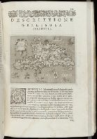
Call Number:
1985 +31
Collection Title:
L'isole piu famose del mondo / descritte da Thomaso Porcacchi da Castiglione Arretino e intagliate
Image Count:
1
Resource Type:
Maps, Atlases & Globes
Found in:
Beinecke Rare Book and Manuscript Library > Descrittione dell'isola Spagnuola prima iso la scoperta dal Colombo
Call Number:
1985 +31
Collection Title:
L'isole piu famose del mondo / descritte da Thomaso Porcacchi da Castiglione Arretino e intagliate
Image Count:
1
Resource Type:
Maps, Atlases & Globes
Found in:
Beinecke Rare Book and Manuscript Library > Descrittione dell'isola Cuba, che dal Colombo fu scoperta insieme con la Spagnuloa
Call Number:
1974 +188
Collection Title:
L'isole piv famose del mondo descritte da Thomaso Porcacchi da Castiglione Arretino e intagliate da
Image Count:
1
Resource Type:
Maps, Atlases & Globes
Found in:
Beinecke Rare Book and Manuscript Library > Descrittione dell' isola Spagnuola
Call Number:
1974 +188
Collection Title:
L'isole piv famose del mondo descritte da Thomaso Porcacchi da Castiglione Arretino e intagliate da
Image Count:
1
Resource Type:
Maps, Atlases & Globes
Found in:
Beinecke Rare Book and Manuscript Library > Descrittione dell' isola Cuba
Call Number:
1976 +310
Collection Title:
L'isole piv famose del mondo descritte da Thomaso Porcacchi da Castiglione Arretino e intagliate da
Image Count:
1
Resource Type:
Maps, Atlases & Globes
Found in:
Beinecke Rare Book and Manuscript Library > Descrittione dell'isola Spagnuola
Call Number:
1976 +310
Collection Title:
L'isole piv famose del mondo descritte da Thomaso Porcacchi da Castiglione Arretino e intagliate da
Image Count:
1
Resource Type:
Maps, Atlases & Globes
Found in:
Beinecke Rare Book and Manuscript Library > Descrittione dell'isola Cuba
Call Number:
Gfp94 +Gi597
Collection Title:
Geografia; cioè, Descrittione vniversale della terra. Partita in due volumi, nel primo de' quali si
Image Count:
1
Resource Type:
Maps, Atlases & Globes
Found in:
Beinecke Rare Book and Manuscript Library > [Geographia. Italian]
Call Number:
1977 +379
Collection Title:
Geografia; cioè, Descrittione vniversale della terra. Partita in due volumi, nel primo de' quali si
Image Count:
1
Resource Type:
Maps, Atlases & Globes
Found in:
Beinecke Rare Book and Manuscript Library > [Geographia. Italian]
Call Number:
1975 +1
Collection Title:
L'isole piv famose del mondo descritte da Thomaso Porcacchi da Castiglione Arretino e intagliate da
Image Count:
1
Resource Type:
Maps, Atlases & Globes
Found in:
Beinecke Rare Book and Manuscript Library > Descrittione dell'isola Spagnuola
Call Number:
1975 +1
Collection Title:
L'isole piv famose del mondo descritte da Thomaso Porcacchi da Castiglione Arretino e intagliate da
Image Count:
1
Resource Type:
Maps, Atlases & Globes
Found in:
Beinecke Rare Book and Manuscript Library > Descrittione dell' isola Cuba
Call Number:
1977 +435
Collection Title:
Geografia; cioè, Descrittione vniversale della terra. Partita in due volumi, nel primo de' quali si
Image Count:
1
Resource Type:
Maps, Atlases & Globes
Found in:
Beinecke Rare Book and Manuscript Library > [Geographia. Italian]
Call Number:
1977 +435
Collection Title:
Geografia; cioè, Descrittione vniversale della terra. Partita in due volumi, nel primo de' quali si
Image Count:
1
Resource Type:
Maps, Atlases & Globes
Found in:
Beinecke Rare Book and Manuscript Library > [Geographia. Italian]
Call Number:
1977 1341
Collection Title:
Geographiae vniversae opvs habentur Cl. Ptolemaei ... Geographicae enarationis libri octo [tr. by W
Image Count:
1
Resource Type:
Maps, Atlases & Globes
Found in:
Beinecke Rare Book and Manuscript Library > Vniversi orbis descriptio ad vsvm navigantivm
Call Number:
Gfp94 gf525j
Collection Title:
Geographiae vniversae ... opvs ... habentur Cl. Ptolemaei ... Geographicae enarrationis libri octo
Image Count:
1
Resource Type:
Maps, Atlases & Globes
Found in:
Beinecke Rare Book and Manuscript Library > Vniversi orbis descriptop as vsvm navigantivm
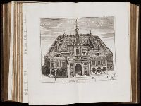
Call Number:
1977 +392
Collection Title:
A survey of the cities of London and Westminster : containing the original, antiquity, increase
Image Count:
1
Resource Type:
Maps, Atlases & Globes
Found in:
Beinecke Rare Book and Manuscript Library > Portsoken ward being part of the parish of St. Buttolphs Aldgate, taken from the last survey, with corrections and additions
Call Number:
1977 +392
Collection Title:
A survey of the cities of London and Westminster : containing the original, antiquity, increase
Image Count:
1
Resource Type:
Maps, Atlases & Globes
Found in:
Beinecke Rare Book and Manuscript Library > The Custom House
Call Number:
1977 +392
Collection Title:
A survey of the cities of London and Westminster : containing the original, antiquity, increase
Image Count:
1
Resource Type:
Maps, Atlases & Globes
Found in:
Beinecke Rare Book and Manuscript Library > Aldgate Ward with its division into parishes. Taken from the last survey, with corrections & additions
Call Number:
1977 +392
Collection Title:
A survey of the cities of London and Westminster : containing the original, antiquity, increase
Image Count:
1
Resource Type:
Maps, Atlases & Globes
Found in:
Beinecke Rare Book and Manuscript Library > Part of Aldgate Ward
Call Number:
1977 +392
Collection Title:
A survey of the cities of London and Westminster : containing the original, antiquity, increase
Image Count:
1
Resource Type:
Maps, Atlases & Globes
Found in:
Beinecke Rare Book and Manuscript Library > Bishop Gate Street Ward taken from the last survey and corrected
Call Number:
1977 +392
Collection Title:
A survey of the cities of London and Westminster : containing the original, antiquity, increase
Image Count:
1
Resource Type:
Maps, Atlases & Globes
Found in:
Beinecke Rare Book and Manuscript Library > Cornhill Ward with its division into parishes, taken from the last survey &c
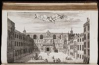
Call Number:
1977 +392
Collection Title:
A survey of the cities of London and Westminster : containing the original, antiquity, increase
Image Count:
1
Found in:
Beinecke Rare Book and Manuscript Library > The Royal Exchange of London
Call Number:
1977 +392
Collection Title:
A survey of the cities of London and Westminster : containing the original, antiquity, increase
Image Count:
1
Resource Type:
Maps, Atlases & Globes
Found in:
Beinecke Rare Book and Manuscript Library > Candlewick Ward with its division into parishes. Corrected from the last survey
Call Number:
1977 +392
Collection Title:
A survey of the cities of London and Westminster : containing the original, antiquity, increase
Image Count:
1
Resource Type:
Maps, Atlases & Globes
Found in:
Beinecke Rare Book and Manuscript Library > Walbrook Ward and Dow Gate Ward with its division into parishes taken from the last surveys
Call Number:
1977 +392
Collection Title:
A survey of the cities of London and Westminster : containing the original, antiquity, increase
Image Count:
1
Resource Type:
Maps, Atlases & Globes
Found in:
Beinecke Rare Book and Manuscript Library > Queen Hith Ward and Vintry Ward with their division into parishes taken from the last surveys
Call Number:
1977 +392
Collection Title:
A survey of the cities of London and Westminster : containing the original, antiquity, increase
Image Count:
1
Resource Type:
Maps, Atlases & Globes
Found in:
Beinecke Rare Book and Manuscript Library > Bread Street Ward and Cordwainer Ward with it's division into parishes taken from the last survey
Call Number:
1977 +392
Collection Title:
A survey of the cities of London and Westminster : containing the original, antiquity, increase
Image Count:
1
Resource Type:
Maps, Atlases & Globes
Found in:
Beinecke Rare Book and Manuscript Library > Cheape Ward with its division into parishes, taken from the last survey, with corrections and additions
Call Number:
1977 +392
Collection Title:
A survey of the cities of London and Westminster : containing the original, antiquity, increase
Image Count:
1
Found in:
Beinecke Rare Book and Manuscript Library > The Prospect of Guild Hall
Call Number:
1977 +392
Collection Title:
A survey of the cities of London and Westminster : containing the original, antiquity, increase
Image Count:
1
Resource Type:
Maps, Atlases & Globes
Found in:
Beinecke Rare Book and Manuscript Library > Coleman Street Ward and Bashishaw Ward taken from the last survey, with corrections and additions
Call Number:
1977 +392
Collection Title:
A survey of the cities of London and Westminster : containing the original, antiquity, increase
Image Count:
1
Resource Type:
Maps, Atlases & Globes
Found in:
Beinecke Rare Book and Manuscript Library > The Wards of Farington within and Baynards Castle with its divisions into parishes taken from the last survey with corrections
Call Number:
1977 +392
Collection Title:
A survey of the cities of London and Westminster : containing the original, antiquity, increase
Image Count:
1
Resource Type:
Maps, Atlases & Globes
Found in:
Beinecke Rare Book and Manuscript Library > Farington Ward without, with its divisions into parishes, taken from the last survey with corrections & amendments
Call Number:
1977 +392
Collection Title:
A survey of the cities of London and Westminster : containing the original, antiquity, increase
Image Count:
1
Resource Type:
Maps, Atlases & Globes
Found in:
Beinecke Rare Book and Manuscript Library > St. Olave and St. Mary Magdalen Bermondsey Southwark, taken from the last survey with corrections
Call Number:
1977 +392
Collection Title:
A survey of the cities of London and Westminster : containing the original, antiquity, increase
Image Count:
1
Resource Type:
Maps, Atlases & Globes
Found in:
Beinecke Rare Book and Manuscript Library > A mapp of the parishes of St. Saviours Southwark and St. Georges taken from the last survey with corrections
Call Number:
1977 +392
Collection Title:
A survey of the cities of London and Westminster : containing the original, antiquity, increase
Image Count:
1
Resource Type:
Maps, Atlases & Globes
Found in:
Beinecke Rare Book and Manuscript Library > A map of the parish if St. Katherines by the Tower
Call Number:
1977 +392
Collection Title:
A survey of the cities of London and Westminster : containing the original, antiquity, increase
Image Count:
1
Resource Type:
Maps, Atlases & Globes
Found in:
Beinecke Rare Book and Manuscript Library > The parish of St. Johns Wapping
Call Number:
1977 +392
Collection Title:
A survey of the cities of London and Westminster : containing the original, antiquity, increase
Image Count:
1
Resource Type:
Maps, Atlases & Globes
Found in:
Beinecke Rare Book and Manuscript Library > A map of the parish of St. Dustans Stepney and Stebunheath divided into hamlets
Call Number:
1977 +392
Collection Title:
A survey of the cities of London and Westminster : containing the original, antiquity, increase
Image Count:
1
Resource Type:
Maps, Atlases & Globes
Found in:
Beinecke Rare Book and Manuscript Library > Spittle Fields and places adjacent taken from the last survey with corrections
Call Number:
1977 +392
Collection Title:
A survey of the cities of London and Westminster : containing the original, antiquity, increase
Image Count:
1
Resource Type:
Maps, Atlases & Globes
Found in:
Beinecke Rare Book and Manuscript Library > Shoreditch, Norton Folgate, and Crepple Gate without, taken from the last survey with corrections
Call Number:
1977 +392
Collection Title:
A survey of the cities of London and Westminster : containing the original, antiquity, increase
Image Count:
1
Resource Type:
Maps, Atlases & Globes
Found in:
Beinecke Rare Book and Manuscript Library > Cow Cross being St. Sepulcher's parish without and the Charter House taken from the last survey with corrections
Call Number:
1977 +392
Collection Title:
A survey of the cities of London and Westminster : containing the original, antiquity, increase
Image Count:
1
Resource Type:
Maps, Atlases & Globes
Found in:
Beinecke Rare Book and Manuscript Library > A mapp of the parishes of St. Clements Danes, St. Mary Savoy; with the Rolls Liberty and Lincolns Inn, taken from the last survey with corrections and additions
Call Number:
1993 +44
Collection Title:
Topographia provinciarum austriacaru, Austriæ, Striæ, Carinthiæ, Carniolæ, Tyrolis. etc.: das ist
Image Count:
1
Found in:
Beinecke Rare Book and Manuscript Library > [Topographia provinciarum Austriacarum]
Call Number:
1977 +392
Collection Title:
A survey of the cities of London and Westminster : containing the original, antiquity, increase
Image Count:
1
Found in:
Beinecke Rare Book and Manuscript Library > The city of London as in Q Elisabeth's time
Creator:
Call Number:
1976 Folio 139
Collection Title:
The English pilot: describing the sea-coasts, capes, head-lands, soundings, sands, shoals, rocks
Image Count:
1
Found in:
Beinecke Rare Book and Manuscript Library > A large description of the two chanells in the River Dwina goeing up to the citty of Archangel by John Seller
Creator:
Call Number:
Ee +633gb
Collection Title:
The voyages and travells of the ambassadors sent by Frederick, duke of Holstein, to the great Duke
Image Count:
1
Resource Type:
Maps, Atlases & Globes
Found in:
Beinecke Rare Book and Manuscript Library > The course of the great River Wolga
Creator:
Published / Created:
1691
Call Number:
1984 Folio 3
Collection Title:
Atlas nouveau : contenant toutes les parties du monde ou sont exactement remarques les empires
Image Count:
1
Resource Type:
Maps, Atlases & Globes
Found in:
Beinecke Rare Book and Manuscript Library > Les Etats de Savoye et de Piemont
Creator:
Published / Created:
1692
Call Number:
1984 Folio 3
Collection Title:
Atlas nouveau : contenant toutes les parties du monde ou sont exactement remarques les empires
Image Count:
1
Resource Type:
Maps, Atlases & Globes
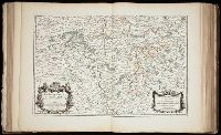
Found in:
Beinecke Rare Book and Manuscript Library > Comte de Namur dresse sur les memoirs les plus nouveaux presente a sa Majeste pour le service de ses troupes par le service de ses troupes par le service de ses troupes ...
Creator:
Call Number:
1973 Folio 17
Collection Title:
Atlas francois, contenant les cartes geographiques dans les quelles sont tres exactement remarquez
Image Count:
1
Resource Type:
Maps, Atlases & Globes
Found in:
Beinecke Rare Book and Manuscript Library > La Generalite de Paris divisee ens ses eslections
Call Number:
1977 Folio 78
Collection Title:
A New and accurate chart of the West-India Islands and coast, with the gulf passage through the New
Image Count:
1
Resource Type:
Maps, Atlases & Globes
Found in:
Beinecke Rare Book and Manuscript Library > A plan of the road of Port Paix in the island of Hispaniola, pl. 35.
Call Number:
1977 Folio 78
Collection Title:
A New and accurate chart of the West-India Islands and coast, with the gulf passage through the New
Image Count:
1
Resource Type:
Maps, Atlases & Globes
Found in:
Beinecke Rare Book and Manuscript Library > A plan of Monte-Christe Bay with the Seven Brothers on the north coast of St. Domingo, pl. 38
Creator:
Call Number:
1998 995
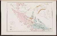
Collection Title:
Voyage au pole sud et dans l'Oceanie sur les corvettes l'Astrolabe et la Zelee : execute par ordre
Image Count:
1
Found in:
Beinecke Rare Book and Manuscript Library > Carte geologique de la Patagonie et de la terre de feu
Creator:
Published / Created:
c1891
Call Number:
Zc86 893scd
Collection Title:
Appletons' guide-book to Alaska and the northwest coast ...
Image Count:
1
Resource Type:
Maps, Atlases & Globes
Found in:
Beinecke Rare Book and Manuscript Library > The route of the Alaska excursion steamers
Creator:
Published / Created:
c1891
Call Number:
Zc86 893sc
Collection Title:
The guide-book to Alaska and the northwest coast, including the shores of Washington, British
Image Count:
1
Resource Type:
Maps, Atlases & Globes
Found in:
Beinecke Rare Book and Manuscript Library > [Map of Alaska]
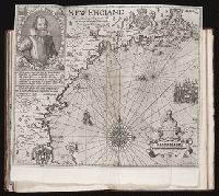
Creator:
Published / Created:
1614-16
Call Number:
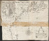
Zd 176
Collection Title:
Path-way to experience to erect a plantation
Image Count:
1
Found in:
Beinecke Rare Book and Manuscript Library > New England: the most remarqueable parts thus named by the high and mighty Prince Charles, Prince of Great Britaine
Call Number:
1977 +246
Collection Title:
Geografia; cioè, Descrittione vniversale della terra. Partita in due volumi, nel primo de' quali si
Image Count:
1
Resource Type:
Books, Journals & Pamphlets
Found in:
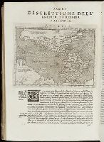
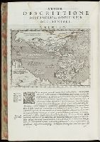
Beinecke Rare Book and Manuscript Library > Descrittione dell-America, o dell'India Occidentale. America
Call Number:
Gfp94 +Gi597
Collection Title:
Geografia; cioe, Descrittione vniversale della terra. Partita in due volumi, nel primo de' quali si
Image Count:
1
Resource Type:
Books, Journals & Pamphlets
Found in:
Beinecke Rare Book and Manuscript Library > [Geographia. Italian]
Call Number:
1977 +379
Collection Title:
Geografia; cioe, Descrittione vniversale della terra. Partita in due volumi, nel primo de' quali si
Image Count:
1
Resource Type:
Books, Journals & Pamphlets
Found in:
Beinecke Rare Book and Manuscript Library > [Geographia. Italian]
Call Number:
1977 1341
Collection Title:
Geographiae vniversae opvs habentur Cl. Ptolemaei ... Geographicae enarationis libri octo [tr. by W
Image Count:
1
Resource Type:
Books, Journals & Pamphlets
Found in:
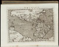
Beinecke Rare Book and Manuscript Library > America
Call Number:
Gfp94 gf525j
Collection Title:
Geographiae vniversae ... opvs ... habentur Cl. Ptolemaei ... Geographicae enarrationis libri octo
Image Count:
1
Resource Type:
Books, Journals & Pamphlets
Found in:
Beinecke Rare Book and Manuscript Library > America
Call Number:
1971 Folio 601
Collection Title:
Description de lEgypte, ou, Recueil de observations et des recherches qui ont ete faites en Egypte
Image Count:
1
Found in:
Beinecke Rare Book and Manuscript Library > Alexandrie. pl. 41
Call Number:
1971 Folio 601
Collection Title:
Description de lEgypte, ou, Recueil de observations et des recherches qui ont ete faites en Egypte
Image Count:
1
Found in:
Beinecke Rare Book and Manuscript Library > Denderah. (Tentyris). pl. 18
Call Number:
1971 Folio 601
Collection Title:
Description de lEgypte, ou, Recueil de observations et des recherches qui ont ete faites en Egypte
Image Count:
1
Found in:
Beinecke Rare Book and Manuscript Library > Denderah. (Tentyris). pl. 30
Call Number:
1971 Folio 601
Collection Title:
Description de lEgypte, ou, Recueil de observations et des recherches qui ont ete faites en Egypte
Image Count:
1
Found in:
Beinecke Rare Book and Manuscript Library > Syout. (Lycopolis). pl. 48
Call Number:
1971 Folio 601
Collection Title:
Description de lEgypte, ou, Recueil de observations et des recherches qui ont ete faites en Egypte
Image Count:
1
Found in:
Beinecke Rare Book and Manuscript Library > Syout. (Lycopolis). pl. 49
Call Number:
1971 Folio 601
Collection Title:
Description de lEgypte, ou, Recueil de observations et des recherches qui ont ete faites en Egypte
Image Count:
1
Found in:
Beinecke Rare Book and Manuscript Library > Ile d'Elephantine. pl. 34
Call Number:
1971 Folio 601
Collection Title:
Description de lEgypte, ou, Recueil de observations et des recherches qui ont ete faites en Egypte
Image Count:
1
Found in:
Beinecke Rare Book and Manuscript Library > Ile d'Elephantine. pl. 35
Call Number:
1971 Folio 601
Collection Title:
Description de lEgypte, ou, Recueil de observations et des recherches qui ont ete faites en Egypte
Image Count:
1
Found in:
Beinecke Rare Book and Manuscript Library > Ile d'Elephantine. pl. 36
Call Number:
1971 Folio 601
Collection Title:
Description de lEgypte, ou, Recueil de observations et des recherches qui ont ete faites en Egypte
Image Count:
1
Found in:
Beinecke Rare Book and Manuscript Library > Ile d'Elephantine. pl. 37
Call Number:
1971 Folio 601
Collection Title:
Description de lEgypte, ou, Recueil de observations et des recherches qui ont ete faites en Egypte
Image Count:
1
Found in:
Beinecke Rare Book and Manuscript Library > Ile d'Elephantine et Syene. pl. 38
Creator:
Published / Created:
[ca. 1814]
Call Number:
Zc10 814Le
Collection Title:
History of the expedition under the command of Captains Lewis and Clark, to the sources of the
Image Count:
2
Resource Type:
Maps, Atlases & Globes
Found in:
Beinecke Rare Book and Manuscript Library > A map of Lewis and Clark's track, across the western portion of North America fom the Mississippi to the Pacific Ocean; by order of the Executive of the United States . In 1804, 5 & 6
Creator:
Published / Created:
[ca. 1814]
Call Number:
Zc10 814Le
Collection Title:
History of the expedition under the command of Captains Lewis and Clark, to the sources of the
Image Count:
1
Resource Type:
Maps, Atlases & Globes
Found in:
Beinecke Rare Book and Manuscript Library > Fortification
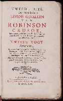
Creator:
Published / Created:
1721
Call Number:
Defoe 52 p721 2
Image Count:
8
Resource Type:
Books, Journals & Pamphlets
Found in:
Beinecke Rare Book and Manuscript Library > Tweede deel der wonderbare levens gevallen van Robinson Crusoe ...
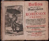
Creator:
Published / Created:
1720
Call Number:
Defoe 52 n720e
Image Count:
14
Resource Type:
Books, Journals & Pamphlets
Found in:
Beinecke Rare Book and Manuscript Library > Das Leben und die gantz ungemeine Begebenheiten des Robinson Crusoe ...
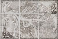
Creator:
Published / Created:
1753
Call Number:
2004 Folio 91
Image Count:
10
Found in:
Beinecke Rare Book and Manuscript Library > Plan stolichnago goroda Sanktpeterburga s izobrazheniem znatnieishikh onago prospektov : izdannyi trudami Imperatorskoi Akademii nauk i khudozhestv.
Published / Created:
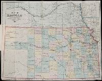
1869
Call Number:
Zc39 869be
Collection Title:
Hand-book of Kansas : containing a description of the physical geography and geology of the state
Image Count:
1
Found in:
Beinecke Rare Book and Manuscript Library > Map of Kansas
Creator:
Published / Created:
1799
Call Number:
2002 Folio 93
Image Count:
40
Resource Type:
Maps, Atlases & Globes
Found in:
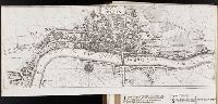
Beinecke Rare Book and Manuscript Library > Plan of the cities of London and Westminster, the Borough of Southwark, and parts adjoining, shewing every house. By R. Horwood
Creator:
Published / Created:
1779
Call Number:
1977 Folio 78
Collection Title:
A New and accurate chart of the West-India Islands and coast, with the gulf passage through the New
Image Count:
1
Resource Type:
Maps, Atlases & Globes
Found in:
Beinecke Rare Book and Manuscript Library > Plan of the city and harbour of Havanna. pl. 23
Creator:
Published / Created:
1779
Call Number:
1977 Folio 78
Collection Title:
A New and accurate chart of the West-India Islands and coast, with the gulf passage through the New
Image Count:
1
Resource Type:
Maps, Atlases & Globes
Found in:
Beinecke Rare Book and Manuscript Library > Leogane and Port au Prince in the island of Hispaniola. pl. 33
Creator:
Call Number:
1977 Folio 96
Collection Title:
The West-India atlas: or, A compendious description of the West-Indies: illustrated with forty
Image Count:
1
Resource Type:
Maps, Atlases & Globes
Found in:
Beinecke Rare Book and Manuscript Library > South part of St. Domingo, of Hispaniola, by Thos Jeffreys geographer to his Majesty
Creator:
Call Number:
1977 Folio 96
Collection Title:
The West-India atlas: or, A compendious description of the West-Indies: illustrated with forty
Image Count:
1
Resource Type:
Maps, Atlases & Globes
Found in:
Beinecke Rare Book and Manuscript Library > Jamaica from the latest surveys; improved and engraved by Thomas Jefferys geographer to the king
Creator:
Published / Created:
1775
Call Number:
1977 Folio 96
Collection Title:
The West-India atlas: or, A compendious description of the West-Indies: illustrated with forty
Image Count:
1
Resource Type:
Maps, Atlases & Globes
Found in:
Beinecke Rare Book and Manuscript Library > Turks Islands, from a survey made in 1753, by the the sloops l'Aigle and l'Emeraude, by order of the French Governor of Hispaniola, with improvements from observations, made in 1770, in the Sr. Edward Hawke Kings Schooner
Creator:
Call Number:
1973 Folio 103
Collection Title:
De Nieuwe groote lichtende zee-fakkel ...
Image Count:
1
Resource Type:
Maps, Atlases & Globes
Found in:
Beinecke Rare Book and Manuscript Library > Des rivier legt op de Hoogte von 18 Graaden Zuyder Breedte aan het Land van de Megosie ter Kuste van Quama / Noord kust van't eyland ...
Creator:
Call Number:
1973 Folio 103
Collection Title:
De Nieuwe groote lichtende zee-fakkel ...
Image Count:
1
Resource Type:
Maps, Atlases & Globes
Found in:
Beinecke Rare Book and Manuscript Library > De Oostin-dische zee / Het Eyland Mayota
Creator:
Call Number:
ZZc70 752L
Collection Title:
Explication de la carte des nouvelles decouvertes au nord de la mer du Sud; par m. de Lisle ...
Image Count:
1
Resource Type:
Maps, Atlases & Globes
Found in:
Beinecke Rare Book and Manuscript Library > Carte de nouvelles decouvertes au nord de la mer du Sud, tant a lest de la Siberie et du Kamtchatka, qua louest de la Nouvelle France
Published / Created:
1755
Call Number:
ZZc90 755be
Collection Title:
Remarques sur la carte de lAmerique Septentrionale : comprise entre le 28e et le 72e degre de
Image Count:
1
Resource Type:
Maps, Atlases & Globes
Found in:
Beinecke Rare Book and Manuscript Library > Carte de lAmerique septentrionale depuis le 28 degre de latitude jusqau 72
Creator:
Call Number:
1973 Folio 103
Collection Title:
De Nieuwe groote lichtende zee-fakkel ...
Image Count:
1
Resource Type:
Maps, Atlases & Globes
Found in:
Beinecke Rare Book and Manuscript Library > Madagascar
Creator:
Published / Created:
[1624]
Call Number:
Taylor 301
Collection Title:
The generall historie of Virginia, New-England, and the Summer Iles : with the names of the
Image Count:
1
Found in:
Beinecke Rare Book and Manuscript Library > Ould Virginia
Published / Created:
[1624?]
Call Number:
Taylor 301
Collection Title:
The generall historie of Virginia, New-England, and the Summer Iles : with the names of the
Image Count:
1
Found in:
Beinecke Rare Book and Manuscript Library > Summer Ils
Call Number:
1977 +379
Collection Title:
Geografia; cioe, Descrittione vniversale della terra. Partita in due volumi, nel primo de' quali si
Image Count:
1
Found in:
Beinecke Rare Book and Manuscript Library > A new map of that part of Africacalled the coast of Guinea ...
Published / Created:
1661
Call Number:
1976 Folio 152
Collection Title:
Arcano del mare di D. Rvberto Dvdleo dvca di Nortvmbria, e conte di VVarvich. Diviso in libri sei ...
Container / Volume:
Volume 2
Image Count:
1
Found in:
Beinecke Rare Book and Manuscript Library > Carta particolare della nuova Belgia e parte della nuova Anglia
Creator:
Published / Created:
1795
Call Number:
1973 Folio 27
Collection Title:
The general atlas for Careys edition of Guthries Geography improved ...
Image Count:
1
Found in:
Beinecke Rare Book and Manuscript Library > Connecticut from the best authorities
Published / Created:
1846
Call Number:
1976 Folio 93
Collection Title:
A new universal atlas containing maps of the various empires, kingdoms, states and republics of the
Image Count:
1
Resource Type:
Maps, Atlases & Globes
Found in:
Beinecke Rare Book and Manuscript Library > 9. Connecticut
Published / Created:
1635
Call Number:
1975 Folio 32
Collection Title:
Toonneel des aerdriicx, ofte nieuwe atlas, dat is beschryving van alle landen; nu nieulycx
Image Count:
1
Found in:
Beinecke Rare Book and Manuscript Library > Nova Belgica et Anglia Nova
Creator:
Published / Created:
[1624?]
Call Number:
Taylor 301
Collection Title:
The generall historie of Virginia, New-England, and the Summer Iles : with the names of the
Image Count:
1
Found in:
Beinecke Rare Book and Manuscript Library > New England
Branch:v1.60.98 ,Deployed:2024-04-17T09:54:30-04:00