Skip to search
Skip to main content
Skip to first result
Search
You Searched For
Format
cartographic
Language
English
Language
German
New Search
Search Results
Creator:
Published / Created:
1777
Call Number:
755 1777B
Container / Volume:
BRBL_00431
Image Count:
1
Resource Type:
Maps, Atlases & Globes
Found in:
Beinecke Rare Book and Manuscript Library > America Septentrionalis a Domino d'Anville in Galliis edita nunc in Anglia : coloniis in interiorem Virginiam deductis nec non Fluvii Ohio cursu aucta notisque geographicis et historicis illustrata et ad bellum praesentis temporis accomodata / sumptibus Homannianorum Heredum.
Creator:
Published / Created:
1756
Call Number:
71 1756H
Container / Volume:
BRBL_00726
Image Count:
1
Resource Type:
Maps, Atlases & Globes
Found in:
Beinecke Rare Book and Manuscript Library > America Septentrionalis a Domino d'Anville in Galliis edita nunc in Anglia : coloniis in interiorem Virginiam deductis nec non Fluvii Ohio cursu aucta notisque geographicis et historicis illustrata / sumptibus Homannianorum Heredum.
Creator:
Published / Created:
1756
Call Number:
755 1756Ea
Image Count:
1
Resource Type:
Maps, Atlases & Globes
Found in:
Beinecke Rare Book and Manuscript Library > America Septentrionalis a Domino d'Anville in Galliis edita nunc in Anglia : coloniis in interiorem Virginiam deductis nec non Fluvii Ohio cursu aucta notisque geographicis et historicis illustrata / sumptibus Homannianorum Heredum.
Creator:
Published / Created:
1756
Call Number:
755 1756B
Container / Volume:
BRBL_00428
Image Count:
1
Resource Type:
Maps, Atlases & Globes
Found in:
Beinecke Rare Book and Manuscript Library > America Septentrionalis a Domino d'Anville in Galliis edita nunc in Anglia : coloniis in interiorem Virginiam deductis nec non Fluvii Ohio cursu aucta notisque geographicis et historicis illustrata / sumptibus Homannianorum Heredum.
Creator:
Published / Created:
1756
Call Number:
755 1756Ea
Container / Volume:
BRBL_00428
Image Count:
1
Resource Type:
Maps, Atlases & Globes
Found in:
Beinecke Rare Book and Manuscript Library > America Septentrionalis a Domino d'Anville in Galliis edita nunc in Anglia : coloniis in interiorem Virginiam deductis nec non Fluvii Ohio cursu aucta notisque geographicis et historicis illustrata / sumptibus Homannianorum Heredum.
Creator:
Published / Created:
1756
Call Number:
755 1756G
Container / Volume:
BRBL_00690
Image Count:
1
Resource Type:
Maps, Atlases & Globes
Found in:
Beinecke Rare Book and Manuscript Library > America Septentrionalis a Domino d'Anville in Galliis edita nunc in Anglia : coloniis in interiorem Virginiam deductis nec non Fluvii Ohio cursu aucta notisque geographicis et historicis illustrata / sumptibus Homannianorum Heredum.
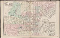
Creator:
Published / Created:
c1876.
Call Number:
774 P53 1876A
Container / Volume:
BRBL_00500
Image Count:
1
Resource Type:
Maps, Atlases & Globes
Found in:
Beinecke Rare Book and Manuscript Library > Philadelphia / [cartographic material] / O.W. Gray & Son.
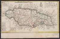
Published / Created:
1737]
Call Number:
8555 1737
Container / Volume:
BRBL_00695
Image Count:
1
Resource Type:
Maps, Atlases & Globes
Found in:
Beinecke Rare Book and Manuscript Library > Insula Iamaica [cartographic material] : in suas parochias divisa et secundum exemplar primitivum Londinense excusa.
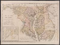
Creator:
Published / Created:
1797
Call Number:
777 1797
Container / Volume:
BRBL_00730
Image Count:
1
Resource Type:
Maps, Atlases & Globes
Found in:
Beinecke Rare Book and Manuscript Library > Maryland und Delaware / entworfen von D.F. Sotzmann.
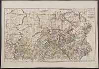
Creator:
Published / Created:
1797
Call Number:
774 1797
Container / Volume:
BRBL_00730
Image Count:
1
Resource Type:
Maps, Atlases & Globes
Found in:
Beinecke Rare Book and Manuscript Library > Pennsylvania / entworfen von D.F. Sotzman[n].
Creator:
Published / Created:
1777
Call Number:
71 1777H
Container / Volume:
BRBL_00726
Image Count:
1
Resource Type:
Maps, Atlases & Globes
Found in:
Beinecke Rare Book and Manuscript Library > America Septentrionalis a Domino d'Anville in Galliis edita nunc in Anglia : coloniis in interiorem Virginiam deductis nec non Fluvii Ohio cursu aucta notisque geographicis et historicis illustrata et ad bellum praesentis temporis accomodata / sumptibus H
Creator:
Published / Created:
1798
Call Number:
761 1798
Container / Volume:
BRBL_00729
Image Count:
1
Resource Type:
Maps, Atlases & Globes
Found in:
Beinecke Rare Book and Manuscript Library > Maine / entworfen von D.F. Sotzmann ; Sander, sc.
Creator:
Published / Created:
1796
Call Number:
763 1796
Container / Volume:
BRBL_00729
Image Count:
1
Resource Type:
Maps, Atlases & Globes
Found in:
Beinecke Rare Book and Manuscript Library > Vermont / entworfen von D.F. Sotzmann ; P. Schmidt sc. zu Berlin.
Creator:
Published / Created:
[ca. 1797?]
Call Number:
764 1796
Container / Volume:
BRBL_00729
Image Count:
1
Resource Type:
Maps, Atlases & Globes
Found in:
Beinecke Rare Book and Manuscript Library > Massachusetts / entworfen von D.F. Sotzmann ; gestochen v. Paulus Schmidt.
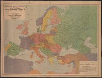
Creator:
Published / Created:
1921
Call Number:
30 1921
Container / Volume:
BRBL_00032
Image Count:
1
Resource Type:
Maps, Atlases & Globes
Found in:
Beinecke Rare Book and Manuscript Library > The Gea map of Europe.
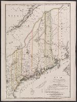
Creator:
Published / Created:
1798
Call Number:
761 1798
Container / Volume:
BRBL_00447
Image Count:
1
Resource Type:
Maps, Atlases & Globes
Found in:
Beinecke Rare Book and Manuscript Library > Maine / entworfen von D.F. Sotzmann ; Sander, sc.
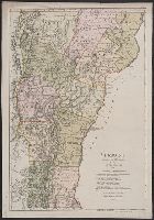
Creator:
Published / Created:
1796
Call Number:
763 1796A
Container / Volume:
BRBL_00452
Image Count:
1
Resource Type:
Maps, Atlases & Globes
Found in:
Beinecke Rare Book and Manuscript Library > Vermont / entworfen von D.F. Sotzmann ; P. Schmidt sc. zu Berlin.
Creator:
Published / Created:
1860
Call Number:
37 1860A
Image Count:
2
Resource Type:
Maps, Atlases & Globes
Found in:
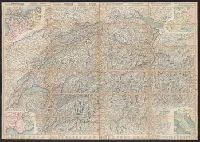
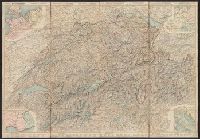
Beinecke Rare Book and Manuscript Library > Roadmap of Switzerland = Reisekarte der Schweiz = Carta stradale della Svizzera = Carte routière de la Suisse : en partie tirée de l'atlas topographique de la confederation / dresée et gravée par Mullhaupt ; publiée par H.F. Leuthold editeur ; ecrit
Creator:
Published / Created:
1861
Call Number:
37 1861A
Image Count:
2
Resource Type:
Maps, Atlases & Globes
Found in:
Beinecke Rare Book and Manuscript Library > Roadmap of Switzerland = Reisekarte der Schweiz = Carta stradale della Svizzera = Carte routière de la Suisse : en partie tirée de l'atlas topographique de la confederation / dresée et gravée par Mullhaupt ; publiée par H.F. Leuthold editeur ; ecrit
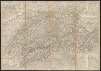
Creator:
Published / Created:
1858
Call Number:
37 1858
Image Count:
2
Resource Type:
Maps, Atlases & Globes
Found in:
Beinecke Rare Book and Manuscript Library > Roadmap of Switzerland = Reisekarte der Schweiz = Carta stradale della Svizzera = Carte routière de la Suisse : en partie tirée de l'atlas topographique de la confederation / dresée et gravée par Mullhaupt ; publiée par H.F. Leuthold editeur ; ecrit
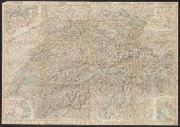
Creator:
Published / Created:
1867
Call Number:
37 1867
Image Count:
2
Resource Type:
Maps, Atlases & Globes
Found in:
Beinecke Rare Book and Manuscript Library > Roadmap of Switzerland = Reisekarte der Schweiz = Carta stradale della Svizzera = Carte routière de la Suisse : en partie tirée de l'atlas topographique de la confederation / dresée et gravée par Mullhaupt ; publiée par H.F. Leuthold editeur ; ecrit
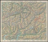
Creator:
Published / Created:
1944
Call Number:
3763 1944
Container / Volume:
BRBL_00150A
Image Count:
2
Resource Type:
Maps, Atlases & Globes
Found in:
Beinecke Rare Book and Manuscript Library > Reisekarte von Graubünden, Schweiz = Carte de voyage des Grisons, Suisse.
Creator:
Published / Created:
1856
Call Number:
37 1856
Image Count:
2
Resource Type:
Maps, Atlases & Globes
Found in:
Beinecke Rare Book and Manuscript Library > Roadmap of Switzerland = Reisekarte der Schweiz = Carta stradale della Svizzera = Carte routière de la Suisse : en partie tirée de l'atlas topographique de la confederation / dresée et gravée par Mullhaupt ; publiée par H.F. Leuthold editeur ; ecrit
Creator:
Call Number:
217 1635
Image Count:
1
Resource Type:
Maps, Atlases & Globes
Found in:
Beinecke Rare Book and Manuscript Library > Mappa Aestivarum insularum, alias Barmudas dictarum : ad ostia Mexicani aestuarij jacentium in latitudine graduum 32 minutorum 25 ab Anglia, Londino scilicet versus Libonotum 3300 miliaribus Anglicanis, et a Roanoack (qui locus est in Virginia) versus Eur
Published / Created:
[1919?]
Call Number:
11hcf 1919-43
Container / Volume:
BRBL_00010L
Image Count:
1
Resource Type:
Maps, Atlases & Globes
Found in:
Beinecke Rare Book and Manuscript Library > The boundary lines of the Czech-Sclavonian state = Die Grenzen des tschecho-slowakischen Staates.
Creator:
Published / Created:
[1877]
Call Number:
30an 1877B
Container / Volume:
BRBL_00037
Image Count:
1
Resource Type:
Maps, Atlases & Globes
Found in:
Beinecke Rare Book and Manuscript Library > Serio-comic war map for the year 1877 / by F.W. Rose.
Creator:
Published / Created:
[1862]
Call Number:
32 L84 1862
Container / Volume:
BRBL_00050
Image Count:
1
Resource Type:
Maps, Atlases & Globes
Found in:
Beinecke Rare Book and Manuscript Library > Wyld's new plan of London = Nouveau plan des Londres = Neuer Plan von London.
Published / Created:
[1946?]
Call Number:
331 1946
Container / Volume:
BRBL_00079
Image Count:
1
Resource Type:
Maps, Atlases & Globes
Found in:
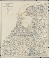
Beinecke Rare Book and Manuscript Library > Map of the Netherlands = Karte der Niederlande = Carte de Pays-Bas.
Creator:
Published / Created:
[1900?]
Call Number:
344ag 1900
Container / Volume:
BRBL_00095
Image Count:
1
Resource Type:
Maps, Atlases & Globes
Found in:
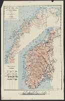
Beinecke Rare Book and Manuscript Library > Turistkart over Norge = Tourist map of Norway = Carte de Norvège pour les tourists = Touristenkarte über Norwegen.
Creator:
Published / Created:
1944
Call Number:
42gmb 1944
Container / Volume:
BRBL_00245
Image Count:
1
Resource Type:
Maps, Atlases & Globes
Found in:
Beinecke Rare Book and Manuscript Library > Austria [cartographic material] : Federal roads 1937.
Creator:
Published / Created:
1941
Call Number:
45gmb 1941A
Container / Volume:
BRBL_00258
Image Count:
1
Resource Type:
Maps, Atlases & Globes
Found in:
Beinecke Rare Book and Manuscript Library > Strassenkarte 1:300,000. 56, Lugoj [cartographic material].
Creator:
Published / Created:
1890-1892
Call Number:
501 1890
Container / Volume:
BRBL_00276
Image Count:
1
Resource Type:
Maps, Atlases & Globes
Found in:
Beinecke Rare Book and Manuscript Library > Specialkarte vom westlichen Kleinasien : nach seinen eigenen Reisen und anderen grösstenteils noch unveröffentlichten Routenaufnahmen bearbeitet / von Heinrich Kiepert = Carte de la partie occidentale de l 'Asie mineure / dressée par Henri Kiepert d'ap
Creator:
Published / Created:
[1941]
Call Number:
53f 1941
Container / Volume:
BRBL_00287
Image Count:
1
Resource Type:
Maps, Atlases & Globes
Found in:
Beinecke Rare Book and Manuscript Library > South-eastern Europe [cartographic material] = Europe Sud-est = Südost-Europa.
Published / Created:
[1894]
Call Number:
643 W782 1894
Container / Volume:
BRBL_00340
Image Count:
1
Resource Type:
Maps, Atlases & Globes
Found in:
Beinecke Rare Book and Manuscript Library > Mittleres Grubenfeld des Witwatersrands (von May Cons. bis United Langlaagte).
Creator:
Call Number:
Zm Sp79
Collection Title:
Allgemeines historisches Taschenbuch, oder, Abriss der merkwurdigsten neuen Welt-Begebenheiten
Image Count:
1
Found in:
Beinecke Rare Book and Manuscript Library > Die Vereinigten Staaten von Nord America. nach der von Wm Faden 1783
Published / Created:
undated
Call Number:
WA MSS S-1316
Collection Title:
Friedrich Armand Strubberg collection
Container / Volume:
Box 3 | Folder 44
Image Count:
1
Found in:
Beinecke Rare Book and Manuscript Library > Zeichnung der ansiedlungen des vereins
Creator:
Published / Created:
Undated
Call Number:
1973 Folio 71
Collection Title:
[Atlas nouveau contenant toutes les parties du monde ou sont exactement marques les empires
Image Count:
1
Resource Type:
Maps, Atlases & Globes
Found in:
Beinecke Rare Book and Manuscript Library > A new mapp of the kingdome of England, representing the princedome of Wales, and other provinces, cities, market towns, with the roads from town to town and the number of reputed miles between them, are given by inspection without scale or compass
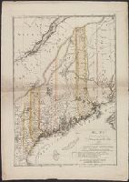
Creator:
Published / Created:
1798
Call Number:
1977 Folio 177
Image Count:
2
Resource Type:
Maps, Atlases & Globes
Found in:
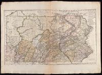
Beinecke Rare Book and Manuscript Library > Maine / entworfen von D.F. Sotzmann ; Sander, sc.
Creator:
Published / Created:
1797
Call Number:
1977 Folio 177
Image Count:
2
Resource Type:
Maps, Atlases & Globes
Found in:
Beinecke Rare Book and Manuscript Library > Maryland und Delaware / entworfen von D.F. Sotzmann.
Creator:
Published / Created:
1796
Call Number:
1977 Folio 177
Image Count:
2
Resource Type:
Maps, Atlases & Globes
Found in:
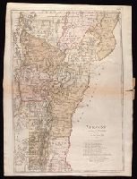
Beinecke Rare Book and Manuscript Library > Vermont / entworfen von D.F. Sotzmann ; P. Schmidt sc. zu Berlin.
Creator:
Published / Created:
1797
Call Number:
1977 Folio 177
Image Count:
2
Resource Type:
Maps, Atlases & Globes
Found in:
Beinecke Rare Book and Manuscript Library > Pennsylvania / entworfen von D.F. Sotzman[n].
Branch:v1.60.98 ,Deployed:2024-04-24T10:14:30-04:00