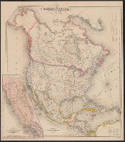
Includes tables of distances for overland routes and sea routes., Inset: Map of the gold region California. Scale [ca. 1:4,752,000]., Prime meridian: Washington, D.C., and Relief shown by hachures.
Includes tables of distances for overland routes and sea routes., Inset map: Map of the gold region, California., Prime meridian: Washington, D.C., and Relief shown by hachures.
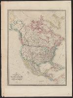
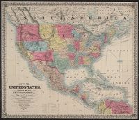
Appears in Wyld's New general atlas. London, 1854. Cf. Phillips, Maps of America, p. 607., In upper right margin: 36., Relief shown by hachures., and Yale's copy stamped on verso: Yale University Library, Karpinski-Von Wieser Map Collection.
Date beneath publisher statement: March 1st 1827., Includes notes., Relief shown by hachures., Some sheets: Published by Jas. Wyld (successor to W. Faden, and Stevens and Tree describe the various issues of this map in Tooley's Mapping of America, p. 91., no. 63.
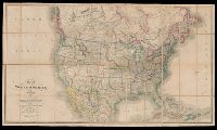
Map of the Northern Pacific Railroad, showing the intercontinental routes, oceanic currents and steamboat lines around the world. and Profiles of the Northern Pacific and the Central and Union Pacific Railroads, showing the difference in configuration of the country along the respective routes.
Description:
Imperfect: chipped along folds, with some loss of text. Backed with paper., Includes inset of "Map of the Northern Pacific Railroad, showing the intercontinental routes, oceanic currents and steamboat lines around the world," text, and "Profiles of the Northern Pacific and the Central and Union Pacific Railroads, showing the difference in configuration of the country along the respective routes.", Prime meridians: Greenwich and Washington., and Relief shown by hachures and spot heights.
Subject (Geographic):
NorthAmerica--Maps.
Subject (Name):
Northern Pacific Railroad Company--Maps.
Subject (Topic):
Railroads--Canada--Maps. and Railroads--United States--Maps.
Colton, G. Woolworth (George Woolworth), 1827-1901
Published / Created:
1854
Call Number:
71 1854B
Container / Volume:
BRBL_00371
Image Count:
2
Resource Type:
Maps, Atlases & Globes
Description:
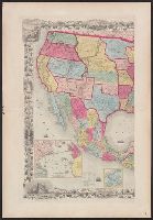
"Entered according to Act of Congress in the year 1848 by J.H. Colton in the Clerk's Office of the District Court for the Southern District of New York.", Includes ill. and decorative border., and Insets: Map of the Atlantic ocean, showing the American & Europe
Publisher:
Published by J.H. Colton and Co., No. 172 William St.,
Subject (Geographic):
NorthAmerica--Maps
Subject (Name):
Atwood, John M., b. ca. 1818, Barnard, William S., b. ca. 1809, and Colton, J. H. (Joseph Hutchins), 1800-1893