Search
You Searched For
Search Results
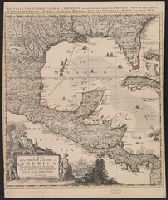
- Creator:
- Popple, Henry, -1743
- Published / Created:
- [ca. 1741]
- Call Number:
- 755 1734A
- Container / Volume:
- BRBL_00426
- Image Count:
- 1
- Resource Type:
- Maps, Atlases & Globes
- Found in:
- Beinecke Rare Book and Manuscript Library > A map of the British Empire in America, with the French, Spanish and Hollandish settlements adjacent thereto / by Henry Popple.
- Creator:
- Popple, Henry, -1743
- Published / Created:
- [ca. 1741]
- Call Number:
- 71 1741
- Container / Volume:
- BRBL_00687
- Image Count:
- 1
- Resource Type:
- Maps, Atlases & Globes
- Found in:
- Beinecke Rare Book and Manuscript Library > A map of the British Empire in America, with the French, Spanish and Hollandish settlements adjacent thereto / by Henry Popple.
- Creator:
- Popple, Henry, -1743
- Published / Created:
- [ca. 1741]
- Call Number:
- 85 1760A
- Container / Volume:
- BRBL_00693
- Image Count:
- 1
- Resource Type:
- Maps, Atlases & Globes
- Found in:
- Beinecke Rare Book and Manuscript Library > A map of the British Empire in America, with the French, Spanish and Hollandish settlements adjacent thereto / by Henry Popple.
- Creator:
- Popple, Henry, -1743
- Published / Created:
- [ca. 1741]
- Call Number:
- 89 1733
- Container / Volume:
- BRBL_00697
- Image Count:
- 1
- Resource Type:
- Maps, Atlases & Globes
- Found in:
- Beinecke Rare Book and Manuscript Library > A map of the British Empire in America, with the French, Spanish and Hollandish settlements adjacent thereto / by Henry Popple.
- Creator:
- Popple, Henry, -1743
- Published / Created:
- [ca. 1741]
- Call Number:
- 85 1734
- Container / Volume:
- BRBL_00636
- Image Count:
- 1
- Resource Type:
- Maps, Atlases & Globes
- Found in:
- Beinecke Rare Book and Manuscript Library > A map of the British Empire in America, with the French, Spanish and Hollandish settlements adjacent thereto / by Henry Popple.
- Creator:
- Popple, Henry, -1743
- Published / Created:
- [ca. 1741]
- Call Number:
- 755 1734B
- Container / Volume:
- BRBL_00426
- Image Count:
- 1
- Resource Type:
- Maps, Atlases & Globes
- Found in:
- Beinecke Rare Book and Manuscript Library > A map of the British Empire in America, with the French, Spanish and Hollandish settlements adjacent thereto / by Henry Popple.
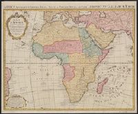
- Creator:
- L'Isle, Guillaume de, 1675-1726
- Published / Created:
- [ca. 1774?]
- Call Number:
- 60 1774A
- Container / Volume:
- BRBL_00323
- Image Count:
- 1
- Resource Type:
- Maps, Atlases & Globes
- Found in:
- Beinecke Rare Book and Manuscript Library > Carte d'Afrique, dressée pour l'usage du Roy / par Guillaume Delisle, Premier Geographe de sa Majesté de l'Academie Royale de Sciences ; J. Kondet, schulpsit.
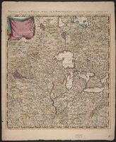
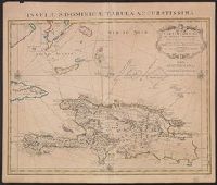
- Creator:
- L'Isle, Guillaume de, 1675-1726
- Published / Created:
- [1730]
- Call Number:
- 853 1722
- Container / Volume:
- BRBL_00694
- Image Count:
- 1
- Resource Type:
- Maps, Atlases & Globes
- Found in:
- Beinecke Rare Book and Manuscript Library > Carte de l'Isle de Saint Domingue / dressée en 1722 pour l'usage du Roy sur les memoires de Mr. Frezier, ingenieur de S.M. et autres, assujettis aux observations astronomiques, par G. De l'Isle ...
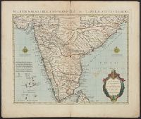
- Creator:
- L'Isle, Guillaume de, 1675-1726
- Published / Created:
- [ca. 1730]
- Call Number:
- 59 1730
- Container / Volume:
- BRBL_00316
- Image Count:
- 1
- Resource Type:
- Maps, Atlases & Globes
- Found in:
- Beinecke Rare Book and Manuscript Library > Carte des Côtes de Malabar et de Coromandel... / par Guillaume de l'Isle.
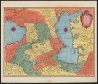
- Creator:
- L'Isle, Guillaume de, 1675-1726
- Published / Created:
- [between 1731 and 1742]
- Call Number:
- 53 1723A
- Container / Volume:
- BRBL_00283
- Image Count:
- 1
- Resource Type:
- Maps, Atlases & Globes
- Found in:
- Beinecke Rare Book and Manuscript Library > Carte des pays voisins de la Mer Caspiene : dressée pour l'usage du Roy : sur la carte de cette Mer faite par l'ordre du Czar, sur les Memoires manuscrits de Soskam-Sabbas, Prince de Georgie ... assujetie aux observations astronomiques / par G. Delisle,