Skip to search
Skip to main content
Skip to first result
Search
You Searched For
Date
1700 - 1749
Access
Public
Format
cartographic
Language
German
Language
Latin
Date Created
1700 to 1749
New Search
Search Results
Creator:
Published / Created:
ca. 1720]
Call Number:
61 1700
Container / Volume:
BRBL_00330
Image Count:
1
Resource Type:
Maps, Atlases & Globes
Found in:
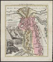
Beinecke Rare Book and Manuscript Library > Aegyptus Hodierna : ex itinerario celeberrimi viri, Pauli Lucae Franci desumpta, ac novissime / repræsentata à Johanne Baptista Homann = das heutige Aegypten : aus der Reyssbeischreiburg des berühmten H.n Paul Lucas / gezogē, und mit folgenden Denkwur
Creator:
Published / Created:
1737?]
Call Number:
85 1740A
Container / Volume:
BRBL_00693
Image Count:
1
Resource Type:
Maps, Atlases & Globes
Found in:
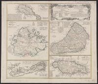
Beinecke Rare Book and Manuscript Library > Dominia anglorum in praecipuis insulis Americae ut sunt insula : S. Christophori, Antegoa, Iamaica, Barbados, nec non insulae Bermudes vel Sommers dictae, singulari mappa omnia a exhibita et edita ab Homannianis Heredibus = Die englische Colonie-Laender a
Creator:
Published / Created:
1737?]
Call Number:
85 1759
Container / Volume:
BRBL_00693
Image Count:
1
Resource Type:
Maps, Atlases & Globes
Found in:
Beinecke Rare Book and Manuscript Library > Dominia anglorum in praecipuis insulis Americae ut sunt insula : S. Christophori, Antegoa, Iamaica, Barbados, nec non insulae Bermudes vel Sommers dictae, singulari mappa omnia a exhibita et edita ab Homannianis Heredibus = Die englische Colonie-Laender a
Published / Created:
1737]
Call Number:
8555 1737
Container / Volume:
BRBL_00695
Image Count:
1
Resource Type:
Maps, Atlases & Globes
Found in:
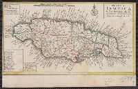
Beinecke Rare Book and Manuscript Library > Insula Iamaica [cartographic material] : in suas parochias divisa et secundum exemplar primitivum Londinense excusa.
Creator:
Published / Created:
[1742]
Call Number:
1977 Folio 177
Image Count:
2
Resource Type:
Maps, Atlases & Globes
Found in:
Beinecke Rare Book and Manuscript Library > Land-Charte des Chur-Fürstenthums Brandenburg [cartographic material].
Creator:
Published / Created:
[1735]
Call Number:
BrSides Double Folio 2019 47
Image Count:
1
Resource Type:
Maps, Atlases & Globes
Found in:
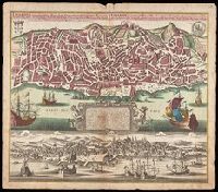
Beinecke Rare Book and Manuscript Library > Lisabona magnificentissima Regia sedes Portugalliae et florentissimum Emorium ad oftia tagi situm / aeri incisium per Matth. Seutter S. Cæs. et Reg. Cathol. Maj. Geogr. Aug. Vindel. = Lisabon die prächtigste Königl. Residenz Statt in Portugall u. floris
Creator:
Published / Created:
[1730?]
Call Number:
1an 1730
Image Count:
1
Resource Type:
Maps, Atlases & Globes
Found in:
Beinecke Rare Book and Manuscript Library > Mappa geographiae naturalis sive tabella synoptica / inventa et adornata à Matth. Seuttero. S. Caes. Maj. geogr. Aug.
Creator:
Published / Created:
1731
Call Number:
1973 Folio 30
Collection Title:
[Atlas factice of 32 maps and 1 distance table, produced by the Homann Erben firm]
Image Count:
2
Found in:
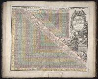
Beinecke Rare Book and Manuscript Library > Neu vermehrter curioser Meilen-Zeiger der vornehmsten Staedte in Europa, besonders in Teutschland ...
Creator:
Published / Created:
1730?]
Call Number:
352 Sa25 1730
Container / Volume:
BRBL_00108
Image Count:
1
Resource Type:
Maps, Atlases & Globes
Found in:
Beinecke Rare Book and Manuscript Library > Nova et accuratissima urbis St. Petersburg à russorum imperatore Petro Alexiewiz ao. 1703 ad ostium Nevae Fl. conditae et regionis circumjacentis / delineatio per Matth. Seutter, chalc. August. = Neue u: accurate Abbildung der von dem grossen russ. Kaise
Creator:
Published / Created:
1746
Call Number:
1973 Folio 30
Collection Title:
[Atlas factice of 32 maps and 1 distance table, produced by the Homann Erben firm]
Image Count:
1
Found in:
Beinecke Rare Book and Manuscript Library > Planiglobii terrestris mappa universalis utrumq[ue] hemisphaerium orient. et occidentale repraesentans, ex IV. mappis generalibus, Hasianis composita et adjectis ceteris hemisphaeriis / [cartographic material] / designata a G.M. Lowizio ; excudentibus Hom
Branch:v1.60.98 ,Deployed:2024-05-29T09:42:50-04:00