Skip to search
Skip to main content
Skip to first result
Search
You Searched For
"Austria--Maps"
Access
Public
Format
cartographic
Language
Latin
New Search
Search Results
Creator:
Published / Created:
[after 1741]
Call Number:
BrSides Double Folio 2019 46
Image Count:
1
Resource Type:
Maps, Atlases & Globes
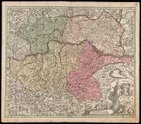
Description:
"Cum gratia et privil. S.R.I. Vicariat[us], in partib[us] Rheni, Suevice, et juris Franconici.", Manuscript number in upper right corner: 11. From the Karpinski-von Wieser Map Collection., Relief shown pictorially., and With reference grid.
Publisher:
[Mattaeus Seutter]
Subject (Geographic):
Austria --Maps
Found in:
Beinecke Rare Book and Manuscript Library > Archiducatus Austriae inferioris accuratissima tabula : cujus ditiones in suos quadrant. / designatae edita opera et studio M. Seutt. Ch. Aug.
Published / Created:
1805
Call Number:
41 1805
Container / Volume:
BRBL_00241
Image Count:
4
Resource Type:
Maps, Atlases & Globes
Publisher:
Artaria et Comp.,
Subject (Geographic):
Austria --Maps
Found in:
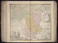
Beinecke Rare Book and Manuscript Library > Mappa novissima regnorum Hungariae, Croatiae, Sclavoniae ... / F. Muller, sculpsit.
Creator:
Published / Created:
[ca. 1710]
Call Number:
1983 Folio 23
Collection Title:
[Atlas factice of 50 maps, primarily by Johann Baptist Homann and/or issued by the Homann Erben
Image Count:
1
Alternative Title:
Basse Autriche qui se divise en 4. quartieres and Basse Avtriche qui se divise en 4. quartieres
Publisher:
[Johann Baptist Homann]
Subject (Geographic):
Austria --Maps --Early works to 1800
Collection Created:
[Nuremberg : Homann Erben, 1710-1786]
Found in:
Beinecke Rare Book and Manuscript Library > Archiducatus Austriae [cartographic material] : inferioris in omnes suas quadrantes ditiones divisi nova et exacta tabula / e conatibus Io. Baptistae Homanni
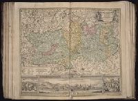
Creator:
Published / Created:
[ca. 1710]
Call Number:
1983 Folio 23
Collection Title:
[Atlas factice of 50 maps, primarily by Johann Baptist Homann and/or issued by the Homann Erben
Image Count:
1
Alternative Title:
Haute Autriche qui se divise en 4 quartieres and Havte Avtriche qui se divise en 4 quartieres
Publisher:
[Johann Baptist Homann]
Subject (Geographic):
Austria --Maps --Early works to 1800
Collection Created:
[Nuremberg : Homann Erben, 1710-1786]
Found in:
Beinecke Rare Book and Manuscript Library > Archiducatus Austriae superioris in suas quadrantes ditiones exacte divisi accuratissima tabula [cartographic material] / ex amplissima Rev. Dn. Georg Matth. Vischer Sac. Caes. Mai. (Leopoldi Glor.mae Mem.) Geogra. ; desumta et exhibita a Ioh. Baptista Ho
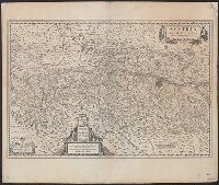
Creator:
Published / Created:
[1641?]
Call Number:
42 1640
Container / Volume:
BRBL_00244
Image Count:
2
Resource Type:
Maps, Atlases & Globes
Alternative Title:
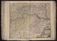
Avstria archidvcatvs
Description:
Appears in Joan and Cornelius Blaeu's Novus atlas (German ed.), 1641-42 and Joan Blaeu's Novus atlas (German ed.), 1647-49., In German on verso; with caption title "Das Ertzhertzogthums Oesterreich," signature 2Y, and paginated 46., and Relief shown pictorially
Publisher:
Guiljelmus Blaeuw excudit,
Subject (Geographic):
Austria --Maps --Early works to 1800
Subject (Name):
Blaeu, Cornelis. Theatrum orbis terrarum. German and Blaeu, Joan, 1596-1673. Theatrum orbis terrarum. German
Found in:
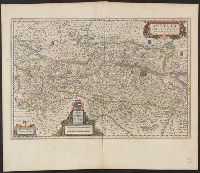
Beinecke Rare Book and Manuscript Library > Austria archiducatus / [cartographic material] / auctore Wolfgango Lazio.
Creator:
Published / Created:
[1635]
Call Number:
42 1630
Container / Volume:
BRBL_00244
Image Count:
2
Resource Type:
Maps, Atlases & Globes
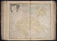
Alternative Title:
Avstria archidvcatvs
Description:
From Willem and Joan Blaeu's Theatrum orbis terrarum (1635)., In Latin on verso; with caption title "Austria archiducatus" and signature 2X., Relief shown pictorially., and Stamp on verso: Karpinski-von Wieser Map Collection. Sheet measures 47.7 x 56.6 cm.
Publisher:
Guiljelmus Blaeuw excudit,
Subject (Geographic):
Austria --Maps --Early works to 1800
Subject (Name):
Blaeu, Joan, 1596-1673. Theatrum orbis terrarum and Blaeu, Willem Janszoon, 1571-1638. Theatrum orbis terrarum
Found in:
Beinecke Rare Book and Manuscript Library > Austria archiducatus / auctore Wolfgango Lazio.
Creator:
Published / Created:
[ca. 1700?]
Call Number:
41 AU79 1700
Container / Volume:
BRBL_00242
Image Count:
1
Resource Type:
Maps, Atlases & Globes
Publisher:
N. Visscher,
Subject (Geographic):
Austria --Maps --Early works to 1800
Subject (Name):
Albany Institute Stamp and Gouwen, Gilliam van der, engraver
Found in:
Beinecke Rare Book and Manuscript Library > Austriae archiducatus pars superior in omnes ejusdem quadrantes ditiones accuratissime et distincte delineata [cartographic material] / per Nic. Visscher.
Creator:
Published / Created:
[ca. 1710]
Call Number:
1983 Folio 23
Collection Title:
[Atlas factice of 50 maps, primarily by Johann Baptist Homann and/or issued by the Homann Erben
Image Count:
1
Publisher:
[Johann Baptist Homann]
Subject (Geographic):
Graz (Austria ) --Maps , Pictorial
Collection Created:
[Nuremberg : Homann Erben, 1710-1786]
Found in:
Beinecke Rare Book and Manuscript Library > Ducatus Stiriae novissima tabula [cartographic material] / ex ampliore mappa olim R. Dni. Georgii Matth. Vischer S.C.M., Leopoldi I. Glorssae. Memae. Geographi deducta ; et in hac utiliore forma curiosorum oculis exhibita a Ioh. Bapti. Homanno
Creator:
Published / Created:
[ca. 1715]
Call Number:
1983 Folio 23
Collection Title:
[Atlas factice of 50 maps, primarily by Johann Baptist Homann and/or issued by the Homann Erben
Image Count:
1
Publisher:
[Johann Baptist Homann]
Subject (Geographic):
Carinthia (Austria ) --Maps --Early
Collection Created:
[Nuremberg : Homann Erben, 1710-1786]
Found in:
Beinecke Rare Book and Manuscript Library > Nova et accurata Carinthiae Ducatus tabula geographica [cartographic material] : in superiorem et inferiorem divisa, cum insertis partibus, Archiepiscopatui Salisburgensi propriis nec non dynastiis aliquot, quae tempore S. Henrici Imperiatoris circa A. 10
Published / Created:
[1760?]
Call Number:
428 1760
Container / Volume:
BRBL_00247
Image Count:
5
Resource Type:
Maps, Atlases & Globes
Subject (Geographic):
Tyrol (Austria )--Maps --Early works to
Found in:
Beinecke Rare Book and Manuscript Library > Atlas Tyrolensis.
Branch:v1.61.6 ,Deployed:2024-06-12T09:55:36-04:00