Skip to search
Skip to main content
Skip to first result
Search
You Searched For
Date
1710 - 1719
Format
cartographic
Language
Latin
Date Created
1710 to 1719
New Search
Search Results
Published / Created:
[1710?]
Call Number:
3764 1710
Image Count:
2
Resource Type:
Maps, Atlases & Globes
Subject (Geographic):
Aargau (Switzerland)--Maps--Early works to 1800
Found in:
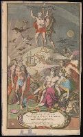
Beinecke Rare Book and Manuscript Library > Argow cum parte Merid. Zurichgow Auctore Ger. Mercatore.
Creator:
Published / Created:
[approximately 1710]
Call Number:
BrSides Folio 2019 86
Image Count:
2
Resource Type:
Maps, Atlases & Globes
Description:
Imperfect: chipped. Accompanied by manuscript title page in Italian, "Nuovo Atlante sopra l'universo mondo ..." with imprint "Norinberga à spese dell' Autore stampato da Gio. Ernesto Adelbalner, 1714." and Title page for Johann Baptist Homann's Atlas novus terrarum orbis imperia.
Publisher:
[Johann Baptist Homann],
Subject (Name):
Homann, Johann Baptist, 1663-1724. Atlas novus terrarum orbis imperia.
Found in:
Beinecke Rare Book and Manuscript Library > Atlas novus terrarum orbis imperia, regna et status exactis tabulis geographicè demonstrans operâ Iohannis Baptistae Homanni ... Noribergae / Caspar Luycken fecit.
Creator:
Published / Created:
[ca. 1710?]
Call Number:
1983 Folio 23
Collection Title:
[Atlas factice of 50 maps, primarily by Johann Baptist Homann and/or issued by the Homann Erben
Image Count:
1
Alternative Title:
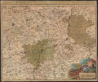
Cercle de Baviere qui comprend la Regence d'Amberg, le Palatinat de Neuberg, et de Sulzbach, le Landgrafiat de Leichtenberg ...
Publisher:
[Johann Baptist Homann]
Subject (Geographic):
Bavaria (Germany) --Maps --Early works to 1800
Collection Created:
[Nuremberg : Homann Erben, 1710-1786]
Found in:
Beinecke Rare Book and Manuscript Library > Bavariae Circulus et Electorat in suas quas que ditiones tam cum adiacentibus quam insertis regionibus accuratissime divisus / [cartographic material] / per Io. Baptistam Homannum
Creator:
Published / Created:
1715?
Call Number:
1973 Folio 30
Collection Title:
[Atlas factice of 32 maps and 1 distance table, produced by the Homann Erben firm]
Image Count:
2
Publisher:
[Johann Baptist Homann]
Subject (Geographic):
Saxony (Germany) --Maps --Early works to 1800
Subject (Topic):
Atlases, German --Early works to 1800
Collection Created:
[Nuremberg : s.n., 1701-1760]
Found in:
Beinecke Rare Book and Manuscript Library > Circulus Saxoniae inferioris in omnes suos status et principatus / [cartographic material] / accurate divisus ex conatibus Io. Bapt. Homanni
Published / Created:
1712
Call Number:
3366 1712
Container / Volume:
BRBL_00089
Image Count:
1
Resource Type:
Maps, Atlases & Globes
Description:
Preliminary record.
Publisher:
Jean Cóvens et Corneille Mortier,
Subject (Geographic):
Namur (Belgium)--Maps--Early works to 1800
Found in:
Beinecke Rare Book and Manuscript Library > Comitatus Namurcensis cum Finitimis Regionibus ad Usum Serenissimi Burgundiae Ducis.
Creator:
Published / Created:
[1710?]
Call Number:
1973 Folio 18
Image Count:
1
Resource Type:
Maps, Atlases & Globes
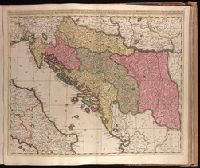
Description:
Backed with paper. Ms. no. "77" in upper right corner. Sheet measures 53.6 x 62.5 cm. No. 71 of 87 maps bound together., Bar scales given in "milliaria Hungarica" and "milliaria Germanica.", Covers Croatia, Bosnia and Hercegovina, Serbia, Montenegro and portions of Italy, Albania, Greece, Macedonia and Hungary., In Latin with place names in Italian., and Relief shown pictorially.
Publisher:
Gerardum et Leonardum Valk,
Subject (Geographic):
Balkan Peninsula--Maps--Early works to 1800.
Subject (Name):
Valck, Leonard, 1675-1746.
Found in:
Beinecke Rare Book and Manuscript Library > Dalmatia, Sclavonia, Croatia, Bosnia, Servia, et Istria [cartographic material] : distributa in singulares ditiones et diœceses, una cum Republica Ragusana, et circumjacentibus regionibus, Hungaria, Venetiis, statu ecclesiastico, Napoli et Macedonia / Venundantur per Gerardum et Leonardum Valk, cum Priv.
Creator:
Published / Created:
[1717]
Call Number:
BrSides 2019 86
Image Count:
1
Resource Type:
Maps, Atlases & Globes
Description:
"Pag. 2" -- top right corner., Bar scales given in "Milliaria germanica" and "Stadia"., Coordinates not present on map and are approximated., From François Halma's Kanaän en d'omleggende landen (1717)., Relief shown pictorially., and Shows topography, drainage, boundaries, travel routes, places of historical interest.
Publisher:
[Franciscus Halma],
Subject (Geographic):
Palestine--Maps--Early works to 1800.
Subject (Topic):
Bible--Geography--Maps--Early works to 1800. and Christianity--Palestine--Maps--Early works to 1800.
Found in:
Beinecke Rare Book and Manuscript Library > Descriptio paradisi et Terrae Canaan : regionumque a patriarchis primum habitatarum.
Published / Created:
[1715?]
Call Number:
3635 1715
Container / Volume:
BRBL_00142
Image Count:
1
Resource Type:
Maps, Atlases & Globes
Description:
Verso: Text.
Publisher:
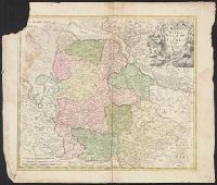
Joh. Bapt. Homanno,
Subject (Geographic):
Lower Saxony (Germany)--Maps--Early works to 1800
Found in:
Beinecke Rare Book and Manuscript Library > Ducatus Bremae et Ferdae ...
Creator:
Published / Created:
[ca. 1710]
Call Number:
1983 Folio 23
Collection Title:
[Atlas factice of 50 maps, primarily by Johann Baptist Homann and/or issued by the Homann Erben
Image Count:
1
Publisher:
[Johann Baptist Homann]
Subject (Geographic):
Graz (Austria) --Maps, Pictorial --Early works to 1800 and Styria (Austria) --Maps --Early works to 1800
Collection Created:
[Nuremberg : Homann Erben, 1710-1786]
Found in:
Beinecke Rare Book and Manuscript Library > Ducatus Stiriae novissima tabula [cartographic material] / ex ampliore mappa olim R. Dni. Georgii Matth. Vischer S.C.M., Leopoldi I. Glorssae. Memae. Geographi deducta ; et in hac utiliore forma curiosorum oculis exhibita a Ioh. Bapti. Homanno
Published / Created:
[1715?]
Call Number:
36 R34 1715
Container / Volume:
BRBL_00126
Image Count:
1
Resource Type:
Maps, Atlases & Globes
Publisher:
Joh Baptista Homan,
Subject (Geographic):
Rheinberg (Germany)--Maps--Early works to 1800
Found in:
Beinecke Rare Book and Manuscript Library > Exactissima Palatinatus ad Rhenum ...
Branch:v1.61.8 ,Deployed:2024-06-20T11:15:02-04:00