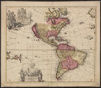
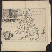
Imperfect; chipped along edges, with some loss of text. Manuscript number "j20" in upper right corner. Left side of Matthaeus Seutter map "Le pays de Perou et Chili ..." pasted onto verso., Includes five bar scales., and Relief shown pictorially.
Publisher:
Venalis prostat Augustae Vindel. apud Ieremiam Wolff,
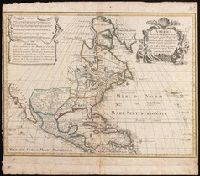
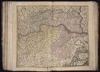
Includes five bar scales., Relief shown pictorially., and Watermark. Manuscript number in upper right corner: jj5. Reinforced at bottom with paper. From the Karpinski Collection.
Publisher:
Venalis prostat Augustae Vindelic apud Jeremiam Wolff,
Subject (Geographic):
North America--Maps.
Subject (Name):
Karpinski, Louis Charles,--1878-1956--Ownership. and Wolf, Jeremias, 1663?-1724, pulbisher.
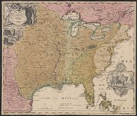
Includes ill. and text., Lowery refers to this version appearing in Homann's Atlas geographicvs maior exhibens tellurem seu globum terraqueum in mappis generalibus & specialibus ... (1759-[1781]), described in Phillips 622. Cf. Lowery 475., and Reference: Antiq
Publisher:
[s.n.,
Subject (Geographic):
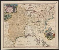
Louisiana--Maps--Early works to 1800, Mississippi River Valley--Maps--Early works to 1800, and North America--Maps--Early works to 1800
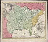
Includes ill. and text., Lowery refers to this version appearing in Homann's Atlas geographicvs maior exhibens tellurem seu globum terraqueum in mappis generalibus & specialibus ... (1759-[1781]), described in Phillips 622. Cf. Lowery 475., and Reference: Antiq
Publisher:
[s.n.,
Subject (Geographic):
Louisiana--Maps--Early works to 1800, Mississippi River Valley--Maps--Early works to 1800, and North America--Maps--Early works to 1800
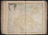
Relief shown pictorially. and Watermark. Manuscript number in right corner: 50. From the Karpinski-von Wieser Map Collection.
Publisher:
[Johann Baptist Homann]
Subject (Geographic):
Cologne (Electorate)--Maps--Early works to 1800., Jülich-Berg--Maps--Early works to 1800., and North Rhine-Westphalia (Germany)--Maps--Early works to 1800.
Subject (Name):
Catholic Church.--Archdiocese of Cologne (Germany)--Maps--Early works to 1800