Skip to search
Skip to main content
Skip to first result
Search
You Searched For
Repository
Beinecke Rare Book and Manuscript Library
Format
cartographic
Language
Russian
New Search
Search Results
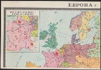
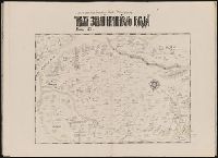
Published / Created:
[19--]
Call Number:
30f 1914
Container / Volume:
BRBL_00037B
Image Count:
4
Resource Type:
Maps, Atlases & Globes
Description:
Insets: Moscow ca. 1:50,000.
Subject (Geographic):
Europe--Maps
Found in:
Beinecke Rare Book and Manuscript Library > [Europe in 1870-1914].
Creator:
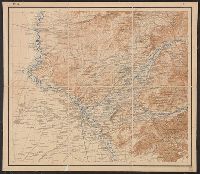
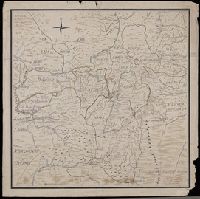
Call Number:
547 1897
Container / Volume:
BRBL_00291
Image Count:
6
Resource Type:
Maps, Atlases & Globes
Alternative Title:
[Карта десятиверстная Туркестанского Военного Округа].
Description:
"Pod redakt︠s︡īeĭ polkovn. Rodīonova.", "Sostav. klas. topogr. Khondazhevskīĭ, graviroval [?], 1897 g."--Sheet P. VII, L.8., "Под редакціей полков. Родіонова.", "Состав. клас. топогр. Хондажевскій, гравировалъ [?], 1897 г."--Sheet P. VII, L.8., and Imperfect
Subject (Geographic):
Asia, Central--Maps
Found in:
Beinecke Rare Book and Manuscript Library > [Karta desi︠a︡tiverstnai︠a︡ Turkestanskogo Voennogo Okruga].
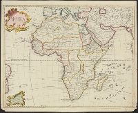
Published / Created:
1722
Call Number:
60 1722
Container / Volume:
BRBL_00323
Image Count:
1
Resource Type:
Maps, Atlases & Globes
Description:
Resembles Guillaume de L'Isle's map of Africa, except there is less interior detail in the Russian map ...
Subject (Geographic):
Africa--Maps--Early works to 1800
Found in:
Beinecke Rare Book and Manuscript Library > [Map of Africa].
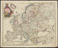
Published / Created:
[1720?]
Call Number:
30 1720
Container / Volume:
BRBL_00029
Image Count:
1
Resource Type:
Maps, Atlases & Globes
Description:
Preliminary record. and Text in Russian, ca. 1720.
Subject (Geographic):
Europe--Maps--Early works to 1800
Found in:
Beinecke Rare Book and Manuscript Library > [Map of Europe, completely identical to the maps of Guillaume de L'Isle].
Published / Created:
Undated
Call Number:
1983 Folio 1
Collection Title:
Chertezhnai'a' kniga Sibiri, sostavlennai'a' tobol'skim synom boi'a'rskim Semenom Remezovym v 1701
Image Count:
1
Resource Type:
Books, Journals & Pamphlets
Subject (Geographic):
China --Maps and Siberia (Russia) --Maps
Subject (Topic):
Great Wall of China (China)
Collection Created:
S.-Peterburg Izdano Arkheograficheskoi'u' kommisiei'u' izhdiveniem P.I. Likhacheva] 1882
Found in:
Beinecke Rare Book and Manuscript Library > [Map of southern Siberia]
Creator:
Published / Created:
[between 1750 and 1800?]
Call Number:
BrSides Double Folio 2019 79
Image Count:
1
Resource Type:
Maps, Atlases & Globes
Description:
In manuscript on map: Kapitan" Matveĭ Loginov"; on verso: Ural-Gebiet, zwischen Kasan u. Jekaterinburg; stampf of the Königliches Kartographisches Institut, Berlin., Relief shown pictorially and by spot heights., and Title devised by cataloger.
Subject (Geographic):
Orenburgskai︠a︡ oblastʹ (Russia)--Maps--Early works to 1800. and Ural Mountains (Russia)--Maps--Early works to 1800.
Subject (Name):
Königliches Kartographisches Institut (Berlin) Stamp.
Found in:
Beinecke Rare Book and Manuscript Library > [Map of the Central and Southern Ural Mountains].
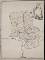
Published / Created:
[1780?]
Call Number:
BrSides Folio 2019 54
Image Count:
1
Resource Type:
Maps, Atlases & Globes
Description:
Illegible annotation on verso of sheet., Title devised by cataloger., and Unfinished manuscript map.
Subject (Geographic):
Permskai︠a︡ oblastʹ (Russia)--Maps--Early works to 1800.
Found in:
Beinecke Rare Book and Manuscript Library > [Map of the Perm province].
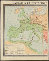
Published / Created:
[19--].
Call Number:
30em 350-650
Container / Volume:
BRBL_00037B
Image Count:
2
Resource Type:
Maps, Atlases & Globes
Description:
In Russian.
Subject (Geographic):
Europe--Maps
Found in:
Beinecke Rare Book and Manuscript Library > [Migrations of peoples in Europe during the 4th-7th centuries].
Published / Created:
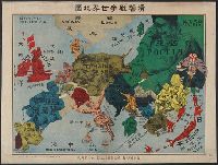
ca. 1914?]
Call Number:
30am 1914A
Container / Volume:
BRBL_00037
Image Count:
1
Resource Type:
Maps, Atlases & Globes
Description:
"No. 32". and In Russian, Japanese and English.
Subject (Geographic):
Europe--Maps
Subject (Topic):
World War, 1914-1918--Maps
Found in:
Beinecke Rare Book and Manuscript Library > [Pictorial war map, in Russian.]
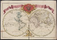
Published / Created:
[1720]
Call Number:
11 1720A
Container / Volume:
BRBL_00004
Image Count:
1
Resource Type:
Maps, Atlases & Globes
Description:
American N.W. Coast is not continued (except in a dotted line) North of California, and no mention is made of Bering's discoveries. and Preliminary record.
Subject (Geographic):
World--Maps--Early works to 1800
Found in:
Beinecke Rare Book and Manuscript Library > [Russian World Map, identical to the maps of Guillaume de L'Isle].
Branch:v1.61.8 ,Deployed:2024-06-20T11:14:55-04:00