Skip to search
Skip to main content
Skip to first result
Search
You Searched For
Repository
Beinecke Rare Book and Manuscript Library
Format
cartographic
New Search
Search Results
Creator:
Published / Created:
[1714]
Call Number:
73 1714
Container / Volume:
BRBL_00688
Image Count:
1
Resource Type:
Maps, Atlases & Globes
Alternative Title:
Nouvelle France.
Description:
From Aa's Nouvel Atlas ... A Leide : Chez Pierre Van der Aa ..., [1714], Mounted on paper. Sheet measures 29.8 x 36 cm. Cross Collection no. 165., and Relief shown pictorially.
Publisher:
Chez Pierre vander Aa,
Subject (Geographic):
Canada--Maps--Early works to 1800
Subject (Name):
Aa, Pieter van der, 1659-1733. Nouvel Atlas
Found in:
Beinecke Rare Book and Manuscript Library > Canada, ou, Nouvelle France [cartographic material] : suivant les nouvelles observations de Mess'rs. de l'Academie Royale des Sciences, etc., augmentées de nouveau.
Creator:
Published / Created:
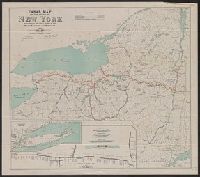
1912
Call Number:
771gma 1912
Container / Volume:
BRBL_00494
Image Count:
1
Resource Type:
Maps, Atlases & Globes
Description:
"J. A. Bensel, State Engineer and Surveyor." and Includes "Profile of Barge Canal," Long Island and Southern part of New York.
Publisher:
State Engineer and Surveyor,
Subject (Geographic):
New York (N.Y.)--Maps
Subject (Name):
Bensel, John Anderson, 1863-
Subject (Topic):
Canals--New York (State)--Maps and Nautical charts--New York (State)
Found in:
Beinecke Rare Book and Manuscript Library > Canal map of the State of New York / to accompany the annual report of the State Engineer and Surveyor, 1912.
Creator:
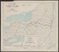
Published / Created:
1911
Call Number:
771gma 1911
Container / Volume:
BRBL_00494
Image Count:
1
Resource Type:
Maps, Atlases & Globes
Description:
Insets: Profile of Barge Canal -- Long Island and southern part of New York.
Publisher:
State Engineer and Surveyor,
Subject (Geographic):
New York State Canal System (N.Y.)
Subject (Topic):
Canals--New York (State)--Maps and Nautical charts--New York (State)
Found in:
Beinecke Rare Book and Manuscript Library > Canal map of the state of New York : to accompany the annual report of the State Engineer and Surveyor.
Creator:
Published / Created:
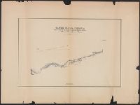
17 de Agosto de 1886.
Call Number:
8816gma C435 1886
Container / Volume:
BRBL_00651
Image Count:
1
Resource Type:
Maps, Atlases & Globes
Description:
"Aprobado: México, 21 de Febrero de 1884. Pacheco." and Oriented with north to right.
Publisher:
[s.n.],
Subject (Name):
Flores, José Alonso
Subject (Topic):
Canals--Mexico--Tamaulipas--Maps
Found in:
Beinecke Rare Book and Manuscript Library > Canal n. del Chijol : proyecto de trazo final para someterio á la aprobacion del supremo gobierno / por el General José Alonso Flores ; redujo y dibujó Alberto Goméz Llata.
Published / Created:
[1918].
Call Number:
11hcf 1919D-7
Image Count:
1
Resource Type:
Maps, Atlases & Globes
Description:
"Con le aggiunte al 1̊ Maggio 1918."
Publisher:
Istituto Geografico militare,
Subject (Geographic):
Italy--Maps
Found in:
Beinecke Rare Book and Manuscript Library > Canale del Brenta.
Call Number:
1977 +392
Collection Title:
A survey of the cities of London and Westminster : containing the original, antiquity, increase
Image Count:
1
Resource Type:
Maps, Atlases & Globes
Description:
Plate between p. 150-151.
Subject (Geographic):
London (England)--History
Collection Created:
London : Printed for A. Churchill, J. Knapton, R. Knaplock, J. Walthoe [and 6 others], 1720
Found in:
Beinecke Rare Book and Manuscript Library > Candlewick Ward with its division into parishes. Corrected from the last survey
Published / Created:
1572]
Call Number:
32am C14 1572
Container / Volume:
BRBL_00074
Image Count:
2
Resource Type:
Maps, Atlases & Globes
Subject (Geographic):
England--Maps--Early works to 1800
Found in:
Beinecke Rare Book and Manuscript Library > Canterbrigia, o pulentiffimi Anglie Regni, orbs celeberrimi nominis, ab Academie conditore Cantabro, Cognominata: A Granta, fluvio vicino, Cairgrant; saxonib. Graunteces fre, Grantebrige iam olim nuncupata.
Published / Created:
1572]
Call Number:
32am C14 1572
Container / Volume:
BRBL_00074
Image Count:
1
Resource Type:
Maps, Atlases & Globes
Subject (Geographic):
England--Maps--Early works to 1800
Found in:
Beinecke Rare Book and Manuscript Library > Canterbrigia, o pulentiffimi Anglie Regni, orbs celeberrimi nominis, ab Academie conditore Cantabro, Cognominata: A Granta, fluvio vicino, Cairgrant; saxonib. Graunteces fre, Grantebrige iam olim nuncupata.
Published / Created:
1836
Call Number:
764cea C172 1836
Container / Volume:
BRBL_00461
Image Count:
3
Resource Type:
Maps, Atlases & Globes
Subject (Geographic):
Cape Cod (Mass.)--Maps
Found in:
Beinecke Rare Book and Manuscript Library > Cape Cod Harbor, Cape Cod Bay. Surveyed and projected by J.D. Graham, Major U,S, Top. Engs. ...
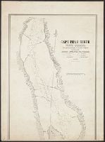
Published / Created:
1839
Call Number:
785cea C17 1839A
Container / Volume:
BRBL_00514
Image Count:
5
Resource Type:
Maps, Atlases & Globes
Description:
Lithy. of P. Haas
Subject (Geographic):
Cape Fear River (N.C.)--Maps
Found in:
Beinecke Rare Book and Manuscript Library > Cape Fear River ... by Lieutenant James Glynn ... Continuation of the Survey of Cape Fear River ... by Lieut. James Glynn.
Branch:v1.61.8 ,Deployed:2024-06-20T11:15:15-04:00