Search
You Searched For
Search Results
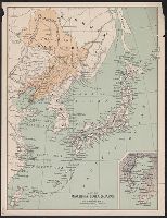
- Creator:
- George H. Walker & Company
- Published / Created:
- 1904
- Call Number:
- 556 1904B
- Container / Volume:
- BRBL_00292
- Image Count:
- 1
- Resource Type:
- Maps, Atlases & Globes
- Found in:
- Beinecke Rare Book and Manuscript Library > Map of Manchuria, Corea & Japan [cartographic material].
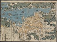
- Published / Created:
- [1846?]
- Call Number:
- 57 N134 1846
- Container / Volume:
- BRBL_00304
- Image Count:
- 1
- Resource Type:
- Maps, Atlases & Globes
- Found in:
- Beinecke Rare Book and Manuscript Library > Map of Nagasaki.
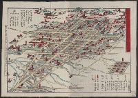
- Published / Created:
- 1891
- Call Number:
- 57 N571 1891
- Container / Volume:
- BRBL_00304
- Image Count:
- 1
- Resource Type:
- Maps, Atlases & Globes
- Found in:
- Beinecke Rare Book and Manuscript Library > Map of Niigate.
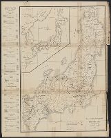
- Published / Created:
- 1895
- Call Number:
- 57EH 1895
- Container / Volume:
- BRBL_00305
- Image Count:
- 1
- Resource Type:
- Maps, Atlases & Globes
- Found in:
- Beinecke Rare Book and Manuscript Library > Map of the missionary districts of north Tokyo & Kyoto : under the jurisdiction of the Bishop of Tokyo 1895.
- Published / Created:
- 1943
- Call Number:
- 57 1943
- Container / Volume:
- BRBL_00303
- Image Count:
- 2
- Resource Type:
- Maps, Atlases & Globes
- Found in:
- Beinecke Rare Book and Manuscript Library > The Japanese empire : with central and southern Manchukuo (Manchuria).
- Published / Created:
- 1943
- Call Number:
- 57 1943
- Container / Volume:
- BRBL_00303
- Image Count:
- 1
- Resource Type:
- Maps, Atlases & Globes
- Found in:
- Beinecke Rare Book and Manuscript Library > The Japanese empire : with central and southern Manchukuo (Manchuria).
- Published / Created:
- 1902
- Call Number:
- 57ceh 1902
- Container / Volume:
- BRBL_00305
- Image Count:
- 1
- Resource Type:
- Maps, Atlases & Globes
- Found in:
- Beinecke Rare Book and Manuscript Library > Tiefenkarte des Japanischen Binnenmeeres : Setouchi / von Dr. N. Yamasaki.
- Creator:
- Chishitsu Chōsajo (Japan)
- Published / Created:
- 1899
- Call Number:
- 57 1899A
- Container / Volume:
- BRBL_00302
- Image Count:
- 15
- Resource Type:
- Maps, Atlases & Globes
- Found in:
- Beinecke Rare Book and Manuscript Library > Topographical map of the Japanese Empire, 1899 / Imperial Geological Survey of Japan ; drawn by T. Togawa and K. Suzuki ; engraved by N. Matsudaira.
- Published / Created:
- 1922
- Call Number:
- 57 Un9 1921
- Container / Volume:
- BRBL_00304
- Image Count:
- 2
- Resource Type:
- Maps, Atlases & Globes
- Found in:
- Beinecke Rare Book and Manuscript Library > Unzen and neighbourhood.
- Creator:
- United States. Hydrographic Office
- Published / Created:
- 1854
- Call Number:
- 57 1854
- Container / Volume:
- BRBL_00302
- Image Count:
- 1
- Resource Type:
- Maps, Atlases & Globes
- Found in:
- Beinecke Rare Book and Manuscript Library > Western shore of the Bay of Yedo / surveyed by order of Commodore M.C. Perry U.S.N. by Lieut. Wm. L. Maury and other officers of the Japan Expedition 1854 ; drawn by Edward Sels ; engraved by Selmar Siebert.