Search
You Searched For
Search Results
- Creator:
- State Highway Commission of Kansas
- Published / Created:
- [1971]
- Call Number:
- 825 1971
- Container / Volume:
- BRBL_00573
- Image Count:
- 2
- Resource Type:
- Maps, Atlases & Globes
- Found in:
- Beinecke Rare Book and Manuscript Library > 1971 Kansas official highway map.
- Creator:
- Holmes, William Henry, 1846-1933
- Published / Created:
- [1859?]
- Call Number:
- 825 1859A
- Container / Volume:
- BRBL_00573
- Image Count:
- 1
- Resource Type:
- Maps, Atlases & Globes
- Found in:
- Beinecke Rare Book and Manuscript Library > A new map of Kansas / by W.H. Holmes.
- Published / Created:
- 1873?]
- Call Number:
- 825gme 1873
- Container / Volume:
- BRBL_00576
- Image Count:
- 2
- Resource Type:
- Maps, Atlases & Globes
- Found in:
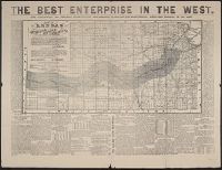
- Beinecke Rare Book and Manuscript Library > Atchison, Topeka & Santa-Fe Railroad and connections : with 3,000,000 acres land for sale on eleven years credit & seven percent interest / Fisk & Russell, N.Y. Map of Kansas / Atchison, Topeka & Santa-Fe Railroad ; Bogart & Stillman, engravers, Cin. O.
- Creator:
- Gunn, O. B. (Otis Berthoude), 1828-1901
- Published / Created:
- 1866
- Call Number:
- 825 1866
- Container / Volume:
- BRBL_00573
- Image Count:
- 1
- Resource Type:
- Maps, Atlases & Globes
- Found in:
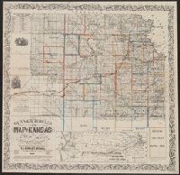
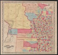
- Beinecke Rare Book and Manuscript Library > Gunn & Mitchell's new map of Kansas and the gold mines : embracing all the public surveys up to 1866, principal meridian / compiled from the original field notes by O.B. Gunn & D.T. Mitchell.
- Creator:
- Gunn, O.B. (Otis Berthoude), 1828-1901
- Published / Created:
- 1862
- Call Number:
- 825 1862
- Container / Volume:
- BRBL_00573
- Image Count:
- 1
- Resource Type:
- Maps, Atlases & Globes
- Found in:
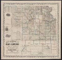
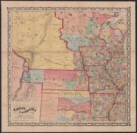
- Beinecke Rare Book and Manuscript Library > Gunn & Mitchell's new map of Kansas and the gold mines embracing all the public surveys up to 1862 / compiled from the original field notes by O.B. Gunn & D.T. Mitchell, LeCompton, K., 1862.
- Creator:
- Johnson, A. J. (Alvin Jewett), 1827-1884
- Published / Created:
- 1866]
- Call Number:
- 816 1866
- Container / Volume:
- BRBL_00561
- Image Count:
- 2
- Resource Type:
- Maps, Atlases & Globes
- Found in:
- Beinecke Rare Book and Manuscript Library > Johnson's Missouri and Kansas.
- Creator:
- Johnson, A. J. (Alvin Jewett), 1827-1884
- Published / Created:
- 1858
- Call Number:
- 825fb 1858
- Container / Volume:
- BRBL_00575
- Image Count:
- 1
- Resource Type:
- Maps, Atlases & Globes
- Found in:
- Beinecke Rare Book and Manuscript Library > Johnson's county, township, and sectional Kansas and Nebraska.
- Creator:
- Johnson, A. J. (Alvin Jewett), 1827-1884
- Published / Created:
- 1859
- Call Number:
- 825 1859
- Container / Volume:
- BRBL_00573
- Image Count:
- 1
- Resource Type:
- Maps, Atlases & Globes
- Found in:
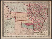
- Beinecke Rare Book and Manuscript Library > Johnson's new rail road and county copper plate map of Kansas gold region and the Great West, from the latest and best authorities.
- Creator:
- Wells, John G. (John Gaylord), 1821-1880
- Published / Created:
- 1857
- Call Number:
- 825 1857B
- Container / Volume:
- BRBL_00573
- Image Count:
- 1
- Resource Type:
- Maps, Atlases & Globes
- Found in:
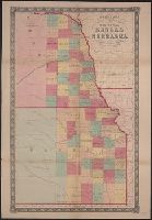
- Beinecke Rare Book and Manuscript Library > Kansas & Nebraska.
- Creator:
- Morse & Gaston (Firm)
- Published / Created:
- 1856
- Call Number:
- 80 1856A
- Container / Volume:
- BRBL_00534
- Image Count:
- 1
- Resource Type:
- Maps, Atlases & Globes
- Found in:
- Beinecke Rare Book and Manuscript Library > Kansas & Nebraska.