Search
You Searched For
Search Results
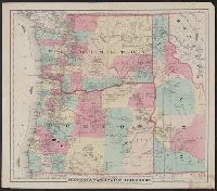
- Creator:
- G.W. & C.B. Colton & Co
- Published / Created:
- [1879?]
- Call Number:
- 846 1879B
- Container / Volume:
- BRBL_00621
- Image Count:
- 1
- Resource Type:
- Maps, Atlases & Globes
- Found in:
- Beinecke Rare Book and Manuscript Library > Colton's map of Oregon & Washington Territory / issued by the Oregon State Board of Immigration ; prepared by G.W. & C.B. Colton & Co.
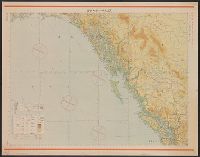
- Published / Created:
- Shōwa 18 [1943] and 昭和 18 [1943]
- Call Number:
- 739CBF 1945 1
- Container / Volume:
- BRBL_00391
- Image Count:
- 1
- Resource Type:
- Maps, Atlases & Globes
- Found in:
- Beinecke Rare Book and Manuscript Library > Junō--Shiyatoru / Rikuchi Sokuryōbu, Sanbō Honbu.
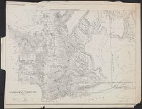
- Creator:
- United States. Surveyor General
- Published / Created:
- 1860
- Call Number:
- 847 1861
- Container / Volume:
- BRBL_00625
- Image Count:
- 1
- Resource Type:
- Maps, Atlases & Globes
- Found in:
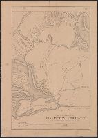
- Beinecke Rare Book and Manuscript Library > Map of a part of Washington Territory : to accompany the report of the Surveyor General, 1860-61.
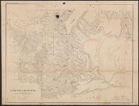
- Creator:
- Washington (State). Surveyor General's Office
- Published / Created:
- 1859
- Call Number:
- 847 1859A
- Container / Volume:
- BRBL_00625
- Image Count:
- 1
- Resource Type:
- Maps, Atlases & Globes
- Found in:
- Beinecke Rare Book and Manuscript Library > Map of a part of Washington Territory : to accompany the report of the Surveyor General.
- Creator:
- Tilton, James
- Published / Created:
- 1857
- Call Number:
- 847 1857
- Container / Volume:
- BRBL_00625
- Image Count:
- 1
- Resource Type:
- Maps, Atlases & Globes
- Found in:
- Beinecke Rare Book and Manuscript Library > Map of a part of Washington Territory lying east of the Cascade Mountains : to accompany report of Surveyor General.
- Creator:
- United States. Surveyor General
- Published / Created:
- 1855
- Call Number:
- 847 1855A
- Container / Volume:
- BRBL_00625
- Image Count:
- 1
- Resource Type:
- Maps, Atlases & Globes
- Found in:
- Beinecke Rare Book and Manuscript Library > Map of a part of the territory of Washington : to accompany report of Surveyor General, 1855.
- Creator:
- Eastwick, Morris & Co
- Published / Created:
- 1878
- Call Number:
- 847 1878
- Container / Volume:
- BRBL_00625
- Image Count:
- 1
- Resource Type:
- Maps, Atlases & Globes
- Found in:
- Beinecke Rare Book and Manuscript Library > Map of south eastern Washington Territory / compiled from official surveys and published by Eastwick, Morris & Co. ; drawn by John Hanson.
- Creator:
- Poole Brothers
- Published / Created:
- c1898.
- Call Number:
- 846gme 1898
- Container / Volume:
- BRBL_00624
- Image Count:
- 1
- Resource Type:
- Maps, Atlases & Globes
- Found in:
- Beinecke Rare Book and Manuscript Library > Map of the Oregon Railroad and Navigation Co.
- Creator:
- Glümer, J. v
- Published / Created:
- 1883?]
- Call Number:
- 847 1883
- Container / Volume:
- BRBL_00625
- Image Count:
- 1
- Resource Type:
- Maps, Atlases & Globes
- Found in:
- Beinecke Rare Book and Manuscript Library > Map of the n.w. boundaries of the United States / compiled in 1883 under the direction of Bvt. Brig. Gen'l. O.M. Poe, U.S. Army Lt. Col. of Engineers, Col. & A.D.C. ; compiled & drawn by J. von Glümer.
- Creator:
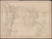
- United States. Army. Corps of Topographical Engineers
- Published / Created:
- 1859
- Call Number:
- 846 1859
- Container / Volume:
- BRBL_00620
- Image Count:
- 1
- Resource Type:
- Maps, Atlases & Globes
- Found in:
- Beinecke Rare Book and Manuscript Library > Map of the state of Oregon and Washington Territory / compiled in the Bureau of Topogrl. Engrs. chiefly for military purposes, by order of John B. Floyd ; engraved by W.H. Dougal.