Search
You Searched For
Search Results
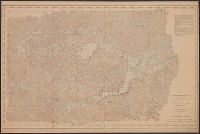
- Creator:
- United States. Mississippi River Commission
- Published / Created:
- 1900]
- Call Number:
- BrSides Double Folio 2018 87
- Image Count:
- 1
- Resource Type:
- Maps, Atlases & Globes
- Found in:
- Beinecke Rare Book and Manuscript Library > Survey of the Mississippi River : made under the direction of the Mississippi River Commission : Lake Itasca basin, Minnesota, within Itasca State Park.
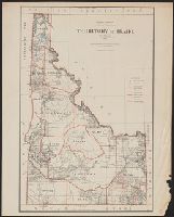
- Creator:
- United States. General Land Office
- Published / Created:
- 1876
- Call Number:
- 832 1876
- Container / Volume:
- BRBL_00582
- Image Count:
- 1
- Resource Type:
- Maps, Atlases & Globes
- Found in:
- Beinecke Rare Book and Manuscript Library > Territory of Idaho, 1876 / compiled from the official records of the General Land Office and other sources by C. Roeser, Principal Draughtsman, General Land Office.
- Creator:
- United States. General Land Office
- Published / Created:
- 1883
- Call Number:
- 832 1883
- Container / Volume:
- BRBL_00582
- Image Count:
- 1
- Resource Type:
- Maps, Atlases & Globes
- Found in:
- Beinecke Rare Book and Manuscript Library > Territory of Idaho, 1883 / compiled from the official records of the General Land Office and other sources by G.P. Strum, Principal Draughtsman, Department of the Interior, General Land Office.
- Creator:
- United States. General Land Office
- Published / Created:
- 1888
- Call Number:
- 833 1888
- Container / Volume:
- BRBL_00584
- Image Count:
- 1
- Resource Type:
- Maps, Atlases & Globes
- Found in:
- Beinecke Rare Book and Manuscript Library > Territory of Wyoming : 1888 / compiled from the official records of the General Land Office and other sources under supervision of Geo. U. Mayo., compiled and drawn by A.F. Dinsmore, 1887.
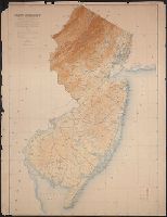
- Creator:
- Geological Survey of New Jersey
- Published / Created:
- 1888
- Call Number:
- 773CBF 1888
- Container / Volume:
- BRBL_00497
- Image Count:
- 1
- Resource Type:
- Maps, Atlases & Globes
- Found in:
- Beinecke Rare Book and Manuscript Library > The State of New Jersey : relief map : from original surveys based on the triangulation of the U.S. Coast and Geodetic Survey.
- Creator:
- Thayer, H. L
- Published / Created:
- 189-?]
- Call Number:
- 834 D437 1880
- Container / Volume:
- BRBL_00589
- Image Count:
- 2
- Resource Type:
- Maps, Atlases & Globes
- Found in:
- Beinecke Rare Book and Manuscript Library > The city of Denver / published by H.L. Thayer, Denver, Colo.
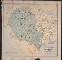
- Published / Created:
- 1885]
- Call Number:
- 80gc 1884
- Container / Volume:
- BRBL_00537
- Image Count:
- 1
- Resource Type:
- Maps, Atlases & Globes
- Found in:
- Beinecke Rare Book and Manuscript Library > The range and ranch cattle area of the United States : 1884.
- Creator:
- Bien, Joseph R
- Published / Created:
- 1902
- Call Number:
- 766 1902
- Container / Volume:
- BRBL_00467
- Image Count:
- 4
- Resource Type:
- Maps, Atlases & Globes
- Found in:
- Beinecke Rare Book and Manuscript Library > The standard map of Connecticut / prepared under the direction of Joseph R. Bien, E.M., from original surveys and the triangulations and surveys of the U.S. Geological Survey and U.S. Coast and Geodetic Survey.
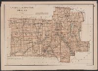
- Creator:
- Bien, Joseph R
- Published / Created:
- 1895].
- Call Number:
- EEgk64 895
- Container / Volume:
- BRBL_00492
- Image Count:
- 1
- Resource Type:
- Maps, Atlases & Globes
- Found in:
- Beinecke Rare Book and Manuscript Library > Wayne, Ontario, Yates and Seneca counties / [cartographic material] / copyright Julius Bien & Company, N.Y.
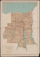
- Creator:
- Bien, Joseph R
- Published / Created:
- c1895.
- Call Number:
- 771 W944 1895
- Container / Volume:
- BRBL_00492
- Image Count:
- 1
- Resource Type:
- Maps, Atlases & Globes
- Found in:
- Beinecke Rare Book and Manuscript Library > Wyoming and Livingston counties.